How to get to Rouxel Agencements by bus?
Click on the bus route to see step by step directions with maps, line arrival times and updated time schedules.
From Orgeval, Orgeval
75 minFrom IKEA, Plaisir
65 minFrom Fête des Loges, Saint-Germain-En-Laye
94 minFrom Le Port-Marly, Le Port-Marly
123 minFrom Centre Commercial Grand Plaisir, Plaisir
46 minFrom Clinique de L'Europe, Le Port-Marly
126 minFrom Voisins-Le-Bretonneux, Voisins-Le-Bretonneux
123 minFrom Hôpital de Poissy, Poissy
58 minFrom Chambourcy, Chambourcy
77 minFrom Bois D'Arcy, Versailles
93 min
How to get to Rouxel Agencements by train?
Click on the train route to see step by step directions with maps, line arrival times and updated time schedules.
Bus stops near Rouxel Agencements in Beynes
Train station near Rouxel Agencements in Beynes
- Beynes, 9 min walk,VIEW
Bus lines to Rouxel Agencements in Beynes
- 5213, Notre Dame Du Bel-Air - Gare De Nézel - Aulnay,VIEW
- 5214, Lycée Jean Monnet - Mauldrette,VIEW
- 5221, Collège François Rabelais - La Maladrerie,VIEW
- 5237, Lycée Violet Le Duc - Gare Des Mureaux (b2),VIEW
- 5231, Collège François Rabelais - Vallée Penaut,VIEW
- 5241, Collège François Rabelais - Croix Rouge,VIEW
- 5251, Collège François Rabelais - La Coudraie,VIEW
- 5355, Gare D'orgerus Béhoust - Place De La Gare / Villiers - Neauphle - Pontchartrain,VIEW
- N, N Transilien,VIEW
- 5312, Gare de Plaisir Grignon - Quai 7,VIEW
What are the closest stations to Rouxel Agencements?
The closest stations to Rouxel Agencements are:
- Croix Verte is 70 meters away, 2 min walk.
- Gare de Beynes is 679 meters away, 11 min walk.
- Beynes is 679 meters away, 9 min walk.
- Mairie is 1147 meters away, 15 min walk.
Which train line stops near Rouxel Agencements?
N (Rambouillet/ Mantes-la-Jolie/ Dreux)
Which bus line stops near Rouxel Agencements?
5312 (Marronniers)
What’s the nearest train station to Rouxel Agencements in Beynes?
The nearest train station to Rouxel Agencements in Beynes is Beynes. It’s a 9 min walk away.
What’s the nearest bus station to Rouxel Agencements in Beynes?
The nearest bus station to Rouxel Agencements in Beynes is Croix Verte. It’s a 2 min walk away.
What time is the first train to Rouxel Agencements in Beynes?
The N is the first train that goes to Rouxel Agencements in Beynes. It stops nearby at 7:19 AM.
What time is the last train to Rouxel Agencements in Beynes?
The N is the last train that goes to Rouxel Agencements in Beynes. It stops nearby at 10:42 PM.
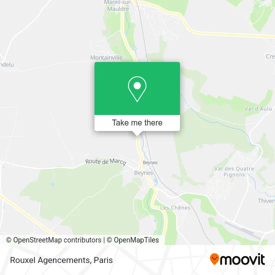
See Rouxel Agencements, Beynes, on the map
Public Transit to Rouxel Agencements in Beynes
Wondering how to get to Rouxel Agencements in Beynes? Moovit helps you find the best way to get to Rouxel Agencements with step-by-step directions from the nearest public transit station.
Moovit provides free maps and live directions to help you navigate through your city. View schedules, routes, timetables, and find out how long does it take to get to Rouxel Agencements in real time.
Looking for the nearest stop or station to Rouxel Agencements? Check out this list of stops closest to your destination: Croix Verte; Gare de Beynes; Beynes; Mairie.
Train: N.Bus: 5312, 5213, 5214, 5221, 5237, 5231, 5241, 5251, 5355, N.
Want to see if there’s another route that gets you there at an earlier time? Moovit helps you find alternative routes or times. Get directions from and directions to Rouxel Agencements easily from the Moovit App or Website.
We make riding to Rouxel Agencements easy, which is why over 1.5 million users, including users in Beynes, trust Moovit as the best app for public transit. You don’t need to download an individual bus app or train app, Moovit is your all-in-one transit app that helps you find the best bus time or train time available.
For information on prices of bus, train, light rail and RER, costs and ride fares to Rouxel Agencements, please check the Moovit app.
Use the app to navigate to popular places including to the airport, hospital, stadium, grocery store, mall, coffee shop, school, college, and university.
Rouxel Agencements Address: 83B Rue de Maule 78650 Beynes street in Beynes
- Rue de Maule,
- Gare SNCF de Beynes,
- Red Mar,
- Street Food African,
- Etude Authenticia,
- Pmu,
- Brasserie la Tribu,
- La Poste,
- RN 12 Autos,
- Betamons,
- 78650,
- Natacha.Creation,
- Sushi Show,
- Supermarché G20,
- Camp militaire de Frileuse,
- Gendarmerie Mobile Beynes,
- 2 Avenue du Général Leclerc,
- Mh2i,
- Montainville Île de France France,
- FedEx
Places Near Rouxel Agencements (Beynes)
- 29 Rue Manin, Paris,
- Gare Routière Flixbus, Paris,
- Galeries Lafayette Haussmann, Paris,
- Hôpital Necker, Paris,
- Créteil Soleil, Creteil,
- Hôpital Henri Mondor, Creteil,
- Hôpital Pitié Salpêtrière, Paris,
- Hôpital Saint-Joseph, Paris,
- Fondation Louis Vuitton, Paris,
- Théâtre Mogador, Paris,
- Galeries Lafayette, Paris,
- Hopital Lariboisière, Paris,
- Centre Hospitalier des 15/20, Paris,
- Marché Saint-Pierre, Paris,
- Beaugrenelle, Paris,
- Hopital Foch, Suresnes,
- Hôpital Beaujon, Clichy,
- Atelier Des Lumieres, Paris,
- Hôpital Cochin, Paris,
- Hôpital de la Pitié-Salpêtrière, Paris
How to get to popular places in Paris with public transit
Get around Beynes by public transit!
Traveling around Beynes has never been so easy. See step by step directions as you travel to any attraction, street or major public transit station. View bus and train schedules, arrival times, service alerts and detailed routes on a map, so you know exactly how to get to anywhere in Beynes.
When traveling to any destination around Beynes use Moovit's Live Directions with Get Off Notifications to know exactly where and how far to walk, how long to wait for your line, and how many stops are left. Moovit will alert you when it's time to get off — no need to constantly re-check whether yours is the next stop.
Wondering how to use public transit in Beynes or how to pay for public transit in Beynes? Moovit public transit app can help you navigate your way with public transit easily, and at minimum cost. It includes public transit fees, ticket prices, and costs. Looking for a map of Beynes public transit lines? Moovit public transit app shows all public transit maps in Beynes with all Bus, Train, Metro, Light Rail, RER, Funicular and Gondola routes and stops on an interactive map.
Paris has 7 transit type(s), including: Bus, Train, Metro, Light Rail, RER, Funicular and Gondola, operated by several transit agencies, including RATP, RER, RER Bus de remplacement, Train, Train Bus de remplacement, Tramway Bus de remplacement, TER, ADP, Magical Shuttle, Argenteuil - Boucles de Seine, Autocars Dominique, Bièvre, Brie et 2 Morin, Le Bus - C.C. du Clermontois and Cœur d’Essonne