How to get to Roxanne Lowit Photographs by bus?
Click on the bus route to see step by step directions with maps, line arrival times and updated time schedules.
How to get to Roxanne Lowit Photographs by train?
Click on the train route to see step by step directions with maps, line arrival times and updated time schedules.
How to get to Roxanne Lowit Photographs by subway?
Click on the subway route to see step by step directions with maps, line arrival times and updated time schedules.
Bus stops near Roxanne Lowit Photographs in Manhattan
Subway station near Roxanne Lowit Photographs in Manhattan
- Grand Central-42 St, 4 min walk,VIEW
Ferry stations near Roxanne Lowit Photographs in Manhattan
Bus lines to Roxanne Lowit Photographs in Manhattan
- M15, Pike St -Via 2 Av,VIEW
- SHORTLINE HUDSON, New York,VIEW
- M34-SBS, Select Bus East Side Fdr Dr Crosstown,VIEW
- M34A-SBS, Select Bus Pa Bus Trm Via 34 St Via 8 Av,VIEW
- BM5, Spring Creek Seaview Av Via Linden Bl Via Penn Av,VIEW
- QM7, Fresh Meadows - Downtown Express,VIEW
- QM8, Glen Oaks - Downtown Express,VIEW
- QM11, Forest Hills - Downtown Express,VIEW
- QM25, Glendale - Downtown Express,VIEW
- QM65, Laurelton-Rochdale-Lower Manhattan,VIEW
- M15-SBS, Select Bus Service Houston St Via 2 Av,VIEW
What are the closest stations to Roxanne Lowit Photographs?
The closest stations to Roxanne Lowit Photographs are:
- 1 Av/E 31 St is 36 yards away, 1 min walk.
- 2nd Ave & East 34th St is 142 yards away, 2 min walk.
- E 34 St/2 Av is 201 yards away, 3 min walk.
- E 34 St /2 Av is 206 yards away, 3 min walk.
- Grand Central-42 St is 285 yards away, 4 min walk.
- E 34 St/1 Av is 308 yards away, 4 min walk.
- 1 Av/E 34 St is 341 yards away, 5 min walk.
- 2nd Ave & East 33rd St is 515 yards away, 7 min walk.
- East 34th Street is 623 yards away, 8 min walk.
- East 35th St., Nyc is 626 yards away, 8 min walk.
Which bus lines stop near Roxanne Lowit Photographs?
These bus lines stop near Roxanne Lowit Photographs: 34TH ST, BM3, M15, M15-SBS, M34-SBS, M34A-SBS, QM25.
Which train lines stop near Roxanne Lowit Photographs?
These train lines stop near Roxanne Lowit Photographs: 1, PORT JEFFERSON BRANCH, RONKONKOMA BRANCH.
Which subway line stops near Roxanne Lowit Photographs?
6 (Downtown & Brooklyn)
What’s the nearest subway station to Roxanne Lowit Photographs in Manhattan?
The nearest subway station to Roxanne Lowit Photographs in Manhattan is Grand Central-42 St. It’s a 4 min walk away.
What’s the nearest bus station to Roxanne Lowit Photographs in Manhattan?
The nearest bus station to Roxanne Lowit Photographs in Manhattan is 1 Av/E 31 St. It’s a 1 min walk away.
What’s the nearest ferry station to Roxanne Lowit Photographs in Manhattan?
The nearest ferry stations to Roxanne Lowit Photographs in Manhattan are East 34th Street and East 35th St., Nyc. The closest one is a 8 min walk away.
What time is the first subway to Roxanne Lowit Photographs in Manhattan?
The 4 is the first subway that goes to Roxanne Lowit Photographs in Manhattan. It stops nearby at 3:00 AM.
What time is the last subway to Roxanne Lowit Photographs in Manhattan?
The 6 is the last subway that goes to Roxanne Lowit Photographs in Manhattan. It stops nearby at 3:47 AM.
What time is the first bus to Roxanne Lowit Photographs in Manhattan?
The M15 is the first bus that goes to Roxanne Lowit Photographs in Manhattan. It stops nearby at 3:21 AM.
What time is the last bus to Roxanne Lowit Photographs in Manhattan?
The M15 is the last bus that goes to Roxanne Lowit Photographs in Manhattan. It stops nearby at 2:54 AM.
What time is the first ferry to Roxanne Lowit Photographs in Manhattan?
The RS is the first ferry that goes to Roxanne Lowit Photographs in Manhattan. It stops nearby at 5:44 AM.
What time is the last ferry to Roxanne Lowit Photographs in Manhattan?
The ER is the last ferry that goes to Roxanne Lowit Photographs in Manhattan. It stops nearby at 10:03 PM.
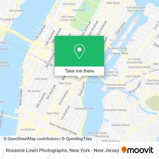
See Roxanne Lowit Photographs, Manhattan, on the map
Public Transit to Roxanne Lowit Photographs in Manhattan
Wondering how to get to Roxanne Lowit Photographs in Manhattan? Moovit helps you find the best way to get to Roxanne Lowit Photographs with step-by-step directions from the nearest public transit station.
Moovit provides free maps and live directions to help you navigate through your city. View schedules, routes, timetables, and find out how long does it take to get to Roxanne Lowit Photographs in real time.
Looking for the nearest stop or station to Roxanne Lowit Photographs? Check out this list of stops closest to your destination: 1 Av/E 31 St; 2nd Ave & East 34th St; E 34 St/2 Av; E 34 St /2 Av; Grand Central-42 St; E 34 St/1 Av; 1 Av/E 34 St; 2nd Ave & East 33rd St; East 34th Street; East 35th St..
Bus: 34TH ST, BM3, M15, M15-SBS, M34-SBS, M34A-SBS, QM25, SHORTLINE HUDSON, BM5.Train: 1, PORT JEFFERSON BRANCH, RONKONKOMA BRANCH.Subway: 6, S, 4, 5, 6X.Ferry: AS, ER, RS, SB.
Want to see if there’s another route that gets you there at an earlier time? Moovit helps you find alternative routes or times. Get directions from and directions to Roxanne Lowit Photographs easily from the Moovit App or Website.
We make riding to Roxanne Lowit Photographs easy, which is why over 1.5 million users, including users in Manhattan, trust Moovit as the best app for public transit. You don’t need to download an individual bus app or train app, Moovit is your all-in-one transit app that helps you find the best bus time or train time available.
For information on prices of bus, subway and train, costs and ride fares to Roxanne Lowit Photographs, please check the Moovit app.
Use the app to navigate to popular places including to the airport, hospital, stadium, grocery store, mall, coffee shop, school, college, and university.
Roxanne Lowit Photographs Address: 330 E 33rd St Apt 21J street in Manhattan
- Arman Erkan, Md,
- Ramy Brow and Makeup Studio,
- New Renaissance Arts Center Of NY,
- Rowan University Student Center,
- Planet Twisted,
- Andre Da Luz Moreira,
- Baron Boisante Editions,
- Shannon Chang,
- David Hudesman,
- Brian Bosworth,
- Rds Delivery,
- Kb,
- Meltzer Media Productions,
- Real Estate Law Firm,
- Chipotle Mexican Grill,
- Prada Transform,
- Happytailsco,
- Steven R. Goldstein Md,
- Karma Solutions Llc,
- Nonna Dora's
Places Near Roxanne Lowit Photographs (Manhattan)
- 3 Stone St, Manhattan,
- Times Square, Manhattan,
- Katz's Deli, Manhattan,
- Pier 83, Manhattan,
- Chinatown, Manhattan,
- 26 Federal Plaza, Manhattan,
- Bellevue Hospital, Manhattan,
- Queens Center Mall, Queens,
- Hudson Yards, Manhattan,
- qqqq, Manhattan,
- San Gennaro Feast, Manhattan,
- 66 John Street, Manhattan,
- 376 Hudson Street, Manhattan,
- 111 Centre New York City Supreme Court, Manhattan,
- Rockefeller Center, Manhattan,
- Mountainside Hospital, Glen Ridge,
- Wall Street, Manhattan,
- 911 Memorial, Manhattan,
- SoHo, Manhattan,
- 1 Police Plaza, Manhattan
How to get to popular places in New York - New Jersey with public transit
Get around Manhattan by public transit!
Traveling around Manhattan has never been so easy. See step by step directions as you travel to any attraction, street or major public transit station. View bus and train schedules, arrival times, service alerts and detailed routes on a map, so you know exactly how to get to anywhere in Manhattan.
When traveling to any destination around Manhattan use Moovit's Live Directions with Get Off Notifications to know exactly where and how far to walk, how long to wait for your line, and how many stops are left. Moovit will alert you when it's time to get off — no need to constantly re-check whether yours is the next stop.
Wondering how to use public transit in Manhattan or how to pay for public transit in Manhattan? Moovit public transit app can help you navigate your way with public transit easily, and at minimum cost. It includes public transit fees, ticket prices, and costs. Looking for a map of Manhattan public transit lines? Moovit public transit app shows all public transit maps in Manhattan with all Bus, Train, Subway, Light Rail, Ferry and Cable Car routes and stops on an interactive map.
New York - New Jersey has 6 transit type(s), including: Bus, Train, Subway, Light Rail, Ferry and Cable Car, operated by several transit agencies, including MTA Subway, Metro-North Railroad, LIRR, PATH, MTA New York City Transit - Express routes, MTA Bus, NJ Transit, NYC Ferry, NICE bus, Bee-Line Bus, NJ Transit Rail, Norwalk Transit District, Hartford Line, River Valley Transit and HART