How to get to Roya Toras by bus?
Click on the bus route to see step by step directions with maps, line arrival times and updated time schedules.
From Perchel Beach Club, San Bartolom�E Tirajana
48 minFrom Playa De Pasito Blanco, San Bartolom�E Tirajana
42 minFrom Playa de las Mujeres, San Bartolom�E Tirajana
53 minFrom Real Aeroclub de Gran Canaria, San Bartolom�E Tirajana
35 minFrom Pasito Blanco, San Bartolom�E Tirajana
39 minFrom Juan Grande, San Bartolom�E Tirajana
38 minFrom Arguineguin, Mogán
41 minFrom Castillo Del Romeral, San Bartolom�E Tirajana
44 min
Bus stops near Roya Toras in San Bartolom�E Tirajana
Bus lines to Roya Toras in San Bartolom�E Tirajana
- 4, Las Palmas De G.C. (San Telmo),VIEW
- 18, Faro De Maspalomas,VIEW
- 73, Clinica Roca,VIEW
- GL-L04, 76 - B - Las Palmas de G.C.,VIEW
- GL-L18, 018/056 - A - Tejeda (Por Roque Nublo),VIEW
- GL-L40, D - San Fernando (desde Montaña La Data) - (por Cruce del Tablero - Mercado),VIEW
- GL-L73, G - Faro de Maspalomas,VIEW
- GL-L333, 194 - B - Campus Universitario,VIEW
- 40, Tablero De Maspalomas,VIEW
- GL-L321, 321/002 - A - Puerto de Mogán,VIEW
- 1, Las Palmas De G.C. (San Telmo),VIEW
- GL-L01, 001/036 - C - Puerto de Mogán (Por Playa del Inglés - Faro de Maspalomas),VIEW
- GL-L09, 009/002 - A - Taurito (Por San Fernando),VIEW
- GL-L31, A - Puerto Rico,VIEW
- GL-L50, 050/001 - B - Las Palmas de G.C. (superfaro),VIEW
- GL-L05, 005/000 - A - Faro de Maspalomas (Por Playa del Inglés),VIEW
- 5, Las Palmas de G.C. - Pya. del Inglés - Faro de Maspalomas,VIEW
- 50, Las Palmas de G.C. - Faro de Maspalomas (superfaro),VIEW
- 52, Carrizal - Faro de Maspalomas,VIEW
- GL-L52, Castillo del Romeral - Faro de Maspalomas,VIEW
What are the closest stations to Roya Toras?
The closest stations to Roya Toras are:
- Urbanizacion Las Llaves is 588 meters away, 8 min walk.
- Centro Comercial Nilo is 595 meters away, 8 min walk.
- San Fernando is 994 meters away, 13 min walk.
- Av. De Gran Canaria, 18 is 1085 meters away, 14 min walk.
Which bus lines stop near Roya Toras?
These bus lines stop near Roya Toras: GL-L01, GL-L09, GL-L31, GL-L52.
What’s the nearest bus station to Roya Toras in San Bartolom�E Tirajana?
The nearest bus stations to Roya Toras in San Bartolom�E Tirajana are Urbanizacion Las Llaves and Centro Comercial Nilo. The closest one is a 8 min walk away.
What time is the first bus to Roya Toras in San Bartolom�E Tirajana?
The GL-L05 is the first bus that goes to Roya Toras in San Bartolom�E Tirajana. It stops nearby at 3:11 AM.
What time is the last bus to Roya Toras in San Bartolom�E Tirajana?
The GL-L01 is the last bus that goes to Roya Toras in San Bartolom�E Tirajana. It stops nearby at 3:38 AM.
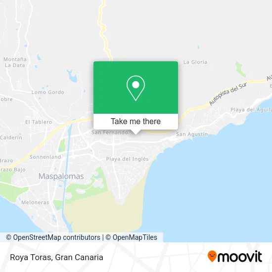
See Roya Toras, San Bartolom�E Tirajana, on the map
Public Transit to Roya Toras in San Bartolom�E Tirajana
Wondering how to get to Roya Toras in San Bartolom�E Tirajana? Moovit helps you find the best way to get to Roya Toras with step-by-step directions from the nearest public transit station.
Moovit provides free maps and live directions to help you navigate through your city. View schedules, routes, timetables, and find out how long does it take to get to Roya Toras in real time.
Looking for the nearest stop or station to Roya Toras? Check out this list of stops closest to your destination: Urbanizacion Las Llaves; Centro Comercial Nilo; San Fernando; Av. De Gran Canaria.
Bus: GL-L01, GL-L09, GL-L31, GL-L52, 4, 18, 73, GL-L04, GL-L18, 1, GL-L50, 40, GL-L321, GL-L05, 5, 50, 52, 91, GL-L30.
Want to see if there’s another route that gets you there at an earlier time? Moovit helps you find alternative routes or times. Get directions from and directions to Roya Toras easily from the Moovit App or Website.
We make riding to Roya Toras easy, which is why over 1.5 million users, including users in San Bartolom�E Tirajana, trust Moovit as the best app for public transit. You don’t need to download an individual bus app or train app, Moovit is your all-in-one transit app that helps you find the best bus time or train time available.
For information on prices of bus, costs and ride fares to Roya Toras, please check the Moovit app.
Use the app to navigate to popular places including to the airport, hospital, stadium, grocery store, mall, coffee shop, school, college, and university.
Roya Toras Address: Calle Alfredo Kraus, 35100 Maspalomas San Bartolomé de Tirajana street in San Bartolom�E Tirajana
- El Zapatero,
- Denimix,
- Sandra Garcia Wolff,
- Zaza Bar,
- Bazar Chen,
- Fernando Belinchon,
- Restaurante Aeroclub,
- Restaurante Abrasa,
- Addio Mare San Agustin,
- Beautik Make Up,
- Urban Classics Yumbo,
- MANGO Meloneras,
- Harry Shop,
- Centro Comercial Eurocenter,
- Lidl,
- Cash & Bisnes,
- C.C. Eurocenter,
- Uniformes Canarias,
- Policía Nacional,
- Pasnova
Places Near Roya Toras (San Bartolom�E Tirajana)
- La Minilla, Las Palmas De Gran Canaria,
- Hospital Dr. Negrín, Las Palmas De Gran Canaria,
- Los Alisios, Las Palmas De Gran Canaria,
- Alcampo, Telde,
- Terminal Naviera Armas, Las Palmas De Gran Canaria,
- IKEA Gran Canaria, Telde,
- Consulta de Traumatología y Cirugía Ortopédica Dr. Juan S Ojeda Castellano, Santa Luc�De Tirajana,
- Cocodrilo Park, Agüimes,
- Centro Comercial Las Arenas, Las Palmas De Gran Canaria,
- Hospital Militar, Las Palmas De Gran Canaria,
- Vegueta, Las Palmas De Gran Canaria,
- C.C. El Mirador, Las Palmas De Gran Canaria,
- Centro Comercial Las Terrazas, Telde,
- CC Las Terrazas, Las Palmas De Gran Canaria,
- Mogán Mall, Mog�30,
- Estadio de Gran Canaria, Las Palmas De Gran Canaria,
- Ferry Bus Armas, Las Palmas De Gran Canaria,
- Centro Comercial Alcampo, Telde,
- C.C. Alisios, Las Palmas De Gran Canaria,
- Tanatorio De San Miguel, Las Palmas De Gran Canaria
How to get to popular places in Gran Canaria with public transit
Get around San Bartolom�E Tirajana by public transit!
Traveling around San Bartolom�E Tirajana has never been so easy. See step by step directions as you travel to any attraction, street or major public transit station. View bus and train schedules, arrival times, service alerts and detailed routes on a map, so you know exactly how to get to anywhere in San Bartolom�E Tirajana.
When traveling to any destination around San Bartolom�E Tirajana use Moovit's Live Directions with Get Off Notifications to know exactly where and how far to walk, how long to wait for your line, and how many stops are left. Moovit will alert you when it's time to get off — no need to constantly re-check whether yours is the next stop.
Wondering how to use public transit in San Bartolom�E Tirajana or how to pay for public transit in San Bartolom�E Tirajana? Moovit public transit app can help you navigate your way with public transit easily, and at minimum cost. It includes public transit fees, ticket prices, and costs. Looking for a map of San Bartolom�E Tirajana public transit lines? Moovit public transit app shows all public transit maps in San Bartolom�E Tirajana with all bus routes and stops on an interactive map.
Gran Canaria has 1 transit type(s), including: bus, operated by several transit agencies, including GLOBAL (AUTGC), GLOBAL Salcai-Utinsa S.A.L., GUAGUAS (AUTGC), Guaguas Municipales, PARDILLA BUS (AUTGC), TELBUS (AUTGC) and ALSA-GUMIDAFE (AUTGC)