Directions to Royal Face Angra dos R (Angra Dos Reis) with public transportation
The following transit lines have routes that pass near Royal Face Angra dos R
 Bus: 102, 106, 230, B206, T11.
- Ferry: ANGRA DOS REIS - ILHA GRANDE, ANGRA DOS REIS - ILHA GRANDE.
How to get to Royal Face Angra dos R by bus?
Click on the bus route to see step by step directions with maps, line arrival times and updated time schedules.
From Rua do Monumento do Aquidabã 95, Jacuecanga
79 minFrom Club Ponta Leste, Jacuecanga
49 minFrom Banqueta, Cunhambebe
44 minFrom Camping Cristina, Cunhambebe
81 minFrom Caputera I, Jacuecanga
63 minFrom Bracuí, Cunhambebe
81 minFrom Riegert e Galindo Engenharia, Jacuecanga
38 minFrom Rod. Governador Mário Covas, Km 115 s/n, Cunhambebe
82 minFrom Ruínas do Engenho do Bracuhy, Cunhambebe
77 minFrom Terminal Aquaviário De Angra Dos Reis (Píer/Transpetro), Jacuecanga
81 min
Bus stops near Royal Face Angra dos R in Angra Dos Reis
- Rua Coronel Carvalho, 846-942, 2 min walk,VIEW
- Ponto De Embarque 07 - Praça Do Porto, 2 min walk,VIEW
- Ponto De Embarque 06 - Praça Do Porto, 2 min walk,VIEW
- Centro / Praça Do Porto, 3 min walk,VIEW
- Rua Coronel Carvalho, 617-713, 3 min walk,VIEW
- Ponto De Embarque 04 - Praça Do Porto, 3 min walk,VIEW
- Centro / Largo Da Lapa, 3 min walk,VIEW
- Ponto Final - Angra Dos Reis (Colitur), 4 min walk,VIEW
- Centro / Santa Luzia, 4 min walk,VIEW
- Ponto 01 - Santa Luzia, 5 min walk,VIEW
- Pronto Socorro, 5 min walk,VIEW
Ferry station near Royal Face Angra dos R in Angra Dos Reis
- Estação Santa Luzia (Angra Dos Reis) ⛴, 19 min walk,VIEW
Bus lines to Royal Face Angra dos R in Angra Dos Reis
- C05, Centro (via Morro da Cruz),VIEW
- B106, Jacuecanga (via Morro da Cruz),VIEW
- 205, Areal,VIEW
- 207, Centro (Via Morro Da Cruz),VIEW
- B207, Japuíba (via Rio-Santos),VIEW
- 224, Vila Nova,VIEW
- 225, Campo Belo,VIEW
- 203, Serra D'Água (Via Zungu),VIEW
- B203, Serra D'Agua (Túnel),VIEW
- 204, Centro,VIEW
- B206, Centro (via Balneário),VIEW
- C206, Centro (Saída Vale da Banqueta),VIEW
- 221, Nova Angra,VIEW
- B221, Nova Angra (via Gamboa / Ribeira),VIEW
- 208, Belém (Circular),VIEW
- A220, Japuíba (Via Gamboa - Circular),VIEW
- B220, Japuíba (Via Balneário / Ribeira - Circular),VIEW
- T11, Garagem → Ponta Leste,VIEW
- 206, Centro (Via Morro Da Cruz),VIEW
- C05B, Centro (via Balneário),VIEW
What are the closest stations to Royal Face Angra dos R?
The closest stations to Royal Face Angra dos R are:
- Rua Coronel Carvalho, 846-942 is 115 meters away, 2 min walk.
- Ponto De Embarque 07 - Praça Do Porto is 133 meters away, 2 min walk.
- Ponto De Embarque 06 - Praça Do Porto is 145 meters away, 2 min walk.
- Centro / Praça Do Porto is 160 meters away, 3 min walk.
- Rua Coronel Carvalho, 617-713 is 162 meters away, 3 min walk.
- Ponto De Embarque 04 - Praça Do Porto is 170 meters away, 3 min walk.
- Centro / Largo Da Lapa is 191 meters away, 3 min walk.
- Ponto Final - Angra Dos Reis (Colitur) is 261 meters away, 4 min walk.
- Centro / Santa Luzia is 287 meters away, 4 min walk.
- Ponto 01 - Santa Luzia is 306 meters away, 5 min walk.
- Pronto Socorro is 316 meters away, 5 min walk.
- Estação Santa Luzia (Angra Dos Reis) ⛴ is 1457 meters away, 19 min walk.
Which bus lines stop near Royal Face Angra dos R?
These bus lines stop near Royal Face Angra dos R: 102, 106, 230, B206, T11.
What’s the nearest bus station to Royal Face Angra dos R in Angra Dos Reis?
The nearest bus stations to Royal Face Angra dos R in Angra Dos Reis are Rua Coronel Carvalho, 846-942, Ponto De Embarque 07 - Praça Do Porto and Ponto De Embarque 06 - Praça Do Porto. The closest one is a 2 min walk away.
What’s the nearest ferry station to Royal Face Angra dos R in Angra Dos Reis?
The nearest ferry station to Royal Face Angra dos R in Angra Dos Reis is Estação Santa Luzia (Angra Dos Reis) ⛴. It’s a 19 min walk away.
What time is the first bus to Royal Face Angra dos R in Angra Dos Reis?
The T11 is the first bus that goes to Royal Face Angra dos R in Angra Dos Reis. It stops nearby at 4:50 AM.
What time is the last bus to Royal Face Angra dos R in Angra Dos Reis?
The T11 is the last bus that goes to Royal Face Angra dos R in Angra Dos Reis. It stops nearby at 2:00 AM.
What time is the first ferry to Royal Face Angra dos R in Angra Dos Reis?
The ANGRA DOS REIS - ILHA GRANDE is the first ferry that goes to Royal Face Angra dos R in Angra Dos Reis. It stops nearby at 8:35 AM.
What time is the last ferry to Royal Face Angra dos R in Angra Dos Reis?
The ANGRA DOS REIS - ILHA GRANDE is the last ferry that goes to Royal Face Angra dos R in Angra Dos Reis. It stops nearby at 6:30 PM.
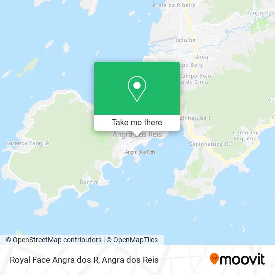
See Royal Face Angra dos R, Angra Dos Reis, on the map
Public Transit to Royal Face Angra dos R in Angra Dos Reis
Wondering how to get to Royal Face Angra dos R in Angra Dos Reis? Moovit helps you find the best way to get to Royal Face Angra dos R with step-by-step directions from the nearest public transit station.
Moovit provides free maps and live directions to help you navigate through your city. View schedules, routes, timetables, and find out how long does it take to get to Royal Face Angra dos R in real time.
Looking for the nearest stop or station to Royal Face Angra dos R? Check out this list of stops closest to your destination: Rua Coronel Carvalho; Ponto De Embarque 07 - Praça Do Porto; Ponto De Embarque 06 - Praça Do Porto; Centro / Praça Do Porto; Rua Coronel Carvalho; Ponto De Embarque 04 - Praça Do Porto; Centro / Largo Da Lapa; Ponto Final - Angra Dos Reis (Colitur); Centro / Santa Luzia; Ponto 01 - Santa Luzia; Pronto Socorro; Estação Santa Luzia (Angra Dos Reis) ⛴.
Bus: 102, 106, 230, B206, T11, C05, B106, 205, 207, B207, 203, B203, 204, C206, 221, B221, 206, 208, A220, B220.Ferry: ANGRA DOS REIS - ILHA GRANDE, ANGRA DOS REIS - ILHA GRANDE.
Want to see if there’s another route that gets you there at an earlier time? Moovit helps you find alternative routes or times. Get directions from and directions to Royal Face Angra dos R easily from the Moovit App or Website.
We make riding to Royal Face Angra dos R easy, which is why over 1.5 million users, including users in Angra Dos Reis, trust Moovit as the best app for public transit. You don’t need to download an individual bus app or train app, Moovit is your all-in-one transit app that helps you find the best bus time or train time available.
For information on prices of bus, costs and ride fares to Royal Face Angra dos R, please check the Moovit app.
Use the app to navigate to popular places including to the airport, hospital, stadium, grocery store, mall, coffee shop, school, college, and university.
Royal Face Angra dos R Address: Rua Coronel Carvalho, 87 Centro Angra dos Reis-RJ 23900-315 street in Angra Dos Reis
- Gs Planejamento,
- Espaco Aline Santo,
- P S Daher Artesanato,
- Organizações Venâncio Ltda Depósito,
- Restaurante Quilomania,
- Tia Cris,
- Joval Restaurante E Churrascaria,
- Brasileirinho,
- Restaurante los Pamps,
- Consultório Odontológica Pró Implante,
- Hortifruti da Cidade,
- Pro-Lar de Angra 32,
- Estar - Escola Tecnica Angra Dos Reis,
- Tabet Miguel Bar e Restaurante Ltda,
- Artpop Comunicacao,
- Barbosa Material de Construcao,
- Venus Store,
- Ks Salgados,
- Fithi Sucos e Lanches,
- Tonys Bar E Lanchonete
Places Near Royal Face Angra dos R (Angra Dos Reis)
- Rua Prefeito João Gregório Galindo 2487, Angra Dos Reis,
- Rua Prefeito João Gregório Galindo, Cunhambebe,
- Vila Galé Eco Resort De Angra, Angra Dos Reis,
- Praia de Paraty Mirim, Parati,
- Mambucaba, Mambucaba,
- Alambique Engenho D'Ouro, Parati,
- Rua Cônegos Bittencourt, Angra Dos Reis,
- Avenida Antônio Bertholdo da Silva Jordão 7346, Jacuecanga,
- Garatucaia, Angra Dos Reis,
- Rodovia Procurador Haroldo Fernandes Duarte, Km 513,5 s / n, Cunhambebe,
- Rodovia BR 101, Km 533 s/n, Mambucaba,
- Praia do Laboratório, Angra Dos Reis,
- Vila Residencial De Mambucaba, Mambucaba,
- Condominio Laranjeiras, Parati Mirim,
- BR 101, Km 508 s/n, Cunhambebe,
- praia jabaquara - parati, Parati,
- Cachoeira do Tobogã, Parati,
- Avenida Almirante Jair Carneiro Toscano de Brito 110, Angra Dos Reis,
- Centro Histórico de Paraty, Parati,
- Verolme, Jacuecanga
How to get to popular places in Angra dos Reis with public transit
Get around Angra Dos Reis by public transit!
Traveling around Angra Dos Reis has never been so easy. See step by step directions as you travel to any attraction, street or major public transit station. View bus and train schedules, arrival times, service alerts and detailed routes on a map, so you know exactly how to get to anywhere in Angra Dos Reis.
When traveling to any destination around Angra Dos Reis use Moovit's Live Directions with Get Off Notifications to know exactly where and how far to walk, how long to wait for your line, and how many stops are left. Moovit will alert you when it's time to get off — no need to constantly re-check whether yours is the next stop.
Wondering how to use public transit in Angra Dos Reis or how to pay for public transit in Angra Dos Reis? Moovit public transit app can help you navigate your way with public transit easily, and at minimum cost. It includes public transit fees, ticket prices, and costs. Looking for a map of Angra Dos Reis public transit lines? Moovit public transit app shows all public transit maps in Angra Dos Reis with all Bus and Ferry routes and stops on an interactive map.
Angra dos Reis has 2 transit type(s), including: Bus and Ferry, operated by several transit agencies, including Viação Senhor do Bonfim, Colitur Transportes Rodoviários, Cooparatyense (Vans), Costa Verde Transportes, Barcas Rio, Objetiva Tour, Vilanova Tour, Rodoviário Oceano, BusUFF and Colitur (Tarifa Zero - Paraty)