Directions to Rozangela Mazur (Santa Felicidade) with public transportation
The following transit lines have routes that pass near Rozangela Mazur
How to get to Rozangela Mazur by bus?
Click on the bus route to see step by step directions with maps, line arrival times and updated time schedules.
From Daju, Água Verde
63 minFrom Praça da Espanha, Batel
45 minFrom Rua João Parolin, Parolin
61 minFrom Hospital Cajuru, Cristo Rei
57 minFrom Hospital Universitário Cajuru, Cristo Rei
56 minFrom Rua Reinaldino Schaffenberg de Quadros, Alto Da Rua XV
46 minFrom Hospital Marcelino Champagnat, Jardim Botânico
54 minFrom Praça das Nações, Alto Da Rua XV
45 minFrom Estação Tubo Prefeitura, Centro Cívico
37 min
Bus stops near Rozangela Mazur in Santa Felicidade
Bus lines to Rozangela Mazur in Santa Felicidade
- 917 JARDIM IPÊ, Jardim Ipê →Terminal Santa Felicidade,VIEW
- 928 PASSAÚNA / JARDIM IPÊ, Terminal Santa Felicidade ↺ Jardim Ipê (Circular),VIEW
- 989 MAD. SANTA FELICIDADE, Praça Rui Barbosa ↺ Santa Felicidade (Circular),VIEW
- 916 PINHEIROS, Terminal Santa Felicidade → Pinheiros,VIEW
- 958 PINHEIROS / JOSÉ CULPI, Pinheiros → Terminal Santa Felicidade,VIEW
- 915 OURO VERDE (VIA VILA BÁDIA), OURO VERDE (via VILA BÁDIA),VIEW
- 948 BUTIATUVINHA / OURO VERDE, BUTIATUVINHA / OURO VERDE,VIEW
- 972 JARDIM ITÁLIA, Terminal Santa Felicidade → Travessa Nestor de Castro,VIEW
What are the closest stations to Rozangela Mazur?
The closest stations to Rozangela Mazur are:
- R. João Reffo, 69 is 102 meters away, 2 min walk.
- R. João Reffo, 84 is 132 meters away, 3 min walk.
- R. Francisco Dallalibera, 1660 is 135 meters away, 3 min walk.
- R. Saturnino Miranda, 822 is 149 meters away, 3 min walk.
Which bus line stops near Rozangela Mazur?
972 JARDIM ITÁLIA (Travessa Nestor de Castro → Terminal Santa Felicidade)
What’s the nearest bus station to Rozangela Mazur in Santa Felicidade?
The nearest bus station to Rozangela Mazur in Santa Felicidade is R. João Reffo, 69. It’s a 2 min walk away.
What time is the first bus to Rozangela Mazur in Santa Felicidade?
The 989 MAD. SANTA FELICIDADE is the first bus that goes to Rozangela Mazur in Santa Felicidade. It stops nearby at 3:01 AM.
What time is the last bus to Rozangela Mazur in Santa Felicidade?
The 989 MAD. SANTA FELICIDADE is the last bus that goes to Rozangela Mazur in Santa Felicidade. It stops nearby at 3:02 AM.
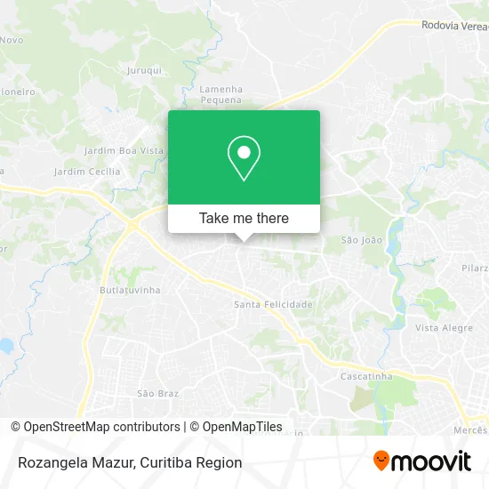
See Rozangela Mazur, Santa Felicidade, on the map
Public Transit to Rozangela Mazur in Santa Felicidade
Wondering how to get to Rozangela Mazur in Santa Felicidade? Moovit helps you find the best way to get to Rozangela Mazur with step-by-step directions from the nearest public transit station.
Moovit provides free maps and live directions to help you navigate through your city. View schedules, routes, timetables, and find out how long does it take to get to Rozangela Mazur in real time.
Looking for the nearest stop or station to Rozangela Mazur? Check out this list of stops closest to your destination: R. João Reffo; R. João Reffo; R. Francisco Dallalibera; R. Saturnino Miranda.
Bus: 972 JARDIM ITÁLIA, 917 JARDIM IPÊ, 928 PASSAÚNA / JARDIM IPÊ, 989 MAD. SANTA FELICIDADE, 916 PINHEIROS, 958 PINHEIROS / JOSÉ CULPI, 915 OURO VERDE (VIA VILA BÁDIA), 948 BUTIATUVINHA / OURO VERDE.
Want to see if there’s another route that gets you there at an earlier time? Moovit helps you find alternative routes or times. Get directions from and directions to Rozangela Mazur easily from the Moovit App or Website.
We make riding to Rozangela Mazur easy, which is why over 1.5 million users, including users in Santa Felicidade, trust Moovit as the best app for public transit. You don’t need to download an individual bus app or train app, Moovit is your all-in-one transit app that helps you find the best bus time or train time available.
For information on prices of bus, costs and ride fares to Rozangela Mazur, please check the Moovit app.
Use the app to navigate to popular places including to the airport, hospital, stadium, grocery store, mall, coffee shop, school, college, and university.
Rozangela Mazur Address: Avenida Fredolin Wolf, 5575 Santa Felicidade Curitiba-PR 82410-330 street in Santa Felicidade
- Dwu Comércio e Serviços,
- Guinchos Caliari,
- Galpão Ventania,
- Associação Espiritualista Xango Caboclo Sete Cachoeira,
- Pbl Incorporadora de Bens,
- Elevacao Topografia,
- Aviario Caliari,
- Panificadora Panetelli,
- Rua Francisco Dallalibera 1539,
- Posto Ventania,
- Débora Botega Fisioterapia,
- Stop Lanches,
- Rua João Refo, 2 - Santa Felicidade,
- Santa Felicidade - Pimenta de Cheiro,
- Marcella Caliari,
- Auto Center Itália,
- Mercearia O Baratão,
- M Line,
- Parada Santa,
- áudio. Com-Assistência Técnica
Places Near Rozangela Mazur (Santa Felicidade)
- Pontifícia Universidade Católica do Paraná (PUCPR), Prado Velho,
- Shopping Palladium, Portão,
- Rua Martim Afonso 558, Mercês,
- Hospital Erasto Gaertner, Jardim Das Américas,
- Jardim Botânico de Curitiba PR, Centro,
- Hospital Nossa Senhora Das Graças, Mercês,
- Hospital Universitário Evangélico de Curitiba, Bigorrilho,
- Arena Da Baixada - Curitiba,
- Hospital de Clínicas (HC - UFPR), Centro,
- Hospital Da Cruz Vermelha, Batel,
- Hospital Madalena Sofia, Bairro Alto,
- Campo Largo, Campo,
- Shopping Estação, Rebouças,
- Parque Barigui, Mercês,
- Hospital do Rocio, Campo,
- Park Shopping Barigüi, Mossunguê,
- Jockey Plaza Shopping Center, Tarumã,
- Hospital Angelina Caron, Campina Grande Do Sul,
- Hhhhh, Fazendinha,
- Rua General Mário Tourinho, Campina Do Siqueira
How to get to popular places in Curitiba Region with public transit
Get around Santa Felicidade by public transit!
Traveling around Santa Felicidade has never been so easy. See step by step directions as you travel to any attraction, street or major public transit station. View bus and train schedules, arrival times, service alerts and detailed routes on a map, so you know exactly how to get to anywhere in Santa Felicidade.
When traveling to any destination around Santa Felicidade use Moovit's Live Directions with Get Off Notifications to know exactly where and how far to walk, how long to wait for your line, and how many stops are left. Moovit will alert you when it's time to get off — no need to constantly re-check whether yours is the next stop.
Wondering how to use public transit in Santa Felicidade or how to pay for public transit in Santa Felicidade? Moovit public transit app can help you navigate your way with public transit easily, and at minimum cost. It includes public transit fees, ticket prices, and costs. Looking for a map of Santa Felicidade public transit lines? Moovit public transit app shows all public transit maps in Santa Felicidade with all Bus and Cable Car routes and stops on an interactive map.
Curitiba Region has 2 transit type(s), including: Bus and Cable Car, operated by several transit agencies, including Sistema Integrado de Mobilidade (URBS), Sistema Integrado de Mobilidade (AMEP), URBS (Cartões bancários e Dinheiro), URBS (Cartões bancários / Cartão URBS), AMEP (Cartões bancários / Cartão MetroCard), AMEP (Cartões bancários / Cartão MetroCard / Dinheiro), Viação Colombo (Dinheiro), TRIAR (Cartão TRIAR / Dinheiro), Empresa Curitiba Cerro Azul (Dinheiro), Expresso Nossa Senhora da Penha (Dinheiro), Empresa Campo Alto Tijucas (Dinheiro), Auto Viação São José (Cartão VEM / Dinheiro), BRT S/A (Cartão VEM / Dinheiro), TransPiedade (Cartão Cidadão / Dinheiro) and Oceânica Sul (Cartão Transporte / Dinheiro)