Directions to Rp Axis (East Williston) with public transportation
The following transit lines have routes that pass near Rp Axis
 Bus: N22, N27.
- Train: OYSTER BAY BRANCH, RONKONKOMA BRANCH, PORT JEFFERSON BRANCH, MONTAUK BRANCH.
How to get to Rp Axis by bus?
Click on the bus route to see step by step directions with maps, line arrival times and updated time schedules.
From East Meadow, NY, East Meadow
71 minFrom Bayside, Queens
80 minFrom Ohel Chabad Lubavitch, Queens
94 minFrom Northwell - Long Island Jewish Medical Center, Queens
50 minFrom Valley Stream, NY, Valley Stream
105 minFrom Queens Village, Queens
65 minFrom North Shore Towers, Queens
75 minFrom Mercy Hospital, Rockville Centre
71 minFrom Long island Jewish Hospital, Queens
45 minFrom Bayside, NY, Queens
81 min
How to get to Rp Axis by train?
Click on the train route to see step by step directions with maps, line arrival times and updated time schedules.
Bus stop near Rp Axis in East Williston
- Hillside Av / Roslyn, 4 min walk,VIEW
Train stations near Rp Axis in East Williston
Bus lines to Rp Axis in East Williston
- N27, Roosevelt Field,VIEW
What are the closest stations to Rp Axis?
The closest stations to Rp Axis are:
- Hillside Av / Roslyn is 306 yards away, 4 min walk.
- Carle Place is 1065 yards away, 13 min walk.
- Albertson is 2270 yards away, 27 min walk.
- Mineola is 5027 yards away, 59 min walk.
Which bus lines stop near Rp Axis?
These bus lines stop near Rp Axis: N22, N27.
Which train lines stop near Rp Axis?
These train lines stop near Rp Axis: OYSTER BAY BRANCH, RONKONKOMA BRANCH.
What’s the nearest train station to Rp Axis in East Williston?
The nearest train station to Rp Axis in East Williston is Carle Place. It’s a 13 min walk away.
What’s the nearest bus station to Rp Axis in East Williston?
The nearest bus station to Rp Axis in East Williston is Hillside Av / Roslyn. It’s a 4 min walk away.
What time is the first train to Rp Axis in East Williston?
The PORT JEFFERSON BRANCH is the first train that goes to Rp Axis in East Williston. It stops nearby at 3:47 AM.
What time is the last train to Rp Axis in East Williston?
The RONKONKOMA BRANCH is the last train that goes to Rp Axis in East Williston. It stops nearby at 2:50 AM.
What time is the first bus to Rp Axis in East Williston?
The N27 is the first bus that goes to Rp Axis in East Williston. It stops nearby at 5:26 AM.
What time is the last bus to Rp Axis in East Williston?
The N27 is the last bus that goes to Rp Axis in East Williston. It stops nearby at 11:04 PM.
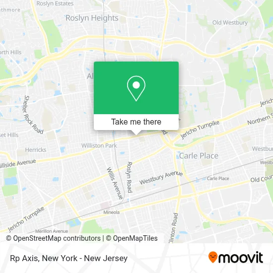
See Rp Axis, East Williston, on the map
Public Transit to Rp Axis in East Williston
Wondering how to get to Rp Axis in East Williston? Moovit helps you find the best way to get to Rp Axis with step-by-step directions from the nearest public transit station.
Moovit provides free maps and live directions to help you navigate through your city. View schedules, routes, timetables, and find out how long does it take to get to Rp Axis in real time.
Looking for the nearest stop or station to Rp Axis? Check out this list of stops closest to your destination: Hillside Av / Roslyn; Carle Place; Albertson; Mineola.
Bus: N22, N27.Train: OYSTER BAY BRANCH, RONKONKOMA BRANCH, PORT JEFFERSON BRANCH, MONTAUK BRANCH.
Want to see if there’s another route that gets you there at an earlier time? Moovit helps you find alternative routes or times. Get directions from and directions to Rp Axis easily from the Moovit App or Website.
We make riding to Rp Axis easy, which is why over 1.5 million users, including users in East Williston, trust Moovit as the best app for public transit. You don’t need to download an individual bus app or train app, Moovit is your all-in-one transit app that helps you find the best bus time or train time available.
For information on prices of bus and train, costs and ride fares to Rp Axis, please check the Moovit app.
Use the app to navigate to popular places including to the airport, hospital, stadium, grocery store, mall, coffee shop, school, college, and university.
Rp Axis Address: 96 E Williston Ave street in East Williston
- Caniano, Daniel J, Dds,
- Young Nak Presbyterian Church,
- Crosspoint Church,
- Buddhist Tzu Chi Foundation,
- Troop 8 East Williston, NY,
- Streetfeeds Llc,
- En - Toto Couture,
- Magentablue,
- C.W.D.A. Inspection Team,
- East Williston Village Historic District,
- Simpson Bathroom Remodeling,
- Blumlein Associates, Inc.,
- Devlin Field,
- Dr. Joseph Barrese,
- United Food & Commercial Workers Union (Local 342-50 Amalgamated Meat Cutters Union),
- The Art Of Art Studio Little Art Studio,
- Citizens,
- Gift Card Galaxy,
- Taurus Fleet Services,
- Piccolo's
Places Near Rp Axis (East Williston)
- 111 Centre New York City Supreme Court, Manhattan,
- San Gennaro Feast, Manhattan,
- Hudson Yards, Manhattan,
- SoHo, Manhattan,
- Wall Street, Manhattan,
- 26 Federal Plaza, Manhattan,
- qqqq, Manhattan,
- 3 Stone St, Manhattan,
- Chinatown, Manhattan,
- Pier 83, Manhattan,
- 376 Hudson Street, Manhattan,
- Times Square, Manhattan,
- Mountainside Hospital, Glen Ridge,
- Katz's Deli, Manhattan,
- Bellevue Hospital, Manhattan,
- 66 John Street, Manhattan,
- Queens Center Mall, Queens,
- 1 Police Plaza, Manhattan,
- 911 Memorial, Manhattan,
- Rockefeller Center, Manhattan
How to get to popular places in New York - New Jersey with public transit
Get around East Williston by public transit!
Traveling around East Williston has never been so easy. See step by step directions as you travel to any attraction, street or major public transit station. View bus and train schedules, arrival times, service alerts and detailed routes on a map, so you know exactly how to get to anywhere in East Williston.
When traveling to any destination around East Williston use Moovit's Live Directions with Get Off Notifications to know exactly where and how far to walk, how long to wait for your line, and how many stops are left. Moovit will alert you when it's time to get off — no need to constantly re-check whether yours is the next stop.
Wondering how to use public transit in East Williston or how to pay for public transit in East Williston? Moovit public transit app can help you navigate your way with public transit easily, and at minimum cost. It includes public transit fees, ticket prices, and costs. Looking for a map of East Williston public transit lines? Moovit public transit app shows all public transit maps in East Williston with all Bus, Train, Subway, Light Rail, Ferry and Cable Car routes and stops on an interactive map.
New York - New Jersey has 6 transit type(s), including: Bus, Train, Subway, Light Rail, Ferry and Cable Car, operated by several transit agencies, including MTA Subway, Metro-North Railroad, LIRR, PATH, MTA New York City Transit - Express routes, MTA Bus, NJ Transit, NYC Ferry, NICE bus, Bee-Line Bus, NJ Transit Rail, Norwalk Transit District, Hartford Line, River Valley Transit and HART