Directions to Rp Mix (Alto Boqueirão) with public transportation
The following transit lines have routes that pass near Rp Mix
How to get to Rp Mix by bus?
Click on the bus route to see step by step directions with maps, line arrival times and updated time schedules.
From Rua Padre Anchieta 2050, Água Verde
62 minFrom Rua Cândido Xavier, Água Verde
62 minFrom Rua Omilio Monteiro Soares, Fanny
39 minFrom Rua Desembargador Westphalen, Rebouças
40 minFrom Pontifícia Universidade Católica do Paraná (PUCPR), Prado Velho
46 minFrom Estação Tubo Paiol, Prado Velho
36 minFrom Estação Tubo Jardim Botânico, Jardim Botânico
48 minFrom Rua José Cadilhe, Água Verde
67 minFrom Avenida Prefeito Maurício Fruet 2150, Cajuru
51 minFrom Praça Do Japão, Água Verde
62 min
Bus stops near Rp Mix in Alto Boqueirão
Bus lines to Rp Mix in Alto Boqueirão
- 531 SANTA INÊS, Santa Inês → Terminal Boqueirão,VIEW
- 533 ÉRICO VERÍSSIMO / PANTANAL, Terminal Boqueirão → Érico Veríssimo,VIEW
- 629 ALTO BOQUEIRÃO, Alto Boqueirão → Terminal Capão Raso,VIEW
- X12 ESPECIAL BOQUEIRÃO, Terminal Boqueirão → Terminal Sítio Cercado,VIEW
- 602 CIRCULAR SUL (ANTI-HORÁRIO), Terminal Sítio Cercado → Terminal Boqueirão,VIEW
- 502 CIRCULAR SUL (HORÁRIO), Sentido Horário,VIEW
- 519 MAD. SÃO FRANCISCO / IGUAPE, Terminal Hauer ↺ São Francisco / Iguape (Circular),VIEW
What are the closest stations to Rp Mix?
The closest stations to Rp Mix are:
- R. Francisco Derosso, 1621 is 188 meters away, 3 min walk.
- Eucaliptos is 229 meters away, 4 min walk.
- R. Francisco Derosso, 5100 is 309 meters away, 5 min walk.
Which bus lines stop near Rp Mix?
These bus lines stop near Rp Mix: 502 CIRCULAR SUL (HORÁRIO), 507 SÍTIO CERCADO (HORÁRIO), 602 CIRCULAR SUL (ANTI-HORÁRIO), 629 ALTO BOQUEIRÃO.
What’s the nearest bus station to Rp Mix in Alto Boqueirão?
The nearest bus station to Rp Mix in Alto Boqueirão is R. Francisco Derosso, 1621. It’s a 3 min walk away.
What time is the first bus to Rp Mix in Alto Boqueirão?
The 519 MAD. SÃO FRANCISCO / IGUAPE is the first bus that goes to Rp Mix in Alto Boqueirão. It stops nearby at 3:38 AM.
What time is the last bus to Rp Mix in Alto Boqueirão?
The 519 MAD. SÃO FRANCISCO / IGUAPE is the last bus that goes to Rp Mix in Alto Boqueirão. It stops nearby at 2:39 AM.
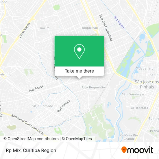
See Rp Mix, Alto Boqueirão, on the map
Public Transit to Rp Mix in Alto Boqueirão
Wondering how to get to Rp Mix in Alto Boqueirão? Moovit helps you find the best way to get to Rp Mix with step-by-step directions from the nearest public transit station.
Moovit provides free maps and live directions to help you navigate through your city. View schedules, routes, timetables, and find out how long does it take to get to Rp Mix in real time.
Looking for the nearest stop or station to Rp Mix? Check out this list of stops closest to your destination: R. Francisco Derosso; Eucaliptos; R. Francisco Derosso.
Bus: 502 CIRCULAR SUL (HORÁRIO), 507 SÍTIO CERCADO (HORÁRIO), 602 CIRCULAR SUL (ANTI-HORÁRIO), 629 ALTO BOQUEIRÃO, 531 SANTA INÊS, 533 ÉRICO VERÍSSIMO / PANTANAL, X12 ESPECIAL BOQUEIRÃO, 519 MAD. SÃO FRANCISCO / IGUAPE.
Want to see if there’s another route that gets you there at an earlier time? Moovit helps you find alternative routes or times. Get directions from and directions to Rp Mix easily from the Moovit App or Website.
We make riding to Rp Mix easy, which is why over 1.5 million users, including users in Alto Boqueirão, trust Moovit as the best app for public transit. You don’t need to download an individual bus app or train app, Moovit is your all-in-one transit app that helps you find the best bus time or train time available.
For information on prices of bus, costs and ride fares to Rp Mix, please check the Moovit app.
Use the app to navigate to popular places including to the airport, hospital, stadium, grocery store, mall, coffee shop, school, college, and university.
Rp Mix Address: Rua José Juliano Ayres, Alto Boqueirão Curitiba-PR 81770-130 street in Alto Boqueirão
- Cwb Importados,
- Novak Pneus,
- Rk Express,
- Trans Gvs,
- Faszank Marketing Digital,
- Professor Cibernetico,
- Estação Tubo Eucaliptos,
- Vetoris Aperfeiçoamento Profissional Segura do Trabalho,
- Acos Gbs Comércio de Tubos e Laminados,
- IORC,
- Super Pão,
- Líder - Fogos e Pipas,
- C. M. E. I. Tiradentes,
- Representante Comercial,
- Sandra Confecções,
- Creche Municipal Xaxim,
- Lutiani Consultoria Turistica,
- Hinode Curitiba,
- d'Rose Lingerie,
- Lotérica
Places Near Rp Mix (Alto Boqueirão)
- Hospital Universitário Evangélico de Curitiba, Bigorrilho,
- Shopping Estação, Rebouças,
- Hhhhh, Fazendinha,
- Jockey Plaza Shopping Center, Tarumã,
- Shopping Palladium, Portão,
- Hospital Erasto Gaertner, Jardim Das Américas,
- Hospital de Clínicas (HC - UFPR), Centro,
- Rua General Mário Tourinho, Campina Do Siqueira,
- Hospital Nossa Senhora Das Graças, Mercês,
- Hospital Da Cruz Vermelha, Batel,
- Hospital do Rocio, Campo,
- Park Shopping Barigüi, Mossunguê,
- Rua Martim Afonso 558, Mercês,
- Hospital Angelina Caron, Campina Grande Do Sul,
- Pontifícia Universidade Católica do Paraná (PUCPR), Prado Velho,
- Campo Largo, Campo,
- Parque Barigui, Mercês,
- Arena Da Baixada - Curitiba,
- Hospital Madalena Sofia, Bairro Alto,
- Jardim Botânico de Curitiba PR, Centro
How to get to popular places in Curitiba Region with public transit
Get around Alto Boqueirão by public transit!
Traveling around Alto Boqueirão has never been so easy. See step by step directions as you travel to any attraction, street or major public transit station. View bus and train schedules, arrival times, service alerts and detailed routes on a map, so you know exactly how to get to anywhere in Alto Boqueirão.
When traveling to any destination around Alto Boqueirão use Moovit's Live Directions with Get Off Notifications to know exactly where and how far to walk, how long to wait for your line, and how many stops are left. Moovit will alert you when it's time to get off — no need to constantly re-check whether yours is the next stop.
Wondering how to use public transit in Alto Boqueirão or how to pay for public transit in Alto Boqueirão? Moovit public transit app can help you navigate your way with public transit easily, and at minimum cost. It includes public transit fees, ticket prices, and costs. Looking for a map of Alto Boqueirão public transit lines? Moovit public transit app shows all public transit maps in Alto Boqueirão with all Bus and Cable Car routes and stops on an interactive map.
Curitiba Region has 2 transit type(s), including: Bus and Cable Car, operated by several transit agencies, including Sistema Integrado de Mobilidade (URBS), Sistema Integrado de Mobilidade (AMEP), URBS (Cartões bancários e Dinheiro), URBS (Cartões bancários / Cartão URBS), AMEP (Cartões bancários / Cartão MetroCard), AMEP (Cartões bancários / Cartão MetroCard / Dinheiro), Viação Colombo (Dinheiro), TRIAR (Cartão TRIAR / Dinheiro), Empresa Curitiba Cerro Azul (Dinheiro), Expresso Nossa Senhora da Penha (Dinheiro), Empresa Campo Alto Tijucas (Dinheiro), Auto Viação São José (Cartão VEM / Dinheiro), BRT S/A (Cartão VEM / Dinheiro), TransPiedade (Cartão Cidadão / Dinheiro) and Oceânica Sul (Cartão Transporte / Dinheiro)