Directions to Rpc Group Llc (Port Jefferson) with public transportation
The following transit lines have routes that pass near Rpc Group Llc
 Bus: 51, 62, 53, 55.
- Train: PORT JEFFERSON BRANCH.
How to get to Rpc Group Llc by bus?
Click on the bus route to see step by step directions with maps, line arrival times and updated time schedules.
From Tanger Outlets, Deer Park
101 minFrom Splish Splash Waterpark, Calverton
57 minFrom Good Samaritan Hospital Medical Center, West Islip
149 minFrom Tanger Outlets, Riverhead, Calverton
64 minFrom Paramount, Huntington
156 minFrom Tanger Outlets, Deer Park, Deer Park
103 minFrom Brentwood, NY, Brentwood
90 minFrom Jake's 58 Casino, Islandia
80 minFrom Hauppauge ny, Hauppauge
52 min
How to get to Rpc Group Llc by train?
Click on the train route to see step by step directions with maps, line arrival times and updated time schedules.
Bus stops near Rpc Group Llc in Port Jefferson
Train station near Rpc Group Llc in Port Jefferson
- Port Jefferson, 7 min walk,VIEW
Bus lines to Rpc Group Llc in Port Jefferson
What are the closest stations to Rpc Group Llc?
The closest stations to Rpc Group Llc are:
- Nys 25a/Sheep Pasture Rd is 294 yards away, 4 min walk.
- Port Jefferson is 579 yards away, 7 min walk.
- Nys 112/Cherub Ln is 1051 yards away, 13 min walk.
Which bus lines stop near Rpc Group Llc?
These bus lines stop near Rpc Group Llc: 51, 62.
Which train line stops near Rpc Group Llc?
PORT JEFFERSON BRANCH (Port Jefferson)
What’s the nearest train station to Rpc Group Llc in Port Jefferson?
The nearest train station to Rpc Group Llc in Port Jefferson is Port Jefferson. It’s a 7 min walk away.
What’s the nearest bus station to Rpc Group Llc in Port Jefferson?
The nearest bus station to Rpc Group Llc in Port Jefferson is Nys 25a/Sheep Pasture Rd. It’s a 4 min walk away.
What time is the first train to Rpc Group Llc in Port Jefferson?
The PORT JEFFERSON BRANCH is the first train that goes to Rpc Group Llc in Port Jefferson. It stops nearby at 4:20 AM.
What time is the last train to Rpc Group Llc in Port Jefferson?
The PORT JEFFERSON BRANCH is the last train that goes to Rpc Group Llc in Port Jefferson. It stops nearby at 2:35 AM.
What time is the first bus to Rpc Group Llc in Port Jefferson?
The 51 is the first bus that goes to Rpc Group Llc in Port Jefferson. It stops nearby at 4:56 AM.
What time is the last bus to Rpc Group Llc in Port Jefferson?
The 62 is the last bus that goes to Rpc Group Llc in Port Jefferson. It stops nearby at 11:09 PM.
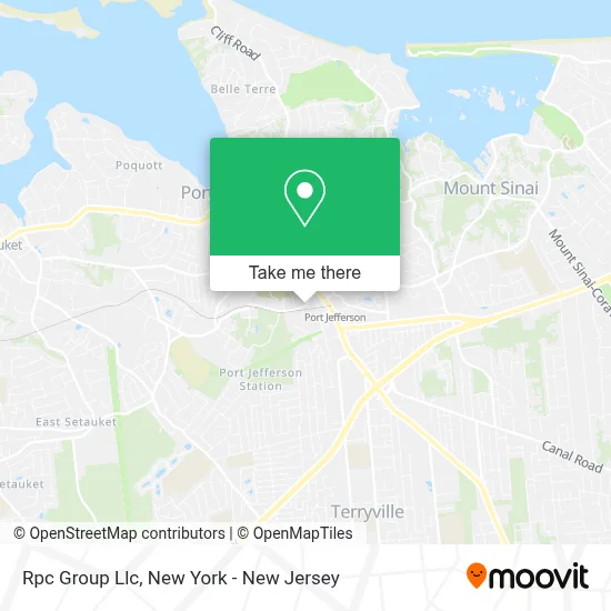
See Rpc Group Llc, Port Jefferson, on the map
Public Transit to Rpc Group Llc in Port Jefferson
Wondering how to get to Rpc Group Llc in Port Jefferson? Moovit helps you find the best way to get to Rpc Group Llc with step-by-step directions from the nearest public transit station.
Moovit provides free maps and live directions to help you navigate through your city. View schedules, routes, timetables, and find out how long does it take to get to Rpc Group Llc in real time.
Looking for the nearest stop or station to Rpc Group Llc? Check out this list of stops closest to your destination: Nys 25a/Sheep Pasture Rd; Port Jefferson; Nys 112/Cherub Ln.
Bus: 51, 62, 53, 55.Train: PORT JEFFERSON BRANCH.
Want to see if there’s another route that gets you there at an earlier time? Moovit helps you find alternative routes or times. Get directions from and directions to Rpc Group Llc easily from the Moovit App or Website.
We make riding to Rpc Group Llc easy, which is why over 1.5 million users, including users in Port Jefferson, trust Moovit as the best app for public transit. You don’t need to download an individual bus app or train app, Moovit is your all-in-one transit app that helps you find the best bus time or train time available.
For information on prices of bus and train, costs and ride fares to Rpc Group Llc, please check the Moovit app.
Get to Rpc Group Llc with public transit and pay for the ride in the Moovit app. In addition to all info you may need for your trip to Rpc Group Llc, including live directions, real-time arrivals and fare prices, you can also buy public transit passes for your rides. No need for cash or paper tickets to get to Rpc Group Llc - everything you need is accessible in the app with a click of the button.
Use the app to navigate to popular places including to the airport, hospital, stadium, grocery store, mall, coffee shop, school, college, and university.
Rpc Group Llc Address: 38 Sheep Pasture Rd street in Port Jefferson
- Manhattan Transfer Registrar Co.,
- Joseph P. O'Neill Agency, Inc.: Allstate Insurance,
- Lawrence Aviation,
- Long Island Buddhist Meditation Center,
- Jmd Construction,
- Bttv,
- Redemption Leadership Team,
- Gateway Science Center,
- 5 Kids Crossfit,
- Port Jeff Signs and Graphics,
- Redemption Fitness,
- Modern Links,
- Point Of Life Acupuncture P.C.,
- North Shore Relationship Center,
- Port Jefferson Taxi Service,
- The Leather Mechanic at Lenny's Shoe Repair & Sales,
- Sonny's Online Piano Store,
- Casa De Adoracion,
- Stacey Pennetti Attorney at Law,
- Cafe Latino Deli Restaurant
Places Near Rpc Group Llc (Port Jefferson)
- San Gennaro Feast, Manhattan,
- Rockefeller Center, Manhattan,
- Katz's Deli, Manhattan,
- 111 Centre New York City Supreme Court, Manhattan,
- Hudson Yards, Manhattan,
- SoHo, Manhattan,
- Wall Street, Manhattan,
- Mountainside Hospital, Glen Ridge,
- Queens Center Mall, Queens,
- 26 Federal Plaza, Manhattan,
- 3 Stone St, Manhattan,
- Bellevue Hospital, Manhattan,
- 66 John Street, Manhattan,
- 376 Hudson Street, Manhattan,
- qqqq, Manhattan,
- 1 Police Plaza, Manhattan,
- Times Square, Manhattan,
- 911 Memorial, Manhattan,
- Pier 83, Manhattan,
- Chinatown, Manhattan
How to get to popular places in New York - New Jersey with public transit
Get around Port Jefferson by public transit!
Traveling around Port Jefferson has never been so easy. See step by step directions as you travel to any attraction, street or major public transit station. View bus and train schedules, arrival times, service alerts and detailed routes on a map, so you know exactly how to get to anywhere in Port Jefferson.
When traveling to any destination around Port Jefferson use Moovit's Live Directions with Get Off Notifications to know exactly where and how far to walk, how long to wait for your line, and how many stops are left. Moovit will alert you when it's time to get off — no need to constantly re-check whether yours is the next stop.
Wondering how to use public transit in Port Jefferson or how to pay for public transit in Port Jefferson? Moovit public transit app can help you navigate your way with public transit easily, and at minimum cost. It includes public transit fees, ticket prices, and costs. Looking for a map of Port Jefferson public transit lines? Moovit public transit app shows all public transit maps in Port Jefferson with all Bus, Train, Subway, Light Rail, Ferry and Cable Car routes and stops on an interactive map.
New York - New Jersey has 6 transit type(s), including: Bus, Train, Subway, Light Rail, Ferry and Cable Car, operated by several transit agencies, including MTA Subway, Metro-North Railroad, LIRR, PATH, MTA New York City Transit - Express routes, MTA Bus, NJ Transit, NYC Ferry, NICE bus, Bee-Line Bus, NJ Transit Rail, Norwalk Transit District, Hartford Line, River Valley Transit and HART