How to get to Rpm by bus?
Click on the bus route to see step by step directions with maps, line arrival times and updated time schedules.
From Middle Village, NY, Queens
52 minFrom Bayonne Golf Club Ferry, Manhattan
55 minFrom Washington Heights, Manhattan
65 minFrom Macy's, Queens
34 minFrom The Bronx, NY, Bronx
73 minFrom Broadway and 168th St, Manhattan
65 minFrom Hudson Mall, Jersey City
75 minFrom Journal Square, Jersey City
46 minFrom Jersey City, NJ, Jersey City
45 minFrom Hudson County Courthouse, Jersey City
47 min
How to get to Rpm by train?
Click on the train route to see step by step directions with maps, line arrival times and updated time schedules.
How to get to Rpm by subway?
Click on the subway route to see step by step directions with maps, line arrival times and updated time schedules.
Subway stations near Rpm in Manhattan
Bus stops near Rpm in Manhattan
Bus lines to Rpm in Manhattan
- SHORTLINE HUDSON, Nanuet,VIEW
- M7, 14 St Via Columbus Via 7 Av,VIEW
- M20, Lincoln Center 66 St Via 8 Av,VIEW
- M104, 41 St Via Broadway/7 Av,VIEW
- 42ND ST, E 42nd St & 3rd Ave,VIEW
- SUBURBAN TRANSIT, New York,VIEW
- SUBURBAN TRANSIT, Twin Rivers,VIEW
- SUBURBAN TRANSIT, Hillsborough,VIEW
- W44, Midtown / W 39th Street,VIEW
- SIM8, Arden Hts Via Richmond Av Via Woodrow Rd,VIEW
- SIM22, Eltingville Via Ar Kill Rd Via Richmond,VIEW
- SIM25, Tottenville Via Rossville Av Via Foster,VIEW
- SIM26, Tottenville Via Blmingdale Rd Via Amboy,VIEW
- SIM30, Sunnyside Via Forest Av,VIEW
- M42, West Side Pier 12 Av Crosstown,VIEW
- BXM2, West Midtown Penn Sta-34 St Via Kappock St,VIEW
- SHORTLINE HUDSON, New York,VIEW
What are the closest stations to Rpm?
The closest stations to Rpm are:
- Times Sq-42 St is 110 yards away, 2 min walk.
- 42nd St & 7th Ave is 150 yards away, 2 min walk.
- 7 Av/W 44 St is 153 yards away, 2 min walk.
- W 42nd St & 7th Ave is 160 yards away, 3 min walk.
- W 44th St & 7th Ave is 174 yards away, 3 min walk.
- W 42 St/7 Av is 179 yards away, 3 min walk.
- 7 Av/W 41 St is 212 yards away, 3 min walk.
- 42 St-Bryant Pk is 223 yards away, 3 min walk.
- W 42nd St and Broadway is 287 yards away, 4 min walk.
Which bus lines stop near Rpm?
These bus lines stop near Rpm: 119, BXM4, M20, M55, QM12, QM24.
Which train lines stop near Rpm?
These train lines stop near Rpm: 2, YEL.
Which subway lines stop near Rpm?
These subway lines stop near Rpm: 1, A, B, M, R, S.
What’s the nearest subway station to Rpm in Manhattan?
The nearest subway station to Rpm in Manhattan is Times Sq-42 St. It’s a 2 min walk away.
What’s the nearest bus station to Rpm in Manhattan?
The nearest bus stations to Rpm in Manhattan are 42nd St & 7th Ave and 7 Av/W 44 St. The closest one is a 2 min walk away.
What time is the first subway to Rpm in Manhattan?
The 2 is the first subway that goes to Rpm in Manhattan. It stops nearby at 3:00 AM.
What time is the last subway to Rpm in Manhattan?
The N is the last subway that goes to Rpm in Manhattan. It stops nearby at 4:01 AM.
What time is the first bus to Rpm in Manhattan?
The M42 is the first bus that goes to Rpm in Manhattan. It stops nearby at 3:02 AM.
What time is the last bus to Rpm in Manhattan?
The M7 is the last bus that goes to Rpm in Manhattan. It stops nearby at 3:12 AM.
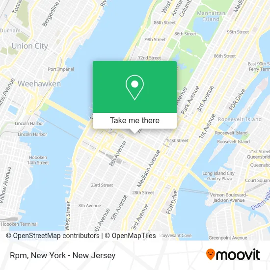
See Rpm, Manhattan, on the map
Public Transit to Rpm in Manhattan
Wondering how to get to Rpm in Manhattan? Moovit helps you find the best way to get to Rpm with step-by-step directions from the nearest public transit station.
Moovit provides free maps and live directions to help you navigate through your city. View schedules, routes, timetables, and find out how long does it take to get to Rpm in real time.
Looking for the nearest stop or station to Rpm? Check out this list of stops closest to your destination: Times Sq-42 St; 42nd St & 7th Ave; 7 Av/W 44 St; W 42nd St & 7th Ave; W 44th St & 7th Ave; W 42 St/7 Av; 7 Av/W 41 St; 42 St-Bryant Pk; W 42nd St and Broadway.
Bus: 119, BXM4, M20, M55, QM12, QM24, SHORTLINE HUDSON, M7, M104, 42ND ST, SUBURBAN TRANSIT, SUBURBAN TRANSIT, SUBURBAN TRANSIT, W44.Train: 2, YEL.Subway: 1, A, B, M, R, S, N, Q, W, D, F, FX.
Want to see if there’s another route that gets you there at an earlier time? Moovit helps you find alternative routes or times. Get directions from and directions to Rpm easily from the Moovit App or Website.
We make riding to Rpm easy, which is why over 1.5 million users, including users in Manhattan, trust Moovit as the best app for public transit. You don’t need to download an individual bus app or train app, Moovit is your all-in-one transit app that helps you find the best bus time or train time available.
For information on prices of bus, subway and train, costs and ride fares to Rpm, please check the Moovit app.
Use the app to navigate to popular places including to the airport, hospital, stadium, grocery store, mall, coffee shop, school, college, and university.
Rpm Address: 1501 Broadway street in Manhattan
- Empower Me Immigration Services,
- Midtown Dental Care - Dr. Jaskaren Randhawa,
- The New York Broker,
- Davenport Theatrical Enterprises,
- Salmen Navarro Law,
- EC New York English School,
- E-Valve Technologies,
- Hard Rock Cafe New York,
- Real Estate Agent 2.0,
- Times Square Post,
- 450,
- Consulate Of The Dominican Republic,
- Itheatrics,
- 1501 Broadway,
- Consulado Dominicano En Nueva York,
- Bluedata International Institute,
- Jada Joel,
- Bridge Partners,
- The Press Room Nyc,
- Sama Oral Health - Dr. Jaskaren Randhawa
Places Near Rpm (Manhattan)
- San Gennaro Feast, Manhattan,
- Rockefeller Center, Manhattan,
- Katz's Deli, Manhattan,
- 111 Centre New York City Supreme Court, Manhattan,
- Hudson Yards, Manhattan,
- SoHo, Manhattan,
- Wall Street, Manhattan,
- Mountainside Hospital, Glen Ridge,
- Queens Center Mall, Queens,
- 26 Federal Plaza, Manhattan,
- 3 Stone St, Manhattan,
- Bellevue Hospital, Manhattan,
- 66 John Street, Manhattan,
- 376 Hudson Street, Manhattan,
- qqqq, Manhattan,
- 1 Police Plaza, Manhattan,
- Times Square, Manhattan,
- 911 Memorial, Manhattan,
- Pier 83, Manhattan,
- Chinatown, Manhattan
How to get to popular places in New York - New Jersey with public transit
Get around Manhattan by public transit!
Traveling around Manhattan has never been so easy. See step by step directions as you travel to any attraction, street or major public transit station. View bus and train schedules, arrival times, service alerts and detailed routes on a map, so you know exactly how to get to anywhere in Manhattan.
When traveling to any destination around Manhattan use Moovit's Live Directions with Get Off Notifications to know exactly where and how far to walk, how long to wait for your line, and how many stops are left. Moovit will alert you when it's time to get off — no need to constantly re-check whether yours is the next stop.
Wondering how to use public transit in Manhattan or how to pay for public transit in Manhattan? Moovit public transit app can help you navigate your way with public transit easily, and at minimum cost. It includes public transit fees, ticket prices, and costs. Looking for a map of Manhattan public transit lines? Moovit public transit app shows all public transit maps in Manhattan with all Bus, Train, Subway, Light Rail, Ferry and Cable Car routes and stops on an interactive map.
New York - New Jersey has 6 transit type(s), including: Bus, Train, Subway, Light Rail, Ferry and Cable Car, operated by several transit agencies, including MTA Subway, Metro-North Railroad, LIRR, PATH, MTA New York City Transit - Express routes, MTA Bus, NJ Transit, NYC Ferry, NICE bus, Bee-Line Bus, NJ Transit Rail, Norwalk Transit District, Hartford Line, River Valley Transit and HART