How to get to Rpm by bus?
Click on the bus route to see step by step directions with maps, line arrival times and updated time schedules.
From Terminal 5, Manhattan
50 minFrom 23rd Street & 6th Ave., Manhattan
80 minFrom Harlem, Manhattan
78 minFrom Randall's Island, Manhattan
83 minFrom Macy's, Queens
48 minFrom The Shops At Atlas Park, Queens
77 minFrom Costco, Queens
67 minFrom Wall Street, New York, Manhattan
47 minFrom Northern Blvd, Queens
66 minFrom Liberty Science Center, Jersey City
104 min
How to get to Rpm by train?
Click on the train route to see step by step directions with maps, line arrival times and updated time schedules.
How to get to Rpm by subway?
Click on the subway route to see step by step directions with maps, line arrival times and updated time schedules.
Bus stops near Rpm in Manhattan
Bus lines to Rpm in Manhattan
- M15, East Harlem 125 St Via 1 Av,VIEW
- M15-SBS, Select Bus Service South Ferry Via 2 Av,VIEW
- B39, Allen Street Delancey St,VIEW
- M9, Kips Bay 1 Av - 26 St Via Avenue C,VIEW
- M14A-SBS, Select Bus Les Grand-Fdr Via 14 St,VIEW
- FLIXBUS N2471, NYC Chinatown - Atlanta,VIEW
- FLIXBUS N2472, NYC Chinatown - Orlando,VIEW
- FLIXBUS 2601, NYC - Washington DC,VIEW
- FLIXBUS 2605, NYC - Richmond,VIEW
- FLIXBUS 2608, NYC - Salisbury - Norfolk,VIEW
- FLIXBUS N2640, NYC - Pittsburgh - Chicago,VIEW
What are the closest stations to Rpm?
The closest stations to Rpm are:
- Allen St/Grand St is 143 yards away, 2 min walk.
- Allen St/Delancey St is 155 yards away, 2 min walk.
- Essex St/Delancey St is 262 yards away, 4 min walk.
- Delancey St-Essex St is 278 yards away, 4 min walk.
- New York City Chinatown (28 Allen St) is 346 yards away, 5 min walk.
- Grand St is 462 yards away, 6 min walk.
Which bus lines stop near Rpm?
These bus lines stop near Rpm: 120, B39, M1, M14A-SBS, M15, M15-SBS.
Which train line stops near Rpm?
BLU (Hoboken - 33rd Street)
Which subway lines stop near Rpm?
These subway lines stop near Rpm: B, D, F, J, M.
What’s the nearest subway station to Rpm in Manhattan?
The nearest subway station to Rpm in Manhattan is Delancey St-Essex St. It’s a 4 min walk away.
What’s the nearest bus station to Rpm in Manhattan?
The nearest bus stations to Rpm in Manhattan are Allen St/Grand St and Allen St/Delancey St. The closest one is a 2 min walk away.
What time is the first subway to Rpm in Manhattan?
The F is the first subway that goes to Rpm in Manhattan. It stops nearby at 3:01 AM.
What time is the last subway to Rpm in Manhattan?
The F is the last subway that goes to Rpm in Manhattan. It stops nearby at 3:59 AM.
What time is the first bus to Rpm in Manhattan?
The M15 is the first bus that goes to Rpm in Manhattan. It stops nearby at 3:04 AM.
What time is the last bus to Rpm in Manhattan?
The FLIXBUS N2640 is the last bus that goes to Rpm in Manhattan. It stops nearby at 5:00 PM.
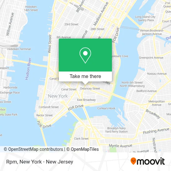
See Rpm, Manhattan, on the map
Public Transit to Rpm in Manhattan
Wondering how to get to Rpm in Manhattan? Moovit helps you find the best way to get to Rpm with step-by-step directions from the nearest public transit station.
Moovit provides free maps and live directions to help you navigate through your city. View schedules, routes, timetables, and find out how long does it take to get to Rpm in real time.
Looking for the nearest stop or station to Rpm? Check out this list of stops closest to your destination: Allen St/Grand St; Allen St/Delancey St; Essex St/Delancey St; Delancey St-Essex St; New York City Chinatown (28 Allen St); Grand St.
Bus: 120, B39, M1, M14A-SBS, M15, M15-SBS, M9, FLIXBUS N2471, FLIXBUS N2472, FLIXBUS 2601, FLIXBUS 2605, FLIXBUS 2608.Train: BLU.Subway: B, D, F, J, M, FX, Z.
Want to see if there’s another route that gets you there at an earlier time? Moovit helps you find alternative routes or times. Get directions from and directions to Rpm easily from the Moovit App or Website.
We make riding to Rpm easy, which is why over 1.5 million users, including users in Manhattan, trust Moovit as the best app for public transit. You don’t need to download an individual bus app or train app, Moovit is your all-in-one transit app that helps you find the best bus time or train time available.
For information on prices of subway, bus, train and light rail, costs and ride fares to Rpm, please check the Moovit app.
Use the app to navigate to popular places including to the airport, hospital, stadium, grocery store, mall, coffee shop, school, college, and university.
Rpm Address: 266 Broome St street in Manhattan
- The Allen Hotel New York,
- Cry Baby,
- Dirt Candy,
- Occulter,
- 85 Orchard St,
- The Allen hotel,
- Whipped - Urban Dessert Lab,
- Sorella,
- Congee Village 粥之家,
- Amaya - Mezcal Social Club,
- Satellite Art Show,
- Barrio Chino,
- Armada,
- spring studio,
- Botanic Lab Cocktail Bar,
- Orchard Street,
- Orchard & Ludlow,
- Artisanbarbershop,
- Christian Vautier Le Concept,
- Tokyo
Places Near Rpm (Manhattan)
- 26 Federal Plaza, Manhattan,
- Wall Street, Manhattan,
- 111 Centre New York City Supreme Court, Manhattan,
- Times Square, Manhattan,
- Mountainside Hospital, Glen Ridge,
- 1 Police Plaza, Manhattan,
- 3 Stone St, Manhattan,
- San Gennaro Feast, Manhattan,
- Hudson Yards, Manhattan,
- Bellevue Hospital, Manhattan,
- 66 John Street, Manhattan,
- Katz's Deli, Manhattan,
- Rockefeller Center, Manhattan,
- Chinatown, Manhattan,
- Queens Center Mall, Queens,
- SoHo, Manhattan,
- Pier 83, Manhattan,
- 911 Memorial, Manhattan,
- 376 Hudson Street, Manhattan,
- qqqq, Manhattan
How to get to popular places in New York - New Jersey with public transit
Get around Manhattan by public transit!
Traveling around Manhattan has never been so easy. See step by step directions as you travel to any attraction, street or major public transit station. View bus and train schedules, arrival times, service alerts and detailed routes on a map, so you know exactly how to get to anywhere in Manhattan.
When traveling to any destination around Manhattan use Moovit's Live Directions with Get Off Notifications to know exactly where and how far to walk, how long to wait for your line, and how many stops are left. Moovit will alert you when it's time to get off — no need to constantly re-check whether yours is the next stop.
Wondering how to use public transit in Manhattan or how to pay for public transit in Manhattan? Moovit public transit app can help you navigate your way with public transit easily, and at minimum cost. It includes public transit fees, ticket prices, and costs. Looking for a map of Manhattan public transit lines? Moovit public transit app shows all public transit maps in Manhattan with all Bus, Train, Subway, Light Rail, Ferry and Cable Car routes and stops on an interactive map.
New York - New Jersey has 6 transit type(s), including: Bus, Train, Subway, Light Rail, Ferry and Cable Car, operated by several transit agencies, including MTA Subway, Metro-North Railroad, LIRR, PATH, MTA New York City Transit - Express routes, MTA Bus, NJ Transit, NYC Ferry, NICE bus, Bee-Line Bus, NJ Transit Rail, Norwalk Transit District, Hartford Line, River Valley Transit and HART