How to get to Rpm Collision Corp by bus?
Click on the bus route to see step by step directions with maps, line arrival times and updated time schedules.
From St. John's Riverside Hospital, Yonkers
69 minFrom George Washington Bridge Bus Station, Manhattan
68 minFrom St. Raymond's Cemetery, Bronx
57 minFrom Van Cortlandt Park, Bronx
73 minFrom 1910 Monterey Avenue, Bronx
39 minFrom New York Botanical Garden, Bronx
35 minFrom United Palace Theatre, Manhattan
69 minFrom The Cloisters, Manhattan
70 minFrom 177th Fort Washington Ave, Manhattan
69 minFrom Yankee Stadium, Bronx
66 min
How to get to Rpm Collision Corp by train?
Click on the train route to see step by step directions with maps, line arrival times and updated time schedules.
How to get to Rpm Collision Corp by subway?
Click on the subway route to see step by step directions with maps, line arrival times and updated time schedules.
From George Washington Bridge Bus Station, Manhattan
72 minFrom Van Cortlandt Park, Bronx
91 minFrom 1910 Monterey Avenue, Bronx
38 minFrom New York Botanical Garden, Bronx
56 minFrom United Palace Theatre, Manhattan
70 minFrom The Cloisters, Manhattan
85 minFrom 177th Fort Washington Ave, Manhattan
69 minFrom Yankee Stadium, Bronx
41 min
Subway stations near Rpm Collision Corp in Bronx
Bus stops near Rpm Collision Corp in Bronx
Bus lines to Rpm Collision Corp in Bronx
What are the closest stations to Rpm Collision Corp?
The closest stations to Rpm Collision Corp are:
- Eastchester-Dyre Av is 54 yards away, 1 min walk.
- Dyre Ave @ Light St is 57 yards away, 1 min walk.
- Light St @ Dyre Ave is 62 yards away, 1 min walk.
- Dyre Av/Light St is 70 yards away, 1 min walk.
- Boston Rd @ Dyre Ave is 423 yards away, 5 min walk.
- 233 St is 2767 yards away, 33 min walk.
Which bus lines stop near Rpm Collision Corp?
These bus lines stop near Rpm Collision Corp: 55, 60, BX16, BX30.
Which train lines stop near Rpm Collision Corp?
These train lines stop near Rpm Collision Corp: 2, 3.
Which subway line stops near Rpm Collision Corp?
5 (Uptown & The Bronx)
What’s the nearest subway station to Rpm Collision Corp in Bronx?
The nearest subway station to Rpm Collision Corp in Bronx is Eastchester-Dyre Av. It’s a 1 min walk away.
What’s the nearest bus station to Rpm Collision Corp in Bronx?
The nearest bus stations to Rpm Collision Corp in Bronx are Dyre Ave @ Light St, Light St @ Dyre Ave and Dyre Av/Light St. The closest one is a 1 min walk away.
What time is the first subway to Rpm Collision Corp in Bronx?
The 2 is the first subway that goes to Rpm Collision Corp in Bronx. It stops nearby at 3:00 AM.
What time is the last subway to Rpm Collision Corp in Bronx?
The 2 is the last subway that goes to Rpm Collision Corp in Bronx. It stops nearby at 4:43 AM.
What time is the first bus to Rpm Collision Corp in Bronx?
The BX16 is the first bus that goes to Rpm Collision Corp in Bronx. It stops nearby at 4:22 AM.
What time is the last bus to Rpm Collision Corp in Bronx?
The BX16 is the last bus that goes to Rpm Collision Corp in Bronx. It stops nearby at 1:19 AM.
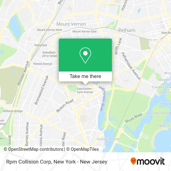
See Rpm Collision Corp, Bronx, on the map
Public Transit to Rpm Collision Corp in Bronx
Wondering how to get to Rpm Collision Corp in Bronx? Moovit helps you find the best way to get to Rpm Collision Corp with step-by-step directions from the nearest public transit station.
Moovit provides free maps and live directions to help you navigate through your city. View schedules, routes, timetables, and find out how long does it take to get to Rpm Collision Corp in real time.
Looking for the nearest stop or station to Rpm Collision Corp? Check out this list of stops closest to your destination: Eastchester-Dyre Av; Dyre Ave @ Light St; Light St @ Dyre Ave; Dyre Av/Light St; Boston Rd @ Dyre Ave; 233 St.
Bus: 55, 60, BX16, BX30, 52, 61, 62.Train: 2, 3.Subway: 5, 2.
Want to see if there’s another route that gets you there at an earlier time? Moovit helps you find alternative routes or times. Get directions from and directions to Rpm Collision Corp easily from the Moovit App or Website.
We make riding to Rpm Collision Corp easy, which is why over 1.5 million users, including users in Bronx, trust Moovit as the best app for public transit. You don’t need to download an individual bus app or train app, Moovit is your all-in-one transit app that helps you find the best bus time or train time available.
For information on prices of bus, subway and train, costs and ride fares to Rpm Collision Corp, please check the Moovit app.
Use the app to navigate to popular places including to the airport, hospital, stadium, grocery store, mall, coffee shop, school, college, and university.
Rpm Collision Corp Address: 2233 Light St street in Bronx
- Rpm Auto Collision,
- Mario Peralta,
- Jamaica Benevolent Arm and Cultural Center - Jbacc,
- Bee Line Bus - Route 55 @ Light Street and Dyre Avenue,
- Eastchester–Dyre Avenue Station,
- Light Street & Dyre Avenue,
- Lowest Price Auto Sales Inc.,
- MTA Bus - BX 16,
- Kidz Klub House Daycare,
- Nuplus Towing & Recovery Corp.,
- New York Chicken and Grill,
- T & A Automotive Inc.,
- The Ups Store,
- Western Union,
- Shred Nations,
- Slo Mo Xzotic Brands,
- Eastchester–Dyre Avenue,
- MTA-Eastchester-Dyre Ave,
- Vasco,
- Eastern Cutting
Places Near Rpm Collision Corp (Bronx)
- Wall Street, Manhattan,
- Pier 83, Manhattan,
- 1 Police Plaza, Manhattan,
- Hudson Yards, Manhattan,
- Rockefeller Center, Manhattan,
- Katz's Deli, Manhattan,
- Mountainside Hospital, Glen Ridge,
- 66 John Street, Manhattan,
- qqqq, Manhattan,
- 111 Centre New York City Supreme Court, Manhattan,
- Bellevue Hospital, Manhattan,
- SoHo, Manhattan,
- 3 Stone St, Manhattan,
- 911 Memorial, Manhattan,
- Chinatown, Manhattan,
- 376 Hudson Street, Manhattan,
- San Gennaro Feast, Manhattan,
- Queens Center Mall, Queens,
- Times Square, Manhattan,
- 26 Federal Plaza, Manhattan
How to get to popular places in New York - New Jersey with public transit
Get around Bronx by public transit!
Traveling around Bronx has never been so easy. See step by step directions as you travel to any attraction, street or major public transit station. View bus and train schedules, arrival times, service alerts and detailed routes on a map, so you know exactly how to get to anywhere in Bronx.
When traveling to any destination around Bronx use Moovit's Live Directions with Get Off Notifications to know exactly where and how far to walk, how long to wait for your line, and how many stops are left. Moovit will alert you when it's time to get off — no need to constantly re-check whether yours is the next stop.
Wondering how to use public transit in Bronx or how to pay for public transit in Bronx? Moovit public transit app can help you navigate your way with public transit easily, and at minimum cost. It includes public transit fees, ticket prices, and costs. Looking for a map of Bronx public transit lines? Moovit public transit app shows all public transit maps in Bronx with all Bus, Train, Subway, Light Rail, Ferry and Cable Car routes and stops on an interactive map.
New York - New Jersey has 6 transit type(s), including: Bus, Train, Subway, Light Rail, Ferry and Cable Car, operated by several transit agencies, including MTA Subway, Metro-North Railroad, LIRR, PATH, MTA New York City Transit - Express routes, MTA Bus, NJ Transit, NYC Ferry, NICE bus, Bee-Line Bus, NJ Transit Rail, Norwalk Transit District, Hartford Line, River Valley Transit and HART