How to get to Rpm Raceway Long Islan by bus?
Click on the bus route to see step by step directions with maps, line arrival times and updated time schedules.
From College Point, NY, Queens
93 minFrom Harlem, Manhattan
77 minFrom Ridge Hill Mall, Yonkers
61 minFrom Cross County Mall, Yonkers
35 minFrom Aaaaa Aaaa, Bronx
57 minFrom Riverside Church, Manhattan
79 minFrom Cross County Shopping Center, Yonkers
34 minFrom Fulton Ave, Bronx
37 minFrom Baruch College, Manhattan
70 minFrom Sojo Spa, Edgewater
76 min
How to get to Rpm Raceway Long Islan by train?
Click on the train route to see step by step directions with maps, line arrival times and updated time schedules.
How to get to Rpm Raceway Long Islan by subway?
Click on the subway route to see step by step directions with maps, line arrival times and updated time schedules.
Bus stops near Rpm Raceway Long Islan in Bronx
Subway stations near Rpm Raceway Long Islan in Bronx
Train station near Rpm Raceway Long Islan in Bronx
- Williams Bridge, 14 min walk,VIEW
Bus lines to Rpm Raceway Long Islan in Bronx
What are the closest stations to Rpm Raceway Long Islan?
The closest stations to Rpm Raceway Long Islan are:
- Bainbridge Av/E 206 St is 17 yards away, 1 min walk.
- Norwood-205 St is 62 yards away, 1 min walk.
- Bainbridge Av/Van Cortlandt Av East is 294 yards away, 4 min walk.
- Bedford Park Blvd is 914 yards away, 11 min walk.
- Mosholu Pkwy is 985 yards away, 12 min walk.
- Williams Bridge is 1143 yards away, 14 min walk.
Which bus lines stop near Rpm Raceway Long Islan?
These bus lines stop near Rpm Raceway Long Islan: BX10, BX16, BX34, BX41-SBS, BX6-SBS.
Which train line stops near Rpm Raceway Long Islan?
2 (611#| Southeast)
Which subway lines stop near Rpm Raceway Long Islan?
These subway lines stop near Rpm Raceway Long Islan: A, D.
What’s the nearest subway station to Rpm Raceway Long Islan in Bronx?
The nearest subway station to Rpm Raceway Long Islan in Bronx is Norwood-205 St. It’s a 1 min walk away.
What’s the nearest train station to Rpm Raceway Long Islan in Bronx?
The nearest train station to Rpm Raceway Long Islan in Bronx is Williams Bridge. It’s a 14 min walk away.
What’s the nearest bus station to Rpm Raceway Long Islan in Bronx?
The nearest bus station to Rpm Raceway Long Islan in Bronx is Bainbridge Av/E 206 St. It’s a 1 min walk away.
What time is the first subway to Rpm Raceway Long Islan in Bronx?
The 4 is the first subway that goes to Rpm Raceway Long Islan in Bronx. It stops nearby at 3:01 AM.
What time is the last subway to Rpm Raceway Long Islan in Bronx?
The D is the last subway that goes to Rpm Raceway Long Islan in Bronx. It stops nearby at 4:30 AM.
What time is the first train to Rpm Raceway Long Islan in Bronx?
The 2 is the first train that goes to Rpm Raceway Long Islan in Bronx. It stops nearby at 5:13 AM.
What time is the last train to Rpm Raceway Long Islan in Bronx?
The 2 is the last train that goes to Rpm Raceway Long Islan in Bronx. It stops nearby at 2:19 AM.
What time is the first bus to Rpm Raceway Long Islan in Bronx?
The BX10 is the first bus that goes to Rpm Raceway Long Islan in Bronx. It stops nearby at 3:00 AM.
What time is the last bus to Rpm Raceway Long Islan in Bronx?
The BX28 is the last bus that goes to Rpm Raceway Long Islan in Bronx. It stops nearby at 3:14 AM.
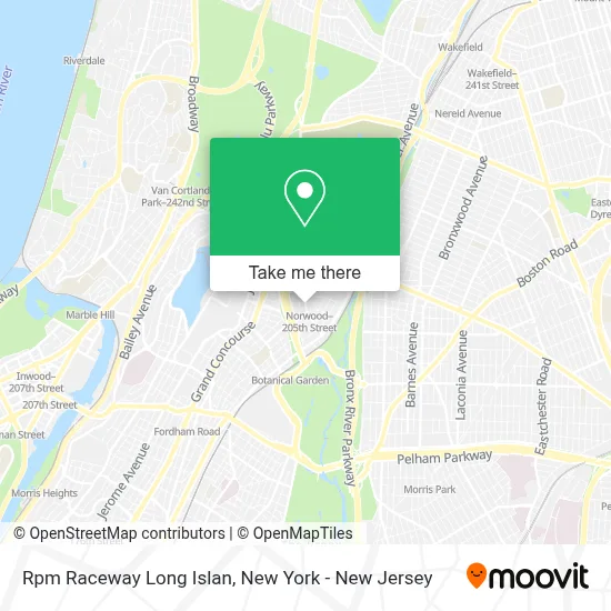
See Rpm Raceway Long Islan, Bronx, on the map
Public Transit to Rpm Raceway Long Islan in Bronx
Wondering how to get to Rpm Raceway Long Islan in Bronx? Moovit helps you find the best way to get to Rpm Raceway Long Islan with step-by-step directions from the nearest public transit station.
Moovit provides free maps and live directions to help you navigate through your city. View schedules, routes, timetables, and find out how long does it take to get to Rpm Raceway Long Islan in real time.
Looking for the nearest stop or station to Rpm Raceway Long Islan? Check out this list of stops closest to your destination: Bainbridge Av/E 206 St; Norwood-205 St; Bainbridge Av/Van Cortlandt Av East; Bedford Park Blvd; Mosholu Pkwy; Williams Bridge.
Bus: BX10, BX16, BX34, BX41-SBS, BX6-SBS, BX28, BX38.Train: 2.Subway: A, D, B, 4.
Want to see if there’s another route that gets you there at an earlier time? Moovit helps you find alternative routes or times. Get directions from and directions to Rpm Raceway Long Islan easily from the Moovit App or Website.
We make riding to Rpm Raceway Long Islan easy, which is why over 1.5 million users, including users in Bronx, trust Moovit as the best app for public transit. You don’t need to download an individual bus app or train app, Moovit is your all-in-one transit app that helps you find the best bus time or train time available.
For information on prices of bus, subway and train, costs and ride fares to Rpm Raceway Long Islan, please check the Moovit app.
Use the app to navigate to popular places including to the airport, hospital, stadium, grocery store, mall, coffee shop, school, college, and university.
Rpm Raceway Long Islan Address: 99 Avon Rd street in Bronx
- Atm Capital One Branch - Bainbridge,
- Redbox,
- Cvs Beauty,
- Shn & Aga,
- Cvs Pharmacy,
- Bainbridge,
- Atm Cvs,
- MTA Subway - Norwood / 205th St (D),
- Bainbridge Ave / E 206th St,
- La Familia Markets,
- Star Furniture,
- Medhanialem Church Of New York,
- Amera's Unique Collection,
- Gilbert's Juices & Smoothies,
- DIAMOND BEAUTY SUPPLY,
- Georgie's Pizza and Restaurant,
- Hakim & Co. Multiservices Inc,
- E 206 St/Bainbridge Av,
- Bainbridge Eye Care,
- 204 Laundry Mart
Places Near Rpm Raceway Long Islan (Bronx)
- Bellevue Hospital, Manhattan,
- 26 Federal Plaza, Manhattan,
- Mountainside Hospital, Glen Ridge,
- Times Square, Manhattan,
- 3 Stone St, Manhattan,
- 66 John Street, Manhattan,
- Hudson Yards, Manhattan,
- Katz's Deli, Manhattan,
- qqqq, Manhattan,
- Pier 83, Manhattan,
- Rockefeller Center, Manhattan,
- Wall Street, Manhattan,
- Queens Center Mall, Queens,
- 111 Centre New York City Supreme Court, Manhattan,
- SoHo, Manhattan,
- 1 Police Plaza, Manhattan,
- Chinatown, Manhattan,
- 376 Hudson Street, Manhattan,
- 911 Memorial, Manhattan,
- San Gennaro Feast, Manhattan
How to get to popular places in New York - New Jersey with public transit
Get around Bronx by public transit!
Traveling around Bronx has never been so easy. See step by step directions as you travel to any attraction, street or major public transit station. View bus and train schedules, arrival times, service alerts and detailed routes on a map, so you know exactly how to get to anywhere in Bronx.
When traveling to any destination around Bronx use Moovit's Live Directions with Get Off Notifications to know exactly where and how far to walk, how long to wait for your line, and how many stops are left. Moovit will alert you when it's time to get off — no need to constantly re-check whether yours is the next stop.
Wondering how to use public transit in Bronx or how to pay for public transit in Bronx? Moovit public transit app can help you navigate your way with public transit easily, and at minimum cost. It includes public transit fees, ticket prices, and costs. Looking for a map of Bronx public transit lines? Moovit public transit app shows all public transit maps in Bronx with all Bus, Train, Subway, Light Rail, Ferry and Cable Car routes and stops on an interactive map.
New York - New Jersey has 6 transit type(s), including: Bus, Train, Subway, Light Rail, Ferry and Cable Car, operated by several transit agencies, including MTA Subway, Metro-North Railroad, LIRR, PATH, MTA New York City Transit - Express routes, MTA Bus, NJ Transit, NYC Ferry, NICE bus, Bee-Line Bus, NJ Transit Rail, Norwalk Transit District, Hartford Line, River Valley Transit and HART