Directions to Rpny Realty Corp. (Manhattan) with public transportation
The following transit lines have routes that pass near Rpny Realty Corp.
 Bus: BXM8, M1, M103, M2, M4.
- Train: 2, BABYLON BRANCH, FAR ROCKAWAY BRANCH, PORT WASHINGTON BRANCH, YEL.
- Subway: 6, B, J, Q, N.
How to get to Rpny Realty Corp. by bus?
Click on the bus route to see step by step directions with maps, line arrival times and updated time schedules.
From Rego Park, Queens
55 minFrom Flushing Meadows-Corona Park, Queens
88 minFrom New York City Hall, Manhattan
67 minFrom East Tremont Ave, Bronx
76 minFrom Katz's Delicatessen, Manhattan
40 minFrom Bayonne Golf Club Ferry, Manhattan
63 minFrom Shea Stadium, Queens
87 minFrom Jersey Gardens Outlet, Manhattan
51 min
How to get to Rpny Realty Corp. by train?
Click on the train route to see step by step directions with maps, line arrival times and updated time schedules.
How to get to Rpny Realty Corp. by subway?
Click on the subway route to see step by step directions with maps, line arrival times and updated time schedules.
From Rego Park, Queens
50 minFrom Flushing Meadows-Corona Park, Queens
58 minFrom New York City Hall, Manhattan
34 minFrom East Tremont Ave, Bronx
58 minFrom Katz's Delicatessen, Manhattan
38 minFrom Bayonne Golf Club Ferry, Manhattan
38 minFrom Shea Stadium, Queens
49 minFrom Jersey Gardens Outlet, Manhattan
29 min
Bus stops near Rpny Realty Corp. in Manhattan
Subway stations near Rpny Realty Corp. in Manhattan
Bus lines to Rpny Realty Corp. in Manhattan
- BXM6, Parkchester - Midtown,VIEW
- BXM7, Co-Op City - Midtown,VIEW
- BXM8, Pelham Bay/City Island - Midtown,VIEW
- BXM9, Throgs Neck - Midtown Express,VIEW
- BXM10, Williamsbridge/Morris Park - Midtown,VIEW
- M72, East Side York Av Crosstown,VIEW
- M1, Soho Centre St Via 5 Av/ Via Broadway,VIEW
- M2, East Village 8 St Via 5 Av,VIEW
- M3, 125 St St. Nicholas Av,VIEW
- M4, Ltd Midtwn 32 St & 5 Av Via Bway 5 Av,VIEW
- BXM3, Yonkers Getty Sq Via Sedgwick Av Via Broadway,VIEW
- BXM4, Midtown 26 St Via 5 Av,VIEW
- BXM11, East Midtown 23 St Via Bronx Riv Pky Via 5 Av,VIEW
- 28, 23rd St @ 5th Ave,VIEW
What are the closest stations to Rpny Realty Corp.?
The closest stations to Rpny Realty Corp. are:
- Madison Av/71 St is 75 yards away, 1 min walk.
- E 72 St/Madison Av is 97 yards away, 2 min walk.
- Madison Av/E 72 St is 140 yards away, 2 min walk.
- Madison Av/E 70 St is 159 yards away, 2 min walk.
- Madison Ave @ 69th St is 248 yards away, 4 min walk.
- 5 Av/59 St is 717 yards away, 9 min walk.
- 68 St-Hunter College is 764 yards away, 10 min walk.
- 72 St is 802 yards away, 10 min walk.
- Lexington Av/63 St is 928 yards away, 11 min walk.
Which bus lines stop near Rpny Realty Corp.?
These bus lines stop near Rpny Realty Corp.: BXM8, M1, M103, M2, M4, M66.
Which train lines stop near Rpny Realty Corp.?
These train lines stop near Rpny Realty Corp.: 2, BABYLON BRANCH, FAR ROCKAWAY BRANCH, PORT WASHINGTON BRANCH, YEL.
Which subway lines stop near Rpny Realty Corp.?
These subway lines stop near Rpny Realty Corp.: 6, B, J, Q.
What’s the nearest subway station to Rpny Realty Corp. in Manhattan?
The nearest subway station to Rpny Realty Corp. in Manhattan is 5 Av/59 St. It’s a 9 min walk away.
What’s the nearest bus station to Rpny Realty Corp. in Manhattan?
The nearest bus station to Rpny Realty Corp. in Manhattan is Madison Av/71 St. It’s a 1 min walk away.
What time is the first subway to Rpny Realty Corp. in Manhattan?
The Q is the first subway that goes to Rpny Realty Corp. in Manhattan. It stops nearby at 3:01 AM.
What time is the last subway to Rpny Realty Corp. in Manhattan?
The 4 is the last subway that goes to Rpny Realty Corp. in Manhattan. It stops nearby at 3:45 AM.
What time is the first bus to Rpny Realty Corp. in Manhattan?
The M2 is the first bus that goes to Rpny Realty Corp. in Manhattan. It stops nearby at 3:35 AM.
What time is the last bus to Rpny Realty Corp. in Manhattan?
The M2 is the last bus that goes to Rpny Realty Corp. in Manhattan. It stops nearby at 2:43 AM.
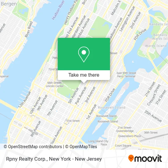
See Rpny Realty Corp., Manhattan, on the map
Public Transit to Rpny Realty Corp. in Manhattan
Wondering how to get to Rpny Realty Corp. in Manhattan? Moovit helps you find the best way to get to Rpny Realty Corp. with step-by-step directions from the nearest public transit station.
Moovit provides free maps and live directions to help you navigate through your city. View schedules, routes, timetables, and find out how long does it take to get to Rpny Realty Corp. in real time.
Looking for the nearest stop or station to Rpny Realty Corp.? Check out this list of stops closest to your destination: Madison Av/71 St; E 72 St/Madison Av; Madison Av/E 72 St; Madison Av/E 70 St; Madison Ave @ 69th St; 5 Av/59 St; 68 St-Hunter College; 72 St; Lexington Av/63 St.
Bus: BXM8, M1, M103, M2, M4, M66, BXM6, BXM7, BXM9, BXM10, M72.Train: 2, BABYLON BRANCH, FAR ROCKAWAY BRANCH, PORT WASHINGTON BRANCH, YEL.Subway: 6, B, J, Q, N, R, W, 4, 5, 6X, F, M.
Want to see if there’s another route that gets you there at an earlier time? Moovit helps you find alternative routes or times. Get directions from and directions to Rpny Realty Corp. easily from the Moovit App or Website.
We make riding to Rpny Realty Corp. easy, which is why over 1.5 million users, including users in Manhattan, trust Moovit as the best app for public transit. You don’t need to download an individual bus app or train app, Moovit is your all-in-one transit app that helps you find the best bus time or train time available.
For information on prices of subway, bus and train, costs and ride fares to Rpny Realty Corp., please check the Moovit app.
Use the app to navigate to popular places including to the airport, hospital, stadium, grocery store, mall, coffee shop, school, college, and university.
Rpny Realty Corp. Address: 872 Madison Ave street in Manhattan
- Active 24 Hour Collision Repair,
- Flourish Nyc,
- St James Episcopal Church,
- R by 45 Rpm,
- Vicki Morav,
- Madison Ave and 71st,
- Sharon Dorram Color,
- Polo Sport Ralph Lauren,
- The Atelier Team,
- Bond No 9 (Bond No. 9),
- Kimberly Jay at Compass,
- Ralph Lauren Men's Flagship,
- Paul Morelli Design,
- Polo Ralph Lauren Flagship,
- Lanvin New York Madison Ave. Store,
- Sous Les Etoiles Gallery,
- Brownings Fitness,
- St James' Church,
- The Stacey Froelich Team Of Compass,
- Teddy Cafaro | Compass
Places Near Rpny Realty Corp. (Manhattan)
- Bellevue Hospital, Manhattan,
- 26 Federal Plaza, Manhattan,
- Queens Center Mall, Queens,
- SoHo, Manhattan,
- Wall Street, Manhattan,
- 3 Stone St, Manhattan,
- qqqq, Manhattan,
- San Gennaro Feast, Manhattan,
- 911 Memorial, Manhattan,
- Chinatown, Manhattan,
- Mountainside Hospital, Glen Ridge,
- 1 Police Plaza, Manhattan,
- 111 Centre New York City Supreme Court, Manhattan,
- 66 John Street, Manhattan,
- Pier 83, Manhattan,
- Hudson Yards, Manhattan,
- Times Square, Manhattan,
- Katz's Deli, Manhattan,
- Rockefeller Center, Manhattan,
- 376 Hudson Street, Manhattan
How to get to popular places in New York - New Jersey with public transit
Get around Manhattan by public transit!
Traveling around Manhattan has never been so easy. See step by step directions as you travel to any attraction, street or major public transit station. View bus and train schedules, arrival times, service alerts and detailed routes on a map, so you know exactly how to get to anywhere in Manhattan.
When traveling to any destination around Manhattan use Moovit's Live Directions with Get Off Notifications to know exactly where and how far to walk, how long to wait for your line, and how many stops are left. Moovit will alert you when it's time to get off — no need to constantly re-check whether yours is the next stop.
Wondering how to use public transit in Manhattan or how to pay for public transit in Manhattan? Moovit public transit app can help you navigate your way with public transit easily, and at minimum cost. It includes public transit fees, ticket prices, and costs. Looking for a map of Manhattan public transit lines? Moovit public transit app shows all public transit maps in Manhattan with all Bus, Train, Subway, Light Rail, Ferry and Cable Car routes and stops on an interactive map.
New York - New Jersey has 6 transit type(s), including: Bus, Train, Subway, Light Rail, Ferry and Cable Car, operated by several transit agencies, including MTA Subway, Metro-North Railroad, LIRR, PATH, MTA New York City Transit - Express routes, MTA Bus, NJ Transit, NYC Ferry, NICE bus, Bee-Line Bus, NJ Transit Rail, Norwalk Transit District, Hartford Line, River Valley Transit and HART