How to get to Rpzl by bus?
Click on the bus route to see step by step directions with maps, line arrival times and updated time schedules.
How to get to Rpzl by train?
Click on the train route to see step by step directions with maps, line arrival times and updated time schedules.
How to get to Rpzl by subway?
Click on the subway route to see step by step directions with maps, line arrival times and updated time schedules.
Bus stops near Rpzl in Manhattan
Subway stations near Rpzl in Manhattan
Train station near Rpzl in Manhattan
- 23rd Street, 8 min walk,VIEW
Bus lines to Rpzl in Manhattan
- DOWNTOWN LOCAL, W Houston & Mercer St,VIEW
- M7, Harlem 147 St Via 6 Av Via Amsterdam,VIEW
- M55, South Ferry,VIEW
- SHORTLINE HUDSON, Nanuet,VIEW
- SHORTLINE HUDSON, Circleville,VIEW
- GREENWICH, Midtown / W 39th Street - Midtown / W 39th Street,VIEW
- M1, Harlem - East Village,VIEW
- M2, Washington Heights - East Village,VIEW
- M3, Fort George - East Village,VIEW
- 28, 23rd St @ 5th Ave,VIEW
- SIM1C, Eltingville - Manhattan Express,VIEW
- SIM3, Pt. Richmond - Midtown Manhattan Express,VIEW
- SIM3C, Pt. Richmond - Manhattan Express,VIEW
- SIM10, Eltingville - Midtown Manhattan Express,VIEW
- X27, Bay Ridge - Manhattan Express,VIEW
- X28, Sea Gate / Bensonhurst - Manhattan Express,VIEW
- M23-SBS, Select Bus East Side Avenue C Crosstown,VIEW
What are the closest stations to Rpzl?
The closest stations to Rpzl are:
- 6th Ave & W 18th St is 188 yards away, 3 min walk.
- 6 Av/W 18 St is 201 yards away, 3 min walk.
- 6th Ave & W 17th St is 238 yards away, 3 min walk.
- 5th Ave & W 20th St is 258 yards away, 4 min walk.
- 23rd St @ 5th Ave is 355 yards away, 5 min walk.
- 6 Av/W 23 St is 406 yards away, 6 min walk.
- W 23 St/6 Av is 472 yards away, 6 min walk.
- 18 St is 617 yards away, 8 min walk.
- 23 St is 624 yards away, 8 min walk.
- 23rd Street is 626 yards away, 8 min walk.
- 14 St/6 Av is 708 yards away, 9 min walk.
Which bus lines stop near Rpzl?
These bus lines stop near Rpzl: 28, BM2, BM3, BM4, M1, M2, M7.
Which train lines stop near Rpzl?
These train lines stop near Rpzl: 1, 2, BLU, YEL.
Which subway lines stop near Rpzl?
These subway lines stop near Rpzl: 1, 2, 3, 5, F, M, W.
What’s the nearest subway station to Rpzl in Manhattan?
The nearest subway stations to Rpzl in Manhattan are 18 St and 23 St. The closest one is a 8 min walk away.
What’s the nearest train station to Rpzl in Manhattan?
The nearest train station to Rpzl in Manhattan is 23rd Street. It’s a 8 min walk away.
What’s the nearest bus station to Rpzl in Manhattan?
The nearest bus stations to Rpzl in Manhattan are 6th Ave & W 18th St, 6 Av/W 18 St and 6th Ave & W 17th St. The closest one is a 3 min walk away.
What time is the first subway to Rpzl in Manhattan?
The Q is the first subway that goes to Rpzl in Manhattan. It stops nearby at 3:01 AM.
What time is the last subway to Rpzl in Manhattan?
The 2 is the last subway that goes to Rpzl in Manhattan. It stops nearby at 3:59 AM.
What time is the first train to Rpzl in Manhattan?
The ATW is the first train that goes to Rpzl in Manhattan. It stops nearby at 3:18 AM.
What time is the last train to Rpzl in Manhattan?
The ATW is the last train that goes to Rpzl in Manhattan. It stops nearby at 3:18 AM.
What time is the first bus to Rpzl in Manhattan?
The M23-SBS is the first bus that goes to Rpzl in Manhattan. It stops nearby at 3:27 AM.
What time is the last bus to Rpzl in Manhattan?
The SIM1C is the last bus that goes to Rpzl in Manhattan. It stops nearby at 2:57 AM.
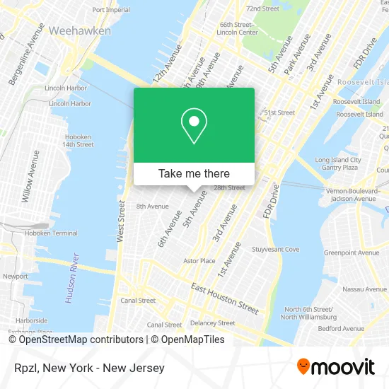
See Rpzl, Manhattan, on the map
Public Transit to Rpzl in Manhattan
Wondering how to get to Rpzl in Manhattan? Moovit helps you find the best way to get to Rpzl with step-by-step directions from the nearest public transit station.
Moovit provides free maps and live directions to help you navigate through your city. View schedules, routes, timetables, and find out how long does it take to get to Rpzl in real time.
Looking for the nearest stop or station to Rpzl? Check out this list of stops closest to your destination: 6th Ave & W 18th St; 6 Av/W 18 St; 6th Ave & W 17th St; 5th Ave & W 20th St; 23rd St @ 5th Ave; 6 Av/W 23 St; W 23 St/6 Av; 18 St; 23 St; 23rd Street; 14 St/6 Av.
Bus: 28, BM2, BM3, BM4, M1, M2, M7, DOWNTOWN LOCAL.Train: 1, 2, BLU, YEL, ATW.Subway: 1, 2, 3, 5, F, M, W, D, FX, N, Q, R, L.
Want to see if there’s another route that gets you there at an earlier time? Moovit helps you find alternative routes or times. Get directions from and directions to Rpzl easily from the Moovit App or Website.
We make riding to Rpzl easy, which is why over 1.5 million users, including users in Manhattan, trust Moovit as the best app for public transit. You don’t need to download an individual bus app or train app, Moovit is your all-in-one transit app that helps you find the best bus time or train time available.
For information on prices of bus, subway and train, costs and ride fares to Rpzl, please check the Moovit app.
Use the app to navigate to popular places including to the airport, hospital, stadium, grocery store, mall, coffee shop, school, college, and university.
Rpzl Address: 27 W 20th St street in Manhattan
- Vicky Bijur Literary Agency,
- Fundr,
- Ultramoda Inc,
- Brax Realty,
- Catch New York,
- Watt Design & Build,
- Elizabeth Fillmore Bridal,
- Fortitude Strength Club,
- Fusebox Inc,
- Delorean Garage,
- San Jose Day Nursery,
- Slate NY,
- J Queen,
- J. Queen New York,
- Seven Point Wellness Chelsea, Nyc,
- Af | New York,
- VIP in NYC,
- Pure Obgyn,
- Art & Style Nyc,
- Mjg Acupuncture & Massage - Flatiron District Nyc
Places Near Rpzl (Manhattan)
- Chinatown, Manhattan,
- San Gennaro Feast, Manhattan,
- Queens Center Mall, Queens,
- 26 Federal Plaza, Manhattan,
- Rockefeller Center, Manhattan,
- Katz's Deli, Manhattan,
- 911 Memorial, Manhattan,
- Times Square, Manhattan,
- 1 Police Plaza, Manhattan,
- Bellevue Hospital, Manhattan,
- Mountainside Hospital, Glen Ridge,
- 111 Centre New York City Supreme Court, Manhattan,
- 376 Hudson Street, Manhattan,
- 66 John Street, Manhattan,
- Pier 83, Manhattan,
- Wall Street, Manhattan,
- SoHo, Manhattan,
- 3 Stone St, Manhattan,
- qqqq, Manhattan,
- Hudson Yards, Manhattan
How to get to popular places in New York - New Jersey with public transit
Get around Manhattan by public transit!
Traveling around Manhattan has never been so easy. See step by step directions as you travel to any attraction, street or major public transit station. View bus and train schedules, arrival times, service alerts and detailed routes on a map, so you know exactly how to get to anywhere in Manhattan.
When traveling to any destination around Manhattan use Moovit's Live Directions with Get Off Notifications to know exactly where and how far to walk, how long to wait for your line, and how many stops are left. Moovit will alert you when it's time to get off — no need to constantly re-check whether yours is the next stop.
Wondering how to use public transit in Manhattan or how to pay for public transit in Manhattan? Moovit public transit app can help you navigate your way with public transit easily, and at minimum cost. It includes public transit fees, ticket prices, and costs. Looking for a map of Manhattan public transit lines? Moovit public transit app shows all public transit maps in Manhattan with all Bus, Train, Subway, Light Rail, Ferry and Cable Car routes and stops on an interactive map.
New York - New Jersey has 6 transit type(s), including: Bus, Train, Subway, Light Rail, Ferry and Cable Car, operated by several transit agencies, including MTA Subway, Metro-North Railroad, LIRR, PATH, MTA New York City Transit - Express routes, MTA Bus, NJ Transit, NYC Ferry, NICE bus, Bee-Line Bus, NJ Transit Rail, Norwalk Transit District, Hartford Line, River Valley Transit and HART