How to get to Rpzl by bus?
Click on the bus route to see step by step directions with maps, line arrival times and updated time schedules.
From Brooklyn Bridge, Manhattan
74 minFrom Prospect Avenue, Bronx
75 minFrom 100 Church Street, Manhattan
57 minFrom Washington Heights, Manhattan
65 minFrom 66 John Street, Manhattan
55 minFrom King Spa, Palisades Park
57 minFrom MetLife Stadium, East Rutherford
58 minFrom Community Lines, Jersey City
82 min
How to get to Rpzl by train?
Click on the train route to see step by step directions with maps, line arrival times and updated time schedules.
How to get to Rpzl by subway?
Click on the subway route to see step by step directions with maps, line arrival times and updated time schedules.
Bus stops near Rpzl in Manhattan
- W 58th St & 5th Ave, 1 min walk,VIEW
- 5 Av/W 58 St, 2 min walk,VIEW
- 5th Ave @ 59th St, 2 min walk,VIEW
- 5 Av/W 59 St, 2 min walk,VIEW
- W 57 St/5 Av, 3 min walk,VIEW
- W 57th St & 5th Ave, 3 min walk,VIEW
- 5th Ave & W 56th St, 4 min walk,VIEW
- 5 Av/E 60 St, 4 min walk,VIEW
- E 57 St/5 Av, 4 min walk,VIEW
- E 57 St/Madison Av, 4 min walk,VIEW
Subway stations near Rpzl in Manhattan
Bus lines to Rpzl in Manhattan
- SHORTLINE HUDSON, New York,VIEW
- BXM6, Parkchester - Midtown,VIEW
- BXM7, Co-Op City - Midtown,VIEW
- BXM8, Pelham Bay/City Island - Midtown,VIEW
- BXM9, Throgs Neck - Midtown Express,VIEW
- BXM10, Williamsbridge/Morris Park - Midtown,VIEW
- BXM11, Wakefield - Midtown,VIEW
- SHORTLINE HUDSON, 200 - Northern District – Nanuet,VIEW
- Q32, Penn Station,VIEW
- 28, 23rd St @ 5th Ave,VIEW
- SIM23, Annadale Via Arden Av,VIEW
- SIM24, Princes Bay Via Huguenot Av,VIEW
- M5, Limited 31 St 6 Av,VIEW
- M1, Soho Centre St Via 5 Av/ Via Broadway,VIEW
- M4, Ltd Midtwn 32 St & 5 Av Via Bway 5 Av,VIEW
- M31, Yorkville 91 St Via York Av,VIEW
- M57, West Side Broadway-72 St Crosstown,VIEW
- 57TH ST, Midtown / W 39th Street,VIEW
- BXM18, Downtown Wall St Via 5 Av Via Broadway,VIEW
- M2, Washington Heights - East Village,VIEW
What are the closest stations to Rpzl?
The closest stations to Rpzl are:
- W 58th St & 5th Ave is 62 yards away, 1 min walk.
- 5 Av/W 58 St is 91 yards away, 2 min walk.
- 5th Ave @ 59th St is 135 yards away, 2 min walk.
- 5 Av/W 59 St is 135 yards away, 2 min walk.
- 57 St is 157 yards away, 3 min walk.
- 57 St-7 Av is 194 yards away, 3 min walk.
- W 57 St/5 Av is 195 yards away, 3 min walk.
- W 57th St & 5th Ave is 199 yards away, 3 min walk.
- 5th Ave & W 56th St is 247 yards away, 4 min walk.
- 5 Av/E 60 St is 254 yards away, 4 min walk.
- E 57 St/5 Av is 270 yards away, 4 min walk.
- E 57 St/Madison Av is 301 yards away, 4 min walk.
- 5 Av/53 St is 608 yards away, 8 min walk.
- Lexington Av/59 St is 708 yards away, 9 min walk.
Which bus lines stop near Rpzl?
These bus lines stop near Rpzl: 57TH ST, BM2, BXM10, M31, M5, M7, Q32.
Which train lines stop near Rpzl?
These train lines stop near Rpzl: 2, FAR ROCKAWAY BRANCH, YEL.
Which subway lines stop near Rpzl?
These subway lines stop near Rpzl: A, M, N, R, W.
What’s the nearest subway station to Rpzl in Manhattan?
The nearest subway stations to Rpzl in Manhattan are 57 St and 57 St-7 Av. The closest one is a 3 min walk away.
What’s the nearest bus station to Rpzl in Manhattan?
The nearest bus station to Rpzl in Manhattan is W 58th St & 5th Ave. It’s a 1 min walk away.
What time is the first subway to Rpzl in Manhattan?
The F is the first subway that goes to Rpzl in Manhattan. It stops nearby at 3:00 AM.
What time is the last subway to Rpzl in Manhattan?
The 4 is the last subway that goes to Rpzl in Manhattan. It stops nearby at 3:41 AM.
What time is the first bus to Rpzl in Manhattan?
The M2 is the first bus that goes to Rpzl in Manhattan. It stops nearby at 3:45 AM.
What time is the last bus to Rpzl in Manhattan?
The M2 is the last bus that goes to Rpzl in Manhattan. It stops nearby at 2:45 AM.
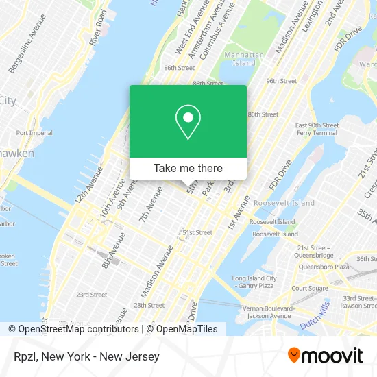
See Rpzl, Manhattan, on the map
Public Transit to Rpzl in Manhattan
Wondering how to get to Rpzl in Manhattan? Moovit helps you find the best way to get to Rpzl with step-by-step directions from the nearest public transit station.
Moovit provides free maps and live directions to help you navigate through your city. View schedules, routes, timetables, and find out how long does it take to get to Rpzl in real time.
Looking for the nearest stop or station to Rpzl? Check out this list of stops closest to your destination: W 58th St & 5th Ave; 5 Av/W 58 St; 5th Ave @ 59th St; 5 Av/W 59 St; 57 St; 57 St-7 Av; W 57 St/5 Av; W 57th St & 5th Ave; 5th Ave & W 56th St; 5 Av/E 60 St; E 57 St/5 Av; E 57 St/Madison Av; 5 Av/53 St; Lexington Av/59 St.
Bus: 57TH ST, BM2, BXM10, M31, M5, M7, Q32, SHORTLINE HUDSON, BXM6, BXM7, BXM8, BXM9.Train: 2, FAR ROCKAWAY BRANCH, YEL.Subway: A, M, N, R, W, F, Q, E, FX, 4, 5, 6, 6X.
Want to see if there’s another route that gets you there at an earlier time? Moovit helps you find alternative routes or times. Get directions from and directions to Rpzl easily from the Moovit App or Website.
We make riding to Rpzl easy, which is why over 1.5 million users, including users in Manhattan, trust Moovit as the best app for public transit. You don’t need to download an individual bus app or train app, Moovit is your all-in-one transit app that helps you find the best bus time or train time available.
For information on prices of subway, bus and train, costs and ride fares to Rpzl, please check the Moovit app.
Use the app to navigate to popular places including to the airport, hospital, stadium, grocery store, mall, coffee shop, school, college, and university.
Rpzl Address: 1 W 58th St street in Manhattan
- Guerlain Spa at The Plaza Hotel,
- Krigler New York,
- Ashley Lynn Becker, Md, Mba,
- Neinstein Plastic Surgery,
- Louise Annlea Chuu, Md,
- Northwell Health Physician Partners Obstetrics and Gynecology at West 58th Street,
- Airsculpt - New York City,
- Kathryn Peck Rutenberg, Md,
- Adi Katz, Md,
- Spear Physical Therapy,
- Demel NY,
- Dr. Robyn Gmyrek,
- Charlotte Birnbaum, Md,
- Nurse Tara,
- Neinstein Plastic Surgery,
- The Palm Court at The Plaza,
- Airsculpt - New York City,
- Boucher Hotel,
- Ct Fashion,
- Illuminati International Brotherhood
Places Near Rpzl (Manhattan)
- Katz's Deli, Manhattan,
- 3 Stone St, Manhattan,
- Bellevue Hospital, Manhattan,
- 66 John Street, Manhattan,
- 26 Federal Plaza, Manhattan,
- 1 Police Plaza, Manhattan,
- SoHo, Manhattan,
- Rockefeller Center, Manhattan,
- Queens Center Mall, Queens,
- 911 Memorial, Manhattan,
- Pier 83, Manhattan,
- Times Square, Manhattan,
- Mountainside Hospital, Glen Ridge,
- 111 Centre New York City Supreme Court, Manhattan,
- San Gennaro Feast, Manhattan,
- qqqq, Manhattan,
- 376 Hudson Street, Manhattan,
- Hudson Yards, Manhattan,
- Wall Street, Manhattan,
- Chinatown, Manhattan
How to get to popular places in New York - New Jersey with public transit
Get around Manhattan by public transit!
Traveling around Manhattan has never been so easy. See step by step directions as you travel to any attraction, street or major public transit station. View bus and train schedules, arrival times, service alerts and detailed routes on a map, so you know exactly how to get to anywhere in Manhattan.
When traveling to any destination around Manhattan use Moovit's Live Directions with Get Off Notifications to know exactly where and how far to walk, how long to wait for your line, and how many stops are left. Moovit will alert you when it's time to get off — no need to constantly re-check whether yours is the next stop.
Wondering how to use public transit in Manhattan or how to pay for public transit in Manhattan? Moovit public transit app can help you navigate your way with public transit easily, and at minimum cost. It includes public transit fees, ticket prices, and costs. Looking for a map of Manhattan public transit lines? Moovit public transit app shows all public transit maps in Manhattan with all Bus, Train, Subway, Light Rail, Ferry and Cable Car routes and stops on an interactive map.
New York - New Jersey has 6 transit type(s), including: Bus, Train, Subway, Light Rail, Ferry and Cable Car, operated by several transit agencies, including MTA Subway, Metro-North Railroad, LIRR, PATH, MTA New York City Transit - Express routes, MTA Bus, NJ Transit, NYC Ferry, NICE bus, Bee-Line Bus, NJ Transit Rail, Norwalk Transit District, Hartford Line, River Valley Transit and HART