How to get to Rq Partners, Inc by bus?
Click on the bus route to see step by step directions with maps, line arrival times and updated time schedules.
From Glendale, NY, Queens
70 minFrom Division Street, Manhattan
49 minFrom The Bronx, NY, Bronx
61 minFrom Ridgewood, Queens
48 minFrom Yankee Stadium, Bronx
54 minFrom Radio Hotel, Manhattan
64 minFrom George Washington Bridge, Manhattan
76 minFrom George Washington Bridge Bus Station, Manhattan
68 minFrom One World Observatory, Manhattan
59 min
How to get to Rq Partners, Inc by train?
Click on the train route to see step by step directions with maps, line arrival times and updated time schedules.
How to get to Rq Partners, Inc by subway?
Click on the subway route to see step by step directions with maps, line arrival times and updated time schedules.
From Glendale, NY, Queens
82 minFrom Division Street, Manhattan
31 minFrom The Bronx, NY, Bronx
42 minFrom Ridgewood, Queens
63 minFrom Yankee Stadium, Bronx
29 minFrom Radio Hotel, Manhattan
51 minFrom George Washington Bridge, Manhattan
57 minFrom George Washington Bridge Bus Station, Manhattan
45 minFrom One World Observatory, Manhattan
27 min
Bus stops near Rq Partners, Inc in Manhattan
Subway stations near Rq Partners, Inc in Manhattan
Bus lines to Rq Partners, Inc in Manhattan
- 57TH ST, Midtown / W 39th Street,VIEW
- SIM8, Arden Hts Via Richmond Av Via Woodrow Rd,VIEW
- SIM22, Eltingville Via Ar Kill Rd Via Richmond,VIEW
- SIM25, Tottenville Via Rossville Av Via Foster,VIEW
- SIM26, Tottenville Via Blmingdale Rd Via Amboy,VIEW
- SIM31, Eltingville Trans Ctr Via Forest Hill Rd,VIEW
- M31, Yorkville 91 St Via York Av,VIEW
- M57, West Side Broadway-72 St Crosstown,VIEW
- SIM6, Eltingville - Midtown Manhattan Express,VIEW
- SIM11, New Dorp - Midtown Manhattan Express,VIEW
- BXM1, East Midtown 34 St Via Lex Av,VIEW
- M101, East Village 3 Av-6 St Via Lex Av,VIEW
- M102, East Village 6 St Via Lex Av,VIEW
- M103, City Hall Via Lex Av,VIEW
- BM1, Mill Basin - E. 66 St Via Avenue K,VIEW
- BM2, Canarsie Williams Av Via Avenue H Via Avenue M,VIEW
- BM3, Sheepshead Bay Emmons Av Via Ocean Av,VIEW
- BM4, Gerritsen Bch Gerritsen Av,VIEW
- BM5, Spring Creek Seaview Av Via Linden Bl Via Penn Av,VIEW
- SHORTLINE HUDSON, New York,VIEW
What are the closest stations to Rq Partners, Inc?
The closest stations to Rq Partners, Inc are:
- E 57th St & Park Ave is 89 yards away, 2 min walk.
- E 57 St/Lexington Av is 174 yards away, 3 min walk.
- E 57 St/Madison Av is 179 yards away, 3 min walk.
- Lexington Av/E 56 St is 191 yards away, 3 min walk.
- 5 Av/53 St is 219 yards away, 3 min walk.
- E 57 St / Lexington Av is 220 yards away, 3 min walk.
- Lexington Ave & East 56th St is 230 yards away, 3 min walk.
- Lexington Av/59 St is 405 yards away, 5 min walk.
Which bus lines stop near Rq Partners, Inc?
These bus lines stop near Rq Partners, Inc: 57TH ST, BM2, BXM4, M102, M103, M5, QM24, QM34.
Which train lines stop near Rq Partners, Inc?
These train lines stop near Rq Partners, Inc: 1, 2, BABYLON BRANCH, YEL.
Which subway lines stop near Rq Partners, Inc?
These subway lines stop near Rq Partners, Inc: 4, 5, E, F, M, R.
What’s the nearest subway station to Rq Partners, Inc in Manhattan?
The nearest subway station to Rq Partners, Inc in Manhattan is 5 Av/53 St. It’s a 3 min walk away.
What’s the nearest bus station to Rq Partners, Inc in Manhattan?
The nearest bus station to Rq Partners, Inc in Manhattan is E 57th St & Park Ave. It’s a 2 min walk away.
What time is the first subway to Rq Partners, Inc in Manhattan?
The 6 is the first subway that goes to Rq Partners, Inc in Manhattan. It stops nearby at 3:00 AM.
What time is the last subway to Rq Partners, Inc in Manhattan?
The 4 is the last subway that goes to Rq Partners, Inc in Manhattan. It stops nearby at 3:41 AM.
What time is the first bus to Rq Partners, Inc in Manhattan?
The M101 is the first bus that goes to Rq Partners, Inc in Manhattan. It stops nearby at 3:01 AM.
What time is the last bus to Rq Partners, Inc in Manhattan?
The M103 is the last bus that goes to Rq Partners, Inc in Manhattan. It stops nearby at 3:11 AM.
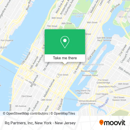
See Rq Partners, Inc, Manhattan, on the map
Public Transit to Rq Partners, Inc in Manhattan
Wondering how to get to Rq Partners, Inc in Manhattan? Moovit helps you find the best way to get to Rq Partners, Inc with step-by-step directions from the nearest public transit station.
Moovit provides free maps and live directions to help you navigate through your city. View schedules, routes, timetables, and find out how long does it take to get to Rq Partners, Inc in real time.
Looking for the nearest stop or station to Rq Partners, Inc? Check out this list of stops closest to your destination: E 57th St & Park Ave; E 57 St/Lexington Av; E 57 St/Madison Av; Lexington Av/E 56 St; 5 Av/53 St; E 57 St / Lexington Av; Lexington Ave & East 56th St; Lexington Av/59 St.
Bus: 57TH ST, BM2, BXM4, M102, M103, M5, QM24, QM34, SIM8, SIM22, SIM25, SIM26, SIM31, M31, M57, SIM6, SIM11.Train: 1, 2, BABYLON BRANCH, YEL.Subway: 4, 5, E, F, M, R, FX, N, W.
Want to see if there’s another route that gets you there at an earlier time? Moovit helps you find alternative routes or times. Get directions from and directions to Rq Partners, Inc easily from the Moovit App or Website.
We make riding to Rq Partners, Inc easy, which is why over 1.5 million users, including users in Manhattan, trust Moovit as the best app for public transit. You don’t need to download an individual bus app or train app, Moovit is your all-in-one transit app that helps you find the best bus time or train time available.
For information on prices of subway, bus and train, costs and ride fares to Rq Partners, Inc, please check the Moovit app.
Use the app to navigate to popular places including to the airport, hospital, stadium, grocery store, mall, coffee shop, school, college, and university.
Rq Partners, Inc Address: 445 Park Ave 9th Fl street in Manhattan
- Andersen Lab,
- Adv Mechanical Services,
- Justin Duffy, Licensed Real Estate Agent In New York City,
- Trusted Translations, Inc.,
- Elaine Clayman / Justine Bray Team, Brown Harris Stevens,
- Infinit Outsourcing, Inc.,
- Altfest Personal Wealth Management,
- Ia-Techcenter,
- Archpoint Advisory,
- Queen Sofia Spanish Institute,
- Dr. Lynn For Early Education,
- Terra Development Marketing,
- Linda Fuller, Pmhnp,
- Kleyman Domestic Relations Law Firm,
- Target Rock Wealth Management,
- Judith Durham-Smith,
- Hq,
- Elite Healers Sports Massage,
- Homeclean Cleaning Services Nyc,
- Arcane Solutions
Places Near Rq Partners, Inc (Manhattan)
- 111 Centre New York City Supreme Court, Manhattan,
- 911 Memorial, Manhattan,
- SoHo, Manhattan,
- Queens Center Mall, Queens,
- Pier 83, Manhattan,
- qqqq, Manhattan,
- Mountainside Hospital, Glen Ridge,
- 66 John Street, Manhattan,
- Bellevue Hospital, Manhattan,
- Katz's Deli, Manhattan,
- 376 Hudson Street, Manhattan,
- 1 Police Plaza, Manhattan,
- Rockefeller Center, Manhattan,
- Times Square, Manhattan,
- 26 Federal Plaza, Manhattan,
- 3 Stone St, Manhattan,
- Chinatown, Manhattan,
- Hudson Yards, Manhattan,
- San Gennaro Feast, Manhattan,
- Wall Street, Manhattan
How to get to popular places in New York - New Jersey with public transit
Get around Manhattan by public transit!
Traveling around Manhattan has never been so easy. See step by step directions as you travel to any attraction, street or major public transit station. View bus and train schedules, arrival times, service alerts and detailed routes on a map, so you know exactly how to get to anywhere in Manhattan.
When traveling to any destination around Manhattan use Moovit's Live Directions with Get Off Notifications to know exactly where and how far to walk, how long to wait for your line, and how many stops are left. Moovit will alert you when it's time to get off — no need to constantly re-check whether yours is the next stop.
Wondering how to use public transit in Manhattan or how to pay for public transit in Manhattan? Moovit public transit app can help you navigate your way with public transit easily, and at minimum cost. It includes public transit fees, ticket prices, and costs. Looking for a map of Manhattan public transit lines? Moovit public transit app shows all public transit maps in Manhattan with all Bus, Train, Subway, Light Rail, Ferry and Cable Car routes and stops on an interactive map.
New York - New Jersey has 6 transit type(s), including: Bus, Train, Subway, Light Rail, Ferry and Cable Car, operated by several transit agencies, including MTA Subway, Metro-North Railroad, LIRR, PATH, MTA New York City Transit - Express routes, MTA Bus, NJ Transit, NYC Ferry, NICE bus, Bee-Line Bus, NJ Transit Rail, Norwalk Transit District, Hartford Line, River Valley Transit and HART