Directions to Rqd* Clearing (Manhattan) with public transportation
The following transit lines have routes that pass near Rqd* Clearing
 Bus: BXM18, M20, M9, QM11, SIM9.
- Train: GRE, RED.
- Subway: 1, 2, 3, E, R.
- Ferry: SG, EDGEWATER - BROOKFIELD PLACE, HOBOKEN / NJ TRANSIT TERMINAL - BROOKFIELD PLACE, PAULUS HOOK - BROOKFIELD PLACE, PORT IMPERIAL - BROOKFIELD PLACE.
How to get to Rqd* Clearing by bus?
Click on the bus route to see step by step directions with maps, line arrival times and updated time schedules.
From Hallets Point, Queens
106 minFrom East 80th Street, Manhattan
78 minFrom Ink 48 Hotel, Manhattan
64 minFrom Mount Sinai Hospital, Manhattan
48 minFrom Maspeth, Queens
69 minFrom The Hotel Edison Nyc, Manhattan
48 minFrom Metropolitan Hospital, Manhattan
57 minFrom Staten Island Ferry, Staten Island
61 minFrom Lotte New York Palace, Manhattan
42 min
How to get to Rqd* Clearing by train?
Click on the train route to see step by step directions with maps, line arrival times and updated time schedules.
How to get to Rqd* Clearing by subway?
Click on the subway route to see step by step directions with maps, line arrival times and updated time schedules.
Bus stops near Rqd* Clearing in Manhattan
Train station near Rqd* Clearing in Manhattan
- World Trade Center, 6 min walk,VIEW
Ferry stations near Rqd* Clearing in Manhattan
Subway station near Rqd* Clearing in Manhattan
- Wtc Cortlandt, 7 min walk,VIEW
Bus lines to Rqd* Clearing in Manhattan
What are the closest stations to Rqd* Clearing?
The closest stations to Rqd* Clearing are:
- South End Ave & Albany St is 195 yards away, 3 min walk.
- South End Av/Gateway Plaza is 221 yards away, 4 min walk.
- South End Av/Albany St is 238 yards away, 4 min walk.
- West St/Carlisle St is 407 yards away, 6 min walk.
- World Trade Center is 412 yards away, 6 min walk.
- Vesey St/North End Av is 486 yards away, 7 min walk.
- Brookfield Place/Battery Park City is 493 yards away, 7 min walk.
- Wtc Cortlandt is 498 yards away, 7 min walk.
- Battery Park City/Vesey St. is 528 yards away, 7 min walk.
- Brookfield Place, NY is 547 yards away, 7 min walk.
Which bus lines stop near Rqd* Clearing?
These bus lines stop near Rqd* Clearing: BXM18, M20, M9, QM11, SIM9, X28.
Which train line stops near Rqd* Clearing?
GRE (Hoboken - World Trade Center)
Which subway lines stop near Rqd* Clearing?
These subway lines stop near Rqd* Clearing: 1, 2, 3, E, R, W.
Which ferry line stops near Rqd* Clearing?
SG (Midtown West/W 39th St-Pier 79)
What’s the nearest subway station to Rqd* Clearing in Manhattan?
The nearest subway station to Rqd* Clearing in Manhattan is Wtc Cortlandt. It’s a 7 min walk away.
What’s the nearest train station to Rqd* Clearing in Manhattan?
The nearest train station to Rqd* Clearing in Manhattan is World Trade Center. It’s a 6 min walk away.
What’s the nearest bus station to Rqd* Clearing in Manhattan?
The nearest bus station to Rqd* Clearing in Manhattan is South End Ave & Albany St. It’s a 3 min walk away.
What’s the nearest ferry station to Rqd* Clearing in Manhattan?
The nearest ferry stations to Rqd* Clearing in Manhattan are Brookfield Place/Battery Park City, Battery Park City/Vesey St. and Brookfield Place, NY. The closest one is a 7 min walk away.
What time is the first subway to Rqd* Clearing in Manhattan?
The 1 is the first subway that goes to Rqd* Clearing in Manhattan. It stops nearby at 3:17 AM.
What time is the last subway to Rqd* Clearing in Manhattan?
The 1 is the last subway that goes to Rqd* Clearing in Manhattan. It stops nearby at 3:39 AM.
What time is the first train to Rqd* Clearing in Manhattan?
The RED is the first train that goes to Rqd* Clearing in Manhattan. It stops nearby at 3:10 AM.
What time is the last train to Rqd* Clearing in Manhattan?
The RED is the last train that goes to Rqd* Clearing in Manhattan. It stops nearby at 2:55 AM.
What time is the first bus to Rqd* Clearing in Manhattan?
The M22 is the first bus that goes to Rqd* Clearing in Manhattan. It stops nearby at 5:00 AM.
What time is the last bus to Rqd* Clearing in Manhattan?
The M22 is the last bus that goes to Rqd* Clearing in Manhattan. It stops nearby at 1:18 AM.
What time is the first ferry to Rqd* Clearing in Manhattan?
The PAULUS HOOK - BROOKFIELD PLACE is the first ferry that goes to Rqd* Clearing in Manhattan. It stops nearby at 6:07 AM.
What time is the last ferry to Rqd* Clearing in Manhattan?
The PAULUS HOOK - BROOKFIELD PLACE is the last ferry that goes to Rqd* Clearing in Manhattan. It stops nearby at 10:52 PM.
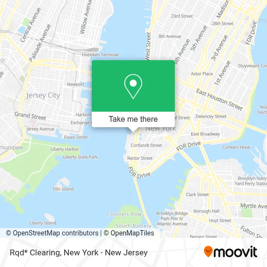
See Rqd* Clearing, Manhattan, on the map
Public Transit to Rqd* Clearing in Manhattan
Wondering how to get to Rqd* Clearing in Manhattan? Moovit helps you find the best way to get to Rqd* Clearing with step-by-step directions from the nearest public transit station.
Moovit provides free maps and live directions to help you navigate through your city. View schedules, routes, timetables, and find out how long does it take to get to Rqd* Clearing in real time.
Looking for the nearest stop or station to Rqd* Clearing? Check out this list of stops closest to your destination: South End Ave & Albany St; South End Av/Gateway Plaza; South End Av/Albany St; West St/Carlisle St; World Trade Center; Vesey St/North End Av; Brookfield Place/Battery Park City; Wtc Cortlandt; Battery Park City/Vesey St.; Brookfield Place.
Bus: BXM18, M20, M9, QM11, SIM9, X28, DOWNTOWN CONNECTION.Train: GRE, RED.Subway: 1, 2, 3, E, R, W.Ferry: SG, EDGEWATER - BROOKFIELD PLACE, HOBOKEN / NJ TRANSIT TERMINAL - BROOKFIELD PLACE, PAULUS HOOK - BROOKFIELD PLACE, PORT IMPERIAL - BROOKFIELD PLACE, SOUTH AMBOY - PIER 11/WALL ST..
Want to see if there’s another route that gets you there at an earlier time? Moovit helps you find alternative routes or times. Get directions from and directions to Rqd* Clearing easily from the Moovit App or Website.
We make riding to Rqd* Clearing easy, which is why over 1.5 million users, including users in Manhattan, trust Moovit as the best app for public transit. You don’t need to download an individual bus app or train app, Moovit is your all-in-one transit app that helps you find the best bus time or train time available.
For information on prices of subway, bus, train and ferry, costs and ride fares to Rqd* Clearing, please check the Moovit app.
Use the app to navigate to popular places including to the airport, hospital, stadium, grocery store, mall, coffee shop, school, college, and university.
Rqd* Clearing Address: 250 Vesey St Ste 2601 street in Manhattan
- Starpro Physical Therapy,
- World Finance Center,
- Dotdash Meredith,
- Pink Shirtmaker - Brookfield Place,
- Daily Provisions - Brookfield Place,
- National Realty & Development Corp.,
- Green Leaf Dispensary,
- Nomura,
- Recover Funds Ltd,
- Locke Lord Llp,
- William J Supper Cfp - Merrill Lynch,
- Rauxa,
- American Lock & Key,
- Clean Market,
- For Five Coffee @ Brookfield Place,
- Tartinery Café,
- Maesa,
- Atlantic Book Publishers,
- Jlw Interiors,
- Future You Wealth
Places Near Rqd* Clearing (Manhattan)
- 376 Hudson Street, Manhattan,
- Queens Center Mall, Queens,
- 911 Memorial, Manhattan,
- 111 Centre New York City Supreme Court, Manhattan,
- Chinatown, Manhattan,
- Hudson Yards, Manhattan,
- 1 Police Plaza, Manhattan,
- 66 John Street, Manhattan,
- qqqq, Manhattan,
- Times Square, Manhattan,
- Wall Street, Manhattan,
- Katz's Deli, Manhattan,
- Rockefeller Center, Manhattan,
- 3 Stone St, Manhattan,
- Pier 83, Manhattan,
- San Gennaro Feast, Manhattan,
- 26 Federal Plaza, Manhattan,
- SoHo, Manhattan,
- Mountainside Hospital, Glen Ridge,
- Bellevue Hospital, Manhattan
How to get to popular places in New York - New Jersey with public transit
Get around Manhattan by public transit!
Traveling around Manhattan has never been so easy. See step by step directions as you travel to any attraction, street or major public transit station. View bus and train schedules, arrival times, service alerts and detailed routes on a map, so you know exactly how to get to anywhere in Manhattan.
When traveling to any destination around Manhattan use Moovit's Live Directions with Get Off Notifications to know exactly where and how far to walk, how long to wait for your line, and how many stops are left. Moovit will alert you when it's time to get off — no need to constantly re-check whether yours is the next stop.
Wondering how to use public transit in Manhattan or how to pay for public transit in Manhattan? Moovit public transit app can help you navigate your way with public transit easily, and at minimum cost. It includes public transit fees, ticket prices, and costs. Looking for a map of Manhattan public transit lines? Moovit public transit app shows all public transit maps in Manhattan with all Bus, Train, Subway, Light Rail, Ferry and Cable Car routes and stops on an interactive map.
New York - New Jersey has 6 transit type(s), including: Bus, Train, Subway, Light Rail, Ferry and Cable Car, operated by several transit agencies, including MTA Subway, Metro-North Railroad, LIRR, PATH, MTA New York City Transit - Express routes, MTA Bus, NJ Transit, NYC Ferry, NICE bus, Bee-Line Bus, NJ Transit Rail, Norwalk Transit District, Hartford Line, River Valley Transit and HART
Public transit lines with stations closest to Rqd* Clearing in Manhattan
Subway lines with stations closest to Rqd* Clearing in Manhattan
Train lines with stations closest to Rqd* Clearing in Manhattan
Bus lines with stations closest to Rqd* Clearing in Manhattan
Ferry lines with stations closest to Rqd* Clearing in Manhattan
Brookfield Place/Battery Park City
- EDGEWATER - BROOKFIELD PLACEEdgewater - Brookfield Place
- HOBOKEN / NJ TRANSIT TERMINAL - BROOKFIELD PLACEHoboken / NJ Transit Terminal - Brookfield Place
- PAULUS HOOK - BROOKFIELD PLACEPaulus Hook - Brookfield Place
- PORT IMPERIAL - BROOKFIELD PLACEPort Imperial - Brookfield Place
- SOUTH AMBOY - PIER 11/WALL ST.South Amboy - Pier 11/Wall St.