Directions to Rr2llc (New York - New Jersey) with public transportation
The following transit lines have routes that pass near Rr2llc
 Bus: B52, B62, B67, B65, B37.
- Train: CITY TERMINAL ZONE, BABYLON BRANCH, FAR ROCKAWAY BRANCH, HEMPSTEAD BRANCH, LONG BEACH BRANCH.
- Subway: 3, 4, B, F, G.
How to get to Rr2llc by bus?
Click on the bus route to see step by step directions with maps, line arrival times and updated time schedules.
From Amc Loews Lincoln Square 13, Manhattan
127 minFrom Memorial Sloan-Kettering Cancer Center, Manhattan
103 minFrom Pier 40, Manhattan
98 minFrom Consulado Ecuatoriano en Queens, Queens
103 minFrom Louis Vuitton, Manhattan
94 minFrom Saint Patrick’S Cathedral, Manhattan
98 minFrom The Shops At Atlas Park, Queens
91 minFrom Costco Wholesale, Queens
91 minFrom New York Presbyterian Hospital, Manhattan
112 min
How to get to Rr2llc by train?
Click on the train route to see step by step directions with maps, line arrival times and updated time schedules.
How to get to Rr2llc by subway?
Click on the subway route to see step by step directions with maps, line arrival times and updated time schedules.
From Amc Loews Lincoln Square 13, Manhattan
43 minFrom Memorial Sloan-Kettering Cancer Center, Manhattan
46 minFrom Pier 40, Manhattan
35 minFrom Consulado Ecuatoriano en Queens, Queens
51 minFrom Louis Vuitton, Manhattan
40 minFrom Saint Patrick’S Cathedral, Manhattan
40 minFrom Costco Wholesale, Queens
68 minFrom New York Presbyterian Hospital, Manhattan
46 min
Bus stops near Rr2llc in New York - New Jersey
Subway stations near Rr2llc in New York - New Jersey
Train station near Rr2llc in New York - New Jersey
- Atlantic Terminal, 10 min walk,VIEW
Bus lines to Rr2llc in New York - New Jersey
What are the closest stations to Rr2llc?
The closest stations to Rr2llc are:
- Bergen St/3 Av is 212 yards away, 3 min walk.
- 3 Av/Dean St is 280 yards away, 4 min walk.
- Atlantic Av/Nevins St is 326 yards away, 4 min walk.
- 3 Av/Baltic St is 416 yards away, 5 min walk.
- Atlantic Av-Barclays Ctr is 598 yards away, 8 min walk.
- Hoyt-Schermerhorn Sts is 704 yards away, 9 min walk.
- Bergen St is 745 yards away, 9 min walk.
- Atlantic Terminal is 788 yards away, 10 min walk.
Which bus lines stop near Rr2llc?
These bus lines stop near Rr2llc: B52, B62, B67.
Which train line stops near Rr2llc?
CITY TERMINAL ZONE (Atlantic Terminal)
Which subway lines stop near Rr2llc?
These subway lines stop near Rr2llc: 3, 4, B, F, G, N, Q.
What’s the nearest subway station to Rr2llc in New York - New Jersey?
The nearest subway station to Rr2llc in New York - New Jersey is Atlantic Av-Barclays Ctr. It’s a 8 min walk away.
What’s the nearest train station to Rr2llc in New York - New Jersey?
The nearest train station to Rr2llc in New York - New Jersey is Atlantic Terminal. It’s a 10 min walk away.
What’s the nearest bus station to Rr2llc in New York - New Jersey?
The nearest bus station to Rr2llc in New York - New Jersey is Bergen St/3 Av. It’s a 3 min walk away.
What time is the first subway to Rr2llc in New York - New Jersey?
The 2 is the first subway that goes to Rr2llc in New York - New Jersey. It stops nearby at 3:00 AM.
What time is the last subway to Rr2llc in New York - New Jersey?
The 2 is the last subway that goes to Rr2llc in New York - New Jersey. It stops nearby at 4:21 AM.
What time is the first train to Rr2llc in New York - New Jersey?
The CITY TERMINAL ZONE is the first train that goes to Rr2llc in New York - New Jersey. It stops nearby at 4:51 AM.
What time is the last train to Rr2llc in New York - New Jersey?
The CITY TERMINAL ZONE is the last train that goes to Rr2llc in New York - New Jersey. It stops nearby at 1:56 AM.
What time is the first bus to Rr2llc in New York - New Jersey?
The B63 is the first bus that goes to Rr2llc in New York - New Jersey. It stops nearby at 3:14 AM.
What time is the last bus to Rr2llc in New York - New Jersey?
The B63 is the last bus that goes to Rr2llc in New York - New Jersey. It stops nearby at 2:56 AM.
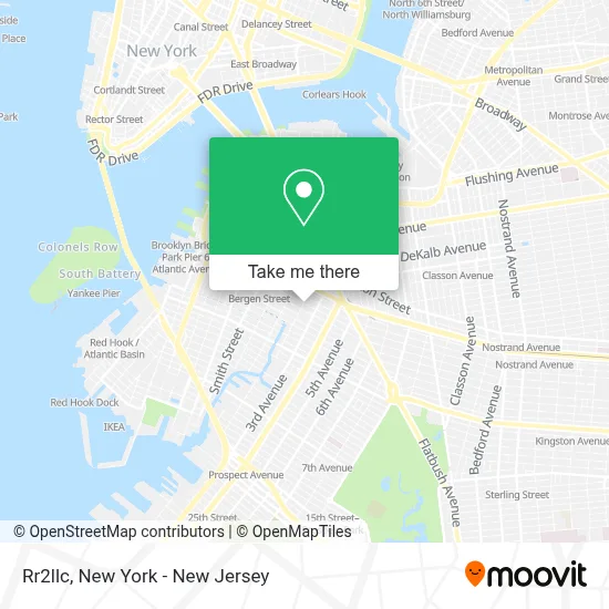
See Rr2llc, New York - New Jersey, on the map
Public Transit to Rr2llc in New York - New Jersey
Wondering how to get to Rr2llc in New York - New Jersey? Moovit helps you find the best way to get to Rr2llc with step-by-step directions from the nearest public transit station.
Moovit provides free maps and live directions to help you navigate through your city. View schedules, routes, timetables, and find out how long does it take to get to Rr2llc in real time.
Looking for the nearest stop or station to Rr2llc? Check out this list of stops closest to your destination: Bergen St/3 Av; 3 Av/Dean St; Atlantic Av/Nevins St; 3 Av/Baltic St; Atlantic Av-Barclays Ctr; Hoyt-Schermerhorn Sts; Bergen St; Atlantic Terminal.
Bus: B52, B62, B67, B65, B37.Train: CITY TERMINAL ZONE, BABYLON BRANCH, FAR ROCKAWAY BRANCH, HEMPSTEAD BRANCH, LONG BEACH BRANCH.Subway: 3, 4, B, F, G, N, Q, D, R, A, C.
Want to see if there’s another route that gets you there at an earlier time? Moovit helps you find alternative routes or times. Get directions from and directions to Rr2llc easily from the Moovit App or Website.
We make riding to Rr2llc easy, which is why over 1.5 million users, including users in New York - New Jersey, trust Moovit as the best app for public transit. You don’t need to download an individual bus app or train app, Moovit is your all-in-one transit app that helps you find the best bus time or train time available.
For information on prices of bus, subway and train, costs and ride fares to Rr2llc, please check the Moovit app.
Use the app to navigate to popular places including to the airport, hospital, stadium, grocery store, mall, coffee shop, school, college, and university.
Rr2llc Address: 258 Bergen St street in New York - New Jersey
- Bergen Street Laundry Service,
- Loved Ones Coffee,
- Ups Access Point Location,
- Language Laughter Studio,
- Jb Mac Real Estate,
- Bergen Street HRA,
- Ps 38 the Pacific School,
- Plantpaper,
- Wyckoff Gardens Community Center,
- New York City Wyckoff Gardens,
- NYCHA - Wyckoff Gardens,
- PS 38 (PS 38 Elementary School),
- Modern Adu Plans,
- State Street,
- Johnny Handy & Brothers,
- Seva Yoga Nyc,
- Gotham Medical and Rec Dispensary Delivery,
- New York City Human Resources,
- Citi Bike: Wyckoff Street and 3rd Avenue,
- Hellbent Scooters
Places Near Rr2llc (New York - New Jersey)
- qqqq, Manhattan,
- 3 Stone St, Manhattan,
- 26 Federal Plaza, Manhattan,
- 376 Hudson Street, Manhattan,
- Chinatown, Manhattan,
- Rockefeller Center, Manhattan,
- SoHo, Manhattan,
- 1 Police Plaza, Manhattan,
- Wall Street, Manhattan,
- San Gennaro Feast, Manhattan,
- 66 John Street, Manhattan,
- 911 Memorial, Manhattan,
- Times Square, Manhattan,
- 111 Centre New York City Supreme Court, Manhattan,
- Katz's Deli, Manhattan,
- Mountainside Hospital, Glen Ridge,
- Bellevue Hospital, Manhattan,
- Pier 83, Manhattan,
- Hudson Yards, Manhattan,
- Queens Center Mall, Queens
How to get to popular places in New York - New Jersey with public transit
Get around New York - New Jersey by public transit!
Traveling around New York - New Jersey has never been so easy. See step by step directions as you travel to any attraction, street or major public transit station. View bus and train schedules, arrival times, service alerts and detailed routes on a map, so you know exactly how to get to anywhere in New York - New Jersey.
When traveling to any destination around New York - New Jersey use Moovit's Live Directions with Get Off Notifications to know exactly where and how far to walk, how long to wait for your line, and how many stops are left. Moovit will alert you when it's time to get off — no need to constantly re-check whether yours is the next stop.
Wondering how to use public transit in New York - New Jersey or how to pay for public transit in New York - New Jersey? Moovit public transit app can help you navigate your way with public transit easily, and at minimum cost. It includes public transit fees, ticket prices, and costs. Looking for a map of New York - New Jersey public transit lines? Moovit public transit app shows all public transit maps in New York - New Jersey with all Bus, Train, Subway, Light Rail, Ferry and Cable Car routes and stops on an interactive map.
New York - New Jersey has 6 transit type(s), including: Bus, Train, Subway, Light Rail, Ferry and Cable Car, operated by several transit agencies, including MTA Subway, Metro-North Railroad, LIRR, PATH, MTA New York City Transit - Express routes, MTA Bus, NJ Transit, NYC Ferry, NICE bus, Bee-Line Bus, NJ Transit Rail, Norwalk Transit District, Hartford Line, River Valley Transit and HART