Directions to Rrk Homes For Sale (Queens) with public transportation
The following transit lines have routes that pass near Rrk Homes For Sale
 Bus: Q10, Q41, Q51, Q80, QM18.
- Train: BABYLON BRANCH, CITY TERMINAL ZONE, FAR ROCKAWAY BRANCH, LONG BEACH BRANCH, RONKONKOMA BRANCH.
- Subway: A, J, SR.
How to get to Rrk Homes For Sale by bus?
Click on the bus route to see step by step directions with maps, line arrival times and updated time schedules.
From Social Security Office, Queens
68 minFrom BAPS Shri Swaminarayan Mandir, Queens
64 minFrom Nostrand Ave, Brooklyn, Queens
58 minFrom 72-06 Northern Boulevard, Queens
61 minFrom 30-56 Whitestone Expwy, Queens
77 minFrom Louis Armstrong Stadium, Queens
81 minFrom Consulado Ecuatoriano en Queens, Queens
61 minFrom College Point DMV, Queens
75 minFrom Far Rockaway, NY, Queens
66 min
How to get to Rrk Homes For Sale by train?
Click on the train route to see step by step directions with maps, line arrival times and updated time schedules.
From Social Security Office, Queens
93 minFrom BAPS Shri Swaminarayan Mandir, Queens
96 minFrom 72-06 Northern Boulevard, Queens
70 minFrom 30-56 Whitestone Expwy, Queens
104 minFrom Louis Armstrong Stadium, Queens
112 minFrom Consulado Ecuatoriano en Queens, Queens
59 minFrom Far Rockaway, NY, Queens
88 min
How to get to Rrk Homes For Sale by subway?
Click on the subway route to see step by step directions with maps, line arrival times and updated time schedules.
From Social Security Office, Queens
64 minFrom BAPS Shri Swaminarayan Mandir, Queens
120 minFrom Nostrand Ave, Brooklyn, Queens
51 minFrom 72-06 Northern Boulevard, Queens
74 minFrom 30-56 Whitestone Expwy, Queens
127 minFrom Louis Armstrong Stadium, Queens
103 minFrom Consulado Ecuatoriano en Queens, Queens
90 minFrom Far Rockaway, NY, Queens
60 min
Bus stops near Rrk Homes For Sale in Queens
Subway station near Rrk Homes For Sale in Queens
- Aqueduct-N Conduit Av, 5 min walk,VIEW
Bus lines to Rrk Homes For Sale in Queens
What are the closest stations to Rrk Homes For Sale?
The closest stations to Rrk Homes For Sale are:
- Lefferts Blvd/Linden Blvd is 65 yards away, 2 min walk.
- Linden Blvd/Lefferts Blvd is 102 yards away, 2 min walk.
- Lefferts Blvd/115 Av is 339 yards away, 5 min walk.
- Aqueduct-N Conduit Av is 371 yards away, 5 min walk.
- 109 Av/Lefferts Blvd is 393 yards away, 5 min walk.
- Rockaway Blvd/Lefferts Blvd is 434 yards away, 6 min walk.
- Lefferts Blvd/Rockaway Blvd is 476 yards away, 6 min walk.
Which bus lines stop near Rrk Homes For Sale?
These bus lines stop near Rrk Homes For Sale: Q10, Q41, Q51, Q80.
Which train lines stop near Rrk Homes For Sale?
These train lines stop near Rrk Homes For Sale: BABYLON BRANCH, CITY TERMINAL ZONE, FAR ROCKAWAY BRANCH, LONG BEACH BRANCH, RONKONKOMA BRANCH.
Which subway lines stop near Rrk Homes For Sale?
These subway lines stop near Rrk Homes For Sale: A, J.
What’s the nearest subway station to Rrk Homes For Sale in Queens?
The nearest subway station to Rrk Homes For Sale in Queens is Aqueduct-N Conduit Av. It’s a 5 min walk away.
What’s the nearest bus station to Rrk Homes For Sale in Queens?
The nearest bus stations to Rrk Homes For Sale in Queens are Lefferts Blvd/Linden Blvd and Linden Blvd/Lefferts Blvd. The closest one is a 2 min walk away.
What time is the first subway to Rrk Homes For Sale in Queens?
The A is the first subway that goes to Rrk Homes For Sale in Queens. It stops nearby at 3:00 AM.
What time is the last subway to Rrk Homes For Sale in Queens?
The A is the last subway that goes to Rrk Homes For Sale in Queens. It stops nearby at 4:20 AM.
What time is the first bus to Rrk Homes For Sale in Queens?
The Q80 is the first bus that goes to Rrk Homes For Sale in Queens. It stops nearby at 3:00 AM.
What time is the last bus to Rrk Homes For Sale in Queens?
The Q7 is the last bus that goes to Rrk Homes For Sale in Queens. It stops nearby at 3:12 AM.
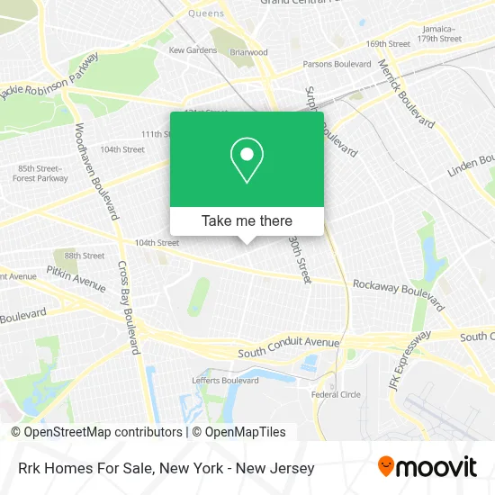
See Rrk Homes For Sale, Queens, on the map
Public Transit to Rrk Homes For Sale in Queens
Wondering how to get to Rrk Homes For Sale in Queens? Moovit helps you find the best way to get to Rrk Homes For Sale with step-by-step directions from the nearest public transit station.
Moovit provides free maps and live directions to help you navigate through your city. View schedules, routes, timetables, and find out how long does it take to get to Rrk Homes For Sale in real time.
Looking for the nearest stop or station to Rrk Homes For Sale? Check out this list of stops closest to your destination: Lefferts Blvd/Linden Blvd; Linden Blvd/Lefferts Blvd; Lefferts Blvd/115 Av; Aqueduct-N Conduit Av; 109 Av/Lefferts Blvd; Rockaway Blvd/Lefferts Blvd; Lefferts Blvd/Rockaway Blvd.
Bus: Q10, Q41, Q51, Q80, QM18, Q7.Train: BABYLON BRANCH, CITY TERMINAL ZONE, FAR ROCKAWAY BRANCH, LONG BEACH BRANCH, RONKONKOMA BRANCH.Subway: A, J, SR.
Want to see if there’s another route that gets you there at an earlier time? Moovit helps you find alternative routes or times. Get directions from and directions to Rrk Homes For Sale easily from the Moovit App or Website.
We make riding to Rrk Homes For Sale easy, which is why over 1.5 million users, including users in Queens, trust Moovit as the best app for public transit. You don’t need to download an individual bus app or train app, Moovit is your all-in-one transit app that helps you find the best bus time or train time available.
For information on prices of bus, subway and train, costs and ride fares to Rrk Homes For Sale, please check the Moovit app.
Use the app to navigate to popular places including to the airport, hospital, stadium, grocery store, mall, coffee shop, school, college, and university.
Rrk Homes For Sale Address: 11135 Lefferts Blvd street in Queens
- Ge Ptac Distributor,
- Hookah Dream,
- The Figure Studio,
- Lefferts Boulevard Laundromat,
- Ink'D Artistry Tattoo Studio,
- Ink'D Artistry,
- Buyeyeglasses,
- MTA Bus - Q10 @ Lefferts Blvd & 111 Avenue,
- Linden Blvd (lefferts and linden blvd),
- Surinails Beauty Salon,
- P.S. 100 - Glen Morris Elementary School,
- Redeeming Grace Ministries,
- J City Barber Shop,
- Trinciti Roti Shop and Restaurant,
- Prack Creative Painting,
- Trinciti Roti Shop,
- P.S. 100 Glen Morris,
- Kimberly Unisex Hair Salon,
- Saturn Lighting Inc.,
- Lefferts Blvd and 111th
Places Near Rrk Homes For Sale (Queens)
- Queens Center Mall, Queens,
- Chinatown, Manhattan,
- Hudson Yards, Manhattan,
- qqqq, Manhattan,
- Pier 83, Manhattan,
- Katz's Deli, Manhattan,
- San Gennaro Feast, Manhattan,
- Times Square, Manhattan,
- 376 Hudson Street, Manhattan,
- SoHo, Manhattan,
- 26 Federal Plaza, Manhattan,
- 111 Centre New York City Supreme Court, Manhattan,
- 3 Stone St, Manhattan,
- 911 Memorial, Manhattan,
- Bellevue Hospital, Manhattan,
- Rockefeller Center, Manhattan,
- Mountainside Hospital, Glen Ridge,
- 66 John Street, Manhattan,
- 1 Police Plaza, Manhattan,
- Wall Street, Manhattan
How to get to popular places in New York - New Jersey with public transit
Get around Queens by public transit!
Traveling around Queens has never been so easy. See step by step directions as you travel to any attraction, street or major public transit station. View bus and train schedules, arrival times, service alerts and detailed routes on a map, so you know exactly how to get to anywhere in Queens.
When traveling to any destination around Queens use Moovit's Live Directions with Get Off Notifications to know exactly where and how far to walk, how long to wait for your line, and how many stops are left. Moovit will alert you when it's time to get off — no need to constantly re-check whether yours is the next stop.
Wondering how to use public transit in Queens or how to pay for public transit in Queens? Moovit public transit app can help you navigate your way with public transit easily, and at minimum cost. It includes public transit fees, ticket prices, and costs. Looking for a map of Queens public transit lines? Moovit public transit app shows all public transit maps in Queens with all Bus, Train, Subway, Light Rail, Ferry and Cable Car routes and stops on an interactive map.
New York - New Jersey has 6 transit type(s), including: Bus, Train, Subway, Light Rail, Ferry and Cable Car, operated by several transit agencies, including MTA Subway, Metro-North Railroad, LIRR, PATH, MTA New York City Transit - Express routes, MTA Bus, NJ Transit, NYC Ferry, NICE bus, Bee-Line Bus, NJ Transit Rail, Norwalk Transit District, Hartford Line, River Valley Transit and HART