How to get to Rrl by bus?
Click on the bus route to see step by step directions with maps, line arrival times and updated time schedules.
From President's Gate - US Open, Queens
83 minFrom Sylvia's Restaurant, Manhattan
89 minFrom St John's University, Queens
70 minFrom John Jay College, Manhattan
67 minFrom Metropolitan Hospital, Manhattan
69 minFrom Flushing Meadows-Corona Park, Queens
83 minFrom Macy's, Queens
57 minFrom Red Rooster Harlem, Manhattan
88 minFrom Consulate General Of Italy, Manhattan
58 minFrom Queens Center Mall, Queens
59 min
How to get to Rrl by train?
Click on the train route to see step by step directions with maps, line arrival times and updated time schedules.
How to get to Rrl by subway?
Click on the subway route to see step by step directions with maps, line arrival times and updated time schedules.
From President's Gate - US Open, Queens
63 minFrom Sylvia's Restaurant, Manhattan
48 minFrom St John's University, Queens
67 minFrom John Jay College, Manhattan
39 minFrom Metropolitan Hospital, Manhattan
44 minFrom Flushing Meadows-Corona Park, Queens
63 minFrom Macy's, Queens
58 minFrom Red Rooster Harlem, Manhattan
47 minFrom Consulate General Of Italy, Manhattan
34 minFrom Queens Center Mall, Queens
58 min
Bus stops near Rrl in New York - New Jersey
Subway stations near Rrl in New York - New Jersey
Ferry station near Rrl in New York - New Jersey
- North Williamsburg, 15 min walk,VIEW
Bus lines to Rrl in New York - New Jersey
What are the closest stations to Rrl?
The closest stations to Rrl are:
- Grand St/Bedford Av is 47 yards away, 1 min walk.
- Bedford Av/Grand St is 77 yards away, 2 min walk.
- Wythe Av/N 6 St is 205 yards away, 3 min walk.
- Bedford Av is 568 yards away, 8 min walk.
- Metropolitan Av is 1002 yards away, 13 min walk.
- Marcy Av is 1075 yards away, 13 min walk.
- North Williamsburg is 1182 yards away, 15 min walk.
Which bus lines stop near Rrl?
These bus lines stop near Rrl: B32, B62, Q59.
Which train lines stop near Rrl?
These train lines stop near Rrl: MONTAUK BRANCH, PORT JEFFERSON BRANCH.
Which subway line stops near Rrl?
L (Downtown & Brooklyn)
What’s the nearest subway station to Rrl in New York - New Jersey?
The nearest subway station to Rrl in New York - New Jersey is Bedford Av. It’s a 8 min walk away.
What’s the nearest bus station to Rrl in New York - New Jersey?
The nearest bus station to Rrl in New York - New Jersey is Grand St/Bedford Av. It’s a 1 min walk away.
What’s the nearest ferry station to Rrl in New York - New Jersey?
The nearest ferry station to Rrl in New York - New Jersey is North Williamsburg. It’s a 15 min walk away.
What time is the first subway to Rrl in New York - New Jersey?
The J is the first subway that goes to Rrl in New York - New Jersey. It stops nearby at 3:07 AM.
What time is the last subway to Rrl in New York - New Jersey?
The J is the last subway that goes to Rrl in New York - New Jersey. It stops nearby at 3:27 AM.
What time is the first bus to Rrl in New York - New Jersey?
The Q59 is the first bus that goes to Rrl in New York - New Jersey. It stops nearby at 3:07 AM.
What time is the last bus to Rrl in New York - New Jersey?
The B62 is the last bus that goes to Rrl in New York - New Jersey. It stops nearby at 3:11 AM.
What time is the first ferry to Rrl in New York - New Jersey?
The ER is the first ferry that goes to Rrl in New York - New Jersey. It stops nearby at 6:29 AM.
What time is the last ferry to Rrl in New York - New Jersey?
The ER is the last ferry that goes to Rrl in New York - New Jersey. It stops nearby at 9:43 PM.
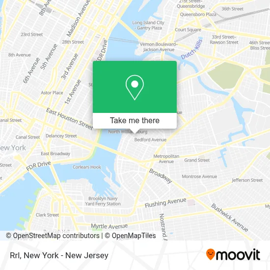
See Rrl, New York - New Jersey, on the map
Public Transit to Rrl in New York - New Jersey
Wondering how to get to Rrl in New York - New Jersey? Moovit helps you find the best way to get to Rrl with step-by-step directions from the nearest public transit station.
Moovit provides free maps and live directions to help you navigate through your city. View schedules, routes, timetables, and find out how long does it take to get to Rrl in real time.
Looking for the nearest stop or station to Rrl? Check out this list of stops closest to your destination: Grand St/Bedford Av; Bedford Av/Grand St; Wythe Av/N 6 St; Bedford Av; Metropolitan Av; Marcy Av; North Williamsburg.
Bus: B32, B62, Q59.Train: MONTAUK BRANCH, PORT JEFFERSON BRANCH.Subway: L, G, J, M, Z.Ferry: ER.
Want to see if there’s another route that gets you there at an earlier time? Moovit helps you find alternative routes or times. Get directions from and directions to Rrl easily from the Moovit App or Website.
We make riding to Rrl easy, which is why over 1.5 million users, including users in New York - New Jersey, trust Moovit as the best app for public transit. You don’t need to download an individual bus app or train app, Moovit is your all-in-one transit app that helps you find the best bus time or train time available.
For information on prices of subway, bus and train, costs and ride fares to Rrl, please check the Moovit app.
Use the app to navigate to popular places including to the airport, hospital, stadium, grocery store, mall, coffee shop, school, college, and university.
Rrl Address: 85 N 3rd St street in New York - New Jersey
- Oli & Wylde,
- Mayanoki,
- Angela Jae Artistry,
- Anine Bing,
- Sola Salons,
- Babe Of Brooklyn: Beard Balm,
- Lovers Laser,
- Cody Cross Hair,
- Chicbythelayers Llc,
- Tomoko Nail Nyc,
- Eden Aesthetics,
- Velvet Cosmetic Tattoos,
- Naturepedic Organic Mattress Gallery,
- Kcdc Skateshop,
- The Doll Room Hair Salon,
- Madison Reed,
- Dan Williams,
- Double Rl Men's,
- Mint Bklyn Hair Studio,
- Sola Brooklyn
Places Near Rrl (New York - New Jersey)
- SoHo, Manhattan,
- 911 Memorial, Manhattan,
- 66 John Street, Manhattan,
- 376 Hudson Street, Manhattan,
- Times Square, Manhattan,
- Chinatown, Manhattan,
- Bellevue Hospital, Manhattan,
- San Gennaro Feast, Manhattan,
- Rockefeller Center, Manhattan,
- 1 Police Plaza, Manhattan,
- Queens Center Mall, Queens,
- 111 Centre New York City Supreme Court, Manhattan,
- Katz's Deli, Manhattan,
- Wall Street, Manhattan,
- Pier 83, Manhattan,
- qqqq, Manhattan,
- Mountainside Hospital, Glen Ridge,
- Hudson Yards, Manhattan,
- 26 Federal Plaza, Manhattan,
- 3 Stone St, Manhattan
How to get to popular places in New York - New Jersey with public transit
Get around New York - New Jersey by public transit!
Traveling around New York - New Jersey has never been so easy. See step by step directions as you travel to any attraction, street or major public transit station. View bus and train schedules, arrival times, service alerts and detailed routes on a map, so you know exactly how to get to anywhere in New York - New Jersey.
When traveling to any destination around New York - New Jersey use Moovit's Live Directions with Get Off Notifications to know exactly where and how far to walk, how long to wait for your line, and how many stops are left. Moovit will alert you when it's time to get off — no need to constantly re-check whether yours is the next stop.
Wondering how to use public transit in New York - New Jersey or how to pay for public transit in New York - New Jersey? Moovit public transit app can help you navigate your way with public transit easily, and at minimum cost. It includes public transit fees, ticket prices, and costs. Looking for a map of New York - New Jersey public transit lines? Moovit public transit app shows all public transit maps in New York - New Jersey with all Bus, Train, Subway, Light Rail, Ferry and Cable Car routes and stops on an interactive map.
New York - New Jersey has 6 transit type(s), including: Bus, Train, Subway, Light Rail, Ferry and Cable Car, operated by several transit agencies, including MTA Subway, Metro-North Railroad, LIRR, PATH, MTA New York City Transit - Express routes, MTA Bus, NJ Transit, NYC Ferry, NICE bus, Bee-Line Bus, NJ Transit Rail, Norwalk Transit District, Hartford Line, River Valley Transit and HART