How to get to Rrl Architecture and Design by bus?
Click on the bus route to see step by step directions with maps, line arrival times and updated time schedules.
From Neue Galerie, Manhattan
46 minFrom 300 E 66th street, Manhattan
49 minFrom 2nd Ave (59th st and 2nd ave), Manhattan
40 minFrom Harlem, Manhattan
70 minFrom Costco Wholesale, Manhattan
79 minFrom Upper West Side, Manhattan
58 minFrom Elmhurst, NY, Queens
62 minFrom Trump Tower, Manhattan
31 minFrom Costco, Manhattan
79 minFrom Resorts World Shuttle Bus, Queens
63 min
How to get to Rrl Architecture and Design by train?
Click on the train route to see step by step directions with maps, line arrival times and updated time schedules.
How to get to Rrl Architecture and Design by subway?
Click on the subway route to see step by step directions with maps, line arrival times and updated time schedules.
From Neue Galerie, Manhattan
31 minFrom 300 E 66th street, Manhattan
30 minFrom 2nd Ave (59th st and 2nd ave), Manhattan
24 minFrom Harlem, Manhattan
34 minFrom Costco Wholesale, Manhattan
46 minFrom Upper West Side, Manhattan
28 minFrom Elmhurst, NY, Queens
47 minFrom Trump Tower, Manhattan
29 minFrom Costco, Manhattan
47 minFrom Resorts World Shuttle Bus, Queens
46 min
Bus stops near Rrl Architecture and Design in Manhattan
Subway stations near Rrl Architecture and Design in Manhattan
Bus lines to Rrl Architecture and Design in Manhattan
- M1, Soho Centre St Via 5 Av/ Via Broadway,VIEW
- M55, South Ferry,VIEW
- SHORTLINE HUDSON, 500 - Monroe - Chester - Goshen,VIEW
- SHORTLINE HUDSON, 200 - Northern District – Nanuet,VIEW
- SHORTLINE HUDSON, 800 - Pennsylvania,VIEW
- SHORTLINE HUDSON, 700 - Newburgh - Poughkeepsie,VIEW
- SHORTLINE HUDSON, 300 - NYC - Middletown,VIEW
- SIM1, Eltngvlle Trans Ctr Via Hylan Via Rich,VIEW
- SIM1C, Eltngvlle Trans Ctr Via Hylan Via Rich,VIEW
- SIM3C, Pt Rchmnd Via Narrows Rd N Via Watchogue,VIEW
- SIM4C, Huguenot Via Richmond Av Via Arthur Kill,VIEW
- SIM33C, Mariners Harbor Via N Gannon Av,VIEW
- SIM34, Mariners Harbor Via Watchogue Rd,VIEW
- X27, Bay Ridge Shore Rd Via Broadway,VIEW
- X28, Coney Island Sea Gate Via Broadway,VIEW
- M103, City Hall Via Lex Av,VIEW
- BXM18, Downtown Wall St Via 5 Av Via Broadway,VIEW
What are the closest stations to Rrl Architecture and Design?
The closest stations to Rrl Architecture and Design are:
- Broadway/Prince St is 2 yards away, 1 min walk.
- Prince St is 66 yards away, 2 min walk.
- Broadway & Spring St is 152 yards away, 3 min walk.
- Spring St is 222 yards away, 4 min walk.
- Canal St is 226 yards away, 3 min walk.
- Broadway/Broome St is 313 yards away, 4 min walk.
- Bowery/Grand St is 489 yards away, 6 min walk.
- Broadway/Lispenard St is 516 yards away, 7 min walk.
- Grand St is 537 yards away, 7 min walk.
Which bus lines stop near Rrl Architecture and Design?
These bus lines stop near Rrl Architecture and Design: M1, M116.
Which train lines stop near Rrl Architecture and Design?
These train lines stop near Rrl Architecture and Design: BLU, YEL.
Which subway lines stop near Rrl Architecture and Design?
These subway lines stop near Rrl Architecture and Design: 6, 6X, B, Q, R.
What’s the nearest subway station to Rrl Architecture and Design in Manhattan?
The nearest subway station to Rrl Architecture and Design in Manhattan is Prince St. It’s a 2 min walk away.
What’s the nearest bus station to Rrl Architecture and Design in Manhattan?
The nearest bus station to Rrl Architecture and Design in Manhattan is Broadway/Prince St. It’s a 1 min walk away.
What time is the first subway to Rrl Architecture and Design in Manhattan?
The N is the first subway that goes to Rrl Architecture and Design in Manhattan. It stops nearby at 3:00 AM.
What time is the last subway to Rrl Architecture and Design in Manhattan?
The 6 is the last subway that goes to Rrl Architecture and Design in Manhattan. It stops nearby at 4:01 AM.
What time is the first bus to Rrl Architecture and Design in Manhattan?
The M103 is the first bus that goes to Rrl Architecture and Design in Manhattan. It stops nearby at 3:28 AM.
What time is the last bus to Rrl Architecture and Design in Manhattan?
The M103 is the last bus that goes to Rrl Architecture and Design in Manhattan. It stops nearby at 3:29 AM.
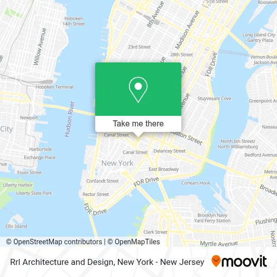
See Rrl Architecture and Design, Manhattan, on the map
Public Transit to Rrl Architecture and Design in Manhattan
Wondering how to get to Rrl Architecture and Design in Manhattan? Moovit helps you find the best way to get to Rrl Architecture and Design with step-by-step directions from the nearest public transit station.
Moovit provides free maps and live directions to help you navigate through your city. View schedules, routes, timetables, and find out how long does it take to get to Rrl Architecture and Design in real time.
Looking for the nearest stop or station to Rrl Architecture and Design? Check out this list of stops closest to your destination: Broadway/Prince St; Prince St; Broadway & Spring St; Spring St; Canal St; Broadway/Broome St; Bowery/Grand St; Broadway/Lispenard St; Grand St.
Bus: M1, M116, M55, SHORTLINE HUDSON, SHORTLINE HUDSON, SHORTLINE HUDSON, SHORTLINE HUDSON, SHORTLINE HUDSON.Train: BLU, YEL.Subway: 6, 6X, B, Q, R, N, W, J, Z, 4, D.
Want to see if there’s another route that gets you there at an earlier time? Moovit helps you find alternative routes or times. Get directions from and directions to Rrl Architecture and Design easily from the Moovit App or Website.
We make riding to Rrl Architecture and Design easy, which is why over 1.5 million users, including users in Manhattan, trust Moovit as the best app for public transit. You don’t need to download an individual bus app or train app, Moovit is your all-in-one transit app that helps you find the best bus time or train time available.
For information on prices of bus, subway and train, costs and ride fares to Rrl Architecture and Design, please check the Moovit app.
Use the app to navigate to popular places including to the airport, hospital, stadium, grocery store, mall, coffee shop, school, college, and university.
Rrl Architecture and Design Address: 224 Centre St street in Manhattan
- The Purposeworks,
- Atria Properties,
- Al Muntazir Shia Online Quran Academy,
- Nyc Party Photographer | Lana Dubkova,
- We Work Nyc,
- Viewfinder,
- Finhabits,
- وەستا ئاسۆ بۆ فرۆشتنی تەنکی پلێت و پلاستیک,
- Centre Plumbing,
- Hair Quarter Nyc,
- Sushidelic,
- Garbo Resto Bar,
- Brooklyn Flea Fort Greene,
- Maman NYC,
- Medium Concepts Agency,
- Mara Hoffman,
- Go Visas,
- Super Natural Wine Co M R,
- Solita Soho Hotel,
- Cummins and Partners
Places Near Rrl Architecture and Design (Manhattan)
- San Gennaro Feast, Manhattan,
- Rockefeller Center, Manhattan,
- Katz's Deli, Manhattan,
- 111 Centre New York City Supreme Court, Manhattan,
- Hudson Yards, Manhattan,
- SoHo, Manhattan,
- Wall Street, Manhattan,
- Mountainside Hospital, Glen Ridge,
- Queens Center Mall, Queens,
- 26 Federal Plaza, Manhattan,
- 3 Stone St, Manhattan,
- Bellevue Hospital, Manhattan,
- 66 John Street, Manhattan,
- 376 Hudson Street, Manhattan,
- qqqq, Manhattan,
- 1 Police Plaza, Manhattan,
- Times Square, Manhattan,
- 911 Memorial, Manhattan,
- Pier 83, Manhattan,
- Chinatown, Manhattan
How to get to popular places in New York - New Jersey with public transit
Get around Manhattan by public transit!
Traveling around Manhattan has never been so easy. See step by step directions as you travel to any attraction, street or major public transit station. View bus and train schedules, arrival times, service alerts and detailed routes on a map, so you know exactly how to get to anywhere in Manhattan.
When traveling to any destination around Manhattan use Moovit's Live Directions with Get Off Notifications to know exactly where and how far to walk, how long to wait for your line, and how many stops are left. Moovit will alert you when it's time to get off — no need to constantly re-check whether yours is the next stop.
Wondering how to use public transit in Manhattan or how to pay for public transit in Manhattan? Moovit public transit app can help you navigate your way with public transit easily, and at minimum cost. It includes public transit fees, ticket prices, and costs. Looking for a map of Manhattan public transit lines? Moovit public transit app shows all public transit maps in Manhattan with all Bus, Train, Subway, Light Rail, Ferry and Cable Car routes and stops on an interactive map.
New York - New Jersey has 6 transit type(s), including: Bus, Train, Subway, Light Rail, Ferry and Cable Car, operated by several transit agencies, including MTA Subway, Metro-North Railroad, LIRR, PATH, MTA New York City Transit - Express routes, MTA Bus, NJ Transit, NYC Ferry, NICE bus, Bee-Line Bus, NJ Transit Rail, Norwalk Transit District, Hartford Line, River Valley Transit and HART