How to get to Rro Music Live by bus?
Click on the bus route to see step by step directions with maps, line arrival times and updated time schedules.
From Hobby Lobby, Las Vegas
60 minFrom Harry Reid International Airport (LAS), Paradise
47 minFrom Mi Ranchito en Dolan Springs, North Las Vegas
35 minFrom Aria Receiving Dock, Paradise
59 minFrom Carmine's Italian Restaurant - Las Vegas, Paradise
37 minFrom Venetian Hotel & Casino, Paradise
46 minFrom Shadow Creek Golf Course, North Las Vegas
39 minFrom Alura Jenson, Paradise
71 minFrom S Tenaya Way / W Charleston Blvd, Las Vegas
54 minFrom Tree Line Dr / E Sahara Ave, Sunrise Manor
54 min
Bus stops near Rro Music Live in Las Vegas
Monorail station near Rro Music Live in Las Vegas
- Sls Station, 41 min walk,VIEW
Bus lines to Rro Music Live in Las Vegas
- DOWNTOWN LOOP, Loop,VIEW
- BHX, Bhx-A Boulder Hwy Express Southbound,VIEW
- DEUCE, Deuce on the Strip Southbound,VIEW
- 113, 113 N. Las Vegas Blvd Southbound,VIEW
- 207, 207 Alta / Stewart Eastbound,VIEW
- 215, 215 Bonanza Eastbound,VIEW
- CX, Centennial Express Southbound,VIEW
- 401, 401 N. Outlets / Symphony Park,VIEW
What are the closest stations to Rro Music Live?
The closest stations to Rro Music Live are:
- The Mob Museum is 257 yards away, 4 min walk.
- Wb Carson Before 3rd is 351 yards away, 5 min walk.
- Sb Las Vegas Before Carson is 441 yards away, 6 min walk.
- Nb 4th After Carson is 559 yards away, 7 min walk.
- Sb Casino Center Before Fremont is 583 yards away, 7 min walk.
- Sls Station is 3404 yards away, 41 min walk.
Which bus lines stop near Rro Music Live?
These bus lines stop near Rro Music Live: 113, 207, BHX, CX, DEUCE, DVX.
What’s the nearest bus station to Rro Music Live in Las Vegas?
The nearest bus station to Rro Music Live in Las Vegas is The Mob Museum. It’s a 4 min walk away.
What time is the first bus to Rro Music Live in Las Vegas?
The DEUCE is the first bus that goes to Rro Music Live in Las Vegas. It stops nearby at 3:00 AM.
What time is the last bus to Rro Music Live in Las Vegas?
The BHX is the last bus that goes to Rro Music Live in Las Vegas. It stops nearby at 3:56 AM.
What time is the first Monorail to Rro Music Live in Las Vegas?
The LVM is the first Monorail that goes to Rro Music Live in Las Vegas. It stops nearby at 7:00 AM.
What time is the last Monorail to Rro Music Live in Las Vegas?
The LVM is the last Monorail that goes to Rro Music Live in Las Vegas. It stops nearby at 12:02 AM.
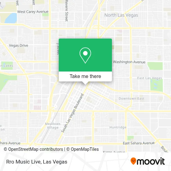
See Rro Music Live, Las Vegas, on the map
Public Transit to Rro Music Live in Las Vegas
Wondering how to get to Rro Music Live in Las Vegas? Moovit helps you find the best way to get to Rro Music Live with step-by-step directions from the nearest public transit station.
Moovit provides free maps and live directions to help you navigate through your city. View schedules, routes, timetables, and find out how long does it take to get to Rro Music Live in real time.
Looking for the nearest stop or station to Rro Music Live? Check out this list of stops closest to your destination: The Mob Museum; Wb Carson Before 3rd; Sb Las Vegas Before Carson; Nb 4th After Carson; Sb Casino Center Before Fremont; Sls Station.
Bus: 113, 207, BHX, CX, DEUCE, DVX, DOWNTOWN LOOP, 215, 401.Monorail: LVM.
Want to see if there’s another route that gets you there at an earlier time? Moovit helps you find alternative routes or times. Get directions from and directions to Rro Music Live easily from the Moovit App or Website.
We make riding to Rro Music Live easy, which is why over 1.7 million users, including users in Las Vegas, trust Moovit as the best app for public transit. You don’t need to download an individual bus app or train app, Moovit is your all-in-one transit app that helps you find the best bus time or train time available.
For information on prices of bus, costs and ride fares to Rro Music Live, please check the Moovit app.
Use the app to navigate to popular places including to the airport, hospital, stadium, grocery store, mall, coffee shop, school, college, and university.
Rro Music Live Address: 450 Fremont St street in Las Vegas
- Hero Prop,
- Telemundo Las Vegas,
- Don't Tell Mama (Dont Tell Mama),
- Hot Shoe Hall Of Fame,
- Neonopolis Parking Garage,
- Indulge Private Lounge,
- Tickled Pink Comedy Club,
- Drug Detox Las Vegas,
- Pema,
- Thai Vegas Cuisine,
- Makers & Finders Coffee,
- Viva Vegas Gifts,
- Glitter Gulch Tiki,
- The Burger Den,
- The 35 Cinema,
- Fat Sal's,
- Substance,
- Denny's Restaurant,
- Cat's Meow Las Vegas,
- H20 Bar at the Tank
Places Near Rro Music Live (Las Vegas)
- The Neon Museum, Las Vegas,
- Las Vegas Premium Outlets-North, Enterprise,
- Las Vegas South Premium Outlets, Enterprise,
- Koolsville Tattoos, Las Vegas,
- Allegiant Stadium, Paradise,
- The Palms Casino Resort, Paradise,
- Las Vegas North Premium Outlets, Las Vegas,
- The Deuce Bus Stop at Fremont St, Las Vegas,
- Area15, Las Vegas,
- Trump International Hotel Las Vegas, Paradise,
- Walmart, Las Vegas,
- Meow Wolf - Las Vegas (Meow Wolf's Omega Mart), Las Vegas,
- Welcome To Fabulous Las Vegas Sign, Paradise,
- Omega Mart, Las Vegas,
- Lee Canyon, Las Vegas,
- Walmart Supercenter, Las Vegas,
- Zak Bagans Haunted Museum, Las Vegas,
- Town Square, Enterprise,
- Arte Museum Las Vegas, Paradise,
- Gold & Silver Pawn Shop, Las Vegas
How to get to popular places in Las Vegas with public transit
Get around Las Vegas by public transit!
Traveling around Las Vegas has never been so easy. See step by step directions as you travel to any attraction, street or major public transit station. View bus and train schedules, arrival times, service alerts and detailed routes on a map, so you know exactly how to get to anywhere in Las Vegas.
When traveling to any destination around Las Vegas use Moovit's Live Directions with Get Off Notifications to know exactly where and how far to walk, how long to wait for your line, and how many stops are left. Moovit will alert you when it's time to get off — no need to constantly re-check whether yours is the next stop.
Wondering how to use public transit in Las Vegas or how to pay for public transit in Las Vegas? Moovit public transit app can help you navigate your way with public transit easily, and at minimum cost. It includes public transit fees, ticket prices, and costs. Looking for a map of Las Vegas public transit lines? Moovit public transit app shows all public transit maps in Las Vegas with all Bus and Monorail routes and stops on an interactive map.
Las Vegas has 2 transit type(s), including: Bus and Monorail, operated by several transit agencies, including RTCSNV, City of Las Vegas, Alvand Transportation, Vegas Airporter, Las Vegas Monorail, FlixBus-us and Greyhound-us