How to get to Rsm Edison by bus?
Click on the bus route to see step by step directions with maps, line arrival times and updated time schedules.
How to get to Rsm Edison by train?
Click on the train route to see step by step directions with maps, line arrival times and updated time schedules.
Train station near Rsm Edison
- Metuchen, 10 min walk,VIEW
Bus stop near Rsm Edison
- Plainfield Rd at Southfield Rd, 14 min walk,VIEW
Bus lines to Rsm Edison
- 819, Metuchen Rail Station,VIEW
What are the closest stations to Rsm Edison?
The closest stations to Rsm Edison are:
- Metuchen is 813 yards away, 10 min walk.
- Plainfield Rd at Southfield Rd is 1170 yards away, 14 min walk.
Which bus lines stop near Rsm Edison?
These bus lines stop near Rsm Edison: 810, 813, 819.
Which train line stops near Rsm Edison?
NC (New York Penn Station)
What’s the nearest train station to Rsm Edison?
The nearest train station to Rsm Edison is Metuchen. It’s a 10 min walk away.
What’s the nearest bus station to Rsm Edison?
The nearest bus station to Rsm Edison is Plainfield Rd at Southfield Rd. It’s a 14 min walk away.
What time is the first train to Rsm Edison?
The NC is the first train that goes to Rsm Edison. It stops nearby at 4:22 AM.
What time is the last train to Rsm Edison?
The NC is the last train that goes to Rsm Edison. It stops nearby at 2:12 AM.
What time is the first bus to Rsm Edison?
The 819 is the first bus that goes to Rsm Edison. It stops nearby at 6:48 AM.
What time is the last bus to Rsm Edison?
The 819 is the last bus that goes to Rsm Edison. It stops nearby at 7:38 PM.
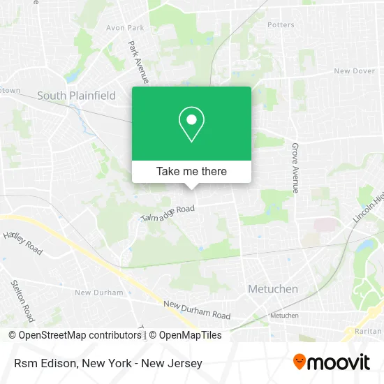
See Rsm Edison on the map
Public Transportation to Rsm Edison
Wondering how to get to Rsm Edison? Moovit helps you find the best way to get to Rsm Edison with step-by-step directions from the nearest public transit station.
Moovit provides free maps and live directions to help you navigate through your city. View schedules, routes, timetables, and find out how long does it take to get to Rsm Edison in real time.
Looking for the nearest stop or station to Rsm Edison? Check out this list of stops closest to your destination: Metuchen; Plainfield Rd at Southfield Rd.
Bus: 810, 813, 819.Train: NC.
Want to see if there’s another route that gets you there at an earlier time? Moovit helps you find alternative routes or times. Get directions from and directions to Rsm Edison easily from the Moovit App or Website.
We make riding to Rsm Edison easy, which is why over 1.5 million users, including users in Edison, trust Moovit as the best app for public transit. You don’t need to download an individual bus app or train app, Moovit is your all-in-one transit app that helps you find the best bus time or train time available.
For information on prices of bus and train, costs and ride fares to Rsm Edison, please check the Moovit app.
Use the app to navigate to popular places including to the airport, hospital, stadium, grocery store, mall, coffee shop, school, college, and university.
Rsm Edison Address: 3900 Park Ave street in Edison
- Dr. Nitin Mishra,
- The Eye Center,
- Spencer Savings Bank,
- One Dental New Jersey,
- The Eye Center,
- Spencer Savings Bank,
- Thomas J Cassidy Md Llc,
- Travel Trivia Online,
- Donald J. Trump - Edison, NJ Campaign Headquarters,
- C2 Medical Aesthetics,
- Industrial Process Measurement, Inc. - Instrumentation2000.Com,
- Papersmiths,
- The Tech Authority,
- Horiba Scientific,
- Dipika Gupta (Astrologer & Vastu Consultant),
- Park Gate Swimming Pool,
- Libertyx Bitcoin Atm,
- Park Gate Condominium,
- Blue Rhino Propane Exchange,
- Assemblyman Robert Karabinchak
Places Near Rsm Edison
- 66 John Street, Manhattan,
- Wall Street, Manhattan,
- Hudson Yards, Manhattan,
- 911 Memorial, Manhattan,
- Mountainside Hospital, Glen Ridge,
- Bellevue Hospital, Manhattan,
- Pier 83, Manhattan,
- Queens Center Mall, Queens,
- qqqq, Manhattan,
- Chinatown, Manhattan,
- 26 Federal Plaza, Manhattan,
- Katz's Deli, Manhattan,
- SoHo, Manhattan,
- 1 Police Plaza, Manhattan,
- Rockefeller Center, Manhattan,
- 3 Stone St, Manhattan,
- 376 Hudson Street, Manhattan,
- 111 Centre New York City Supreme Court, Manhattan,
- San Gennaro Feast, Manhattan,
- Times Square, Manhattan
How to get to popular places in New York - New Jersey with public transit
Get around Edison by public transit!
Traveling around Edison has never been so easy. See step by step directions as you travel to any attraction, street or major public transit station. View bus and train schedules, arrival times, service alerts and detailed routes on a map, so you know exactly how to get to anywhere in Edison.
When traveling to any destination around Edison use Moovit's Live Directions with Get Off Notifications to know exactly where and how far to walk, how long to wait for your line, and how many stops are left. Moovit will alert you when it's time to get off — no need to constantly re-check whether yours is the next stop.
Wondering how to use public transit in Edison or how to pay for public transit in Edison? Moovit public transit app can help you navigate your way with public transit easily, and at minimum cost. It includes public transit fees, ticket prices, and costs. Looking for a map of Edison public transit lines? Moovit public transit app shows all public transit maps in Edison with all Bus, Train, Subway, Light Rail, Ferry and Cable Car routes and stops on an interactive map.
New York - New Jersey has 6 transit type(s), including: Bus, Train, Subway, Light Rail, Ferry and Cable Car, operated by several transit agencies, including MTA Subway, Metro-North Railroad, LIRR, PATH, MTA New York City Transit - Express routes, MTA Bus, NJ Transit, NYC Ferry, NICE bus, Bee-Line Bus, NJ Transit Rail, Norwalk Transit District, Hartford Line, River Valley Transit and HART