How to get to Rssc by bus?
Click on the bus route to see step by step directions with maps, line arrival times and updated time schedules.
From Met Cloisters, Manhattan
91 minFrom 1910 monterey avenue, Bronx
66 minFrom Van Cortlandt Park, Bronx
52 minFrom The Cloisters, Manhattan
92 minFrom Crotona Park, Bronx
71 minFrom East Tremont Ave, Bronx
68 minFrom New York Botanical Garden, Bronx
56 minFrom Bronx VA Medical Center, Bronx
52 minFrom City Island, Bronx
86 minFrom 1910 Monterey Avenue, Bronx
68 min
How to get to Rssc by train?
Click on the train route to see step by step directions with maps, line arrival times and updated time schedules.
How to get to Rssc by subway?
Click on the subway route to see step by step directions with maps, line arrival times and updated time schedules.
From Met Cloisters, Manhattan
126 minFrom 1910 monterey avenue, Bronx
97 minFrom Van Cortlandt Park, Bronx
129 minFrom The Cloisters, Manhattan
127 minFrom Crotona Park, Bronx
63 minFrom East Tremont Ave, Bronx
78 minFrom New York Botanical Garden, Bronx
75 minFrom Bronx VA Medical Center, Bronx
108 minFrom 1910 Monterey Avenue, Bronx
78 min
Bus stops near Rssc in Mount Vernon
Train stations near Rssc in Mount Vernon
Bus lines to Rssc in Mount Vernon
What are the closest stations to Rssc?
The closest stations to Rssc are:
- N Terrace Ave @ W Grand St is 68 yards away, 1 min walk.
- Gramatan Ave @ E Grand St is 303 yards away, 4 min walk.
- Midland Ave @ Bronx River Rd is 522 yards away, 7 min walk.
- Mount Vernon East is 2133 yards away, 25 min walk.
- Mount Vernon West is 3535 yards away, 42 min walk.
Which bus lines stop near Rssc?
These bus lines stop near Rssc: 52, 55, 7.
Which train line stops near Rssc?
2 (513#| North White Plains)
Which subway line stops near Rssc?
2 (Uptown & The Bronx)
What’s the nearest train station to Rssc in Mount Vernon?
The nearest train station to Rssc in Mount Vernon is Mount Vernon East. It’s a 25 min walk away.
What’s the nearest bus station to Rssc in Mount Vernon?
The nearest bus station to Rssc in Mount Vernon is N Terrace Ave @ W Grand St. It’s a 1 min walk away.
What time is the first train to Rssc in Mount Vernon?
The 2 is the first train that goes to Rssc in Mount Vernon. It stops nearby at 5:01 AM.
What time is the last train to Rssc in Mount Vernon?
The 2 is the last train that goes to Rssc in Mount Vernon. It stops nearby at 2:31 AM.
What time is the first bus to Rssc in Mount Vernon?
The 55 is the first bus that goes to Rssc in Mount Vernon. It stops nearby at 5:49 AM.
What time is the last bus to Rssc in Mount Vernon?
The 55 is the last bus that goes to Rssc in Mount Vernon. It stops nearby at 9:51 PM.
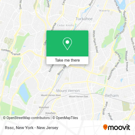
See Rssc, Mount Vernon, on the map
Public Transit to Rssc in Mount Vernon
Wondering how to get to Rssc in Mount Vernon? Moovit helps you find the best way to get to Rssc with step-by-step directions from the nearest public transit station.
Moovit provides free maps and live directions to help you navigate through your city. View schedules, routes, timetables, and find out how long does it take to get to Rssc in real time.
Looking for the nearest stop or station to Rssc? Check out this list of stops closest to your destination: N Terrace Ave @ W Grand St; Gramatan Ave @ E Grand St; Midland Ave @ Bronx River Rd; Mount Vernon East; Mount Vernon West.
Bus: 52, 55, 7, 26.Train: 2, 3, 4.Subway: 2.
Want to see if there’s another route that gets you there at an earlier time? Moovit helps you find alternative routes or times. Get directions from and directions to Rssc easily from the Moovit App or Website.
We make riding to Rssc easy, which is why over 1.5 million users, including users in Mount Vernon, trust Moovit as the best app for public transit. You don’t need to download an individual bus app or train app, Moovit is your all-in-one transit app that helps you find the best bus time or train time available.
For information on prices of bus, train and subway, costs and ride fares to Rssc, please check the Moovit app.
Use the app to navigate to popular places including to the airport, hospital, stadium, grocery store, mall, coffee shop, school, college, and university.
Rssc Address: 61 W Grand St street in Mount Vernon
- Tj's Deli,
- Grand St Locust St,
- Gee Acupuncture & Herbs,
- Superior Nail Spa,
- Century Systems 1 Ltd,
- Descarga Latina Dance Studio,
- Nuna Harvest,
- NU Concept & School Photography,
- Mitchell Electronics Corporation,
- Cvs Beauty,
- Bajazit M Derri,
- The Nail Bar,
- Total Wash Inc Laundromat,
- Mount Vernon Medical,
- Ruthy Babysitting and Childcare Services,
- Tauland Kitchen & Bath,
- Mariani Management Corp.,
- Homeschool Music Conservatory,
- Bp,
- Apartment For Rent Nyc
Places Near Rssc (Mount Vernon)
- Wall Street, Manhattan,
- Pier 83, Manhattan,
- 1 Police Plaza, Manhattan,
- Hudson Yards, Manhattan,
- Rockefeller Center, Manhattan,
- Katz's Deli, Manhattan,
- Mountainside Hospital, Glen Ridge,
- 66 John Street, Manhattan,
- qqqq, Manhattan,
- 111 Centre New York City Supreme Court, Manhattan,
- Bellevue Hospital, Manhattan,
- SoHo, Manhattan,
- 3 Stone St, Manhattan,
- 911 Memorial, Manhattan,
- Chinatown, Manhattan,
- 376 Hudson Street, Manhattan,
- San Gennaro Feast, Manhattan,
- Queens Center Mall, Queens,
- Times Square, Manhattan,
- 26 Federal Plaza, Manhattan
How to get to popular places in New York - New Jersey with public transit
Get around Mount Vernon by public transit!
Traveling around Mount Vernon has never been so easy. See step by step directions as you travel to any attraction, street or major public transit station. View bus and train schedules, arrival times, service alerts and detailed routes on a map, so you know exactly how to get to anywhere in Mount Vernon.
When traveling to any destination around Mount Vernon use Moovit's Live Directions with Get Off Notifications to know exactly where and how far to walk, how long to wait for your line, and how many stops are left. Moovit will alert you when it's time to get off — no need to constantly re-check whether yours is the next stop.
Wondering how to use public transit in Mount Vernon or how to pay for public transit in Mount Vernon? Moovit public transit app can help you navigate your way with public transit easily, and at minimum cost. It includes public transit fees, ticket prices, and costs. Looking for a map of Mount Vernon public transit lines? Moovit public transit app shows all public transit maps in Mount Vernon with all Bus, Train, Subway, Light Rail, Ferry and Cable Car routes and stops on an interactive map.
New York - New Jersey has 6 transit type(s), including: Bus, Train, Subway, Light Rail, Ferry and Cable Car, operated by several transit agencies, including MTA Subway, Metro-North Railroad, LIRR, PATH, MTA New York City Transit - Express routes, MTA Bus, NJ Transit, NYC Ferry, NICE bus, Bee-Line Bus, NJ Transit Rail, Norwalk Transit District, Hartford Line, River Valley Transit and HART