How to get to Rsvip Services Llc by bus?
Click on the bus route to see step by step directions with maps, line arrival times and updated time schedules.
From Central Park, Manhattan
53 minFrom Hospital for Special Surgery, Manhattan
62 minFrom 42, Manhattan
44 minFrom Frick Collection, Manhattan
43 minFrom Noguchi Museum, Queens
92 minFrom Walter Kerr Theatre, Manhattan
55 minFrom East 96th Street, Manhattan
66 minFrom Hallets Point, Queens
95 minFrom Walmart Supercenter, Secaucus
96 minFrom Walmart, Secaucus
96 min
How to get to Rsvip Services Llc by train?
Click on the train route to see step by step directions with maps, line arrival times and updated time schedules.
How to get to Rsvip Services Llc by subway?
Click on the subway route to see step by step directions with maps, line arrival times and updated time schedules.
Bus stops near Rsvip Services Llc in Manhattan
Subway stations near Rsvip Services Llc in Manhattan
Ferry stations near Rsvip Services Llc in Manhattan
Bus lines to Rsvip Services Llc in Manhattan
- DOWNTOWN CONNECTION, Chambers Street,VIEW
- M15, East Harlem 125 St Via 1 Av,VIEW
- SIM5, Eltvlle Trans Ctr Via F Cap Bl Via Gfrds,VIEW
- SIM35, Port Richmond Via Clove Rd,VIEW
- M15-SBS, Select Bus Service South Ferry Via 2 Av,VIEW
- QM7, Downtown,VIEW
- QM8, Super Express Glen Oaks 260 St Via Fresh Meadows,VIEW
- QM11, Forest Hills,VIEW
- QM25, Downtown Via Church St Via Water St,VIEW
- QM65, Laurelton,VIEW
- BM1, Mill Basin - Downtown/Midtown,VIEW
- BM2, Canarsie/Spring Creek - Downtown/Midtown,VIEW
- BM3, Sheepshead Bay - Downtown/Midtown,VIEW
- BM4, Gerritsen Beach - Downtown/Midtown,VIEW
- SIM15, Eltingville Transit Center Via Richmond,VIEW
What are the closest stations to Rsvip Services Llc?
The closest stations to Rsvip Services Llc are:
- Water St/Wall St is 59 yards away, 1 min walk.
- Water St/Pine St is 106 yards away, 2 min walk.
- Water St/Gouverneur Ln is 121 yards away, 2 min walk.
- Water St/Maiden Ln is 190 yards away, 3 min walk.
- Wall St is 253 yards away, 4 min walk.
- Broad St is 283 yards away, 4 min walk.
- Wall St/Pier 11 is 293 yards away, 4 min walk.
- Pier 11 / Wall Street is 353 yards away, 5 min walk.
Which bus lines stop near Rsvip Services Llc?
These bus lines stop near Rsvip Services Llc: BXM18, M15, M15-SBS.
Which train line stops near Rsvip Services Llc?
GRE (Hoboken - World Trade Center)
Which subway lines stop near Rsvip Services Llc?
These subway lines stop near Rsvip Services Llc: 2, 3, 4, C.
Which ferry line stops near Rsvip Services Llc?
AS (Wall St./Pier 11)
What’s the nearest subway station to Rsvip Services Llc in Manhattan?
The nearest subway stations to Rsvip Services Llc in Manhattan are Wall St and Broad St. The closest one is a 4 min walk away.
What’s the nearest bus station to Rsvip Services Llc in Manhattan?
The nearest bus station to Rsvip Services Llc in Manhattan is Water St/Wall St. It’s a 1 min walk away.
What’s the nearest ferry station to Rsvip Services Llc in Manhattan?
The nearest ferry station to Rsvip Services Llc in Manhattan is Wall St/Pier 11. It’s a 4 min walk away.
What time is the first subway to Rsvip Services Llc in Manhattan?
The 3 is the first subway that goes to Rsvip Services Llc in Manhattan. It stops nearby at 3:00 AM.
What time is the last subway to Rsvip Services Llc in Manhattan?
The 2 is the last subway that goes to Rsvip Services Llc in Manhattan. It stops nearby at 4:12 AM.
What time is the first bus to Rsvip Services Llc in Manhattan?
The M15 is the first bus that goes to Rsvip Services Llc in Manhattan. It stops nearby at 3:02 AM.
What time is the last bus to Rsvip Services Llc in Manhattan?
The M15 is the last bus that goes to Rsvip Services Llc in Manhattan. It stops nearby at 3:14 AM.
What time is the first ferry to Rsvip Services Llc in Manhattan?
The RS is the first ferry that goes to Rsvip Services Llc in Manhattan. It stops nearby at 6:05 AM.
What time is the last ferry to Rsvip Services Llc in Manhattan?
The SG is the last ferry that goes to Rsvip Services Llc in Manhattan. It stops nearby at 10:08 PM.
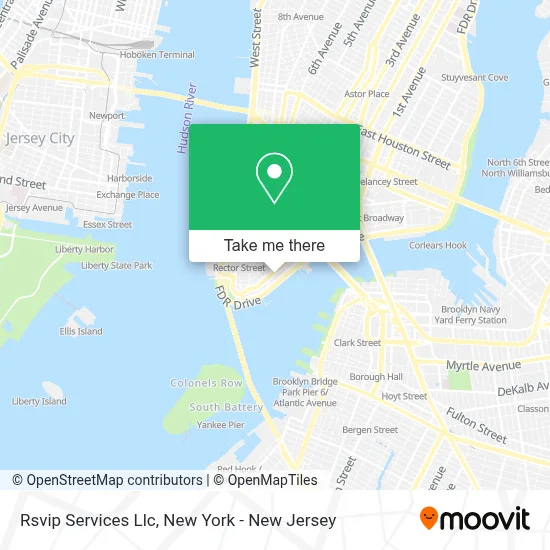
See Rsvip Services Llc, Manhattan, on the map
Public Transit to Rsvip Services Llc in Manhattan
Wondering how to get to Rsvip Services Llc in Manhattan? Moovit helps you find the best way to get to Rsvip Services Llc with step-by-step directions from the nearest public transit station.
Moovit provides free maps and live directions to help you navigate through your city. View schedules, routes, timetables, and find out how long does it take to get to Rsvip Services Llc in real time.
Looking for the nearest stop or station to Rsvip Services Llc? Check out this list of stops closest to your destination: Water St/Wall St; Water St/Pine St; Water St/Gouverneur Ln; Water St/Maiden Ln; Wall St; Broad St; Wall St/Pier 11; Pier 11 / Wall Street.
Bus: BXM18, M15, M15-SBS, DOWNTOWN CONNECTION, SIM5, SIM35.Train: GRE.Subway: 2, 3, 4, C, 5, J, Z.Ferry: AS, ER, GI, RS, SB.
Want to see if there’s another route that gets you there at an earlier time? Moovit helps you find alternative routes or times. Get directions from and directions to Rsvip Services Llc easily from the Moovit App or Website.
We make riding to Rsvip Services Llc easy, which is why over 1.5 million users, including users in Manhattan, trust Moovit as the best app for public transit. You don’t need to download an individual bus app or train app, Moovit is your all-in-one transit app that helps you find the best bus time or train time available.
For information on prices of subway, bus, train and ferry, costs and ride fares to Rsvip Services Llc, please check the Moovit app.
Use the app to navigate to popular places including to the airport, hospital, stadium, grocery store, mall, coffee shop, school, college, and university.
Rsvip Services Llc Address: 99 Wall St Ste 3998 street in Manhattan
- Sweet Release Agency,
- Allure Ascension Beauty and Wellness,
- Gowbe 108 Digital Radio,
- Sustainable Invest,
- Family Is Forever,
- Edny,
- She Is Amorous,
- Venture Capital World Summit,
- John Day Roofing and Protective Coatings,
- Public Agenda,
- Cheapinter.Net,
- Soulful Delight Catering,
- Take Profit Trader,
- Kdk Ltd,
- Michelles Design House,
- De Castro Tax Services,
- Mae Hair,
- Peohan Diamond Vault Llc,
- Geckocustom,
- The Law Office Of Solomon N. Klein
Places Near Rsvip Services Llc (Manhattan)
- qqqq, Manhattan,
- SoHo, Manhattan,
- Mountainside Hospital, Glen Ridge,
- Katz's Deli, Manhattan,
- 376 Hudson Street, Manhattan,
- 111 Centre New York City Supreme Court, Manhattan,
- Bellevue Hospital, Manhattan,
- Queens Center Mall, Queens,
- Rockefeller Center, Manhattan,
- Times Square, Manhattan,
- San Gennaro Feast, Manhattan,
- 911 Memorial, Manhattan,
- Wall Street, Manhattan,
- 66 John Street, Manhattan,
- Chinatown, Manhattan,
- 3 Stone St, Manhattan,
- Pier 83, Manhattan,
- Hudson Yards, Manhattan,
- 26 Federal Plaza, Manhattan,
- 1 Police Plaza, Manhattan
How to get to popular places in New York - New Jersey with public transit
Get around Manhattan by public transit!
Traveling around Manhattan has never been so easy. See step by step directions as you travel to any attraction, street or major public transit station. View bus and train schedules, arrival times, service alerts and detailed routes on a map, so you know exactly how to get to anywhere in Manhattan.
When traveling to any destination around Manhattan use Moovit's Live Directions with Get Off Notifications to know exactly where and how far to walk, how long to wait for your line, and how many stops are left. Moovit will alert you when it's time to get off — no need to constantly re-check whether yours is the next stop.
Wondering how to use public transit in Manhattan or how to pay for public transit in Manhattan? Moovit public transit app can help you navigate your way with public transit easily, and at minimum cost. It includes public transit fees, ticket prices, and costs. Looking for a map of Manhattan public transit lines? Moovit public transit app shows all public transit maps in Manhattan with all Bus, Train, Subway, Light Rail, Ferry and Cable Car routes and stops on an interactive map.
New York - New Jersey has 6 transit type(s), including: Bus, Train, Subway, Light Rail, Ferry and Cable Car, operated by several transit agencies, including MTA Subway, Metro-North Railroad, LIRR, PATH, MTA New York City Transit - Express routes, MTA Bus, NJ Transit, NYC Ferry, NICE bus, Bee-Line Bus, NJ Transit Rail, Norwalk Transit District, Hartford Line, River Valley Transit and HART