How to get to Rte El Castillo by bus?
Click on the bus route to see step by step directions with maps, line arrival times and updated time schedules.
From Hospital Virgen De La Poveda, Villa Del Prado
155 minFrom Universidad Europea De Madrid, Área Metropolitana De Madrid Y Corredor Del Henares
85 minFrom Playa del Alberche, Aldea Del Fresno
124 minFrom Centro Comercial Xanadú, Arroyomolinos
120 minFrom Universidad Camilo José Cela (UCJC), Villanueva De La Cañada
119 minFrom Universidad Alfonso X El Sabio (UAX), Villanueva De La Cañada
92 minFrom Parque Coimbra, Área Metropolitana De Madrid Y Corredor Del Henares
124 minFrom Embalse de San Juan, San Martín De Valdeiglesias
28 min
Bus stops near Rte El Castillo in San Martín De Valdeiglesias
Bus lines to Rte El Castillo in San Martín De Valdeiglesias
What are the closest stations to Rte El Castillo?
The closest stations to Rte El Castillo are:
- Ctra. Ávila - Martín Bravo is 204 meters away, 3 min walk.
- Est. De Autobuses De San Martín De V. is 968 meters away, 13 min walk.
Which bus line stops near Rte El Castillo?
551 (Est. De Autobuses De El Tiemblo)
What’s the nearest bus station to Rte El Castillo in San Martín De Valdeiglesias?
The nearest bus station to Rte El Castillo in San Martín De Valdeiglesias is Ctra. Ávila - Martín Bravo. It’s a 3 min walk away.
What time is the first bus to Rte El Castillo in San Martín De Valdeiglesias?
The 551 is the first bus that goes to Rte El Castillo in San Martín De Valdeiglesias. It stops nearby at 6:41 AM.
What time is the last bus to Rte El Castillo in San Martín De Valdeiglesias?
The 551 is the last bus that goes to Rte El Castillo in San Martín De Valdeiglesias. It stops nearby at 12:18 AM.
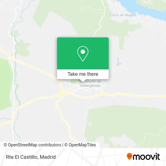
See Rte El Castillo, San Martín De Valdeiglesias, on the map
Public Transit to Rte El Castillo in San Martín De Valdeiglesias
Wondering how to get to Rte El Castillo in San Martín De Valdeiglesias? Moovit helps you find the best way to get to Rte El Castillo with step-by-step directions from the nearest public transit station.
Moovit provides free maps and live directions to help you navigate through your city. View schedules, routes, timetables, and find out how long does it take to get to Rte El Castillo in real time.
Looking for the nearest stop or station to Rte El Castillo? Check out this list of stops closest to your destination: Ctra. Ávila - Martín Bravo; Est. De Autobuses De San Martín De V..
Bus: 551, VAC224.
Want to see if there’s another route that gets you there at an earlier time? Moovit helps you find alternative routes or times. Get directions from and directions to Rte El Castillo easily from the Moovit App or Website.
We make riding to Rte El Castillo easy, which is why over 1.5 million users, including users in San Martín De Valdeiglesias, trust Moovit as the best app for public transit. You don’t need to download an individual bus app or train app, Moovit is your all-in-one transit app that helps you find the best bus time or train time available.
For information on prices of bus, costs and ride fares to Rte El Castillo, please check the Moovit app.
Use the app to navigate to popular places including to the airport, hospital, stadium, grocery store, mall, coffee shop, school, college, and university.
Rte El Castillo Address: Plaza Teodoro Bravo, 7 28680 San Martín de Valdeiglesias street in San Martín De Valdeiglesias
- Café Burguer El Castillo,
- Clickportatil,
- Consorcio de la Sierra Oeste de Madrid,
- Telefónica Telecomunicaciones Públicas,
- Talismán,
- Real Vida Seguros,
- Escuela Técnica de Enseñanzas Especializadas,
- Frutas Dilla,
- Maria del Carmen de la Fuente Serrano,
- Ayllón Podas en Altura,
- Valleiglesias,
- Tienda de Ropa Online,
- Ht Vending Madrid S.L.,
- Frutería Mediterráneo,
- Las Mañanas de Radio 21,
- La Despensa Express San Martín de Valdeiglesias,
- Instituto De Educación Secundaria Pedro De Tolosa,
- Álvarez Competicion,
- Zafra Monteida,
- Club Navegación Dorama
Places Near Rte El Castillo (San Martín De Valdeiglesias)
- Estacion de Chamartin, Madrid,
- Tres Aguas, Alcorcón,
- Centro Comercial La Gavia, Área Metropolitana De Madrid Y Corredor Del Henares,
- Hospital Clínico Universitario San Carlos, Madrid,
- Centro Comercial La Vaguada, Área Metropolitana De Madrid Y Corredor Del Henares,
- Mercadillo de Majadahonda, Majadahonda,
- Hospital Universitario Ramón y Cajal, Madrid,
- Estadio Wanda Metropolitano, Área Metropolitana De Madrid Y Corredor Del Henares,
- Plenilunio, Área Metropolitana De Madrid Y Corredor Del Henares,
- Sala La Riviera, Madrid,
- Nassica, Área Metropolitana De Madrid Y Corredor Del Henares,
- Mendez Alvaro, Madrid,
- Hospital Universitario La Paz, Madrid,
- Plaza Mayor, Madrid,
- Centro Comercial Islazul, Área Metropolitana De Madrid Y Corredor Del Henares,
- Wizink Center, Madrid,
- Palacio De Vistalegre, Área Metropolitana De Madrid Y Corredor Del Henares,
- Centro Comercial Oasiz Madrid, Área Metropolitana De Madrid Y Corredor Del Henares,
- Calle de López de Hoyos 169, Madrid,
- Rastro De Madrid, Área Metropolitana De Madrid Y Corredor Del Henares
How to get to popular places in Madrid with public transit
Get around San Martín De Valdeiglesias by public transit!
Traveling around San Martín De Valdeiglesias has never been so easy. See step by step directions as you travel to any attraction, street or major public transit station. View bus and train schedules, arrival times, service alerts and detailed routes on a map, so you know exactly how to get to anywhere in San Martín De Valdeiglesias.
When traveling to any destination around San Martín De Valdeiglesias use Moovit's Live Directions with Get Off Notifications to know exactly where and how far to walk, how long to wait for your line, and how many stops are left. Moovit will alert you when it's time to get off — no need to constantly re-check whether yours is the next stop.
Wondering how to use public transit in San Martín De Valdeiglesias or how to pay for public transit in San Martín De Valdeiglesias? Moovit public transit app can help you navigate your way with public transit easily, and at minimum cost. It includes public transit fees, ticket prices, and costs. Looking for a map of San Martín De Valdeiglesias public transit lines? Moovit public transit app shows all public transit maps in San Martín De Valdeiglesias with all Bus, Train, Metro and Light Rail routes and stops on an interactive map.
Madrid has 4 transit type(s), including: Bus, Train, Metro and Light Rail, operated by several transit agencies, including Metro de Madrid, Metro Ligero, Tranvía de Parla, Renfe Cercanías - Servicios de Autobús especiales, Renfe Cercanias, Renfe Cercanías, EMT, Interurbanos, Urbanos de Alcalá de Henares, Urbanos de Alcobendas, Urbanos de Alcorcón, Urbanos de Algete, Urbanos de Aranjuez, Urbanos de Arganda del Rey and Urbanos de Arroyomolinos