How to get to Rtr Financial Services by bus?
Click on the bus route to see step by step directions with maps, line arrival times and updated time schedules.
From Battery Maritime Building, Manhattan
55 minFrom Casa Cipriani New York, Manhattan
55 minFrom Staten Island Ferry - Whitehall Terminal, Manhattan
53 minFrom Bayonne, NJ, Bayonne
50 minFrom Staten Island Ferry, Manhattan
53 minFrom Wagner Park, Manhattan
54 minFrom Newark Liberty International Airport, Newark
158 minFrom Hudson Mall, Jersey City
93 minFrom NJ 440, Jersey City
86 min
Bus stops near Rtr Financial Services in Staten Island
Subway station near Rtr Financial Services in Staten Island
- St George, 28 min walk,VIEW
Ferry station near Rtr Financial Services in Staten Island
- St. George Ferry Terminal, 30 min walk,VIEW
Bus lines to Rtr Financial Services in Staten Island
- S48, St George Ferry Via Forest,VIEW
- S61, Marsh Avenue Richmond Hill Rd,VIEW
- S62, Travis Via Victory,VIEW
- S66, St George Ferry Via Grymes Hill,VIEW
- S91, Limited St George,VIEW
- S92, Limited St George Ferry,VIEW
- S52, Staten Island Hospital Seaview Av,VIEW
- SIM30, Midtown Via 42 St Via Madison Av,VIEW
- S98, Limited Richmond Av Via Forest,VIEW
- S46, St George Ferry Via Castleton,VIEW
What are the closest stations to Rtr Financial Services?
The closest stations to Rtr Financial Services are:
- Victory Blvd/Woodstock Av is 26 yards away, 1 min walk.
- Victory Blvd/Forest Av is 259 yards away, 4 min walk.
- Cebra Av/Victory Blvd is 284 yards away, 4 min walk.
- Forest Av/Victory Blvd is 290 yards away, 4 min walk.
- Castleton Av/Woodstock Av is 311 yards away, 4 min walk.
- St George is 2335 yards away, 28 min walk.
- St. George Ferry Terminal is 2512 yards away, 30 min walk.
Which bus lines stop near Rtr Financial Services?
These bus lines stop near Rtr Financial Services: S46, S48, S52.
Which ferry line stops near Rtr Financial Services?
SG (Wall St./Pier 11)
What’s the nearest subway station to Rtr Financial Services in Staten Island?
The nearest subway station to Rtr Financial Services in Staten Island is St George. It’s a 28 min walk away.
What’s the nearest bus station to Rtr Financial Services in Staten Island?
The nearest bus station to Rtr Financial Services in Staten Island is Victory Blvd/Woodstock Av. It’s a 1 min walk away.
What’s the nearest ferry station to Rtr Financial Services in Staten Island?
The nearest ferry station to Rtr Financial Services in Staten Island is St. George Ferry Terminal. It’s a 30 min walk away.
What time is the first subway to Rtr Financial Services in Staten Island?
The SIR is the first subway that goes to Rtr Financial Services in Staten Island. It stops nearby at 3:06 AM.
What time is the last subway to Rtr Financial Services in Staten Island?
The SIR is the last subway that goes to Rtr Financial Services in Staten Island. It stops nearby at 3:13 AM.
What time is the first bus to Rtr Financial Services in Staten Island?
The S48 is the first bus that goes to Rtr Financial Services in Staten Island. It stops nearby at 3:03 AM.
What time is the last bus to Rtr Financial Services in Staten Island?
The S62 is the last bus that goes to Rtr Financial Services in Staten Island. It stops nearby at 3:13 AM.
What time is the first ferry to Rtr Financial Services in Staten Island?
The STATEN ISLAND FERRY is the first ferry that goes to Rtr Financial Services in Staten Island. It stops nearby at 3:00 AM.
What time is the last ferry to Rtr Financial Services in Staten Island?
The STATEN ISLAND FERRY is the last ferry that goes to Rtr Financial Services in Staten Island. It stops nearby at 2:55 AM.
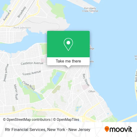
See Rtr Financial Services, Staten Island, on the map
Public Transit to Rtr Financial Services in Staten Island
Wondering how to get to Rtr Financial Services in Staten Island? Moovit helps you find the best way to get to Rtr Financial Services with step-by-step directions from the nearest public transit station.
Moovit provides free maps and live directions to help you navigate through your city. View schedules, routes, timetables, and find out how long does it take to get to Rtr Financial Services in real time.
Looking for the nearest stop or station to Rtr Financial Services? Check out this list of stops closest to your destination: Victory Blvd/Woodstock Av; Victory Blvd/Forest Av; Cebra Av/Victory Blvd; Forest Av/Victory Blvd; Castleton Av/Woodstock Av; St George; St. George Ferry Terminal.
Bus: S46, S48, S52, S61, S62, S66, S91, S92, SIM30, S98.Subway: SIR.Ferry: SG, STATEN ISLAND FERRY.
Want to see if there’s another route that gets you there at an earlier time? Moovit helps you find alternative routes or times. Get directions from and directions to Rtr Financial Services easily from the Moovit App or Website.
We make riding to Rtr Financial Services easy, which is why over 1.5 million users, including users in Staten Island, trust Moovit as the best app for public transit. You don’t need to download an individual bus app or train app, Moovit is your all-in-one transit app that helps you find the best bus time or train time available.
For information on prices of bus, ferry and train, costs and ride fares to Rtr Financial Services, please check the Moovit app.
Use the app to navigate to popular places including to the airport, hospital, stadium, grocery store, mall, coffee shop, school, college, and university.
Rtr Financial Services Address: 433 Victory Blvd street in Staten Island
- The Fragrance Creator,
- Our Lady Of Good Counsel Roman Catholic Church,
- Marketing Blueprint,
- Fatherhood Matters,
- Holly's Staten Island Buzz Realty,
- Usa Direct Phl Online,
- Encore! Thrift Store,
- NBT Copy and Fax,
- La Plaza Deli,
- Nb Technologies Web Design and Internet Marketing,
- Nb Technologies - Web Design & Media Production,
- Eventgram,
- Reflex Cinema,
- Silver Mount Cemetery,
- Lyons Pool,
- Jewish Community Center of Staten Island,
- Richmond Christian Church Staten,
- Integrated Martial Arts Staten Island,
- Boba le Tea Cafe,
- Khadija Bourhaba Digital Business
Places Near Rtr Financial Services (Staten Island)
- Rockefeller Center, Manhattan,
- Bellevue Hospital, Manhattan,
- Times Square, Manhattan,
- Mountainside Hospital, Glen Ridge,
- qqqq, Manhattan,
- SoHo, Manhattan,
- Wall Street, Manhattan,
- Hudson Yards, Manhattan,
- 66 John Street, Manhattan,
- San Gennaro Feast, Manhattan,
- Chinatown, Manhattan,
- Katz's Deli, Manhattan,
- 3 Stone St, Manhattan,
- 111 Centre New York City Supreme Court, Manhattan,
- 376 Hudson Street, Manhattan,
- 1 Police Plaza, Manhattan,
- Queens Center Mall, Queens,
- 911 Memorial, Manhattan,
- 26 Federal Plaza, Manhattan,
- Pier 83, Manhattan
How to get to popular places in New York - New Jersey with public transit
Get around Staten Island by public transit!
Traveling around Staten Island has never been so easy. See step by step directions as you travel to any attraction, street or major public transit station. View bus and train schedules, arrival times, service alerts and detailed routes on a map, so you know exactly how to get to anywhere in Staten Island.
When traveling to any destination around Staten Island use Moovit's Live Directions with Get Off Notifications to know exactly where and how far to walk, how long to wait for your line, and how many stops are left. Moovit will alert you when it's time to get off — no need to constantly re-check whether yours is the next stop.
Wondering how to use public transit in Staten Island or how to pay for public transit in Staten Island? Moovit public transit app can help you navigate your way with public transit easily, and at minimum cost. It includes public transit fees, ticket prices, and costs. Looking for a map of Staten Island public transit lines? Moovit public transit app shows all public transit maps in Staten Island with all Bus, Train, Subway, Light Rail, Ferry and Cable Car routes and stops on an interactive map.
New York - New Jersey has 6 transit type(s), including: Bus, Train, Subway, Light Rail, Ferry and Cable Car, operated by several transit agencies, including MTA Subway, Metro-North Railroad, LIRR, PATH, MTA New York City Transit - Express routes, MTA Bus, NJ Transit, NYC Ferry, NICE bus, Bee-Line Bus, NJ Transit Rail, Norwalk Transit District, Hartford Line, River Valley Transit and HART