How to get to Rts by bus?
Click on the bus route to see step by step directions with maps, line arrival times and updated time schedules.
From Tripsdrill, Verwaltungsgemeinschaft Brackenheim
86 minFrom Pflanzen Mauk, Verwaltungsgemeinschaft Lauffen am Neckar
45 minFrom Erlebnispark Tripsdrill, Verwaltungsgemeinschaft Brackenheim
82 minFrom Antalya Pizza & Kebaphaus, Verwaltungsgemeinschaft Eppingen
71 minFrom Goldberg, Großbottwar
113 minFrom Vulpiusklinik, Bad Rappenau
90 minFrom Audi AG Neckarsulm A21, Verwaltungsgemeinschaft Neckarsulm
45 minFrom Klinik Löwenstein, Verwaltungsgemeinschaft Obersulm
127 minFrom Luson Hair, Verwaltungsgemeinschaft Bad Friedrichshall
67 minFrom Heilbronner Straße 86, Verwaltungsgemeinschaft Brackenheim
58 min
How to get to Rts by train?
Click on the train route to see step by step directions with maps, line arrival times and updated time schedules.
Bus stops near Rts in Heilbronn
Train stations near Rts in Heilbronn
Light Rail stations near Rts in Heilbronn
- Heilbronn Industriepl.(S-Bahn), 4 min walk,VIEW
Bus lines to Rts in Heilbronn
- 31, Kirchhausen Wimpfener Weg,VIEW
- 32, Frankenbach Gemeindehalle,VIEW
- 5, Heilbronn Hbf/Willy-Brandt-Pl.,VIEW
- 682, Heilbronn Wollhausplatz,VIEW
- 33, Hn, Böllinger Höfe Wannenäcker,VIEW
- 1, Heilbronn Badener Hof,VIEW
- RE 8, Würzburg Hbf,VIEW
- RE 10A, Mannheim, Hauptbahnhof,VIEW
- RE 10B, Heilbronn Hauptbahnhof,VIEW
- 11, Heilbronn Schickhardtstraße,VIEW
- MEX 12, Tübingen Hauptbahnhof,VIEW
- MEX 18, Tübingen Hauptbahnhof,VIEW
- N20, Lampoldshausen Waldstraße,VIEW
- 620, Heilbronn Wollhausplatz,VIEW
- 631, Weinsbg., Klinik. am Weissenhof,VIEW
- 41, Heilbronn Allee Post West,VIEW
- 42, Böckingen Schanz Süd,VIEW
- 12, Neckargartach Im Falter,VIEW
- 8, Biberach Weirachstraße,VIEW
What are the closest stations to Rts?
The closest stations to Rts are:
- Heilbronn Industriepl. (West) is 215 meters away, 3 min walk.
- Heilbronn Industrieplatz is 259 meters away, 4 min walk.
- Heilbronn Industrieplatz (Ost) is 290 meters away, 4 min walk.
- Heilbronn Industriepl.(S-Bahn) is 292 meters away, 4 min walk.
- Heilbronn Sülmertor is 596 meters away, 9 min walk.
- Heilbronn Fügerstrasse is 613 meters away, 9 min walk.
- Heilbronn Zukunftspark Ost is 1100 meters away, 15 min walk.
Which train lines stop near Rts?
These train lines stop near Rts: S41, S42.
Which light rail line stops near Rts?
S41 (Neckarsulm)
Which bus lines stop near Rts?
These bus lines stop near Rts: 32, 620, 682, 692.
What’s the nearest light rail station to Rts in Heilbronn?
The nearest light rail station to Rts in Heilbronn is Heilbronn Industriepl.(S-Bahn). It’s a 4 min walk away.
What’s the nearest train station to Rts in Heilbronn?
The nearest train stations to Rts in Heilbronn are Heilbronn Industrieplatz and Heilbronn Industriepl.(S-Bahn). The closest one is a 4 min walk away.
What’s the nearest bus station to Rts in Heilbronn?
The nearest bus station to Rts in Heilbronn is Heilbronn Industriepl. (West). It’s a 3 min walk away.
What time is the first light rail to Rts in Heilbronn?
The S42 is the first light rail that goes to Rts in Heilbronn. It stops nearby at 4:37 AM.
What time is the last light rail to Rts in Heilbronn?
The S41 is the last light rail that goes to Rts in Heilbronn. It stops nearby at 1:04 AM.
What time is the first train to Rts in Heilbronn?
The S42 is the first train that goes to Rts in Heilbronn. It stops nearby at 4:37 AM.
What time is the last train to Rts in Heilbronn?
The S41 is the last train that goes to Rts in Heilbronn. It stops nearby at 1:04 AM.
What time is the first bus to Rts in Heilbronn?
The 31 is the first bus that goes to Rts in Heilbronn. It stops nearby at 5:14 AM.
What time is the last bus to Rts in Heilbronn?
The 32 is the last bus that goes to Rts in Heilbronn. It stops nearby at 11:23 PM.
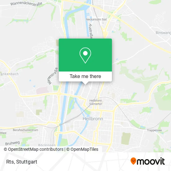
See Rts, Heilbronn, on the map
Public Transit to Rts in Heilbronn
Wondering how to get to Rts in Heilbronn? Moovit helps you find the best way to get to Rts with step-by-step directions from the nearest public transit station.
Moovit provides free maps and live directions to help you navigate through your city. View schedules, routes, timetables, and find out how long does it take to get to Rts in real time.
Looking for the nearest stop or station to Rts? Check out this list of stops closest to your destination: Heilbronn Industriepl. (West); Heilbronn Industrieplatz; Heilbronn Industrieplatz (Ost); Heilbronn Industriepl.(S-Bahn); Heilbronn Sülmertor; Heilbronn Fügerstrasse; Heilbronn Zukunftspark Ost.
Train: S41, S42, S4.Light Rail: S41.Bus: 32, 620, 682, 692, 31, 5, 33, 1, RE 8, RE 10A, RE 10B, 11, 41, 42.
Want to see if there’s another route that gets you there at an earlier time? Moovit helps you find alternative routes or times. Get directions from and directions to Rts easily from the Moovit App or Website.
We make riding to Rts easy, which is why over 1.5 million users, including users in Heilbronn, trust Moovit as the best app for public transit. You don’t need to download an individual bus app or train app, Moovit is your all-in-one transit app that helps you find the best bus time or train time available.
For information on prices of bus, train and light rail, costs and ride fares to Rts, please check the Moovit app.
Use the app to navigate to popular places including to the airport, hospital, stadium, grocery store, mall, coffee shop, school, college, and university.
Rts Address: Koepffstraße 17 74076 Heilbronn street in Heilbronn
- Express Gebäudedienstleistungen,
- Remex Conmin GmbH, NL Heilbronn,
- Gottlieb-Daimler-Straße,
- SB-Autowaesche,
- Obi,
- Lotto-Annahmestelle,
- Katsigiannis Transporte,
- Kaan Barut Gaststätte Kupfer Dächle,
- Naani-Tandoor,
- Magic X Erotic Megastore,
- Proceiling GmbH & Co,
- Andreas Paetow Cad-Cam Dienstleistungen,
- Backstube Hermann Härdtner,
- Zeroeight Burger,
- Istanbul Computer,
- Energie,
- Neuffer Malerwerkstätte,
- Waitz,
- Eiberger,
- Gw-Innenausbau mit System
Places Near Rts (Heilbronn)
- Pariser Platz Stuttgart, Stuttgart-Mitte,
- Gleis 101/102 (tief), Stuttgart-Mitte,
- Hauptbahnhof Stuttgart, Stuttgart-Mitte,
- Porsche-Arena, Bad Cannstatt,
- Geilhaus Haus 33a, Reutlingen-Betzingen,
- Hanns-Martin-Schleyer-Halle (Stuttgart Hans-Martin-Schleyerhalle), Bad Cannstatt,
- Mercedes-Benz Museum, Bad Cannstatt,
- Schleyerhalle, Bad Cannstatt,
- SI-Centrum, Möhringen,
- Waldfriedhof, Degerloch,
- Wilhelma (U-Bahn Wilhelma), Bad Cannstatt,
- FlixBus Haltestelle, Stuttgart,
- Mercedes-Benz Museum (Mercedes Museum Stuttgart), Bad Cannstatt,
- Marmorsaal Im Weissenburgpark, Stuttgart-Süd,
- Klinikum Stuttgart - Katharinenhospital, Stuttgart-Mitte,
- Hanns-Martin-Schleyer-Halle, Bad Cannstatt,
- Porsche Museum, Zuffenhausen,
- Gasometer Pforzheim, Pforzheim,
- Im Wizemann (Halle), Bad Cannstatt,
- Mettingen Eros-Center Puff Laufhaus, Esslingen Am Neckar
How to get to popular places in Stuttgart with public transit
Get around Heilbronn by public transit!
Traveling around Heilbronn has never been so easy. See step by step directions as you travel to any attraction, street or major public transit station. View bus and train schedules, arrival times, service alerts and detailed routes on a map, so you know exactly how to get to anywhere in Heilbronn.
When traveling to any destination around Heilbronn use Moovit's Live Directions with Get Off Notifications to know exactly where and how far to walk, how long to wait for your line, and how many stops are left. Moovit will alert you when it's time to get off — no need to constantly re-check whether yours is the next stop.
Wondering how to use public transit in Heilbronn or how to pay for public transit in Heilbronn? Moovit public transit app can help you navigate your way with public transit easily, and at minimum cost. It includes public transit fees, ticket prices, and costs. Looking for a map of Heilbronn public transit lines? Moovit public transit app shows all public transit maps in Heilbronn with all Bus, Train, Subway, Light Rail, Ferry, S-Bahn and Funicular routes and stops on an interactive map.
Stuttgart has 7 transit type(s), including: Bus, Train, Subway, Light Rail, Ferry, S-Bahn and Funicular, operated by several transit agencies, including SSB - Stadtbahn, SSB, SSB - Seilbahn / Zacke, S-Bahn Stuttgart, Rhein-Neckar-Verkehr GmbH (rnv), Karlsruher Verkehrsverbund, DB AG, DB Regiobus BW, Arverio Baden-Württemberg GmbH, DB RegioNetz Verkehrs GmbH Westfrankenbahn, DB Regio AG Baden-Württemberg, Südwestdeutsche Verkehrs-AG, DB Regio AG Mitte Region Hessen, DB and Bodensee-Oberschwaben-Bahn
Public transit lines with stations closest to Rts in Heilbronn
Train lines with stations closest to Rts in Heilbronn
Bus lines with stations closest to Rts in Heilbronn
Heilbronn Sülmertor
 1Böckingen Jäkleinstraße (West) - Heilbronn Trappensee/Literaturhaus
- RE 8Würzburg Hbf - Stuttgart Hauptbahnhof (oben) Gleis 7
- RE 10AMannheim, Hauptbahnhof - Heilbronn Hauptbahnhof Gleis 5
- RE 10BMannheim, Hauptbahnhof - Heilbronn Hauptbahnhof Gleis 5
- 11Heilbronn Badener Hof - Heilbronn Schickhardtstraße