Directions to Rua Alagoas 84 (Campo) with public transportation
The following transit lines have routes that pass near Rua Alagoas 84
How to get to Rua Alagoas 84 by bus?
Click on the bus route to see step by step directions with maps, line arrival times and updated time schedules.
From Capela Velha, Araucária
197 minFrom Campo Magro, Campo Magro
118 minFrom Rua Lodovico Kaminski 2055, Augusta
151 minFrom Ligeirinho Curitiba - Campo Largo, Campo
57 minFrom Volvo do Brasil, Cic
98 minFrom Avenida Juscelino Kubitschek de Oliveira 2600, Cic
109 minFrom Boqueirão/Araucária, Araucária
213 minFrom Universidade Positivo (UP), Cic
101 minFrom Araucária Acqua Park, Araucária
109 min
Bus stops near Rua Alagoas 84 in Campo
Bus lines to Rua Alagoas 84 in Campo
- 101 ITAQUI, Terminal Urbano Campo Largo → Itaqui,VIEW
- 111 GERMER, Tropes → Terminal Urbano Campo Largo (via Campo do Meio / Itaboa),VIEW
- 111 SCHMIDT, Terminal Urbano Campo Largo → Germer (via Schmidt / Itaboa / Rivabem),VIEW
- 111 OUTLET CITY CENTER, Linha 01 - Outlet → Itaboa / Itaqui / Cristo Rei / F. Gorski / Três Rios / Iruama / Acácias,VIEW
- 300 NOTURNA, Terminal → Bairros (Circular),VIEW
- J71 ITAMBÉ, Itambé (Jardim Serrinha) → Terminal Campo Largo,VIEW
- 122 SÃO CAETANO, Terminal Urbano Campo Largo → São Caetano,VIEW
- 208 ITAMBEZINHO, Itambezinho → Terminal Metropolitano Campo Largo,VIEW
What are the closest stations to Rua Alagoas 84?
The closest stations to Rua Alagoas 84 are:
- Rua Amazonas, 1 - Schmidt is 36 meters away, 1 min walk.
- Avenida Porcelana, 244-328 is 281 meters away, 4 min walk.
- Rodovia Br 277 (Do Café) - Entrada Escola Hans S. is 473 meters away, 7 min walk.
Which bus line stops near Rua Alagoas 84?
101 ITAQUI (Terminal Urbano Campo Largo → Itaqui)
What’s the nearest bus station to Rua Alagoas 84 in Campo?
The nearest bus station to Rua Alagoas 84 in Campo is Rua Amazonas, 1 - Schmidt. It’s a 1 min walk away.
What time is the first bus to Rua Alagoas 84 in Campo?
The 101 ITAQUI is the first bus that goes to Rua Alagoas 84 in Campo. It stops nearby at 5:10 AM.
What time is the last bus to Rua Alagoas 84 in Campo?
The 300 NOTURNA is the last bus that goes to Rua Alagoas 84 in Campo. It stops nearby at 12:51 AM.
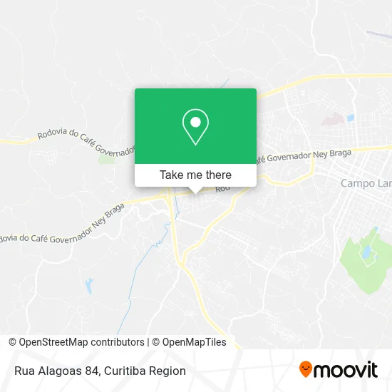
See Rua Alagoas 84, Campo, on the map
Public Transit to Rua Alagoas 84 in Campo
Wondering how to get to Rua Alagoas 84 in Campo? Moovit helps you find the best way to get to Rua Alagoas 84 with step-by-step directions from the nearest public transit station.
Moovit provides free maps and live directions to help you navigate through your city. View schedules, routes, timetables, and find out how long does it take to get to Rua Alagoas 84 in real time.
Looking for the nearest stop or station to Rua Alagoas 84? Check out this list of stops closest to your destination: Rua Amazonas; Avenida Porcelana; Rodovia Br 277 (Do Café) - Entrada Escola Hans S..
Bus: 101 ITAQUI, 111 GERMER, 111 SCHMIDT, 111 OUTLET CITY CENTER, 300 NOTURNA, J71 ITAMBÉ, 122 SÃO CAETANO, 208 ITAMBEZINHO.
Want to see if there’s another route that gets you there at an earlier time? Moovit helps you find alternative routes or times. Get directions from and directions to Rua Alagoas 84 easily from the Moovit App or Website.
We make riding to Rua Alagoas 84 easy, which is why over 1.5 million users, including users in Campo, trust Moovit as the best app for public transit. You don’t need to download an individual bus app or train app, Moovit is your all-in-one transit app that helps you find the best bus time or train time available.
For information on prices of bus, costs and ride fares to Rua Alagoas 84, please check the Moovit app.
Use the app to navigate to popular places including to the airport, hospital, stadium, grocery store, mall, coffee shop, school, college, and university.
Rua Alagoas 84 Address: R. Alagoas, 84 - Vila Itaqui, Campo Largo - PR, 83604-280, Brasil street in Campo
- Gesasul Ferramentas,
- Simone Brantes Sociedade Individual de Advocacia,
- Sao Miguel Residencia Geriátrica,
- Super Job App Network,
- Lacoste,
- Distribuidora de Bebidas Itaqui,
- Banco Topázio,
- Bonsai Literato - Excelencia Em Arte Ceramica,
- Portafacil Indústria de Artefatos de Madeira,
- Só Legging,
- Ariel George Schmidt Lima dos Santos,
- Jean Carlo Paes e Pizzas,
- Paróquia Santa Cecília Itaqui Campo Largo,
- Falcom - Fabricacao, Montagem e Manutencao Industrial,
- Farmácia Leny Ltda,
- Sagrada Serra,
- Schmidt e Pães Advogados Associados,
- Escola Municipal Hans Ernst Schmidt,
- Bar Do Adir,
- Porcelana Grejj Graus
Places Near Rua Alagoas 84 (Campo)
- Hospital de Clínicas (HC - UFPR), Centro,
- Hospital Angelina Caron, Campina Grande Do Sul,
- Hospital Madalena Sofia, Bairro Alto,
- Park Shopping Barigüi, Mossunguê,
- Jockey Plaza Shopping Center, Tarumã,
- Campo Largo, Campo,
- Hhhhh, Fazendinha,
- Shopping Estação, Rebouças,
- Hospital Universitário Evangélico de Curitiba, Bigorrilho,
- Jardim Botânico de Curitiba PR, Centro,
- Arena Da Baixada - Curitiba,
- Hospital Da Cruz Vermelha, Batel,
- Shopping Palladium, Portão,
- Rua General Mário Tourinho, Campina Do Siqueira,
- Hospital do Rocio, Campo,
- Rua Martim Afonso 558, Mercês,
- Pontifícia Universidade Católica do Paraná (PUCPR), Prado Velho,
- Hospital Erasto Gaertner, Jardim Das Américas,
- Hospital Nossa Senhora Das Graças, Mercês,
- Parque Barigui, Mercês
How to get to popular places in Curitiba Region with public transit
Get around Campo by public transit!
Traveling around Campo has never been so easy. See step by step directions as you travel to any attraction, street or major public transit station. View bus and train schedules, arrival times, service alerts and detailed routes on a map, so you know exactly how to get to anywhere in Campo.
When traveling to any destination around Campo use Moovit's Live Directions with Get Off Notifications to know exactly where and how far to walk, how long to wait for your line, and how many stops are left. Moovit will alert you when it's time to get off — no need to constantly re-check whether yours is the next stop.
Wondering how to use public transit in Campo or how to pay for public transit in Campo? Moovit public transit app can help you navigate your way with public transit easily, and at minimum cost. It includes public transit fees, ticket prices, and costs. Looking for a map of Campo public transit lines? Moovit public transit app shows all public transit maps in Campo with all Bus and Cable Car routes and stops on an interactive map.
Curitiba Region has 2 transit type(s), including: Bus and Cable Car, operated by several transit agencies, including Sistema Integrado de Mobilidade (URBS), Sistema Integrado de Mobilidade (AMEP), URBS (Cartões bancários e Dinheiro), URBS (Cartões bancários / Cartão URBS), AMEP (Cartões bancários / Cartão MetroCard), AMEP (Cartões bancários / Cartão MetroCard / Dinheiro), Viação Colombo (Dinheiro), TRIAR (Cartão TRIAR / Dinheiro), Empresa Curitiba Cerro Azul (Dinheiro), Expresso Nossa Senhora da Penha (Dinheiro), Empresa Campo Alto Tijucas (Dinheiro), Auto Viação São José (Cartão VEM / Dinheiro), BRT S/A (Cartão VEM / Dinheiro), TransPiedade (Cartão Cidadão / Dinheiro) and Oceânica Sul (Cartão Transporte / Dinheiro)