Directions to Rua Angelo Gulin 25 (Santa Cândida) with public transportation
The following transit lines have routes that pass near Rua Angelo Gulin 25
How to get to Rua Angelo Gulin 25 by bus?
Click on the bus route to see step by step directions with maps, line arrival times and updated time schedules.
From Rua Doutor Faivre 141, Centro
40 minFrom Rua Brigadeiro Franco 641, Mercês
44 minFrom Estação Tubo Praça da Ucrânia, Bigorrilho
49 minFrom Angeloni, Bigorrilho
57 minFrom Rua Castro 417, Água Verde
59 minFrom Park Shopping Barigui-Saída Estacionamento, Mossunguê
66 minFrom Rua Castro, Água Verde
55 minFrom Rua General Mário Tourinho, Campina Do Siqueira
65 minFrom Campina Do Siqueira, Campina Do Siqueira
67 minFrom Terminal Santa Felicidade, Santa Felicidade
60 min
Bus stops near Rua Angelo Gulin 25 in Santa Cândida
Bus lines to Rua Angelo Gulin 25 in Santa Cândida
What are the closest stations to Rua Angelo Gulin 25?
The closest stations to Rua Angelo Gulin 25 are:
- Rua José Antônio Leprevost 801 is 33 meters away, 1 min walk.
- R. Coronel Wallace Scott Murray, 763 is 162 meters away, 3 min walk.
- R. Engenheiro Luiz Augusto Leão Fonseca, 387 is 306 meters away, 5 min walk.
Which bus lines stop near Rua Angelo Gulin 25?
These bus lines stop near Rua Angelo Gulin 25: 224 CASSIOPÉIA, 275 FERNANDO DE NORONHA / LARANJEIRAS, 280 NOSSA SENHORA DE NAZARÉ.
What’s the nearest bus station to Rua Angelo Gulin 25 in Santa Cândida?
The nearest bus station to Rua Angelo Gulin 25 in Santa Cândida is Rua José Antônio Leprevost 801. It’s a 1 min walk away.
What time is the first bus to Rua Angelo Gulin 25 in Santa Cândida?
The 226 ABAETÉ is the first bus that goes to Rua Angelo Gulin 25 in Santa Cândida. It stops nearby at 5:04 AM.
What time is the last bus to Rua Angelo Gulin 25 in Santa Cândida?
The 275 FERNANDO DE NORONHA / LARANJEIRAS is the last bus that goes to Rua Angelo Gulin 25 in Santa Cândida. It stops nearby at 12:34 AM.
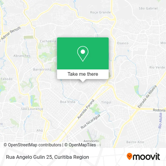
See Rua Angelo Gulin 25, Santa Cândida, on the map
Public Transit to Rua Angelo Gulin 25 in Santa Cândida
Wondering how to get to Rua Angelo Gulin 25 in Santa Cândida? Moovit helps you find the best way to get to Rua Angelo Gulin 25 with step-by-step directions from the nearest public transit station.
Moovit provides free maps and live directions to help you navigate through your city. View schedules, routes, timetables, and find out how long does it take to get to Rua Angelo Gulin 25 in real time.
Looking for the nearest stop or station to Rua Angelo Gulin 25? Check out this list of stops closest to your destination: Rua José Antônio Leprevost 801; R. Coronel Wallace Scott Murray; R. Engenheiro Luiz Augusto Leão Fonseca.
Bus: 224 CASSIOPÉIA, 275 FERNANDO DE NORONHA / LARANJEIRAS, 280 NOSSA SENHORA DE NAZARÉ, 226 ABAETÉ.
Want to see if there’s another route that gets you there at an earlier time? Moovit helps you find alternative routes or times. Get directions from and directions to Rua Angelo Gulin 25 easily from the Moovit App or Website.
We make riding to Rua Angelo Gulin 25 easy, which is why over 1.5 million users, including users in Santa Cândida, trust Moovit as the best app for public transit. You don’t need to download an individual bus app or train app, Moovit is your all-in-one transit app that helps you find the best bus time or train time available.
For information on prices of bus, costs and ride fares to Rua Angelo Gulin 25, please check the Moovit app.
Use the app to navigate to popular places including to the airport, hospital, stadium, grocery store, mall, coffee shop, school, college, and university.
Rua Angelo Gulin 25 Address: Rua Angelo Gulin, 25 - Santa Cândida, Curitiba - PR, Brasil street in Santa Cândida
- Alex Cardoso Costa,
- Daiane Modas e Beleza,
- Ong Nacao Brasil,
- Centro Evangelistico Rocha Viva,
- Adauto Cruz de Souza,
- Conjunto Laranjeiras II,
- Hps Solucoes Elétricas,
- Isabella Geane,
- Sweety Doll Ragada,
- Celia Cavalli,
- Vic Fitness,
- Rua Engenheiro Luiz Augusto Leão Fonseca 681,
- Edgar Costa & Cia,
- Condominio Conjunto Residencial Moradias Laranjeiras II,
- Ches Bebidas,
- Residencial Felini,
- mae,
- Elorenzo,
- Condomínio Residencial Vo Lourdes,
- Gonini & Lima Servicos Medicos
Places Near Rua Angelo Gulin 25 (Santa Cândida)
- Rua General Mário Tourinho, Campina Do Siqueira,
- Hospital Erasto Gaertner, Jardim Das Américas,
- Hospital Madalena Sofia, Bairro Alto,
- Jockey Plaza Shopping Center, Tarumã,
- Shopping Estação, Rebouças,
- Rua Martim Afonso 558, Mercês,
- Park Shopping Barigüi, Mossunguê,
- Hospital do Rocio, Campo,
- Hospital Angelina Caron, Campina Grande Do Sul,
- Hhhhh, Fazendinha,
- Jardim Botânico de Curitiba PR, Centro,
- Campo Largo, Campo,
- Hospital Da Cruz Vermelha, Batel,
- Hospital Nossa Senhora Das Graças, Mercês,
- Shopping Palladium, Portão,
- Arena Da Baixada - Curitiba,
- Parque Barigui, Mercês,
- Hospital Universitário Evangélico de Curitiba, Bigorrilho,
- Pontifícia Universidade Católica do Paraná (PUCPR), Prado Velho,
- Hospital de Clínicas (HC - UFPR), Centro
How to get to popular places in Curitiba Region with public transit
Get around Santa Cândida by public transit!
Traveling around Santa Cândida has never been so easy. See step by step directions as you travel to any attraction, street or major public transit station. View bus and train schedules, arrival times, service alerts and detailed routes on a map, so you know exactly how to get to anywhere in Santa Cândida.
When traveling to any destination around Santa Cândida use Moovit's Live Directions with Get Off Notifications to know exactly where and how far to walk, how long to wait for your line, and how many stops are left. Moovit will alert you when it's time to get off — no need to constantly re-check whether yours is the next stop.
Wondering how to use public transit in Santa Cândida or how to pay for public transit in Santa Cândida? Moovit public transit app can help you navigate your way with public transit easily, and at minimum cost. It includes public transit fees, ticket prices, and costs. Looking for a map of Santa Cândida public transit lines? Moovit public transit app shows all public transit maps in Santa Cândida with all Bus and Cable Car routes and stops on an interactive map.
Curitiba Region has 2 transit type(s), including: Bus and Cable Car, operated by several transit agencies, including Sistema Integrado de Mobilidade (URBS), Sistema Integrado de Mobilidade (AMEP), URBS (Cartões bancários e Dinheiro), URBS (Cartões bancários / Cartão URBS), AMEP (Cartões bancários / Cartão MetroCard), AMEP (Cartões bancários / Cartão MetroCard / Dinheiro), Viação Colombo (Dinheiro), TRIAR (Cartão TRIAR / Dinheiro), Empresa Curitiba Cerro Azul (Dinheiro), Expresso Nossa Senhora da Penha (Dinheiro), Empresa Campo Alto Tijucas (Dinheiro), Auto Viação São José (Cartão VEM / Dinheiro), BRT S/A (Cartão VEM / Dinheiro), TransPiedade (Cartão Cidadão / Dinheiro) and Oceânica Sul (Cartão Transporte / Dinheiro)