How to get to Rua Aroazes by bus?
Click on the bus route to see step by step directions with maps, line arrival times and updated time schedules.
From Campo Dos Afonsos, Campo Dos Afonsos
41 minFrom Estação Ricardo Marinho, Barra Da Tijuca
43 minFrom Barrinha, Barra Da Tijuca
36 minFrom Estrada do Bananal, Freguesia (Jacarepaguá)
45 minFrom Avenida Marechal Fontenelle, Campo Dos Afonsos
48 minFrom BRT - Estação Salvador Allende, Recreio Dos Bandeirantes
27 minFrom Rua Alberto Cavalcanti, Recreio Dos Bandeirantes
35 minFrom Metrô Barra, Barra Da Tijuca
30 minFrom Vila Valqueire, Vila Valqueire
43 minFrom BRT - Estação Gilka Machado, Recreio Dos Bandeirantes
37 min
Bus stops near Rua Aroazes in Jacarepaguá
Bus lines to Rua Aroazes in Jacarepaguá
What are the closest stations to Rua Aroazes?
The closest stations to Rua Aroazes are:
- Villas De España is 114 meters away, 2 min walk.
- Parque Olímpico is 580 meters away, 8 min walk.
- Pedro Correia is 620 meters away, 8 min walk.
- Av. Embaixador Abelardo Bueno | Cond. Bora Bora is 634 meters away, 9 min walk.
Which bus lines stop near Rua Aroazes?
These bus lines stop near Rua Aroazes: 40, 46, 50, 52, 53, 881.
What’s the nearest bus station to Rua Aroazes in Jacarepaguá?
The nearest bus station to Rua Aroazes in Jacarepaguá is Villas De España. It’s a 2 min walk away.
What time is the first bus to Rua Aroazes in Jacarepaguá?
The 352 is the first bus that goes to Rua Aroazes in Jacarepaguá. It stops nearby at 3:47 AM.
What time is the last bus to Rua Aroazes in Jacarepaguá?
The 50 is the last bus that goes to Rua Aroazes in Jacarepaguá. It stops nearby at 12:47 AM.
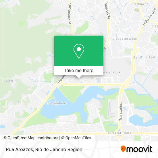
See Rua Aroazes, Jacarepaguá, on the map
Public Transit to Rua Aroazes in Jacarepaguá
Wondering how to get to Rua Aroazes in Jacarepaguá? Moovit helps you find the best way to get to Rua Aroazes with step-by-step directions from the nearest public transit station.
Moovit provides free maps and live directions to help you navigate through your city. View schedules, routes, timetables, and find out how long does it take to get to Rua Aroazes in real time.
Looking for the nearest stop or station to Rua Aroazes? Check out this list of stops closest to your destination: Villas De España; Parque Olímpico; Pedro Correia; Av. Embaixador Abelardo Bueno | Cond. Bora Bora.
Bus: 40, 46, 50, 52, 53, 881, UPTOWN, 35, 352, SC460S, 613, SPA 613.
Want to see if there’s another route that gets you there at an earlier time? Moovit helps you find alternative routes or times. Get directions from and directions to Rua Aroazes easily from the Moovit App or Website.
We make riding to Rua Aroazes easy, which is why over 1.5 million users, including users in Jacarepaguá, trust Moovit as the best app for public transit. You don’t need to download an individual bus app or train app, Moovit is your all-in-one transit app that helps you find the best bus time or train time available.
For information on prices of bus, costs and ride fares to Rua Aroazes, please check the Moovit app.
Use the app to navigate to popular places including to the airport, hospital, stadium, grocery store, mall, coffee shop, school, college, and university.
Rua Aroazes Address: Rua Aroazes street in Jacarepaguá
- Majestic Place,
- Vilarejo Festas,
- Estrada Coronel Pedro Corrêa 123,
- Vittoria Crossfit - Rio2,
- Campo Society Rio 2,
- Colégio Qi Rio 2,
- Andina Iluminacao,
- Creche Escola Ipê,
- Cooperativa dos Oculos Barra,
- Condomínio Villas Da Barra,
- Espaço de Desenvolvimento Ciranda Infantil,
- Rua Aroazes 145,
- Carlos Cunha,
- Condomínio Barra Corinto,
- Parcão Rio 2,
- Noble Motors,
- Krav Maga Rio2,
- Rua Aroazes / Estrada Coronel Pedro Corrêa,
- Chaveiro Aroazes,
- Bar da Piscina
Places Near Rua Aroazes (Jacarepaguá)
- Hospital Pedro Ernesto, Vila Isabel,
- Rua Licínio Cardoso, São Francisco Xavier,
- Rua Ulysses Guimarães 16, Cidade Nova,
- Avenida Rio Branco, Centro,
- Rio De Janeiro,
- Niterói, Niterói,
- Museu Do Amanhã, Centro,
- Norte Shopping, Cachambi,
- Hospital Municipal Ronaldo Gazolla, Acari,
- Rodoviária Novo Rio (Rodoviária do Rio de Janeiro), Santo Cristo,
- Hospital Federal Do Andaraí, Andaraí,
- Shopping Nova América, Del Castilho,
- Shopping Rio Sul, Botafogo,
- Shopping RioSul, Botafogo,
- Feira Livre da Gloria, Glória,
- Shopping Downtown, Barra Da Tijuca,
- Hospital Federal Cardoso Fontes, Jacarepaguá,
- Feirão De Malhas, Duque De Caxias,
- Praia do Arpoador, Ipanema,
- Avenida Venezuela 134, Saúde
How to get to popular places in Rio de Janeiro Region with public transit
Get around Jacarepaguá by public transit!
Traveling around Jacarepaguá has never been so easy. See step by step directions as you travel to any attraction, street or major public transit station. View bus and train schedules, arrival times, service alerts and detailed routes on a map, so you know exactly how to get to anywhere in Jacarepaguá.
When traveling to any destination around Jacarepaguá use Moovit's Live Directions with Get Off Notifications to know exactly where and how far to walk, how long to wait for your line, and how many stops are left. Moovit will alert you when it's time to get off — no need to constantly re-check whether yours is the next stop.
Wondering how to use public transit in Jacarepaguá or how to pay for public transit in Jacarepaguá? Moovit public transit app can help you navigate your way with public transit easily, and at minimum cost. It includes public transit fees, ticket prices, and costs. Looking for a map of Jacarepaguá public transit lines? Moovit public transit app shows all public transit maps in Jacarepaguá with all Bus, Train, Metro, Light Rail, Ferry, Cable Car, Gondola and Funicular routes and stops on an interactive map.
Rio de Janeiro Region has 8 transit type(s), including: Bus, Train, Metro, Light Rail, Ferry, Cable Car, Gondola and Funicular, operated by several transit agencies, including TrensRJ, Metrô Rio, VLT Carioca, Barcas Rio, BRT MOBI-Rio, Auto Viação Alpha, Auto Viação Tijuca, Gire Transportes, Transurb, Viação Nossa Senhora das Graças, Consórcio INTERSUL, Braso Lisboa (Municipal), Caprichosa Auto Ônibus, Auto Viação Três Amigos and Rodoviária Âncora Matias