Directions to Rua Arthur Marques de Carvalho (Sapucaia) with public transportation
The following transit lines have routes that pass near Rua Arthur Marques de Carvalho
How to get to Rua Arthur Marques de Carvalho by bus?
Click on the bus route to see step by step directions with maps, line arrival times and updated time schedules.
From Itaipava, Petrópolis
305 minFrom Presidio Romeiro Neto Mage, Magé
378 minFrom Magé, Magé
402 minFrom Petrópolis, Petrópolis
350 minFrom Ônibus - Magé x Central - Seletiva - Empresa Reginas, Magé
394 minFrom Lumiar, Nova Friburgo
407 minFrom SESC Nogueira, Petrópolis
327 minFrom Taquara, Duque De Caxias
358 min
Bus stops near Rua Arthur Marques de Carvalho in Sapucaia
Bus lines to Rua Arthur Marques de Carvalho in Sapucaia
What are the closest stations to Rua Arthur Marques de Carvalho?
The closest stations to Rua Arthur Marques de Carvalho are:
- Rua Nicolau Langoni, 26 is 84 meters away, 2 min walk.
- Rodovia Lúcio Meira, 255 | Praça Barão De Ayuruoca is 151 meters away, 3 min walk.
Which bus lines stop near Rua Arthur Marques de Carvalho?
These bus lines stop near Rua Arthur Marques de Carvalho: ANTA - PIÃO, TRÊS RIOS - SAPUCAIA.
What’s the nearest bus station to Rua Arthur Marques de Carvalho in Sapucaia?
The nearest bus station to Rua Arthur Marques de Carvalho in Sapucaia is Rua Nicolau Langoni, 26. It’s a 2 min walk away.
What time is the first bus to Rua Arthur Marques de Carvalho in Sapucaia?
The ANTA - SAPUCAIA is the first bus that goes to Rua Arthur Marques de Carvalho in Sapucaia. It stops nearby at 5:30 AM.
What time is the last bus to Rua Arthur Marques de Carvalho in Sapucaia?
The ANTA - SAPUCAIA is the last bus that goes to Rua Arthur Marques de Carvalho in Sapucaia. It stops nearby at 9:50 PM.
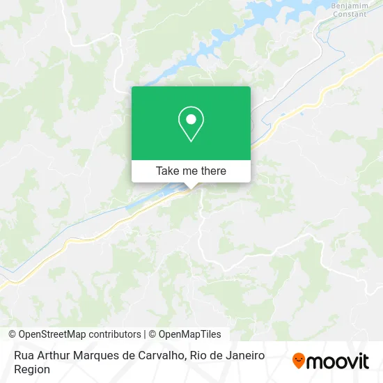
See Rua Arthur Marques de Carvalho, Sapucaia, on the map
Public Transit to Rua Arthur Marques de Carvalho in Sapucaia
Wondering how to get to Rua Arthur Marques de Carvalho in Sapucaia? Moovit helps you find the best way to get to Rua Arthur Marques de Carvalho with step-by-step directions from the nearest public transit station.
Moovit provides free maps and live directions to help you navigate through your city. View schedules, routes, timetables, and find out how long does it take to get to Rua Arthur Marques de Carvalho in real time.
Looking for the nearest stop or station to Rua Arthur Marques de Carvalho? Check out this list of stops closest to your destination: Rua Nicolau Langoni; Rodovia Lúcio Meira.
Bus: ANTA - PIÃO, TRÊS RIOS - SAPUCAIA, ANTA - APARECIDA, ANTA - JAMAPARÁ, ANTA - SAPUCAIA, SAPUCAIA - SANTO ANTÔNIO.
Want to see if there’s another route that gets you there at an earlier time? Moovit helps you find alternative routes or times. Get directions from and directions to Rua Arthur Marques de Carvalho easily from the Moovit App or Website.
We make riding to Rua Arthur Marques de Carvalho easy, which is why over 1.5 million users, including users in Sapucaia, trust Moovit as the best app for public transit. You don’t need to download an individual bus app or train app, Moovit is your all-in-one transit app that helps you find the best bus time or train time available.
For information on prices of bus, costs and ride fares to Rua Arthur Marques de Carvalho, please check the Moovit app.
Use the app to navigate to popular places including to the airport, hospital, stadium, grocery store, mall, coffee shop, school, college, and university.
Rua Arthur Marques de Carvalho Address: Sapucaia Sapucaia-RJ street in Sapucaia
- Via Caixa,
- Loteria Consorte,
- Igreja Batista Atitude Sapucaia,
- Cross Training One,
- Cfc - Autoescola Sapucaiense,
- La Margarita Tecidos,
- Padaria Sapucaiense,
- Dede Festas,
- Plan Minas Administradora de Planos de Assistencia Funerária,
- Sumicity Networks,
- Igreja Metodista Em Sapucaia,
- Odontocompany Sapucaia,
- Topmat Topografia e Engenharia,
- Gambau's Lanchonete e Choperia,
- Casa de Cultura de Sapucaia Manoelina Vieira Francisco,
- Farmácia São José,
- Alcileia Souza de Assis,
- Posto Vale Paraíso Direcional,
- Cfc Sapucaiense,
- Maria Bonita Perfumaria
Places Near Rua Arthur Marques de Carvalho (Sapucaia)
- Hospital Municipal Ronaldo Gazolla, Acari,
- Hospital Pedro Ernesto, Vila Isabel,
- Praia do Arpoador, Ipanema,
- Shopping Nova América, Del Castilho,
- Niterói, Niterói,
- Shopping Rio Sul, Botafogo,
- Rua Licínio Cardoso, São Francisco Xavier,
- Avenida Rio Branco, Centro,
- Feira Livre da Gloria, Glória,
- Museu Do Amanhã, Centro,
- Hospital Federal Cardoso Fontes, Jacarepaguá,
- Shopping RioSul, Botafogo,
- Rio De Janeiro,
- Rua Ulysses Guimarães 16, Cidade Nova,
- Feirão De Malhas, Duque De Caxias,
- Norte Shopping, Cachambi,
- Shopping Downtown, Barra Da Tijuca,
- Hospital Federal Do Andaraí, Andaraí,
- Avenida Venezuela 134, Saúde,
- Rodoviária Novo Rio (Rodoviária do Rio de Janeiro), Santo Cristo
How to get to popular places in Rio de Janeiro Region with public transit
Get around Sapucaia by public transit!
Traveling around Sapucaia has never been so easy. See step by step directions as you travel to any attraction, street or major public transit station. View bus and train schedules, arrival times, service alerts and detailed routes on a map, so you know exactly how to get to anywhere in Sapucaia.
When traveling to any destination around Sapucaia use Moovit's Live Directions with Get Off Notifications to know exactly where and how far to walk, how long to wait for your line, and how many stops are left. Moovit will alert you when it's time to get off — no need to constantly re-check whether yours is the next stop.
Wondering how to use public transit in Sapucaia or how to pay for public transit in Sapucaia? Moovit public transit app can help you navigate your way with public transit easily, and at minimum cost. It includes public transit fees, ticket prices, and costs. Looking for a map of Sapucaia public transit lines? Moovit public transit app shows all public transit maps in Sapucaia with all Bus, Train, Metro, Light Rail, Ferry, Cable Car, Gondola and Funicular routes and stops on an interactive map.
Rio de Janeiro Region has 8 transit type(s), including: Bus, Train, Metro, Light Rail, Ferry, Cable Car, Gondola and Funicular, operated by several transit agencies, including TrensRJ, Metrô Rio, VLT Carioca, Barcas Rio, BRT MOBI-Rio, Auto Viação Alpha, Auto Viação Tijuca, Gire Transportes, Transurb, Viação Nossa Senhora das Graças, Consórcio INTERSUL, Braso Lisboa (Municipal), Caprichosa Auto Ônibus, Auto Viação Três Amigos and Rodoviária Âncora Matias