How to get to Rua Brigadeiro Faria Lima by bus?
Click on the bus route to see step by step directions with maps, line arrival times and updated time schedules.
From Shopping São Gonçalo., São Gonçalo
51 minFrom Hospital Estadual Azevedo Lima, Niterói
36 minFrom Alameda São Boaventura, Niterói
47 minFrom São Gonçalo Shopping, São Gonçalo
48 minFrom Rodovia BR-101, Km 298 s/n, Itaboraí
40 minFrom Clínica Barro Vermelho, São Gonçalo
49 minFrom São Gonçalo, São Gonçalo
38 minFrom Barro Vermelho, São Gonçalo
46 minFrom Shopping Partage, São Gonçalo
38 minFrom Partage Shopping São Gonçalo, São Gonçalo
42 min
Bus stops near Rua Brigadeiro Faria Lima in São Gonçalo
Bus lines to Rua Brigadeiro Faria Lima in São Gonçalo
What are the closest stations to Rua Brigadeiro Faria Lima?
The closest stations to Rua Brigadeiro Faria Lima are:
- Rua Roberto Araújo Cruz 515-551 - Pacheco São Gonçalo is 34 meters away, 1 min walk.
- Rua Major Rubéns Vaz, 18 is 77 meters away, 2 min walk.
Which bus lines stop near Rua Brigadeiro Faria Lima?
These bus lines stop near Rua Brigadeiro Faria Lima: 25A, 30A, 49B, 553M.
What’s the nearest bus station to Rua Brigadeiro Faria Lima in São Gonçalo?
The nearest bus station to Rua Brigadeiro Faria Lima in São Gonçalo is Rua Roberto Araújo Cruz 515-551 - Pacheco São Gonçalo. It’s a 1 min walk away.
What time is the first bus to Rua Brigadeiro Faria Lima in São Gonçalo?
The 25 is the first bus that goes to Rua Brigadeiro Faria Lima in São Gonçalo. It stops nearby at 4:00 AM.
What time is the last bus to Rua Brigadeiro Faria Lima in São Gonçalo?
The 25A is the last bus that goes to Rua Brigadeiro Faria Lima in São Gonçalo. It stops nearby at 12:25 AM.
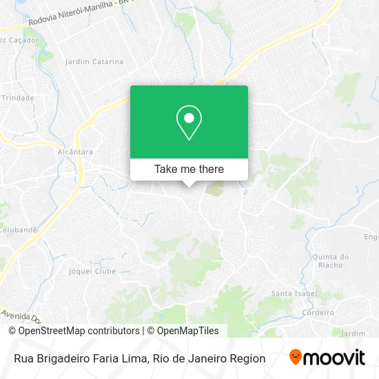
See Rua Brigadeiro Faria Lima, São Gonçalo, on the map
Public Transit to Rua Brigadeiro Faria Lima in São Gonçalo
Wondering how to get to Rua Brigadeiro Faria Lima in São Gonçalo? Moovit helps you find the best way to get to Rua Brigadeiro Faria Lima with step-by-step directions from the nearest public transit station.
Moovit provides free maps and live directions to help you navigate through your city. View schedules, routes, timetables, and find out how long does it take to get to Rua Brigadeiro Faria Lima in real time.
Looking for the nearest stop or station to Rua Brigadeiro Faria Lima? Check out this list of stops closest to your destination: Rua Roberto Araújo Cruz 515-551 - Pacheco São Gonçalo; Rua Major Rubéns Vaz.
Bus: 25A, 30A, 49B, 553M, 25.
Want to see if there’s another route that gets you there at an earlier time? Moovit helps you find alternative routes or times. Get directions from and directions to Rua Brigadeiro Faria Lima easily from the Moovit App or Website.
We make riding to Rua Brigadeiro Faria Lima easy, which is why over 1.5 million users, including users in São Gonçalo, trust Moovit as the best app for public transit. You don’t need to download an individual bus app or train app, Moovit is your all-in-one transit app that helps you find the best bus time or train time available.
For information on prices of bus, costs and ride fares to Rua Brigadeiro Faria Lima, please check the Moovit app.
Use the app to navigate to popular places including to the airport, hospital, stadium, grocery store, mall, coffee shop, school, college, and university.
Rua Brigadeiro Faria Lima Address: Tiradentes São Gonçalo-RJ street in São Gonçalo
- Ilê de São João Menino,
- Jardim Tiradentes- São Gonçalo,
- Rua Avelino Dutra de Carvalho,
- Rua Leonídia Pinheiro da Silva,
- Estrada Lagoinha / Rua Marcelino Mesquita,
- Estrada Bichinho,
- IBARP,
- Primeira Igreja Batista Renovada Em Pacheco,
- Colégio Estadual Augusto Cezário Diáz André,
- Amendoeira,
- Rua Nazário Machado Próximo ao 190-244,
- Estrada Nazário Machado / Rua Ascendino de Abreu,
- Cemitério Parque da Paz,
- Morro da Alegria,
- Posto Municipal De Saúde Adolfo Lutz,
- Rua Delfim Moreira 13,
- Salão de Festas Fazenda Casarão,
- Parque do Pacheco,
- Hugo Lanches,
- Salão de Festas Fonte das Águas
Places Near Rua Brigadeiro Faria Lima (São Gonçalo)
- Feira Livre da Gloria, Glória,
- Shopping Nova América, Del Castilho,
- Hospital Federal Do Andaraí, Andaraí,
- Hospital Federal Cardoso Fontes, Jacarepaguá,
- Norte Shopping, Cachambi,
- Rua Ulysses Guimarães 16, Cidade Nova,
- Museu Do Amanhã, Centro,
- Rodoviária Novo Rio (Rodoviária do Rio de Janeiro), Santo Cristo,
- Hospital Municipal Ronaldo Gazolla, Acari,
- Praia do Arpoador, Ipanema,
- Hospital Pedro Ernesto, Vila Isabel,
- Shopping Downtown, Barra Da Tijuca,
- Rua Licínio Cardoso, São Francisco Xavier,
- Feirão De Malhas, Duque De Caxias,
- Niterói, Niterói,
- Avenida Venezuela 134, Saúde,
- Shopping Rio Sul, Botafogo,
- Shopping RioSul, Botafogo,
- Avenida Rio Branco, Centro,
- Rio De Janeiro
How to get to popular places in Rio de Janeiro Region with public transit
Get around São Gonçalo by public transit!
Traveling around São Gonçalo has never been so easy. See step by step directions as you travel to any attraction, street or major public transit station. View bus and train schedules, arrival times, service alerts and detailed routes on a map, so you know exactly how to get to anywhere in São Gonçalo.
When traveling to any destination around São Gonçalo use Moovit's Live Directions with Get Off Notifications to know exactly where and how far to walk, how long to wait for your line, and how many stops are left. Moovit will alert you when it's time to get off — no need to constantly re-check whether yours is the next stop.
Wondering how to use public transit in São Gonçalo or how to pay for public transit in São Gonçalo? Moovit public transit app can help you navigate your way with public transit easily, and at minimum cost. It includes public transit fees, ticket prices, and costs. Looking for a map of São Gonçalo public transit lines? Moovit public transit app shows all public transit maps in São Gonçalo with all Bus, Train, Metro, Light Rail, Ferry, Cable Car, Gondola and Funicular routes and stops on an interactive map.
Rio de Janeiro Region has 8 transit type(s), including: Bus, Train, Metro, Light Rail, Ferry, Cable Car, Gondola and Funicular, operated by several transit agencies, including TrensRJ, Metrô Rio, VLT Carioca, Barcas Rio, BRT MOBI-Rio, Auto Viação Alpha, Auto Viação Tijuca, Gire Transportes, Transurb, Viação Nossa Senhora das Graças, Consórcio INTERSUL, Braso Lisboa (Municipal), Caprichosa Auto Ônibus, Auto Viação Três Amigos and Rodoviária Âncora Matias