Directions to Rua China 48 (Paulista) with public transportation
The following transit lines have routes that pass near Rua China 48
How to get to Rua China 48 by bus?
Click on the bus route to see step by step directions with maps, line arrival times and updated time schedules.
From Paulista, Paulista
43 minFrom Artur Lundgren I, Paulista
63 minFrom Hospital Miguel Arraes, Paulista
69 minFrom Rodovia BR-101 Norte, Km 48 s/n, Abreu E Lima
86 minFrom Forte Orange, Ilha De Itamaraca
160 minFrom Shopping Patteo Olinda, Olinda
46 minFrom Patteo Shopping, Olinda
46 minFrom Terminal Integrado De Abreu E Lima, Paulista
58 minFrom Praia do Quartel, Olinda
44 minFrom Patteo Olinda Shopping, Olinda
47 min
Bus stops near Rua China 48 in Paulista
Bus lines to Rua China 48 in Paulista
- 1958 COSTA AZUL / TI PELÓPIDAS, Via Rua Walfrido Carneiro Da Silva,VIEW
- 1982 CONJUNTO BEIRA MAR / DERBY, Saída Da Costa Azul,VIEW
- 1960 TI RIO DOCE / MARIA FARINHA (CASA CAIADA), Ti Rio Doce / Maria Farinha (Casa Caiada),VIEW
- 1992 PAU AMARELO, Pau Amarelo,VIEW
- 1995 PAU AMARELO (BACURAU), Pau Amarelo (Bacurau),VIEW
- 1922 PAU AMARELO / TI PELÓPIDAS, Pau Amarelo / Ti Pelópidas,VIEW
What are the closest stations to Rua China 48?
The closest stations to Rua China 48 are:
- Rua José Geraldo Castro Paes, 1200 is 28 meters away, 1 min walk.
- Av. Costa Azul, 707 is 254 meters away, 4 min walk.
- Av. Dr. Cláudio José Gueiros Leite (Pe-001), 545 | Marítimos Bar E Restaurante is 548 meters away, 8 min walk.
- Av. Dr. Cláudio José Gueiros Leite (Pe-001), 620 is 645 meters away, 9 min walk.
Which bus lines stop near Rua China 48?
These bus lines stop near Rua China 48: 1922 PAU AMARELO / TI PELÓPIDAS, 1958 COSTA AZUL / TI PELÓPIDAS, 1992 PAU AMARELO.
What’s the nearest bus station to Rua China 48 in Paulista?
The nearest bus station to Rua China 48 in Paulista is Rua José Geraldo Castro Paes, 1200. It’s a 1 min walk away.
What time is the first bus to Rua China 48 in Paulista?
The 1995 PAU AMARELO (BACURAU) is the first bus that goes to Rua China 48 in Paulista. It stops nearby at 3:18 AM.
What time is the last bus to Rua China 48 in Paulista?
The 1995 PAU AMARELO (BACURAU) is the last bus that goes to Rua China 48 in Paulista. It stops nearby at 3:20 AM.
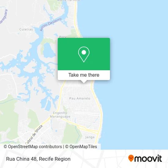
See Rua China 48, Paulista, on the map
Public Transit to Rua China 48 in Paulista
Wondering how to get to Rua China 48 in Paulista? Moovit helps you find the best way to get to Rua China 48 with step-by-step directions from the nearest public transit station.
Moovit provides free maps and live directions to help you navigate through your city. View schedules, routes, timetables, and find out how long does it take to get to Rua China 48 in real time.
Looking for the nearest stop or station to Rua China 48? Check out this list of stops closest to your destination: Rua José Geraldo Castro Paes; Av. Costa Azul; Av. Dr. Cláudio José Gueiros Leite (Pe-001); Av. Dr. Cláudio José Gueiros Leite (Pe-001).
Bus: 1922 PAU AMARELO / TI PELÓPIDAS, 1958 COSTA AZUL / TI PELÓPIDAS, 1992 PAU AMARELO, 1982 CONJUNTO BEIRA MAR / DERBY, 1960 TI RIO DOCE / MARIA FARINHA (CASA CAIADA), 1995 PAU AMARELO (BACURAU).
Want to see if there’s another route that gets you there at an earlier time? Moovit helps you find alternative routes or times. Get directions from and directions to Rua China 48 easily from the Moovit App or Website.
We make riding to Rua China 48 easy, which is why over 1.5 million users, including users in Paulista, trust Moovit as the best app for public transit. You don’t need to download an individual bus app or train app, Moovit is your all-in-one transit app that helps you find the best bus time or train time available.
For information on prices of bus, costs and ride fares to Rua China 48, please check the Moovit app.
Use the app to navigate to popular places including to the airport, hospital, stadium, grocery store, mall, coffee shop, school, college, and university.
Rua China 48 Address: R. China, 48 - Nossa Sra. do Ó, Paulista - PE, 53431-440, Brasil street in Paulista
- Sj Design de Moveis e Movelaria,
- Lacos e Tiaras da Juju,
- Rua Doutor Benoni Sá,
- Rua Arquiteto Jose Geraldo Castro Paes 458,
- Colegio Patrícia Costa,
- Granja Santa Terezinha,
- Fashion House Casa de Shows Recepções & Eventos,
- Arte no PE,
- Assembleia De Deus - Pau Amarelo 2,
- Igreja Batista Boas Novas,
- salão de beleza JJ cabelos,
- Sorveteria BACANA,
- BOPPE - Base Operacional de Paintball de Pernambuco,
- Rua Gambia,
- Kamila Ramos Buffet e Recepções,
- Rua José Geraldo Castro Paes,
- Pau Amarelo Assembleia de Deus Rua Somália,
- Praia de Maria Farinha,
- Luiz Targino,
- Rua Taquaritinga do Norte
Places Near Rua China 48 (Paulista)
- Arena de Pernambuco, São Lourenço Da Mata,
- Shopping RioMar Recife, Pina,
- hospital otavio de freitas - UTI, Tejipió,
- Hospital Maria Lucinda, Parnamirim,
- Hospital Altino Ventura, Iputinga,
- Hospital Universitário Oswaldo Cruz, Santo Amaro,
- SHOPPING GUARARAPES, Jaboatão Dos Guararapes,
- tuuuuu, Olinda,
- Parque da Jaqueira, Jaqueira,
- Hospital Geral De Areias, Areias,
- SHOPPING TACARUNA, Santo Amaro,
- Shopping Patteo Olinda, Olinda,
- Imbiribeira, Imbiribeira,
- llll, Fundão,
- Hospital Agamenon Magalhães, Tamarineira,
- Marco Zero, Bairro Do Recife,
- Centro de Convenções de Pernambuco, Olinda,
- Shopping Recife, Boa Viagem,
- Imip (Instituto Materno-Infantil De Pernambuco), Coelhos,
- Hospital Eduardo Campus Da Pessoa Idosa, Areias
How to get to popular places in Recife Region with public transit
Get around Paulista by public transit!
Traveling around Paulista has never been so easy. See step by step directions as you travel to any attraction, street or major public transit station. View bus and train schedules, arrival times, service alerts and detailed routes on a map, so you know exactly how to get to anywhere in Paulista.
When traveling to any destination around Paulista use Moovit's Live Directions with Get Off Notifications to know exactly where and how far to walk, how long to wait for your line, and how many stops are left. Moovit will alert you when it's time to get off — no need to constantly re-check whether yours is the next stop.
Wondering how to use public transit in Paulista or how to pay for public transit in Paulista? Moovit public transit app can help you navigate your way with public transit easily, and at minimum cost. It includes public transit fees, ticket prices, and costs. Looking for a map of Paulista public transit lines? Moovit public transit app shows all public transit maps in Paulista with all Bus, Train, Subway and Ferry routes and stops on an interactive map.
Recife Region has 4 transit type(s), including: Bus, Train, Subway and Ferry, operated by several transit agencies, including CBTU (Metrorec), BRT (Via Livre), Grande Recife, BORBOREMA IMPERIAL (TIP), BORBOREMA IMPERIAL (B.V), RODOVIÁRIA POTENGY, EMPRESA METROPOLITANA, CONSÓRCIO RECIFE, SÃO JUDAS TADEU, Expresso 1002, Rodotur Turismo, Complementar Recife, Sistema Municipal - Jaboatão, Sistema Municipal - Cabo and Sistema Municipal - Ipojuca