Directions to Rua Clara Kuchenny (Abranches) with public transportation
The following transit lines have routes that pass near Rua Clara Kuchenny
How to get to Rua Clara Kuchenny by bus?
Click on the bus route to see step by step directions with maps, line arrival times and updated time schedules.
From Praça Do Expedicionario, Centro
39 minFrom Jardim das Américas, Jardim Das Américas
69 minFrom Rua Tv Particular II (VL ARAUJO), Colombo
83 minFrom SENAC PR, Centro
33 minFrom Estação Tubo Marechal Floriano Peixoto, Hauer
47 minFrom Rua XV de Novembro, Centro
32 minFrom Rua Luiz França, Cajuru
63 minFrom Rodovia Deputado João Leopoldo Jacomel 12813, Pinhais
60 minFrom Rua Alferes Poli, Rebouças
44 min
Bus stops near Rua Clara Kuchenny in Abranches
Bus lines to Rua Clara Kuchenny in Abranches
- 181 MATEUS LEME, Capela São Francisco Xavier → Praça Tiradentes,VIEW
- A07 TAMANDARÉ / PRAÇA 19 (LAMENHA), (Reforço) Praça 19 → Kabel,VIEW
- 924 SANTA FELICIDADE / SANTA CÂNDIDA, Terminal Santa Cândida → Terminal Santa Felicidade,VIEW
- 176 PARQUE TANGUÁ, Travessa Nestor de Castro → Parque Tanguá,VIEW
- 177 CABRAL / PARQUE TANGUÁ, Terminal Cabral → Parque Tanguá,VIEW
What are the closest stations to Rua Clara Kuchenny?
The closest stations to Rua Clara Kuchenny are:
- R. Clara Kuchenny, 630 is 100 meters away, 2 min walk.
- R. Desembargador José Carlos Ribeiro Ribas, 652 is 168 meters away, 3 min walk.
- R. Eugênio Flor, 596 is 272 meters away, 4 min walk.
Which bus lines stop near Rua Clara Kuchenny?
These bus lines stop near Rua Clara Kuchenny: 176 PARQUE TANGUÁ, 181 MATEUS LEME, 182 ABRANCHES, 924 SANTA FELICIDADE / SANTA CÂNDIDA, A07 TAMANDARÉ / PRAÇA 19 (LAMENHA).
What’s the nearest bus station to Rua Clara Kuchenny in Abranches?
The nearest bus station to Rua Clara Kuchenny in Abranches is R. Clara Kuchenny, 630. It’s a 2 min walk away.
What time is the first bus to Rua Clara Kuchenny in Abranches?
The 181 MATEUS LEME is the first bus that goes to Rua Clara Kuchenny in Abranches. It stops nearby at 5:18 AM.
What time is the last bus to Rua Clara Kuchenny in Abranches?
The 924 SANTA FELICIDADE / SANTA CÂNDIDA is the last bus that goes to Rua Clara Kuchenny in Abranches. It stops nearby at 12:45 AM.
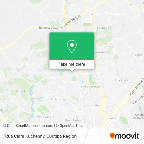
See Rua Clara Kuchenny, Abranches, on the map
Public Transit to Rua Clara Kuchenny in Abranches
Wondering how to get to Rua Clara Kuchenny in Abranches? Moovit helps you find the best way to get to Rua Clara Kuchenny with step-by-step directions from the nearest public transit station.
Moovit provides free maps and live directions to help you navigate through your city. View schedules, routes, timetables, and find out how long does it take to get to Rua Clara Kuchenny in real time.
Looking for the nearest stop or station to Rua Clara Kuchenny? Check out this list of stops closest to your destination: R. Clara Kuchenny; R. Desembargador José Carlos Ribeiro Ribas; R. Eugênio Flor.
Bus: 176 PARQUE TANGUÁ, 181 MATEUS LEME, 182 ABRANCHES, 924 SANTA FELICIDADE / SANTA CÂNDIDA, A07 TAMANDARÉ / PRAÇA 19 (LAMENHA), 177 CABRAL / PARQUE TANGUÁ.
Want to see if there’s another route that gets you there at an earlier time? Moovit helps you find alternative routes or times. Get directions from and directions to Rua Clara Kuchenny easily from the Moovit App or Website.
We make riding to Rua Clara Kuchenny easy, which is why over 1.5 million users, including users in Abranches, trust Moovit as the best app for public transit. You don’t need to download an individual bus app or train app, Moovit is your all-in-one transit app that helps you find the best bus time or train time available.
For information on prices of bus, costs and ride fares to Rua Clara Kuchenny, please check the Moovit app.
Use the app to navigate to popular places including to the airport, hospital, stadium, grocery store, mall, coffee shop, school, college, and university.
Rua Clara Kuchenny Address: Rua Clara Kuchenny - Abranches, Curitiba - PR, Brasil street in Abranches
- Associacao de Amigos e Moradores Crescer Região Norte,
- Massa do Lontra,
- Rua Martin Kaiser 137,
- Mas Instalações,
- Actoep,
- Dubiali,
- Carlos Alberto Vasconcelos,
- Residencial Opera Garden,
- Auto Center Quatro Rodas,
- Hernandes Sociedade Individual de Advocacia,
- Condominio Tanguá Veredas,
- Ateliê Club Madeira Criativa Restauro e Marcenaria,
- Kucaniz Soluções Em Ti,
- Ohcam Representacoes Comerciais,
- Design TO Business,
- Clinica Veterinaria Ribas,
- Tangua Classique,
- Doutor Informacao,
- Frizzera Adm. Obras,
- Werc Industrial Ltda
Places Near Rua Clara Kuchenny (Abranches)
- Parque Barigui, Mercês,
- Shopping Palladium, Portão,
- Jardim Botânico de Curitiba PR, Centro,
- Pontifícia Universidade Católica do Paraná (PUCPR), Prado Velho,
- Campo Largo, Campo,
- Hospital Angelina Caron, Campina Grande Do Sul,
- Hhhhh, Fazendinha,
- Rua Martim Afonso 558, Mercês,
- Arena Da Baixada - Curitiba,
- Hospital Madalena Sofia, Bairro Alto,
- Shopping Estação, Rebouças,
- Hospital Erasto Gaertner, Jardim Das Américas,
- Hospital do Rocio, Campo,
- Hospital Da Cruz Vermelha, Batel,
- Hospital Universitário Evangélico de Curitiba, Bigorrilho,
- Park Shopping Barigüi, Mossunguê,
- Jockey Plaza Shopping Center, Tarumã,
- Rua General Mário Tourinho, Campina Do Siqueira,
- Hospital Nossa Senhora Das Graças, Mercês,
- Hospital de Clínicas (HC - UFPR), Centro
How to get to popular places in Curitiba Region with public transit
Get around Abranches by public transit!
Traveling around Abranches has never been so easy. See step by step directions as you travel to any attraction, street or major public transit station. View bus and train schedules, arrival times, service alerts and detailed routes on a map, so you know exactly how to get to anywhere in Abranches.
When traveling to any destination around Abranches use Moovit's Live Directions with Get Off Notifications to know exactly where and how far to walk, how long to wait for your line, and how many stops are left. Moovit will alert you when it's time to get off — no need to constantly re-check whether yours is the next stop.
Wondering how to use public transit in Abranches or how to pay for public transit in Abranches? Moovit public transit app can help you navigate your way with public transit easily, and at minimum cost. It includes public transit fees, ticket prices, and costs. Looking for a map of Abranches public transit lines? Moovit public transit app shows all public transit maps in Abranches with all Bus and Cable Car routes and stops on an interactive map.
Curitiba Region has 2 transit type(s), including: Bus and Cable Car, operated by several transit agencies, including Sistema Integrado de Mobilidade (URBS), Sistema Integrado de Mobilidade (AMEP), URBS (Cartões bancários e Dinheiro), URBS (Cartões bancários / Cartão URBS), AMEP (Cartões bancários / Cartão MetroCard), AMEP (Cartões bancários / Cartão MetroCard / Dinheiro), Viação Colombo (Dinheiro), TRIAR (Cartão TRIAR / Dinheiro), Empresa Curitiba Cerro Azul (Dinheiro), Expresso Nossa Senhora da Penha (Dinheiro), Empresa Campo Alto Tijucas (Dinheiro), Auto Viação São José (Cartão VEM / Dinheiro), BRT S/A (Cartão VEM / Dinheiro), TransPiedade (Cartão Cidadão / Dinheiro) and Oceânica Sul (Cartão Transporte / Dinheiro)