Directions to Rua Clotilde Maria Linhares Pinsky 91 (Niterói) with public transportation
The following transit lines have routes that pass near Rua Clotilde Maria Linhares Pinsky 91
 Bus: 1775D (EXECUTIVO), 2740D (EXECUTIVO), 2755D (EXECUTIVO), 62, 740D.
- Ferry: CHARITAS - PRAÇA XV.
How to get to Rua Clotilde Maria Linhares Pinsky 91 by bus?
Click on the bus route to see step by step directions with maps, line arrival times and updated time schedules.
From Rua Riachuelo 350, Centro
57 minFrom Rua Arnaldo Quintela / Rua da Passagem, Botafogo
58 minFrom Instituto Nacional De Cardiologia, Laranjeiras
50 minFrom Avenida Barão de Tefé 27, Saúde
62 minFrom Avenida Almirante Barroso 91, Centro
43 minFrom Hospital Municipal Souza Aguiar, Centro
50 minFrom Rua Dezenove de Fevereiro, Botafogo
55 minFrom Praia do Leme, Copacabana
62 minFrom Largo De São Francisco De Paula, Centro
58 minFrom Marechal Câmara, Centro
44 min
How to get to Rua Clotilde Maria Linhares Pinsky 91 by ferry?
Click on the ferry route to see step by step directions with maps, line arrival times and updated time schedules.
Bus stops near Rua Clotilde Maria Linhares Pinsky 91 in Niterói
Ferry station near Rua Clotilde Maria Linhares Pinsky 91 in Niterói
- Avenida Prefeito Silvio Picanço 1400, 6 min walk,VIEW
Bus lines to Rua Clotilde Maria Linhares Pinsky 91 in Niterói
- 62, Santa Bárbara X Charitas,VIEW
- 740D, Charitas - Leblon (BRS I - via Copacabana / T. Gentileza / Ipanema),VIEW
- 755D, Charitas - Gávea (BRS I - via Túnel Santa Bárbara),VIEW
- 760D, Charitas - Galeão ✈,VIEW
- 775D, Charitas - Gávea (BRS I - via Lapa / Gasômetro),VIEW
- 785D, Charitas - Barra da Tijuca (BRS I - via Túnel Santa Bárbara),VIEW
- 1760D (EXECUTIVO), Charitas - Galeão ✈,VIEW
- 1775D (EXECUTIVO), Charitas - Gávea (BRS I - via Lapa / Gasômetro),VIEW
- 1785D (EXECUTIVO), Charitas - Barra da Tijuca (Via Túnel Santa Bárbara),VIEW
- 1910D (EXECUTIVO), Itaipu - Castelo (Brs I - Via Engenho do Mato),VIEW
- 2740D (EXECUTIVO), Charitas - Leblon (BRS I - via Copacabana / T. Gentileza / Ipanema),VIEW
- 2755D (EXECUTIVO), Charitas - Gávea (Brs I - Via Túnel Santa Bárbara),VIEW
- 2905D (EXECUTIVO), Charitas - Castelo (Brs I - Via Binário do Porto),VIEW
- OC1, OCEÂNICA 1,VIEW
- OC2, OCEÂNICA 2,VIEW
- OC3, OCEÂNICA 3,VIEW
- OC3A, OCEÂNICA 3A,VIEW
- 33, JURUJUBA X TERMINAL RODOVIARIO,VIEW
- 52A, BALDEADOR X CHARITAS,VIEW
- 740D, CHARITAS X LEBLON,VIEW
What are the closest stations to Rua Clotilde Maria Linhares Pinsky 91?
The closest stations to Rua Clotilde Maria Linhares Pinsky 91 are:
- Avenida Prefeito Silvio Picanço, 1109-1203 is 197 meters away, 3 min walk.
- Avenida Prefeito Silvio Picanço 1400 is 424 meters away, 6 min walk.
- Avenida Rui Barbosa 89 is 692 meters away, 10 min walk.
Which bus lines stop near Rua Clotilde Maria Linhares Pinsky 91?
These bus lines stop near Rua Clotilde Maria Linhares Pinsky 91: 1775D (EXECUTIVO), 2740D (EXECUTIVO), 2755D (EXECUTIVO), 62.
Which ferry line stops near Rua Clotilde Maria Linhares Pinsky 91?
CHARITAS - PRAÇA XV (Charitas)
What’s the nearest bus station to Rua Clotilde Maria Linhares Pinsky 91 in Niterói?
The nearest bus station to Rua Clotilde Maria Linhares Pinsky 91 in Niterói is Avenida Prefeito Silvio Picanço, 1109-1203. It’s a 3 min walk away.
What’s the nearest ferry station to Rua Clotilde Maria Linhares Pinsky 91 in Niterói?
The nearest ferry station to Rua Clotilde Maria Linhares Pinsky 91 in Niterói is Avenida Prefeito Silvio Picanço 1400. It’s a 6 min walk away.
What time is the first bus to Rua Clotilde Maria Linhares Pinsky 91 in Niterói?
The 740D is the first bus that goes to Rua Clotilde Maria Linhares Pinsky 91 in Niterói. It stops nearby at 3:03 AM.
What time is the last bus to Rua Clotilde Maria Linhares Pinsky 91 in Niterói?
The 740D is the last bus that goes to Rua Clotilde Maria Linhares Pinsky 91 in Niterói. It stops nearby at 3:06 AM.
What time is the first ferry to Rua Clotilde Maria Linhares Pinsky 91 in Niterói?
The CHARITAS - PRAÇA XV is the first ferry that goes to Rua Clotilde Maria Linhares Pinsky 91 in Niterói. It stops nearby at 6:30 AM.
What time is the last ferry to Rua Clotilde Maria Linhares Pinsky 91 in Niterói?
The CHARITAS - PRAÇA XV is the last ferry that goes to Rua Clotilde Maria Linhares Pinsky 91 in Niterói. It stops nearby at 9:20 PM.
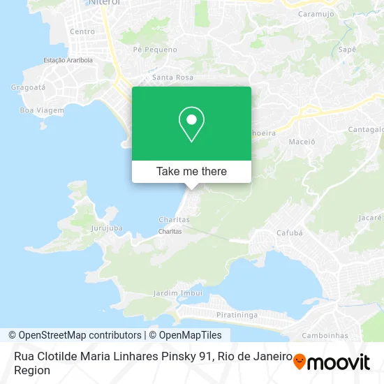
See Rua Clotilde Maria Linhares Pinsky 91, Niterói, on the map
Public Transit to Rua Clotilde Maria Linhares Pinsky 91 in Niterói
Wondering how to get to Rua Clotilde Maria Linhares Pinsky 91 in Niterói? Moovit helps you find the best way to get to Rua Clotilde Maria Linhares Pinsky 91 with step-by-step directions from the nearest public transit station.
Moovit provides free maps and live directions to help you navigate through your city. View schedules, routes, timetables, and find out how long does it take to get to Rua Clotilde Maria Linhares Pinsky 91 in real time.
Looking for the nearest stop or station to Rua Clotilde Maria Linhares Pinsky 91? Check out this list of stops closest to your destination: Avenida Prefeito Silvio Picanço; Avenida Prefeito Silvio Picanço 1400; Avenida Rui Barbosa 89.
Bus: 1775D (EXECUTIVO), 2740D (EXECUTIVO), 2755D (EXECUTIVO), 62, 740D, 755D, 760D, 775D, 32.Ferry: CHARITAS - PRAÇA XV.
Want to see if there’s another route that gets you there at an earlier time? Moovit helps you find alternative routes or times. Get directions from and directions to Rua Clotilde Maria Linhares Pinsky 91 easily from the Moovit App or Website.
We make riding to Rua Clotilde Maria Linhares Pinsky 91 easy, which is why over 1.5 million users, including users in Niterói, trust Moovit as the best app for public transit. You don’t need to download an individual bus app or train app, Moovit is your all-in-one transit app that helps you find the best bus time or train time available.
For information on prices of bus and ferry, costs and ride fares to Rua Clotilde Maria Linhares Pinsky 91, please check the Moovit app.
Use the app to navigate to popular places including to the airport, hospital, stadium, grocery store, mall, coffee shop, school, college, and university.
Rua Clotilde Maria Linhares Pinsky 91 Address: R. Clotilde Maria Linhares Pinsky, 91 - Charitas, Niterói - RJ, 24370-015, Brasil street in Niterói
- Tropical Casa de Festas,
- Condominio Charitas Bay,
- Cáritas,
- Avenida Quintino Bocaiúva,
- Rua Marechal Raul de Albuquerque 273,
- Rua Murilo Portugal, 140,
- praia de charitas,
- Verdanna Grill,
- Igreja Batista da Lagoinha,
- Aeroclube de Charitas,
- Charitas Aero Clube,
- Casa Da Amizade,
- Cemitério De Charitas,
- Cemitério São Francisco Xavier,
- Restaurante Siri De Niteroi,
- Praia de Charitas,
- Casa do Caranguejo,
- Condominio do Edificio Residencial Vilamoura,
- Casarão Charitas,
- Kool Ibiza
Places Near Rua Clotilde Maria Linhares Pinsky 91 (Niterói)
- Hospital Federal Do Andaraí, Andaraí,
- Norte Shopping, Cachambi,
- Avenida Venezuela 134, Saúde,
- Niterói, Niterói,
- Hospital Pedro Ernesto, Vila Isabel,
- Shopping Nova América, Del Castilho,
- Feira Livre da Gloria, Glória,
- Avenida Rio Branco, Centro,
- Shopping Downtown, Barra Da Tijuca,
- Shopping Rio Sul, Botafogo,
- Rua Ulysses Guimarães 16, Cidade Nova,
- Rio De Janeiro,
- Rodoviária Novo Rio (Rodoviária do Rio de Janeiro), Santo Cristo,
- Shopping RioSul, Botafogo,
- Hospital Federal Cardoso Fontes, Jacarepaguá,
- Hospital Municipal Ronaldo Gazolla, Acari,
- Feirão De Malhas, Duque De Caxias,
- Rua Licínio Cardoso, São Francisco Xavier,
- Museu Do Amanhã, Centro,
- Praia do Arpoador, Ipanema
How to get to popular places in Rio de Janeiro Region with public transit
Get around Niterói by public transit!
Traveling around Niterói has never been so easy. See step by step directions as you travel to any attraction, street or major public transit station. View bus and train schedules, arrival times, service alerts and detailed routes on a map, so you know exactly how to get to anywhere in Niterói.
When traveling to any destination around Niterói use Moovit's Live Directions with Get Off Notifications to know exactly where and how far to walk, how long to wait for your line, and how many stops are left. Moovit will alert you when it's time to get off — no need to constantly re-check whether yours is the next stop.
Wondering how to use public transit in Niterói or how to pay for public transit in Niterói? Moovit public transit app can help you navigate your way with public transit easily, and at minimum cost. It includes public transit fees, ticket prices, and costs. Looking for a map of Niterói public transit lines? Moovit public transit app shows all public transit maps in Niterói with all Bus, Train, Metro, Light Rail, Ferry, Cable Car, Gondola and Funicular routes and stops on an interactive map.
Rio de Janeiro Region has 8 transit type(s), including: Bus, Train, Metro, Light Rail, Ferry, Cable Car, Gondola and Funicular, operated by several transit agencies, including TrensRJ, Metrô Rio, VLT Carioca, Barcas Rio, BRT MOBI-Rio, Auto Viação Alpha, Auto Viação Tijuca, Gire Transportes, Transurb, Viação Nossa Senhora das Graças, Consórcio INTERSUL, Braso Lisboa (Municipal), Caprichosa Auto Ônibus, Auto Viação Três Amigos and Rodoviária Âncora Matias