How to get to Rua Imbé by bus?
Click on the bus route to see step by step directions with maps, line arrival times and updated time schedules.
From Feirão Moda Rio, Duque De Caxias
51 minFrom Pechincha, Pechincha
57 minFrom Taquara, Taquara
46 minFrom 25 de Agosto, Duque De Caxias
49 minFrom Brt Linha Expressa 41 Madureira X Recreio, Taquara
45 minFrom Linha 667 - Madureira / Méier, Encantado
42 minFrom Hospital Da Mulher Heloneida Studart, São João De Meriti
33 minFrom Piedade, Piedade
42 minFrom Estrada do Tindiba, Taquara
53 minFrom Avenida Nélson Cardoso, Taquara
49 min
How to get to Rua Imbé by train?
Click on the train route to see step by step directions with maps, line arrival times and updated time schedules.
Bus stops near Rua Imbé in Coelho Neto
Train station near Rua Imbé in Coelho Neto
- Honório Gurgel, 8 min walk,VIEW
Metro station near Rua Imbé in Coelho Neto
- Coelho Neto, 54 min walk,VIEW
Bus lines to Rua Imbé in Coelho Neto
- LECD141, Méier,VIEW
- SVB 685, Méier (Área De Lazer),VIEW
- 711, Rio Comprido,VIEW
- 685, LECD140 - Terminal Margaridas - Méier (via Rua dos Diamantes),VIEW
- SN 685, Irajá - Méier (Via Rua dos Diamantes),VIEW
- SVA 685, Irajá - Méier (Via Rua Embaú),VIEW
- 362, Castelo (Desvio - Feira Na Carlos Sampaio),VIEW
- SR 362, Castelo,VIEW
- 713L, Cosmorama,VIEW
- 715L, Cascadura (Via Três Setas / Jardim Redentor),VIEW
- 720L, Cascadura,VIEW
- 729L, São Vicente,VIEW
- 785, Marechal Hermes,VIEW
- 946, Engenho Da Rainha,VIEW
- 112B, Itaguaí - Central (Brs I),VIEW
- 113D, Itaguaí - Niterói,VIEW
- 119T, Caxias - Itaguaí (via Vila Militar/Campo Grande/Palmares),VIEW
- 121T, Caxias - Itaguaí (Via Estrada do Campinho / Santa Cruz),VIEW
- 124B, Nilópolis - Candelária (Brs I - Via Anchieta - Rápido),VIEW
- 133, Nova Iguaçu - Central (Brs I - Via Deodoro),VIEW
What are the closest stations to Rua Imbé?
The closest stations to Rua Imbé are:
- Rua Ururaí, 317 is 335 meters away, 5 min walk.
- Rua Dos Diamantes, 1619 is 432 meters away, 6 min walk.
- Honório Gurgel is 565 meters away, 8 min walk.
- Avenida Dos Italianos, 1082-1098 is 671 meters away, 9 min walk.
- Avenida Brasil | Fazenda Botafogo (Sentido Centro) is 1025 meters away, 14 min walk.
- Avenida Brasil - Passarela 28 (Fazenda Botafogo) is 1162 meters away, 15 min walk.
- Fazenda Botafogo is 1168 meters away, 15 min walk.
- Coelho Neto is 4224 meters away, 54 min walk.
Which bus lines stop near Rua Imbé?
These bus lines stop near Rua Imbé: 1901T, 685, 715L, 729L, SVB 685.
Which train line stops near Rua Imbé?
RAMAL BELFORD ROXO (Belford Roxo)
What’s the nearest train station to Rua Imbé in Coelho Neto?
The nearest train station to Rua Imbé in Coelho Neto is Honório Gurgel. It’s a 8 min walk away.
What’s the nearest bus station to Rua Imbé in Coelho Neto?
The nearest bus station to Rua Imbé in Coelho Neto is Rua Ururaí, 317. It’s a 5 min walk away.
What time is the first metro to Rua Imbé in Coelho Neto?
The L2 is the first metro that goes to Rua Imbé in Coelho Neto. It stops nearby at 5:04 AM.
What time is the last metro to Rua Imbé in Coelho Neto?
The L2 is the last metro that goes to Rua Imbé in Coelho Neto. It stops nearby at 12:47 AM.
What time is the first train to Rua Imbé in Coelho Neto?
The RAMAL BELFORD ROXO is the first train that goes to Rua Imbé in Coelho Neto. It stops nearby at 5:07 AM.
What time is the last train to Rua Imbé in Coelho Neto?
The RAMAL BELFORD ROXO is the last train that goes to Rua Imbé in Coelho Neto. It stops nearby at 10:09 PM.
What time is the first bus to Rua Imbé in Coelho Neto?
The 397 is the first bus that goes to Rua Imbé in Coelho Neto. It stops nearby at 3:04 AM.
What time is the last bus to Rua Imbé in Coelho Neto?
The 388 is the last bus that goes to Rua Imbé in Coelho Neto. It stops nearby at 4:08 AM.
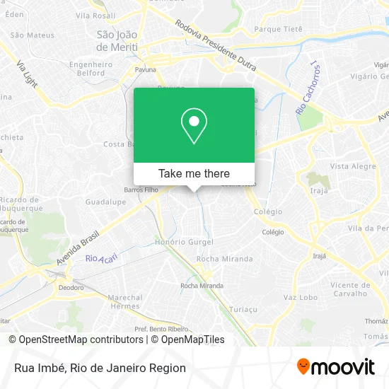
See Rua Imbé, Coelho Neto, on the map
Public Transit to Rua Imbé in Coelho Neto
Wondering how to get to Rua Imbé in Coelho Neto? Moovit helps you find the best way to get to Rua Imbé with step-by-step directions from the nearest public transit station.
Moovit provides free maps and live directions to help you navigate through your city. View schedules, routes, timetables, and find out how long does it take to get to Rua Imbé in real time.
Looking for the nearest stop or station to Rua Imbé? Check out this list of stops closest to your destination: Rua Ururaí; Rua Dos Diamantes; Honório Gurgel; Avenida Dos Italianos; Avenida Brasil | Fazenda Botafogo (Sentido Centro); Avenida Brasil - Passarela 28 (Fazenda Botafogo); Fazenda Botafogo; Coelho Neto.
Bus: 1901T, 685, 715L, 729L, SVB 685, LECD141, 711, SN 685, SVA 685, 362, SR 362, 713L, 720L, 112B, 113D, 119T, 121T, 124B.Metro: L2.Train: RAMAL BELFORD ROXO.
Want to see if there’s another route that gets you there at an earlier time? Moovit helps you find alternative routes or times. Get directions from and directions to Rua Imbé easily from the Moovit App or Website.
We make riding to Rua Imbé easy, which is why over 1.7 million users, including users in Coelho Neto, trust Moovit as the best app for public transit. You don’t need to download an individual bus app or train app, Moovit is your all-in-one transit app that helps you find the best bus time or train time available.
For information on prices of bus and train, costs and ride fares to Rua Imbé, please check the Moovit app.
Use the app to navigate to popular places including to the airport, hospital, stadium, grocery store, mall, coffee shop, school, college, and university.
Rua Imbé Address: Coelho Neto Rio de Janeiro-RJ street in Coelho Neto
- ETR Marechal Hermes,
- Centro Médico Rocha Miranda,
- Rua Jatuaia 55,
- Rua Mambucaba,
- 5 CRE,
- Rua Macabu, 546,
- Rua Guaxindiba, 191,
- Vila Olímpica de Honório Gurgel,
- Paróquia Santa Teresa de Jesus,
- Rua Serafim Braga,
- ponto 685,
- Rua dos Diamantes,
- Distribuidora Cummins Brasil,
- Rua José Barbosa,
- Grupo Cristao Espirita Cantinho do Oriente,
- Aga Gás,
- Maria Inacia Carrageta Cavalcanti,
- Casa De Macumba Peba's,
- Edi Karine Lorraine Chagas de Oliveira,
- Rua Ururaí
Places Near Rua Imbé (Coelho Neto)
- Hospital Federal Do Andaraí, Andaraí,
- Shopping Rio Sul, Botafogo,
- Norte Shopping, Cachambi,
- Avenida Rio Branco, Centro,
- Feira Livre da Gloria, Glória,
- Shopping RioSul, Botafogo,
- Praia do Arpoador, Ipanema,
- Hospital Federal Cardoso Fontes, Jacarepaguá,
- Rio De Janeiro,
- Feirão De Malhas, Duque De Caxias,
- Avenida Venezuela 134, Saúde,
- Hospital Pedro Ernesto, Vila Isabel,
- Shopping Nova América, Del Castilho,
- Rodoviária Novo Rio (Rodoviária do Rio de Janeiro), Santo Cristo,
- Shopping Downtown, Barra Da Tijuca,
- Museu Do Amanhã, Centro,
- Hospital Municipal Ronaldo Gazolla, Acari,
- Rua Ulysses Guimarães 16, Cidade Nova,
- Rua Licínio Cardoso, São Francisco Xavier,
- Niterói, Niterói
How to get to popular places in Rio de Janeiro Region with public transit
Get around Coelho Neto by public transit!
Traveling around Coelho Neto has never been so easy. See step by step directions as you travel to any attraction, street or major public transit station. View bus and train schedules, arrival times, service alerts and detailed routes on a map, so you know exactly how to get to anywhere in Coelho Neto.
When traveling to any destination around Coelho Neto use Moovit's Live Directions with Get Off Notifications to know exactly where and how far to walk, how long to wait for your line, and how many stops are left. Moovit will alert you when it's time to get off — no need to constantly re-check whether yours is the next stop.
Wondering how to use public transit in Coelho Neto or how to pay for public transit in Coelho Neto? Moovit public transit app can help you navigate your way with public transit easily, and at minimum cost. It includes public transit fees, ticket prices, and costs. Looking for a map of Coelho Neto public transit lines? Moovit public transit app shows all public transit maps in Coelho Neto with all Bus, Train, Metro, Light Rail, Ferry, Cable Car, Gondola and Funicular routes and stops on an interactive map.
Rio de Janeiro Region has 8 transit type(s), including: Bus, Train, Metro, Light Rail, Ferry, Cable Car, Gondola and Funicular, operated by several transit agencies, including TrensRJ, Metrô Rio, VLT Carioca, Barcas Rio, BRT MOBI-Rio, Auto Viação Alpha, Auto Viação Tijuca, Gire Transportes, Transurb, Viação Nossa Senhora das Graças, Consórcio INTERSUL, Braso Lisboa (Municipal), Caprichosa Auto Ônibus, Auto Viação Três Amigos and Rodoviária Âncora Matias