Rua Ipiranga, 112 stop - Monday schedule
| Line | Direction | Time |
|---|---|---|
| 7660 | - Petrolândia ⇄ B.H. | Ida & Volta | 5:45 AM |
| 7700 | - Tropical ⇄ B.H. | Ida & Volta | 6:14 AM |
| 7660 | - Petrolândia ⇄ B.H. | Ida & Volta | 6:18 AM |
| 7700 | - Tropical ⇄ B.H. | Ida & Volta | 6:32 AM |
| 7660 | - Petrolândia ⇄ B.H. | Ida & Volta | 6:42 AM |
| 7700 | - Tropical ⇄ B.H. | Ida & Volta | 6:51 AM |
| 7660 | - Petrolândia ⇄ B.H. | Ida & Volta | 6:58 AM |
| 7700 | - Tropical ⇄ B.H. | Ida & Volta | 7:08 AM |
| 7660 | - Petrolândia ⇄ B.H. | Ida & Volta | 7:11 AM |
| 7700 | AL - Nascentes Imperiais ⇄ B.H. | Ida & Volta | 7:21 AM |
| 7700 | - Tropical ⇄ B.H. | Ida & Volta | 7:39 AM |
| 7660 | - Petrolândia ⇄ B.H. | Ida & Volta | 7:44 AM |
| 7700 | - Tropical ⇄ B.H. | Ida & Volta | 8:00 AM |
| 7700 | - Tropical ⇄ B.H. | Ida & Volta | 8:06 AM |
| 7700 | - Tropical ⇄ B.H. | Ida & Volta | 8:16 AM |
| 7660 | - Petrolândia ⇄ B.H. | Ida & Volta | 8:16 AM |
| 7700 | - Tropical ⇄ B.H. | Ida & Volta | 8:36 AM |
| 7700 | - Tropical ⇄ B.H. | Ida & Volta | 10:01 AM |
| 7660 | - Petrolândia ⇄ B.H. | Ida & Volta | 10:41 AM |
| 7700 | - Tropical ⇄ B.H. | Ida & Volta | 10:51 AM |
| 7700 | - Tropical ⇄ B.H. | Ida & Volta | 11:28 AM |
| 7700 | - Tropical ⇄ B.H. | Ida & Volta | 12:09 PM |
| 7700 | - Tropical ⇄ B.H. | Ida & Volta | 12:17 PM |
| 7700 | - Tropical ⇄ B.H. | Ida & Volta | 12:48 PM |
| 7660 | - Petrolândia ⇄ B.H. | Ida & Volta | 1:23 PM |
Directions to Rua Ipiranga, 112 stop (Contagem) with public transit
The following transit lines have routes that pass near Rua Ipiranga, 112
 Bus: 301A, 305A, 307A, 307B, 7660.
How to get to Rua Ipiranga, 112 stop by bus?
Click on the bus route to see step by step directions with maps, line arrival times and updated time schedules.
Bus stops near Rua Ipiranga, 112 stop in Contagem
- Rua Da Gasolina, 142, 2 min walk,
- Rua Gasolina 154 Contagem - Minas Gerais 32619 Brasil, 2 min walk,
- 326913545, 3 min walk,
- Rua Mato Grosso, 415, 7 min walk,
Bus lines to Rua Ipiranga, 112 stop in Contagem
- 7660, - Petrolândia ⇄ B.H. | Ida & Volta,
- 7700, AL - Nascentes Imperiais ⇄ B.H. | Ida & Volta,
- 7711, Sapucaia Via Tropical ⇄ B.H.,
- 301A, RI-Tropical/Petrolândia/Eldorado/Metrô,
- 305B, Tropical/Petrol./PUC/Carref/Cid.Ind/Metrô/P.M.C.,
- 305D, RI-Estâncias Imperiais/Petrolândia/Centro/Metrô,
- 307A, Sapucaias/Petrolândia/Prefeitura/ Metrô/Cid. Ind.,
- 307B, Sapucaias/São Luiz/Metrô/Bernardo Monteiro,
- 305A, Tropical/Centro/Metrô/Cid.Ind./Carrefour/PUC,
- 2590, - Vila Cristina ⇄ Estação Eldorado | Ida & Volta,
- 2600, Cidade Industrial ➞ Duque De Caxias (P.I.),
What are the closest stations to Rua Ipiranga, 112?
The closest stations to Rua Ipiranga, 112 are:
- Rua Da Gasolina, 142 stop is 141 meters away, 2 min walk.
- Rua Gasolina 154 Contagem - Minas Gerais 32619 Brasil stop is 141 meters away, 2 min walk.
- 326913545 stop is 198 meters away, 3 min walk.
- Rua Mato Grosso, 415 stop is 478 meters away, 7 min walk.
Which bus lines stop near Rua Ipiranga, 112?
These bus lines stop near Rua Ipiranga, 112: 301A, 305A, 307A, 307B, 7660, 7700.
What’s the nearest bus station to Rua Ipiranga, 112 in Contagem?
The nearest bus stations to Rua Ipiranga, 112 in Contagem are Rua Da Gasolina, 142 and Rua Gasolina 154 Contagem - Minas Gerais 32619 Brasil. The closest one is a 2 min walk away.
What time is the first bus to Rua Ipiranga, 112 in Contagem?
The 7660 is the first bus that goes to Rua Ipiranga, 112 in Contagem. It stops nearby at 4:09 AM.
What time is the last bus to Rua Ipiranga, 112 in Contagem?
The 307A is the last bus that goes to Rua Ipiranga, 112 in Contagem. It stops nearby at 1:06 AM.
Rua Ipiranga, 112 station
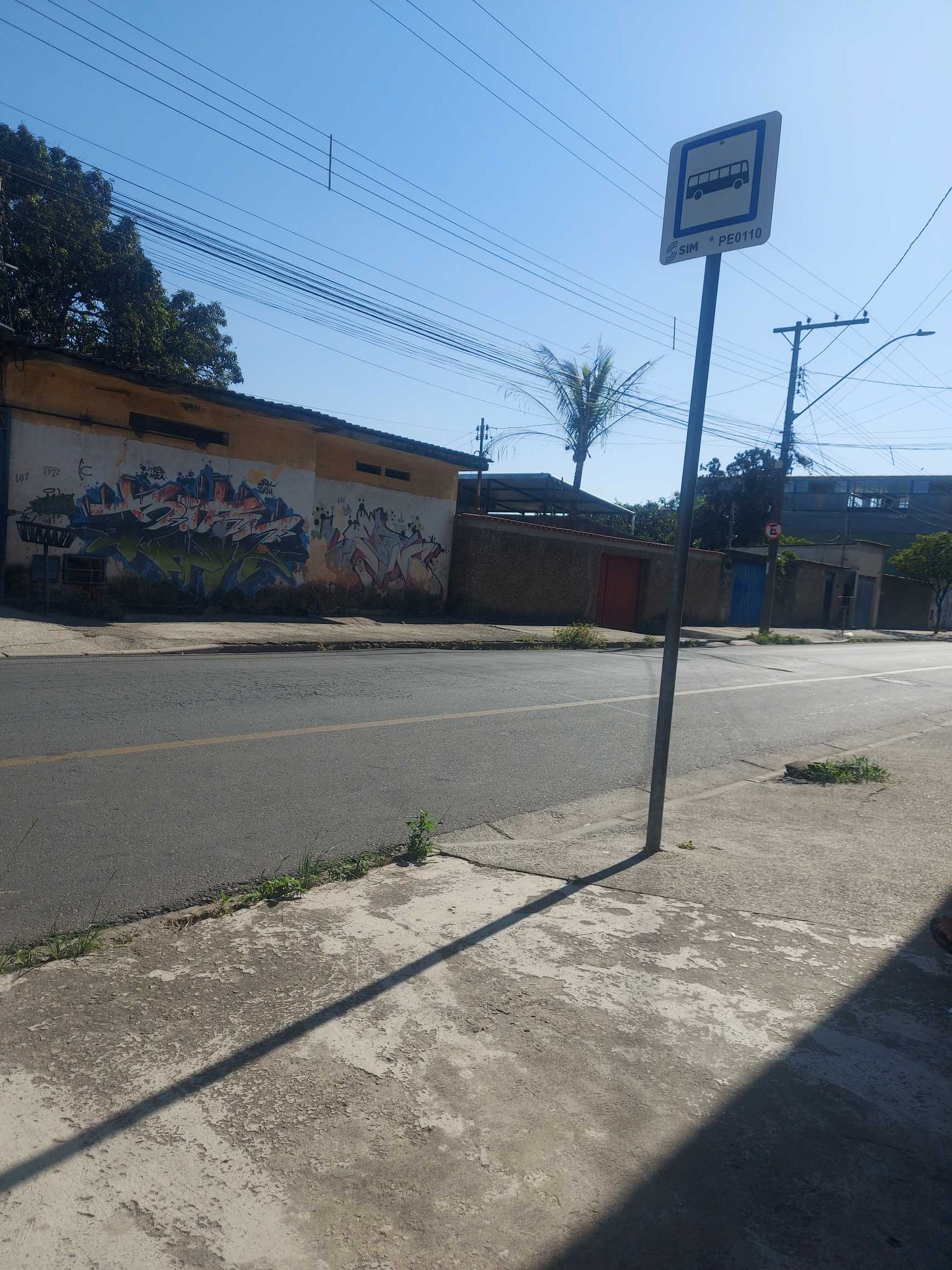 Taken by Marlene P.
See Rua Ipiranga, 112 stop, Contagem, on the map
Public transit to Rua Ipiranga, 112 stop (ID: 339) in Contagem
Looking for directions to Rua Ipiranga, 112 in Contagem, Brazil?
Download the Moovit App to find the current schedule and step-by-step directions for Bus routes that pass through Rua Ipiranga, 112.
Looking for the nearest stops closest to Rua Ipiranga, 112 ? Check out this list of closest stops to your destination: Rua Da Gasolina; Rua Gasolina 154 Contagem - Minas Gerais 32619 Brasil; 326913545; Rua Mato Grosso.
Bus: 301A, 305A, 307A, 307B, 7660, 7700, 305B, 305D, 7711, 2590, 2600.
We make riding on public transit to Rua Ipiranga, 112 easy, which is why over 1.7 billion users, including users in Contagem trust Moovit as the best app for public transit.
Use the app to navigate to popular places including to the airport, hospital, stadium, grocery store, mall, coffee shop, school, college, and university.
Rua Ipiranga, 112 stop’s code is 339
The first line to this stop is 7660, at 5:45 AM, and the last line is 7711 at 12:11 AM.
112 Rua Ipiranga, Contagem, Brazil
This stop serves Transporte Coletivo Metropolitano de MG - (SEINFRA)’s lines
- Rua Da Gasolina, 142,
- Rua Gasolina 154 Contagem - Minas Gerais 32619 Brasil,
- 326913545,
- Rua Mato Grosso, 415
Bus stops near Rua Ipiranga, 112 stop
- Avenida Antonio Francisco Lisboa 192,
- Mg-432, Km 3,7 Oeste | Bairro Santa Cecília,
- Av. João César De Oliveira, 5757 | Pollyruber,
- Mg-030, Km 30,6 Sul,
- Av. Divino Marques Guimarães, 480,
- Av. Dr. Marco Paulo Simon Jardim, 980,
- Br-040, Km 503,8 Norte | Bairro Ipê Amarelo,
- Br-381 Rodovia Fernão Dias, Km 540 Sul | Santa Terezinha De Minas,
- Av. Denise Cristina Da Rocha, 2555 | Linhas Metropolitanas,
- Hospital Municipal Sentido Eldorado,
- Av. Dos Andradas, 3050,
- Br-381, Km 434,9 Sul,
- Estação Calafate,
- Ponto Final Da Linha 2390 No Ceasa,
- Av. São Paulo, 1104 | Upa/Maternidade De Ibirité,
- Via Municipal Vereador Joaquim Costa, 1405 - Centro Logístico Vm5,
- Via Expressa De Contagem, 450 | Passarela De Acesso A Est. Eldorado,
- Br-381 Rod. Fernão Dias, Km 505,4 Sul,
- Av. Cristiano Machado, 7600,
- Br-381, Km 430,2 Norte
Popular public transit stations in Contagem
Get around Contagem by public transit!
Traveling around Contagem has never been so easy. See step by step directions as you travel to any attraction, street or major public transit station. View bus and train schedules, arrival times, service alerts and detailed routes on a map, so you know exactly how to get to anywhere in Contagem.
When traveling to any destination around Contagem use Moovit's Live Directions with Get Off Notifications to know exactly where and how far to walk, how long to wait for your line, and how many stops are left. Moovit will alert you when it's time to get off — no need to constantly re-check whether yours is the next stop.
Wondering how to use public transit in Contagem or how to pay for public transit in Contagem? Moovit public transit app can help you navigate your way with public transit easily, and at minimum cost. It includes public transit fees, ticket prices, and costs. Looking for a map of Contagem public transit lines? Moovit public transit app shows all public transit maps in Contagem with all Bus, Train and Metro routes and stops on an interactive map.
Belo Horizonte Region has 3 transit type(s), including: Bus, Train and Metro, operated by several transit agencies, including Grupo Comporte, BHTrans linhas convencionais, BHTrans Suplementar, Cidade Administrativa de Minas Gerais, Transporte Coletivo Metropolitano de MG - (SEINFRA), Transportadora Abreu & Souza, Viação Santa Edwiges | Linhas Transbetim, Transporte Complementar de Betim, RODAP | Municipais Santa Luzia, ViaOuro Coletivos | Municipais Nova Lima, TURI - Transporte Urbano Rodoviário e Intermunicipal Ltda, Cooperseltta, SIT Neves, Saritur Esmeraldas and CAF Transportes| Municipais Brumadinho