Directions to Rua Juá 32 (Uberaba) with public transportation
The following transit lines have routes that pass near Rua Juá 32
How to get to Rua Juá 32 by bus?
Click on the bus route to see step by step directions with maps, line arrival times and updated time schedules.
From Rua Voluntários da Pátria 400, Centro
45 minFrom Rua Emílio de Menezes, São Francisco
48 minFrom Rua Nova Aurora, Sítio Cercado
54 minFrom Alameda Júlia da Costa, Bigorrilho
50 minFrom Curitiba, Centro
39 minFrom Santa Quitéria, Santa Quitéria
61 minFrom Bairro Seminario - Urb.Curitiba/,PR, Seminário
49 minFrom Roseira De São Sebastião, São José Dos Pinhais
74 minFrom Sesi Senai, Cic
69 minFrom Avenida Presidente Getúlio Vargas, Água Verde
54 min
Bus stops near Rua Juá 32 in Uberaba
Bus lines to Rua Juá 32 in Uberaba
- 335 CENTENÁRIO / BOQUEIRÃO, Terminal Boqueirão → Terminal Centenário,VIEW
- 468 JARDIM CENTAURO, Jardim Centauro → Praça Rui Barbosa,VIEW
- 462 PETRÓPOLIS, Praça Rui Barbosa → Ouro Verde,VIEW
- 030 INTERBAIRROS III, Terminal Santa Cândida → Terminal Capão Raso,VIEW
- 489 MAD. PETRÓPOLIS / SOLITUDE, Praça Rui Barbosa ↺ Petrópolis / Solitude (Circular),VIEW
What are the closest stations to Rua Juá 32?
The closest stations to Rua Juá 32 are:
- R. Capitão Leônidas Marques, 2291 is 182 meters away, 3 min walk.
- R. Artur José Nísio, 366 is 433 meters away, 6 min walk.
- R. Henrique Mehl, 917 is 450 meters away, 7 min walk.
- R. Artur José Nísio, 289 is 460 meters away, 7 min walk.
Which bus lines stop near Rua Juá 32?
These bus lines stop near Rua Juá 32: 030 INTERBAIRROS III, 335 CENTENÁRIO / BOQUEIRÃO, 468 JARDIM CENTAURO.
What’s the nearest bus station to Rua Juá 32 in Uberaba?
The nearest bus station to Rua Juá 32 in Uberaba is R. Capitão Leônidas Marques, 2291. It’s a 3 min walk away.
What time is the first bus to Rua Juá 32 in Uberaba?
The 489 MAD. PETRÓPOLIS / SOLITUDE is the first bus that goes to Rua Juá 32 in Uberaba. It stops nearby at 3:18 AM.
What time is the last bus to Rua Juá 32 in Uberaba?
The 489 MAD. PETRÓPOLIS / SOLITUDE is the last bus that goes to Rua Juá 32 in Uberaba. It stops nearby at 2:19 AM.
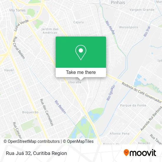
See Rua Juá 32, Uberaba, on the map
Public Transit to Rua Juá 32 in Uberaba
Wondering how to get to Rua Juá 32 in Uberaba? Moovit helps you find the best way to get to Rua Juá 32 with step-by-step directions from the nearest public transit station.
Moovit provides free maps and live directions to help you navigate through your city. View schedules, routes, timetables, and find out how long does it take to get to Rua Juá 32 in real time.
Looking for the nearest stop or station to Rua Juá 32? Check out this list of stops closest to your destination: R. Capitão Leônidas Marques; R. Artur José Nísio; R. Henrique Mehl; R. Artur José Nísio.
Bus: 030 INTERBAIRROS III, 335 CENTENÁRIO / BOQUEIRÃO, 468 JARDIM CENTAURO, 462 PETRÓPOLIS, 489 MAD. PETRÓPOLIS / SOLITUDE.
Want to see if there’s another route that gets you there at an earlier time? Moovit helps you find alternative routes or times. Get directions from and directions to Rua Juá 32 easily from the Moovit App or Website.
We make riding to Rua Juá 32 easy, which is why over 1.5 million users, including users in Uberaba, trust Moovit as the best app for public transit. You don’t need to download an individual bus app or train app, Moovit is your all-in-one transit app that helps you find the best bus time or train time available.
For information on prices of bus, costs and ride fares to Rua Juá 32, please check the Moovit app.
Use the app to navigate to popular places including to the airport, hospital, stadium, grocery store, mall, coffee shop, school, college, and university.
Rua Juá 32 Address: R. Juá, 32 - Uberaba, Curitiba - PR, 81550-020, Brasil street in Uberaba
- Rua Caja Manga 1006,
- Rua Capitão Leônidas Marques,
- Rua Dalila Lopes Costa 108,
- Rua Augusto Zibarth, 1233 - Uberaba,
- Rua Capitão Leônidas Marques,
- Associacao Da CEF,
- Rua Capitão Leônidas Marques 2727,
- Escola Municipal CEI Issa Nacli,
- Rua Gilda Pitarch Forcadell 340,
- Rua Caja Manga,
- Rua Louis Esquier 404,
- Condomínio Residencial Green Valley,
- Rua Alberto Pasqualini 900,
- Associação Caixa Federal,
- Academia Coliseo For Fitness,
- Rua Capitão Leônidas Marques,
- Uberaba De Cima,
- Apcef / PR - Associação do Pessoal da Cef do PR - Curitiba,
- Rua Capitão Leônidas Marques,
- Rua Cacau 141
Places Near Rua Juá 32 (Uberaba)
- Hospital do Rocio, Campo,
- Pontifícia Universidade Católica do Paraná (PUCPR), Prado Velho,
- Hospital Da Cruz Vermelha, Batel,
- Hospital Angelina Caron, Campina Grande Do Sul,
- Hospital Erasto Gaertner, Jardim Das Américas,
- Arena Da Baixada - Curitiba,
- Shopping Estação, Rebouças,
- Campo Largo, Campo,
- Rua Martim Afonso 558, Mercês,
- Parque Barigui, Mercês,
- Hospital Nossa Senhora Das Graças, Mercês,
- Hospital Universitário Evangélico de Curitiba, Bigorrilho,
- Jardim Botânico de Curitiba PR, Centro,
- Park Shopping Barigüi, Mossunguê,
- Jockey Plaza Shopping Center, Tarumã,
- Hhhhh, Fazendinha,
- Rua General Mário Tourinho, Campina Do Siqueira,
- Hospital de Clínicas (HC - UFPR), Centro,
- Shopping Palladium, Portão,
- Hospital Madalena Sofia, Bairro Alto
How to get to popular places in Curitiba Region with public transit
Get around Uberaba by public transit!
Traveling around Uberaba has never been so easy. See step by step directions as you travel to any attraction, street or major public transit station. View bus and train schedules, arrival times, service alerts and detailed routes on a map, so you know exactly how to get to anywhere in Uberaba.
When traveling to any destination around Uberaba use Moovit's Live Directions with Get Off Notifications to know exactly where and how far to walk, how long to wait for your line, and how many stops are left. Moovit will alert you when it's time to get off — no need to constantly re-check whether yours is the next stop.
Wondering how to use public transit in Uberaba or how to pay for public transit in Uberaba? Moovit public transit app can help you navigate your way with public transit easily, and at minimum cost. It includes public transit fees, ticket prices, and costs. Looking for a map of Uberaba public transit lines? Moovit public transit app shows all public transit maps in Uberaba with all Bus and Cable Car routes and stops on an interactive map.
Curitiba Region has 2 transit type(s), including: Bus and Cable Car, operated by several transit agencies, including Sistema Integrado de Mobilidade (URBS), Sistema Integrado de Mobilidade (AMEP), URBS (Cartões bancários e Dinheiro), URBS (Cartões bancários / Cartão URBS), AMEP (Cartões bancários / Cartão MetroCard), AMEP (Cartões bancários / Cartão MetroCard / Dinheiro), Viação Colombo (Dinheiro), TRIAR (Cartão TRIAR / Dinheiro), Empresa Curitiba Cerro Azul (Dinheiro), Expresso Nossa Senhora da Penha (Dinheiro), Empresa Campo Alto Tijucas (Dinheiro), Auto Viação São José (Cartão VEM / Dinheiro), BRT S/A (Cartão VEM / Dinheiro), TransPiedade (Cartão Cidadão / Dinheiro) and Oceânica Sul (Cartão Transporte / Dinheiro)