How to get to Rua Laranjeiras by bus?
Click on the bus route to see step by step directions with maps, line arrival times and updated time schedules.
From Village Mall (Shopping VillageMall), Barra Da Tijuca
50 minFrom Previdência Social - INSS, Bangu
74 minFrom Hospital Memorial, Engenho De Dentro
44 minFrom Hospital Vitória, Barra Da Tijuca
47 minFrom Avenida João de Cabral de Mello Neto 850, Barra Da Tijuca
40 minFrom Barra Shopping, Barra Da Tijuca
47 minFrom Shopping Barra World, Recreio Dos Bandeirantes
39 minFrom Maternidade Carmela Dutra, Lins De Vasconcelos
57 minFrom Realengo, Realengo
69 minFrom Guadalupe, Guadalupe
65 min
Bus stops near Rua Laranjeiras in Taquara
Bus lines to Rua Laranjeiras in Taquara
- 380, Curicica - Candelária (Brs 5 - Via Linha Amarela),VIEW
- 390, Curicica - Candelária (Brs 5 - Via Freguesia),VIEW
- SP 390, Curicica - Freguesia (Via Taquara),VIEW
- 611, Riocentro - Nova América / Del Castilho (Via Merck / Linha Amarela - Integração Com Metrô),VIEW
- SN 810, Taquara - Pontal (Via Estrada do Guerenguê),VIEW
- 861, Curicica (Via Floresta),VIEW
- SN 861, Curicica,VIEW
- 831, Colônia,VIEW
- SV 831, Taquara,VIEW
- 900, Colônia → Downtown,VIEW
What are the closest stations to Rua Laranjeiras?
The closest stations to Rua Laranjeiras are:
- Praça São Casemiro - Smtr is 752 meters away, 10 min walk.
- Estrada Do Outeiro Santo - Smtr is 806 meters away, 11 min walk.
- Estrada Rodrigues Caldas, 1400-1420 is 1076 meters away, 14 min walk.
- Estrada Rodrigues Caldas, 1223 is 1095 meters away, 15 min walk.
Which bus lines stop near Rua Laranjeiras?
These bus lines stop near Rua Laranjeiras: 390, 611.
What’s the nearest bus station to Rua Laranjeiras in Taquara?
The nearest bus station to Rua Laranjeiras in Taquara is Praça São Casemiro - Smtr. It’s a 10 min walk away.
What time is the first bus to Rua Laranjeiras in Taquara?
The SN 861 is the first bus that goes to Rua Laranjeiras in Taquara. It stops nearby at 3:07 AM.
What time is the last bus to Rua Laranjeiras in Taquara?
The SP 390 is the last bus that goes to Rua Laranjeiras in Taquara. It stops nearby at 3:09 AM.
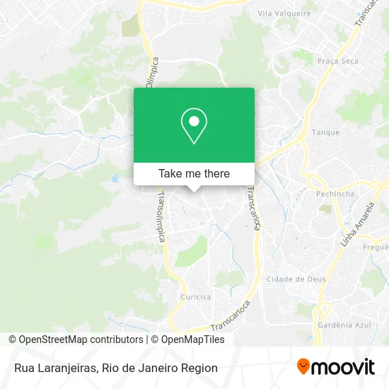
See Rua Laranjeiras, Taquara, on the map
Public Transit to Rua Laranjeiras in Taquara
Wondering how to get to Rua Laranjeiras in Taquara? Moovit helps you find the best way to get to Rua Laranjeiras with step-by-step directions from the nearest public transit station.
Moovit provides free maps and live directions to help you navigate through your city. View schedules, routes, timetables, and find out how long does it take to get to Rua Laranjeiras in real time.
Looking for the nearest stop or station to Rua Laranjeiras? Check out this list of stops closest to your destination: Praça São Casemiro - Smtr; Estrada Do Outeiro Santo - Smtr; Estrada Rodrigues Caldas; Estrada Rodrigues Caldas.
Bus: 390, 611, 380, SP 390, SN 810, 861, SN 861, 831, SV 831, 900.
Want to see if there’s another route that gets you there at an earlier time? Moovit helps you find alternative routes or times. Get directions from and directions to Rua Laranjeiras easily from the Moovit App or Website.
We make riding to Rua Laranjeiras easy, which is why over 1.5 million users, including users in Taquara, trust Moovit as the best app for public transit. You don’t need to download an individual bus app or train app, Moovit is your all-in-one transit app that helps you find the best bus time or train time available.
For information on prices of bus, costs and ride fares to Rua Laranjeiras, please check the Moovit app.
Use the app to navigate to popular places including to the airport, hospital, stadium, grocery store, mall, coffee shop, school, college, and university.
Rua Laranjeiras Address: R. Laranjeiras - Pavuna, Rio de Janeiro - RJ, 21650-600, Brasil street in Taquara
- Rua Pau Brasil,
- Estrada do Outeiro Santo 742,
- Rua Leny Eversong, 141,
- Rua Trinca Ferro,
- Colegio Santa Monica Taquara,
- Praça Mapuá / Rua Chan Chão,
- Largo do Remi,
- Estrada Mapuá 302b,
- Estrada Mapuá / Rua Laranjeira,
- Praça Mapuá,
- Estrada Mapuá, 742,
- Rua Nadim Zeidam Ac Est Outeiro Santo 16,
- Estrada Mapuá 491,
- Estrada do Mapuá,
- Biomérieux Brasil sa,
- Sacolao Rm,
- Bar do Jayme Maia,
- Deposito De Bebidas E Mercearia Dagostover,
- Rua Nadim Zeidan,
- Rua Bem-te-vi de Coroa
Places Near Rua Laranjeiras (Taquara)
- Rio De Janeiro,
- Hospital Federal Do Andaraí, Andaraí,
- Avenida Rio Branco, Centro,
- Hospital Pedro Ernesto, Vila Isabel,
- Hospital Federal Cardoso Fontes, Jacarepaguá,
- Hospital Municipal Ronaldo Gazolla, Acari,
- Rodoviária Novo Rio (Rodoviária do Rio de Janeiro), Santo Cristo,
- Feira Livre da Gloria, Glória,
- Feirão De Malhas, Duque De Caxias,
- Niterói, Niterói,
- Praia do Arpoador, Ipanema,
- Rua Ulysses Guimarães 16, Cidade Nova,
- Avenida Venezuela 134, Saúde,
- Rua Licínio Cardoso, São Francisco Xavier,
- Norte Shopping, Cachambi,
- Museu Do Amanhã, Centro,
- Shopping Rio Sul, Botafogo,
- Shopping Nova América, Del Castilho,
- Shopping RioSul, Botafogo,
- Shopping Downtown, Barra Da Tijuca
How to get to popular places in Rio de Janeiro Region with public transit
Get around Taquara by public transit!
Traveling around Taquara has never been so easy. See step by step directions as you travel to any attraction, street or major public transit station. View bus and train schedules, arrival times, service alerts and detailed routes on a map, so you know exactly how to get to anywhere in Taquara.
When traveling to any destination around Taquara use Moovit's Live Directions with Get Off Notifications to know exactly where and how far to walk, how long to wait for your line, and how many stops are left. Moovit will alert you when it's time to get off — no need to constantly re-check whether yours is the next stop.
Wondering how to use public transit in Taquara or how to pay for public transit in Taquara? Moovit public transit app can help you navigate your way with public transit easily, and at minimum cost. It includes public transit fees, ticket prices, and costs. Looking for a map of Taquara public transit lines? Moovit public transit app shows all public transit maps in Taquara with all Bus, Train, Metro, Light Rail, Ferry, Cable Car, Gondola and Funicular routes and stops on an interactive map.
Rio de Janeiro Region has 8 transit type(s), including: Bus, Train, Metro, Light Rail, Ferry, Cable Car, Gondola and Funicular, operated by several transit agencies, including TrensRJ, Metrô Rio, VLT Carioca, Barcas Rio, BRT MOBI-Rio, Auto Viação Alpha, Auto Viação Tijuca, Gire Transportes, Transurb, Viação Nossa Senhora das Graças, Consórcio INTERSUL, Braso Lisboa (Municipal), Caprichosa Auto Ônibus, Auto Viação Três Amigos and Rodoviária Âncora Matias