Directions to Rua Leverger (Duque De Caxias) with public transportation
The following transit lines have routes that pass near Rua Leverger
 Bus: 018, 1415C (EXECUTIVO), 011, 29, 28.
- Train: RAMAL SARACURUNA.
How to get to Rua Leverger by bus?
Click on the bus route to see step by step directions with maps, line arrival times and updated time schedules.
From Guadalupe, Guadalupe
63 minFrom Hospital Municipal Ronaldo Gazolla, Acari
51 minFrom Rua Calumbi, 39, Irajá
58 minFrom Shopping Jardim Guadalupe, Guadalupe
54 minFrom CEASA-RJ, Irajá
55 minFrom Vista Alegre, Vista Alegre
47 minFrom Coelho Neto, Coelho Neto
50 minFrom Figueira, Duque De Caxias
59 minFrom Vicente De Carvalho, Vicente De Carvalho
53 minFrom Pilar, Duque De Caxias
51 min
How to get to Rua Leverger by train?
Click on the train route to see step by step directions with maps, line arrival times and updated time schedules.
Bus stops near Rua Leverger in Duque De Caxias
Train station near Rua Leverger in Duque De Caxias
- Gramacho, 19 min walk,VIEW
Bus lines to Rua Leverger in Duque De Caxias
What are the closest stations to Rua Leverger?
The closest stations to Rua Leverger are:
- Rua Lerverger is 17 meters away, 1 min walk.
- Rua Ivai, 30 is 93 meters away, 2 min walk.
- Rua Pedro Lessa, 1629 is 361 meters away, 5 min walk.
- Rua Pedro Lessa, 1036 is 426 meters away, 6 min walk.
- Ponto Final Linha 011 is 540 meters away, 7 min walk.
- Gramacho is 1443 meters away, 19 min walk.
Which bus lines stop near Rua Leverger?
These bus lines stop near Rua Leverger: 018, 1415C (EXECUTIVO).
Which train line stops near Rua Leverger?
RAMAL SARACURUNA (Gramacho)
What’s the nearest train station to Rua Leverger in Duque De Caxias?
The nearest train station to Rua Leverger in Duque De Caxias is Gramacho. It’s a 19 min walk away.
What’s the nearest bus station to Rua Leverger in Duque De Caxias?
The nearest bus station to Rua Leverger in Duque De Caxias is Rua Lerverger. It’s a 1 min walk away.
What time is the first train to Rua Leverger in Duque De Caxias?
The RAMAL SARACURUNA is the first train that goes to Rua Leverger in Duque De Caxias. It stops nearby at 4:22 AM.
What time is the last train to Rua Leverger in Duque De Caxias?
The RAMAL SARACURUNA is the last train that goes to Rua Leverger in Duque De Caxias. It stops nearby at 11:24 PM.
What time is the first bus to Rua Leverger in Duque De Caxias?
The 28 is the first bus that goes to Rua Leverger in Duque De Caxias. It stops nearby at 4:01 AM.
What time is the last bus to Rua Leverger in Duque De Caxias?
The 415C is the last bus that goes to Rua Leverger in Duque De Caxias. It stops nearby at 3:44 AM.
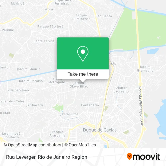
See Rua Leverger, Duque De Caxias, on the map
Public Transit to Rua Leverger in Duque De Caxias
Wondering how to get to Rua Leverger in Duque De Caxias? Moovit helps you find the best way to get to Rua Leverger with step-by-step directions from the nearest public transit station.
Moovit provides free maps and live directions to help you navigate through your city. View schedules, routes, timetables, and find out how long does it take to get to Rua Leverger in real time.
Looking for the nearest stop or station to Rua Leverger? Check out this list of stops closest to your destination: Rua Lerverger; Rua Ivai; Rua Pedro Lessa; Rua Pedro Lessa; Ponto Final Linha 011; Gramacho.
Bus: 018, 1415C (EXECUTIVO), 011, 29, 28, 415C, 419C.Train: RAMAL SARACURUNA.
Want to see if there’s another route that gets you there at an earlier time? Moovit helps you find alternative routes or times. Get directions from and directions to Rua Leverger easily from the Moovit App or Website.
We make riding to Rua Leverger easy, which is why over 1.5 million users, including users in Duque De Caxias, trust Moovit as the best app for public transit. You don’t need to download an individual bus app or train app, Moovit is your all-in-one transit app that helps you find the best bus time or train time available.
For information on prices of bus and train, costs and ride fares to Rua Leverger, please check the Moovit app.
Use the app to navigate to popular places including to the airport, hospital, stadium, grocery store, mall, coffee shop, school, college, and university.
Rua Leverger Address: Olavo Bilac Duque de Caxias-RJ street in Duque De Caxias
- Rua Cassiporé,
- Praça Expedicionário,
- Rua Brás Cubas,
- Olavo Bilac,
- Top Grill,
- Loja da Re,
- Rosangela Ramos da Silva,
- Salão de festas Raaj,
- Rua J. J. Seabra, 1,
- Invicta do Bilac Madeiras,
- Linha 011 - Jardim Leal X Caxias,
- Varandão Do Bilac,
- Jardim Olavo Bilac,
- Em Alto da Boa Vista,
- Colégio Setembro,
- Rua Pedro Lessa 1631,
- Colegio Omega,
- Rua Brás Cubas Próximo ao 576-604,
- Escola Municipal Alto da Boa Vista,
- Supermercados Rede Economia Do Bilac
Places Near Rua Leverger (Duque De Caxias)
- Shopping RioSul, Botafogo,
- Hospital Federal Do Andaraí, Andaraí,
- Praia do Arpoador, Ipanema,
- Hospital Federal Cardoso Fontes, Jacarepaguá,
- Avenida Rio Branco, Centro,
- Rodoviária Novo Rio (Rodoviária do Rio de Janeiro), Santo Cristo,
- Hospital Municipal Ronaldo Gazolla, Acari,
- Shopping Rio Sul, Botafogo,
- Museu Do Amanhã, Centro,
- Rua Ulysses Guimarães 16, Cidade Nova,
- Feirão De Malhas, Duque De Caxias,
- Shopping Nova América, Del Castilho,
- Shopping Downtown, Barra Da Tijuca,
- Niterói, Niterói,
- Rio De Janeiro,
- Feira Livre da Gloria, Glória,
- Norte Shopping, Cachambi,
- Avenida Venezuela 134, Saúde,
- Rua Licínio Cardoso, São Francisco Xavier,
- Hospital Pedro Ernesto, Vila Isabel
How to get to popular places in Rio de Janeiro Region with public transit
Get around Duque De Caxias by public transit!
Traveling around Duque De Caxias has never been so easy. See step by step directions as you travel to any attraction, street or major public transit station. View bus and train schedules, arrival times, service alerts and detailed routes on a map, so you know exactly how to get to anywhere in Duque De Caxias.
When traveling to any destination around Duque De Caxias use Moovit's Live Directions with Get Off Notifications to know exactly where and how far to walk, how long to wait for your line, and how many stops are left. Moovit will alert you when it's time to get off — no need to constantly re-check whether yours is the next stop.
Wondering how to use public transit in Duque De Caxias or how to pay for public transit in Duque De Caxias? Moovit public transit app can help you navigate your way with public transit easily, and at minimum cost. It includes public transit fees, ticket prices, and costs. Looking for a map of Duque De Caxias public transit lines? Moovit public transit app shows all public transit maps in Duque De Caxias with all Bus, Train, Metro, Light Rail, Ferry, Cable Car, Gondola and Funicular routes and stops on an interactive map.
Rio de Janeiro Region has 8 transit type(s), including: Bus, Train, Metro, Light Rail, Ferry, Cable Car, Gondola and Funicular, operated by several transit agencies, including TrensRJ, Metrô Rio, VLT Carioca, Barcas Rio, BRT MOBI-Rio, Auto Viação Alpha, Auto Viação Tijuca, Gire Transportes, Transurb, Viação Nossa Senhora das Graças, Consórcio INTERSUL, Braso Lisboa (Municipal), Caprichosa Auto Ônibus, Auto Viação Três Amigos and Rodoviária Âncora Matias