Directions to Rua Marcos Bertoldi 538 (Campo De Santana) with public transportation
The following transit lines have routes that pass near Rua Marcos Bertoldi 538
How to get to Rua Marcos Bertoldi 538 by bus?
Click on the bus route to see step by step directions with maps, line arrival times and updated time schedules.
From Terminal do Pinheirinho, Pinheirinho
60 minFrom Rua Engenheiro José B. Muniz de Queiroz, Cic
58 minFrom UPA 24h - Unidade De Pronto Atendimento Barigui, Cic
45 minFrom Rua Francisco Dranka, Araucária
41 minFrom Posigraf, Cic
53 minFrom Cidade da Lapa (PR), Capão Raso
60 minFrom Rua João Chede, Cic
34 minFrom Rua Primeiro de Maio, Xaxim
64 minFrom Rodovia Régis Bittencourt (BR-116), Cic
37 minFrom Avenida das Industrias 1974, Cic
50 min
Bus stops near Rua Marcos Bertoldi 538 in Campo De Santana
Bus lines to Rua Marcos Bertoldi 538 in Campo De Santana
- I11 ARAUCÁRIA / FAZENDA, Terminal Araucária → Terminal Fazenda,VIEW
- 685 RIO BONITO / CIC, Terminal CIC → Rio Bonito,VIEW
- X38 RIO BONITO (SEMI-DIRETO), Terminal Pinheirinho → Rio Bonito,VIEW
- 679 MAD. TATUQUARA, Terminal Pinheirinho ↺ Tatuquara (Circular),VIEW
- 684 RIO BONITO, Rio Bonito → Terminal Pinheirinho,VIEW
What are the closest stations to Rua Marcos Bertoldi 538?
The closest stations to Rua Marcos Bertoldi 538 are:
- R. Marcos Bertoldi, 538 is 88 meters away, 2 min walk.
- R. Marcos Bertoldi, 344 is 265 meters away, 4 min walk.
Which bus lines stop near Rua Marcos Bertoldi 538?
These bus lines stop near Rua Marcos Bertoldi 538: 684 RIO BONITO, 685 RIO BONITO / CIC, I11 ARAUCÁRIA / FAZENDA.
What’s the nearest bus station to Rua Marcos Bertoldi 538 in Campo De Santana?
The nearest bus station to Rua Marcos Bertoldi 538 in Campo De Santana is R. Marcos Bertoldi, 538. It’s a 2 min walk away.
What time is the first bus to Rua Marcos Bertoldi 538 in Campo De Santana?
The 679 MAD. TATUQUARA is the first bus that goes to Rua Marcos Bertoldi 538 in Campo De Santana. It stops nearby at 3:32 AM.
What time is the last bus to Rua Marcos Bertoldi 538 in Campo De Santana?
The 679 MAD. TATUQUARA is the last bus that goes to Rua Marcos Bertoldi 538 in Campo De Santana. It stops nearby at 2:00 AM.
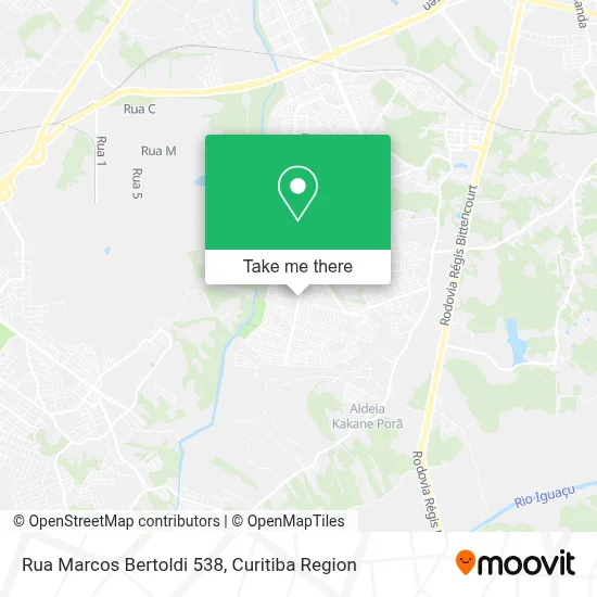
See Rua Marcos Bertoldi 538, Campo De Santana, on the map
Public Transit to Rua Marcos Bertoldi 538 in Campo De Santana
Wondering how to get to Rua Marcos Bertoldi 538 in Campo De Santana? Moovit helps you find the best way to get to Rua Marcos Bertoldi 538 with step-by-step directions from the nearest public transit station.
Moovit provides free maps and live directions to help you navigate through your city. View schedules, routes, timetables, and find out how long does it take to get to Rua Marcos Bertoldi 538 in real time.
Looking for the nearest stop or station to Rua Marcos Bertoldi 538? Check out this list of stops closest to your destination: R. Marcos Bertoldi; R. Marcos Bertoldi.
Bus: 684 RIO BONITO, 685 RIO BONITO / CIC, I11 ARAUCÁRIA / FAZENDA, X38 RIO BONITO (SEMI-DIRETO), 679 MAD. TATUQUARA.
Want to see if there’s another route that gets you there at an earlier time? Moovit helps you find alternative routes or times. Get directions from and directions to Rua Marcos Bertoldi 538 easily from the Moovit App or Website.
We make riding to Rua Marcos Bertoldi 538 easy, which is why over 1.5 million users, including users in Campo De Santana, trust Moovit as the best app for public transit. You don’t need to download an individual bus app or train app, Moovit is your all-in-one transit app that helps you find the best bus time or train time available.
For information on prices of bus, costs and ride fares to Rua Marcos Bertoldi 538, please check the Moovit app.
Use the app to navigate to popular places including to the airport, hospital, stadium, grocery store, mall, coffee shop, school, college, and university.
Rua Marcos Bertoldi 538 Address: R. Marcos Bertoldi, 538 - Campo de Santana, Curitiba - PR, 81490-530, Brasil street in Campo De Santana
- Novo Horizonte Construtora Ltda,
- Panificadora e Confeitaria Delícias do Trigo,
- Igreja Mundial Do Poder De Deus,
- Supermercado Roca Grande,
- Rua Adolfo Ançay,
- Rua Radialista Wilson Brustolin,
- Marcenaria Wood Line,
- Colégio Estadual Nirlei Medeiros,
- Dulce Mania,
- Rua Antônio Bertoldi 409,
- Le Cosmeticos e Acessorios,
- Big Shop Campo do Santana,
- Frangomir Casa dos Assados,
- Estudio Jbn,
- Academia Pop Fitness,
- Escola Municipal Helena Kolody,
- Dom Favero Pizzaria,
- Rua Neusa Gusso 291,
- M J a Souza Materiais de Construcao,
- Rua Adolpho Bertoldi
Places Near Rua Marcos Bertoldi 538 (Campo De Santana)
- Hospital Nossa Senhora Das Graças, Mercês,
- Park Shopping Barigüi, Mossunguê,
- Jardim Botânico de Curitiba PR, Centro,
- Rua Martim Afonso 558, Mercês,
- Hospital Madalena Sofia, Bairro Alto,
- Shopping Estação, Rebouças,
- Parque Barigui, Mercês,
- Hospital de Clínicas (HC - UFPR), Centro,
- Hospital Universitário Evangélico de Curitiba, Bigorrilho,
- Arena Da Baixada - Curitiba,
- Rua General Mário Tourinho, Campina Do Siqueira,
- Hospital Erasto Gaertner, Jardim Das Américas,
- Hhhhh, Fazendinha,
- Hospital Da Cruz Vermelha, Batel,
- Shopping Palladium, Portão,
- Campo Largo, Campo,
- Hospital do Rocio, Campo,
- Pontifícia Universidade Católica do Paraná (PUCPR), Prado Velho,
- Jockey Plaza Shopping Center, Tarumã,
- Hospital Angelina Caron, Campina Grande Do Sul
How to get to popular places in Curitiba Region with public transit
Get around Campo De Santana by public transit!
Traveling around Campo De Santana has never been so easy. See step by step directions as you travel to any attraction, street or major public transit station. View bus and train schedules, arrival times, service alerts and detailed routes on a map, so you know exactly how to get to anywhere in Campo De Santana.
When traveling to any destination around Campo De Santana use Moovit's Live Directions with Get Off Notifications to know exactly where and how far to walk, how long to wait for your line, and how many stops are left. Moovit will alert you when it's time to get off — no need to constantly re-check whether yours is the next stop.
Wondering how to use public transit in Campo De Santana or how to pay for public transit in Campo De Santana? Moovit public transit app can help you navigate your way with public transit easily, and at minimum cost. It includes public transit fees, ticket prices, and costs. Looking for a map of Campo De Santana public transit lines? Moovit public transit app shows all public transit maps in Campo De Santana with all Bus and Cable Car routes and stops on an interactive map.
Curitiba Region has 2 transit type(s), including: Bus and Cable Car, operated by several transit agencies, including Sistema Integrado de Mobilidade (URBS), Sistema Integrado de Mobilidade (AMEP), URBS (Cartões bancários e Dinheiro), URBS (Cartões bancários / Cartão URBS), AMEP (Cartões bancários / Cartão MetroCard), AMEP (Cartões bancários / Cartão MetroCard / Dinheiro), Viação Colombo (Dinheiro), TRIAR (Cartão TRIAR / Dinheiro), Empresa Curitiba Cerro Azul (Dinheiro), Expresso Nossa Senhora da Penha (Dinheiro), Empresa Campo Alto Tijucas (Dinheiro), Auto Viação São José (Cartão VEM / Dinheiro), BRT S/A (Cartão VEM / Dinheiro), TransPiedade (Cartão Cidadão / Dinheiro) and Oceânica Sul (Cartão Transporte / Dinheiro)