How to get to Rua Prefeito Ribeiro by bus?
Click on the bus route to see step by step directions with maps, line arrival times and updated time schedules.
From Aeroporto Galeão, Galeão
48 minFrom Feira de Areia Branca, Belford Roxo
56 minFrom Vila Valqueire, Vila Valqueire
76 minFrom Avenida Itaóca, Bonsucesso
50 minFrom Estrada Adhemar Bebiano, Del Castilho
41 minFrom BRT - Estação Madureira, Madureira
54 minFrom Refinaria Duque de Caxias (REDUC), Duque De Caxias
50 minFrom Pilar, Duque De Caxias
59 minFrom Avenida Monsenhor Félix, Irajá
44 minFrom Praça Dos Lavradores, Madureira
64 min
How to get to Rua Prefeito Ribeiro by train?
Click on the train route to see step by step directions with maps, line arrival times and updated time schedules.
Bus stops near Rua Prefeito Ribeiro in Duque De Caxias
Metro station near Rua Prefeito Ribeiro in Duque De Caxias
- Acari / Fazenda Botafogo, 5 min walk,VIEW
Train station near Rua Prefeito Ribeiro in Duque De Caxias
- Duque De Caxias, 16 min walk,VIEW
Bus lines to Rua Prefeito Ribeiro in Duque De Caxias
What are the closest stations to Rua Prefeito Ribeiro?
The closest stations to Rua Prefeito Ribeiro are:
- Rua Prefeito Ribeiro, 6 is 124 meters away, 2 min walk.
- Acari / Fazenda Botafogo is 344 meters away, 5 min walk.
- Rua Itaboraí, 261 is 527 meters away, 7 min walk.
- Ponto Final - Bar Dos Cavaleiros (Linhas 012 E 486l) is 598 meters away, 8 min walk.
- Duque De Caxias is 1213 meters away, 16 min walk.
Which bus lines stop near Rua Prefeito Ribeiro?
These bus lines stop near Rua Prefeito Ribeiro: 011, 603I, L012.
Which train line stops near Rua Prefeito Ribeiro?
RAMAL SARACURUNA (Gramacho)
What’s the nearest metro station to Rua Prefeito Ribeiro in Duque De Caxias?
The nearest metro station to Rua Prefeito Ribeiro in Duque De Caxias is Acari / Fazenda Botafogo. It’s a 5 min walk away.
What’s the nearest train station to Rua Prefeito Ribeiro in Duque De Caxias?
The nearest train station to Rua Prefeito Ribeiro in Duque De Caxias is Duque De Caxias. It’s a 16 min walk away.
What’s the nearest bus station to Rua Prefeito Ribeiro in Duque De Caxias?
The nearest bus station to Rua Prefeito Ribeiro in Duque De Caxias is Rua Prefeito Ribeiro, 6. It’s a 2 min walk away.
What time is the first metro to Rua Prefeito Ribeiro in Duque De Caxias?
The L2 is the first metro that goes to Rua Prefeito Ribeiro in Duque De Caxias. It stops nearby at 5:04 AM.
What time is the last metro to Rua Prefeito Ribeiro in Duque De Caxias?
The L2 is the last metro that goes to Rua Prefeito Ribeiro in Duque De Caxias. It stops nearby at 12:47 AM.
What time is the first train to Rua Prefeito Ribeiro in Duque De Caxias?
The RAMAL SARACURUNA is the first train that goes to Rua Prefeito Ribeiro in Duque De Caxias. It stops nearby at 4:31 AM.
What time is the last train to Rua Prefeito Ribeiro in Duque De Caxias?
The RAMAL SARACURUNA is the last train that goes to Rua Prefeito Ribeiro in Duque De Caxias. It stops nearby at 11:17 PM.
What time is the first bus to Rua Prefeito Ribeiro in Duque De Caxias?
The L012 is the first bus that goes to Rua Prefeito Ribeiro in Duque De Caxias. It stops nearby at 4:10 AM.
What time is the last bus to Rua Prefeito Ribeiro in Duque De Caxias?
The L012 is the last bus that goes to Rua Prefeito Ribeiro in Duque De Caxias. It stops nearby at 12:15 AM.
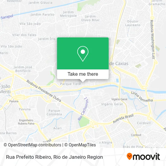
See Rua Prefeito Ribeiro, Duque De Caxias, on the map
Public Transit to Rua Prefeito Ribeiro in Duque De Caxias
Wondering how to get to Rua Prefeito Ribeiro in Duque De Caxias? Moovit helps you find the best way to get to Rua Prefeito Ribeiro with step-by-step directions from the nearest public transit station.
Moovit provides free maps and live directions to help you navigate through your city. View schedules, routes, timetables, and find out how long does it take to get to Rua Prefeito Ribeiro in real time.
Looking for the nearest stop or station to Rua Prefeito Ribeiro? Check out this list of stops closest to your destination: Rua Prefeito Ribeiro; Acari / Fazenda Botafogo; Rua Itaboraí; Ponto Final - Bar Dos Cavaleiros (Linhas 012 E 486l); Duque De Caxias.
Bus: 011, 603I, L012, 486L.Metro: L2.Train: RAMAL SARACURUNA.
Want to see if there’s another route that gets you there at an earlier time? Moovit helps you find alternative routes or times. Get directions from and directions to Rua Prefeito Ribeiro easily from the Moovit App or Website.
We make riding to Rua Prefeito Ribeiro easy, which is why over 1.5 million users, including users in Duque De Caxias, trust Moovit as the best app for public transit. You don’t need to download an individual bus app or train app, Moovit is your all-in-one transit app that helps you find the best bus time or train time available.
For information on prices of bus and train, costs and ride fares to Rua Prefeito Ribeiro, please check the Moovit app.
Use the app to navigate to popular places including to the airport, hospital, stadium, grocery store, mall, coffee shop, school, college, and university.
Rua Prefeito Ribeiro Address: Bar dos Cavalheiros Duque de Caxias-RJ street in Duque De Caxias
- Rua Helena Passos De Souza 0,
- Prainha,
- Mercado Tubarão,
- Rua Vidal de Negreiros Próximo ao 31-99,
- Rua Helena Passos de Souza Próximo ao 336-488,
- Rua Vidal Barbosa 47,
- Rua Valença, 230,
- Rua Bernardino Machado, 791,
- Mercado Tubarao,
- Favela Da Prainha,
- Rua Perimetral Alcântara, 104,
- Rua Alcantara,
- Igreja Batista Betel do Parque Lafaiete,
- Salão da Michelle,
- Maria Madalena da Silva,
- Maia Transportes,
- Avenida Perimetral Bernardo Machado Próximo ao 361,
- Ciep 198,
- Rua Santa Marta 5,
- Praça da Prainha
Places Near Rua Prefeito Ribeiro (Duque De Caxias)
- Norte Shopping, Cachambi,
- Museu Do Amanhã, Centro,
- Hospital Pedro Ernesto, Vila Isabel,
- Hospital Municipal Ronaldo Gazolla, Acari,
- Niterói, Niterói,
- Shopping Downtown, Barra Da Tijuca,
- Feira Livre da Gloria, Glória,
- Avenida Venezuela 134, Saúde,
- Feirão De Malhas, Duque De Caxias,
- Hospital Federal Do Andaraí, Andaraí,
- Rio De Janeiro,
- Praia do Arpoador, Ipanema,
- Rua Ulysses Guimarães 16, Cidade Nova,
- Rodoviária Novo Rio (Rodoviária do Rio de Janeiro), Santo Cristo,
- Shopping RioSul, Botafogo,
- Rua Licínio Cardoso, São Francisco Xavier,
- Shopping Rio Sul, Botafogo,
- Shopping Nova América, Del Castilho,
- Hospital Federal Cardoso Fontes, Jacarepaguá,
- Avenida Rio Branco, Centro
How to get to popular places in Rio de Janeiro Region with public transit
Get around Duque De Caxias by public transit!
Traveling around Duque De Caxias has never been so easy. See step by step directions as you travel to any attraction, street or major public transit station. View bus and train schedules, arrival times, service alerts and detailed routes on a map, so you know exactly how to get to anywhere in Duque De Caxias.
When traveling to any destination around Duque De Caxias use Moovit's Live Directions with Get Off Notifications to know exactly where and how far to walk, how long to wait for your line, and how many stops are left. Moovit will alert you when it's time to get off — no need to constantly re-check whether yours is the next stop.
Wondering how to use public transit in Duque De Caxias or how to pay for public transit in Duque De Caxias? Moovit public transit app can help you navigate your way with public transit easily, and at minimum cost. It includes public transit fees, ticket prices, and costs. Looking for a map of Duque De Caxias public transit lines? Moovit public transit app shows all public transit maps in Duque De Caxias with all Bus, Train, Metro, Light Rail, Ferry, Cable Car, Gondola and Funicular routes and stops on an interactive map.
Rio de Janeiro Region has 8 transit type(s), including: Bus, Train, Metro, Light Rail, Ferry, Cable Car, Gondola and Funicular, operated by several transit agencies, including TrensRJ, Metrô Rio, VLT Carioca, Barcas Rio, BRT MOBI-Rio, Auto Viação Alpha, Auto Viação Tijuca, Gire Transportes, Transurb, Viação Nossa Senhora das Graças, Consórcio INTERSUL, Braso Lisboa (Municipal), Caprichosa Auto Ônibus, Auto Viação Três Amigos and Rodoviária Âncora Matias