How to get to Rua Regência by bus?
Click on the bus route to see step by step directions with maps, line arrival times and updated time schedules.
From Parque Olímpico Da Barra, Barra Da Tijuca
52 minFrom BRT - Estação Recanto das Palmeiras (Jd. São Luiz), Jacarepaguá
49 minFrom Hospital Municipal Ronaldo Gazolla, Acari
67 minFrom Espaço Hall, Gardênia Azul
62 minFrom Avenida José Wilker, Jacarepaguá
53 minFrom Estrada Marechal Miguel Salazar Mendes de Moraes, Cidade De Deus
50 minFrom TRE 179ª Zona Eleitoral, Freguesia (Jacarepaguá)
56 minFrom Estrada dos Três Rios, Freguesia (Jacarepaguá)
58 minFrom Pavuna x Nova Iguaçu Via Light, Pavuna
58 minFrom Av. das Americas, 3443, Jacarepaguá
54 min
Bus stops near Rua Regência in Realengo
Train station near Rua Regência in Realengo
- Realengo, 39 min walk,VIEW
Bus lines to Rua Regência in Realengo
- 383, Realengo - Praça da República (Brs 5),VIEW
- SN 383, Realengo - Praça da República (BRS 5 - Noturno),VIEW
- SV 391, Padre Miguel - Praça da República (Brs 5 - Via Sulacap / Méier),VIEW
- 794, Bangu - Cascadura (Via Jardim Novo),VIEW
- SN 794, Jabour - Cascadura (Via Jardim Novo),VIEW
- 799, Pavuna - Bangu Shopping (via Deodoro / Sulacap / Jd. Novo),VIEW
- 801, Bangu Shopping - Taquara / Merck (Via Jardim Novo),VIEW
- SP 801, Bangu - Terminal Sulacap,VIEW
- 741, Sulacap ↔ Bangu (Circular),VIEW
- 743, Sulacap ↔ Bangu,VIEW
What are the closest stations to Rua Regência?
The closest stations to Rua Regência are:
- Estrada Manuel Nogueira De Sá, 1237-1319 is 354 meters away, 5 min walk.
- Rua Piraquara, 1247-1281 is 441 meters away, 6 min walk.
- Realengo is 3035 meters away, 39 min walk.
Which bus lines stop near Rua Regência?
These bus lines stop near Rua Regência: 794, 799, 801.
What’s the nearest bus station to Rua Regência in Realengo?
The nearest bus station to Rua Regência in Realengo is Estrada Manuel Nogueira De Sá, 1237-1319. It’s a 5 min walk away.
What time is the first train to Rua Regência in Realengo?
The RAMAL SANTA CRUZ is the first train that goes to Rua Regência in Realengo. It stops nearby at 4:30 AM.
What time is the last train to Rua Regência in Realengo?
The RAMAL SANTA CRUZ is the last train that goes to Rua Regência in Realengo. It stops nearby at 11:22 PM.
What time is the first bus to Rua Regência in Realengo?
The SN 794 is the first bus that goes to Rua Regência in Realengo. It stops nearby at 3:00 AM.
What time is the last bus to Rua Regência in Realengo?
The SN 383 is the last bus that goes to Rua Regência in Realengo. It stops nearby at 3:31 AM.
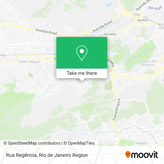
See Rua Regência, Realengo, on the map
Public Transit to Rua Regência in Realengo
Wondering how to get to Rua Regência in Realengo? Moovit helps you find the best way to get to Rua Regência with step-by-step directions from the nearest public transit station.
Moovit provides free maps and live directions to help you navigate through your city. View schedules, routes, timetables, and find out how long does it take to get to Rua Regência in real time.
Looking for the nearest stop or station to Rua Regência? Check out this list of stops closest to your destination: Estrada Manuel Nogueira De Sá; Rua Piraquara; Realengo.
Bus: 794, 799, 801, 383, SN 383, SV 391, SN 794, 741, 743.Train: RAMAL SANTA CRUZ.
Want to see if there’s another route that gets you there at an earlier time? Moovit helps you find alternative routes or times. Get directions from and directions to Rua Regência easily from the Moovit App or Website.
We make riding to Rua Regência easy, which is why over 1.5 million users, including users in Realengo, trust Moovit as the best app for public transit. You don’t need to download an individual bus app or train app, Moovit is your all-in-one transit app that helps you find the best bus time or train time available.
For information on prices of bus, costs and ride fares to Rua Regência, please check the Moovit app.
Use the app to navigate to popular places including to the airport, hospital, stadium, grocery store, mall, coffee shop, school, college, and university.
Rua Regência Address: Realengo Rio de Janeiro-RJ street in Realengo
- Avenida Frederico Faulhaber,
- Assembléia de Deus de Realengo,
- Escola Municipal Eduardo De Almeida Cardoso,
- Escola Municipal Azul E Branco,
- Jardim Novo,
- Igreja Adventista Do Sétimo Dia Jardim Novo,
- Rua Irmã Alegria, 132,
- Salão Elite,
- Campo Sao Luiz Realengo,
- Campo Sao Luiz,
- Paróquia Nossa Senhora de Fátima e São João de Deus,
- Rua Bandeira de Melo, 82,
- Rua Grão Mogol, 13,
- Rua Adolfo Franck, 130,
- Gruta Oeste,
- Rua Antônio de Holanda, 86,
- Espaço Cabana dos Sonhos Festas,
- UPA Magalhães Bastos,
- Depósito de Bebidas Duarte,
- UPA Jardim Novo
Places Near Rua Regência (Realengo)
- Avenida Venezuela 134, Saúde,
- Museu Do Amanhã, Centro,
- Shopping Nova América, Del Castilho,
- Rua Licínio Cardoso, São Francisco Xavier,
- Rodoviária Novo Rio (Rodoviária do Rio de Janeiro), Santo Cristo,
- Hospital Pedro Ernesto, Vila Isabel,
- Norte Shopping, Cachambi,
- Shopping Downtown, Barra Da Tijuca,
- Rua Ulysses Guimarães 16, Cidade Nova,
- Hospital Federal Cardoso Fontes, Jacarepaguá,
- Hospital Municipal Ronaldo Gazolla, Acari,
- Hospital Federal Do Andaraí, Andaraí,
- Feira Livre da Gloria, Glória,
- Feirão De Malhas, Duque De Caxias,
- Shopping Rio Sul, Botafogo,
- Niterói, Niterói,
- Praia do Arpoador, Ipanema,
- Avenida Rio Branco, Centro,
- Rio De Janeiro,
- Shopping RioSul, Botafogo
How to get to popular places in Rio de Janeiro Region with public transit
Get around Realengo by public transit!
Traveling around Realengo has never been so easy. See step by step directions as you travel to any attraction, street or major public transit station. View bus and train schedules, arrival times, service alerts and detailed routes on a map, so you know exactly how to get to anywhere in Realengo.
When traveling to any destination around Realengo use Moovit's Live Directions with Get Off Notifications to know exactly where and how far to walk, how long to wait for your line, and how many stops are left. Moovit will alert you when it's time to get off — no need to constantly re-check whether yours is the next stop.
Wondering how to use public transit in Realengo or how to pay for public transit in Realengo? Moovit public transit app can help you navigate your way with public transit easily, and at minimum cost. It includes public transit fees, ticket prices, and costs. Looking for a map of Realengo public transit lines? Moovit public transit app shows all public transit maps in Realengo with all Bus, Train, Metro, Light Rail, Ferry, Cable Car, Gondola and Funicular routes and stops on an interactive map.
Rio de Janeiro Region has 8 transit type(s), including: Bus, Train, Metro, Light Rail, Ferry, Cable Car, Gondola and Funicular, operated by several transit agencies, including TrensRJ, Metrô Rio, VLT Carioca, Barcas Rio, BRT MOBI-Rio, Auto Viação Alpha, Auto Viação Tijuca, Gire Transportes, Transurb, Viação Nossa Senhora das Graças, Consórcio INTERSUL, Braso Lisboa (Municipal), Caprichosa Auto Ônibus, Auto Viação Três Amigos and Rodoviária Âncora Matias