How to get to Rua Tenente Elias Magalhães by bus?
Click on the bus route to see step by step directions with maps, line arrival times and updated time schedules.
From 770 - Itaipu x Candelária, Niterói
59 minFrom Ilha Da Conceição, Niterói
67 minFrom Barreto, Niterói
43 minFrom Rua Dr Mario Viana, Niterói
50 minFrom Clínica Barro Vermelho, São Gonçalo
31 minFrom Mercado Municipal De Niterói, Niterói
43 minFrom Casa de Saúde Santa Martha, Niterói
61 minFrom Santa Rosa, Niterói
46 minFrom Neves, São Gonçalo
39 minFrom Alameda São Boaventura, Niterói
44 min
Bus stops near Rua Tenente Elias Magalhães in São Gonçalo
Bus lines to Rua Tenente Elias Magalhães in São Gonçalo
- 02, Circular CEASA (via Amaral Peixoto - Anti-horário),VIEW
- 10, Circular CEASA (via Amaral Peixoto - anti-horário),VIEW
- 445M, Engenho Pequeno (até CEASA),VIEW
- 529, Ceasa,VIEW
- 530, Niterói,VIEW
- 04, BNH Marambaia - Várzea das Moças (via Alcântara),VIEW
- 50, Anaia - Centro (Via Arsenal),VIEW
- 53, Calaboca - Centro,VIEW
- 58, Centro - Maria Paula (Via Arsenal),VIEW
- 58A, Ipiiba - Centro,VIEW
- 43, Jardim República X Forum,VIEW
- 17, Jardim Catarina - Maria Paula,VIEW
- 17B, Santa Luzia - Maria Paula,VIEW
- 17C, Jardim Catarina - Maria Paula (Via Dalva Raposo),VIEW
- 22, Várzea das Moças - Centro,VIEW
- 53A, Calaboca - Alcântara,VIEW
- 57, Alacomba - Centro (Via Alcântara),VIEW
- 500R, Maricá - Alcântara,VIEW
- 590M, Amendoeira - Niterói (Via Tribobó),VIEW
- 750R, Itaipuaçu - Alcântara,VIEW
What are the closest stations to Rua Tenente Elias Magalhães?
The closest stations to Rua Tenente Elias Magalhães are:
- Fórum Patrícia Accioli / Hospital Alberto Torres is 484 meters away, 7 min walk.
- Avenida José Mendonça De Campos, 932 is 773 meters away, 10 min walk.
- Rua Capitão Juvenal Figueiredo, 570 is 800 meters away, 11 min walk.
- Rodovia Rj-104 | Passarela Do Makro - Sentido Niterói is 830 meters away, 11 min walk.
Which bus lines stop near Rua Tenente Elias Magalhães?
These bus lines stop near Rua Tenente Elias Magalhães: 17, 430M, 445, 484M, 521D, 7721D.
What’s the nearest bus station to Rua Tenente Elias Magalhães in São Gonçalo?
The nearest bus station to Rua Tenente Elias Magalhães in São Gonçalo is Fórum Patrícia Accioli / Hospital Alberto Torres. It’s a 7 min walk away.
What time is the first bus to Rua Tenente Elias Magalhães in São Gonçalo?
The 549M is the first bus that goes to Rua Tenente Elias Magalhães in São Gonçalo. It stops nearby at 3:25 AM.
What time is the last bus to Rua Tenente Elias Magalhães in São Gonçalo?
The 483M is the last bus that goes to Rua Tenente Elias Magalhães in São Gonçalo. It stops nearby at 3:00 AM.
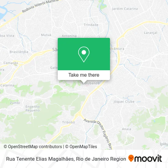
See Rua Tenente Elias Magalhães, São Gonçalo, on the map
Public Transit to Rua Tenente Elias Magalhães in São Gonçalo
Wondering how to get to Rua Tenente Elias Magalhães in São Gonçalo? Moovit helps you find the best way to get to Rua Tenente Elias Magalhães with step-by-step directions from the nearest public transit station.
Moovit provides free maps and live directions to help you navigate through your city. View schedules, routes, timetables, and find out how long does it take to get to Rua Tenente Elias Magalhães in real time.
Looking for the nearest stop or station to Rua Tenente Elias Magalhães? Check out this list of stops closest to your destination: Fórum Patrícia Accioli / Hospital Alberto Torres; Avenida José Mendonça De Campos; Rua Capitão Juvenal Figueiredo; Rodovia Rj-104 | Passarela Do Makro - Sentido Niterói.
Bus: 17, 430M, 445, 484M, 521D, 7721D, 02, 10, 445M, 529, 530, 04, 50, 53, 58, 58A, 43, 17B, 17C, 22.
Want to see if there’s another route that gets you there at an earlier time? Moovit helps you find alternative routes or times. Get directions from and directions to Rua Tenente Elias Magalhães easily from the Moovit App or Website.
We make riding to Rua Tenente Elias Magalhães easy, which is why over 1.5 million users, including users in São Gonçalo, trust Moovit as the best app for public transit. You don’t need to download an individual bus app or train app, Moovit is your all-in-one transit app that helps you find the best bus time or train time available.
For information on prices of bus, costs and ride fares to Rua Tenente Elias Magalhães, please check the Moovit app.
Use the app to navigate to popular places including to the airport, hospital, stadium, grocery store, mall, coffee shop, school, college, and university.
Rua Tenente Elias Magalhães Address: Colubandê São Gonçalo-RJ street in São Gonçalo
- Centro Espírita Damião,
- Hospital Estadual Alberto Torres,
- CENTRO DE TRAUMA HEAT,
- Hospital Estadual Alberto Torres (Hospital Geral de São Gonçalo),
- Ministério Publico,
- Atacaderj - Ceasa,
- Wallace Fretes,
- BrF São Gonçalo,
- Rua Vicente Celestino, 1070,
- Fórum,
- Colubandê,
- Fórum Regional de Alcântara,
- Colubandê,
- Rua Madame Sara / Rua Odete São Paio,
- Auto Viação Asa Branca Gonçalense,
- Fisio Shape - Clínica de Fisioterapia,
- Fórum Jz. Patrícia Lourival Acioli,
- Majestade Doces - Ceasa,
- Forum Regional de Alcântara Juíza Patrícia Lourival Acioli,
- Rua Odete São Paio, 104
Places Near Rua Tenente Elias Magalhães (São Gonçalo)
- Norte Shopping, Cachambi,
- Hospital Federal Cardoso Fontes, Jacarepaguá,
- Hospital Municipal Ronaldo Gazolla, Acari,
- Shopping Downtown, Barra Da Tijuca,
- Feira Livre da Gloria, Glória,
- Rua Ulysses Guimarães 16, Cidade Nova,
- Hospital Pedro Ernesto, Vila Isabel,
- Museu Do Amanhã, Centro,
- Shopping RioSul, Botafogo,
- Rio De Janeiro,
- Rodoviária Novo Rio (Rodoviária do Rio de Janeiro), Santo Cristo,
- Niterói, Niterói,
- Shopping Rio Sul, Botafogo,
- Praia do Arpoador, Ipanema,
- Feirão De Malhas, Duque De Caxias,
- Shopping Nova América, Del Castilho,
- Rua Licínio Cardoso, São Francisco Xavier,
- Avenida Rio Branco, Centro,
- Hospital Federal Do Andaraí, Andaraí,
- Avenida Venezuela 134, Saúde
How to get to popular places in Rio de Janeiro Region with public transit
Get around São Gonçalo by public transit!
Traveling around São Gonçalo has never been so easy. See step by step directions as you travel to any attraction, street or major public transit station. View bus and train schedules, arrival times, service alerts and detailed routes on a map, so you know exactly how to get to anywhere in São Gonçalo.
When traveling to any destination around São Gonçalo use Moovit's Live Directions with Get Off Notifications to know exactly where and how far to walk, how long to wait for your line, and how many stops are left. Moovit will alert you when it's time to get off — no need to constantly re-check whether yours is the next stop.
Wondering how to use public transit in São Gonçalo or how to pay for public transit in São Gonçalo? Moovit public transit app can help you navigate your way with public transit easily, and at minimum cost. It includes public transit fees, ticket prices, and costs. Looking for a map of São Gonçalo public transit lines? Moovit public transit app shows all public transit maps in São Gonçalo with all Bus, Train, Metro, Light Rail, Ferry, Cable Car, Gondola and Funicular routes and stops on an interactive map.
Rio de Janeiro Region has 8 transit type(s), including: Bus, Train, Metro, Light Rail, Ferry, Cable Car, Gondola and Funicular, operated by several transit agencies, including TrensRJ, Metrô Rio, VLT Carioca, Barcas Rio, BRT MOBI-Rio, Auto Viação Alpha, Auto Viação Tijuca, Gire Transportes, Transurb, Viação Nossa Senhora das Graças, Consórcio INTERSUL, Braso Lisboa (Municipal), Caprichosa Auto Ônibus, Auto Viação Três Amigos and Rodoviária Âncora Matias