Directions to Rua Waldemar Orso 4 (Campo De Santana) with public transportation
The following transit lines have routes that pass near Rua Waldemar Orso 4
How to get to Rua Waldemar Orso 4 by bus?
Click on the bus route to see step by step directions with maps, line arrival times and updated time schedules.
From Cidade Industrial de Curitiba, Cic
24 minFrom Rua Francisco Derosso, Alto Boqueirão
73 minFrom faculdade santa cruz, Capão Raso
45 minFrom Rua Izaac Ferreira da Cruz, Sítio Cercado
41 minFrom terminal do hauer, Boqueirão
54 minFrom Araucária Acqua Park, Araucária
75 minFrom 11º Distrito Policial, Cic
48 minFrom Rua Francisco Derosso, Xaxim
59 minFrom Rua Gabriel Frecceiro de Miranda, Xaxim
53 minFrom Hospital Vitória, Cic
52 min
Bus stops near Rua Waldemar Orso 4 in Campo De Santana
Bus lines to Rua Waldemar Orso 4 in Campo De Santana
What are the closest stations to Rua Waldemar Orso 4?
The closest stations to Rua Waldemar Orso 4 are:
- R. Ângelo Tozim, 298 is 73 meters away, 1 min walk.
- R. Júlio Pereira Sobrinho, 296 is 415 meters away, 6 min walk.
- Estr. Del. Bruno De Almeida, 3018 is 450 meters away, 6 min walk.
Which bus lines stop near Rua Waldemar Orso 4?
These bus lines stop near Rua Waldemar Orso 4: 659 CAXIMBA / OLARIA, 680 RURBANA, 772 TUPY / JULIANA.
What’s the nearest bus station to Rua Waldemar Orso 4 in Campo De Santana?
The nearest bus station to Rua Waldemar Orso 4 in Campo De Santana is R. Ângelo Tozim, 298. It’s a 1 min walk away.
What time is the first bus to Rua Waldemar Orso 4 in Campo De Santana?
The 646 POMPÉIA / JANAÍNA is the first bus that goes to Rua Waldemar Orso 4 in Campo De Santana. It stops nearby at 4:48 AM.
What time is the last bus to Rua Waldemar Orso 4 in Campo De Santana?
The 646 POMPÉIA / JANAÍNA is the last bus that goes to Rua Waldemar Orso 4 in Campo De Santana. It stops nearby at 12:38 AM.
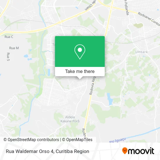
See Rua Waldemar Orso 4, Campo De Santana, on the map
Public Transit to Rua Waldemar Orso 4 in Campo De Santana
Wondering how to get to Rua Waldemar Orso 4 in Campo De Santana? Moovit helps you find the best way to get to Rua Waldemar Orso 4 with step-by-step directions from the nearest public transit station.
Moovit provides free maps and live directions to help you navigate through your city. View schedules, routes, timetables, and find out how long does it take to get to Rua Waldemar Orso 4 in real time.
Looking for the nearest stop or station to Rua Waldemar Orso 4? Check out this list of stops closest to your destination: R. Ângelo Tozim; R. Júlio Pereira Sobrinho; Estr. Del. Bruno De Almeida.
Bus: 659 CAXIMBA / OLARIA, 680 RURBANA, 772 TUPY / JULIANA, X38 RIO BONITO (SEMI-DIRETO), 646 POMPÉIA / JANAÍNA.
Want to see if there’s another route that gets you there at an earlier time? Moovit helps you find alternative routes or times. Get directions from and directions to Rua Waldemar Orso 4 easily from the Moovit App or Website.
We make riding to Rua Waldemar Orso 4 easy, which is why over 1.5 million users, including users in Campo De Santana, trust Moovit as the best app for public transit. You don’t need to download an individual bus app or train app, Moovit is your all-in-one transit app that helps you find the best bus time or train time available.
For information on prices of bus, costs and ride fares to Rua Waldemar Orso 4, please check the Moovit app.
Use the app to navigate to popular places including to the airport, hospital, stadium, grocery store, mall, coffee shop, school, college, and university.
Rua Waldemar Orso 4 Address: Rua Waldemar Orso, 4 - Campo de Santana, Curitiba - PR, Brasil street in Campo De Santana
- Jp Estofados e Colchoes,
- Bar Do Capixaba,
- Bloods Black,
- Supermercado São Miguel,
- Ivaiporã,
- Vitória Mix Loja F,
- Valdir Strobel,
- Jm10 Sports,
- Grbb Confeccoes,
- Shopfire Brasil,
- Oliveira Print,
- Forasteiro,
- Panificadora E Confeitaria Ana Paula,
- Top10 Auto Vidros,
- Saf - Digitacao e Planilhamento,
- Transportes Claudino,
- Salão Espaço VIP,
- Clear Clean,
- Escola Municipal Santa Ana Mestra,
- Luz de Maria Fardamento Santo Daime
Places Near Rua Waldemar Orso 4 (Campo De Santana)
- Hospital Nossa Senhora Das Graças, Mercês,
- Hospital de Clínicas (HC - UFPR), Centro,
- Hospital Erasto Gaertner, Jardim Das Américas,
- Shopping Estação, Rebouças,
- Rua General Mário Tourinho, Campina Do Siqueira,
- Jockey Plaza Shopping Center, Tarumã,
- Hhhhh, Fazendinha,
- Pontifícia Universidade Católica do Paraná (PUCPR), Prado Velho,
- Parque Barigui, Mercês,
- Hospital Angelina Caron, Campina Grande Do Sul,
- Arena Da Baixada - Curitiba,
- Hospital Da Cruz Vermelha, Batel,
- Rua Martim Afonso 558, Mercês,
- Hospital do Rocio, Campo,
- Jardim Botânico de Curitiba PR, Centro,
- Park Shopping Barigüi, Mossunguê,
- Shopping Palladium, Portão,
- Hospital Universitário Evangélico de Curitiba, Bigorrilho,
- Hospital Madalena Sofia, Bairro Alto,
- Campo Largo, Campo
How to get to popular places in Curitiba Region with public transit
Get around Campo De Santana by public transit!
Traveling around Campo De Santana has never been so easy. See step by step directions as you travel to any attraction, street or major public transit station. View bus and train schedules, arrival times, service alerts and detailed routes on a map, so you know exactly how to get to anywhere in Campo De Santana.
When traveling to any destination around Campo De Santana use Moovit's Live Directions with Get Off Notifications to know exactly where and how far to walk, how long to wait for your line, and how many stops are left. Moovit will alert you when it's time to get off — no need to constantly re-check whether yours is the next stop.
Wondering how to use public transit in Campo De Santana or how to pay for public transit in Campo De Santana? Moovit public transit app can help you navigate your way with public transit easily, and at minimum cost. It includes public transit fees, ticket prices, and costs. Looking for a map of Campo De Santana public transit lines? Moovit public transit app shows all public transit maps in Campo De Santana with all Bus and Cable Car routes and stops on an interactive map.
Curitiba Region has 2 transit type(s), including: Bus and Cable Car, operated by several transit agencies, including Sistema Integrado de Mobilidade (URBS), Sistema Integrado de Mobilidade (AMEP), URBS (Cartões bancários e Dinheiro), URBS (Cartões bancários / Cartão URBS), AMEP (Cartões bancários / Cartão MetroCard), AMEP (Cartões bancários / Cartão MetroCard / Dinheiro), Viação Colombo (Dinheiro), TRIAR (Cartão TRIAR / Dinheiro), Empresa Curitiba Cerro Azul (Dinheiro), Expresso Nossa Senhora da Penha (Dinheiro), Empresa Campo Alto Tijucas (Dinheiro), Auto Viação São José (Cartão VEM / Dinheiro), BRT S/A (Cartão VEM / Dinheiro), TransPiedade (Cartão Cidadão / Dinheiro) and Oceânica Sul (Cartão Transporte / Dinheiro)