How to get to Rubeo Monte by bus?
Click on the bus route to see step by step directions with maps, line arrival times and updated time schedules.
From La Géode, Paris
75 minFrom L'Ambassade, Paris
56 minFrom Rue du Faubourg Saint-Denis, Paris
48 minFrom Cité des sciences, Paris
74 minFrom Clinique du Val d'Or, Saint-Cloud
64 minFrom Victor Hugo, Arrondissement de Nanterre
62 minFrom 9e Arrondissement, Paris
47 minFrom Consulat De Tunisie - Pantin, Pantin
76 minFrom Hôtel Mercure Paris La Défense 5, Courbevoie
70 minFrom Garches, Garches
67 min
How to get to Rubeo Monte by metro?
Click on the metro route to see step by step directions with maps, line arrival times and updated time schedules.
From La Géode, Paris
45 minFrom L'Ambassade, Paris
45 minFrom Rue du Faubourg Saint-Denis, Paris
32 minFrom Cité des sciences, Paris
44 minFrom Clinique du Val d'Or, Saint-Cloud
69 minFrom Victor Hugo, Arrondissement de Nanterre
54 minFrom 9e Arrondissement, Paris
35 minFrom Consulat De Tunisie - Pantin, Pantin
49 minFrom Hôtel Mercure Paris La Défense 5, Courbevoie
61 min
Bus stops near Rubeo Monte in Montrouge
Metro station near Rubeo Monte in Montrouge
- Porte D'Orléans, 11 min walk,VIEW
Bus lines to Rubeo Monte in Montrouge
What are the closest stations to Rubeo Monte?
The closest stations to Rubeo Monte are:
- Verdier - République is 202 meters away, 3 min walk.
- Place Des Etats-Unis is 249 meters away, 4 min walk.
- Mairie de Montrouge is 257 meters away, 4 min walk.
- Porte D'Orléans is 787 meters away, 11 min walk.
Which metro line stops near Rubeo Monte?
4 (Porte de Clignancourt)
Which bus lines stop near Rubeo Monte?
These bus lines stop near Rubeo Monte: 126, 38, 68.
What’s the nearest metro station to Rubeo Monte in Montrouge?
The nearest metro station to Rubeo Monte in Montrouge is Porte D'Orléans. It’s a 11 min walk away.
What’s the nearest bus station to Rubeo Monte in Montrouge?
The nearest bus station to Rubeo Monte in Montrouge is Verdier - République. It’s a 3 min walk away.
What time is the first light rail to Rubeo Monte in Montrouge?
The T3A is the first light rail that goes to Rubeo Monte in Montrouge. It stops nearby at 6:18 AM.
What time is the last light rail to Rubeo Monte in Montrouge?
The T3A is the last light rail that goes to Rubeo Monte in Montrouge. It stops nearby at 1:34 AM.
What time is the first metro to Rubeo Monte in Montrouge?
The 4 is the first metro that goes to Rubeo Monte in Montrouge. It stops nearby at 5:31 AM.
What time is the last metro to Rubeo Monte in Montrouge?
The 4 is the last metro that goes to Rubeo Monte in Montrouge. It stops nearby at 1:13 AM.
What time is the first bus to Rubeo Monte in Montrouge?
The 68 is the first bus that goes to Rubeo Monte in Montrouge. It stops nearby at 5:33 AM.
What time is the last bus to Rubeo Monte in Montrouge?
The 68 is the last bus that goes to Rubeo Monte in Montrouge. It stops nearby at 1:52 AM.
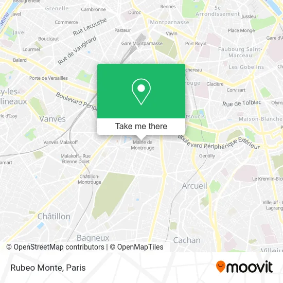
See Rubeo Monte, Montrouge, on the map
Public Transit to Rubeo Monte in Montrouge
Wondering how to get to Rubeo Monte in Montrouge? Moovit helps you find the best way to get to Rubeo Monte with step-by-step directions from the nearest public transit station.
Moovit provides free maps and live directions to help you navigate through your city. View schedules, routes, timetables, and find out how long does it take to get to Rubeo Monte in real time.
Looking for the nearest stop or station to Rubeo Monte? Check out this list of stops closest to your destination: Verdier - République; Place Des Etats-Unis; Mairie de Montrouge; Porte D'Orléans.
Metro: 4, T3A.Bus: 126, 38, 68, 128, MONTBUS, 7805.
Want to see if there’s another route that gets you there at an earlier time? Moovit helps you find alternative routes or times. Get directions from and directions to Rubeo Monte easily from the Moovit App or Website.
We make riding to Rubeo Monte easy, which is why over 1.5 million users, including users in Montrouge, trust Moovit as the best app for public transit. You don’t need to download an individual bus app or train app, Moovit is your all-in-one transit app that helps you find the best bus time or train time available.
For information on prices of metro, bus and train, costs and ride fares to Rubeo Monte, please check the Moovit app.
Use the app to navigate to popular places including to the airport, hospital, stadium, grocery store, mall, coffee shop, school, college, and university.
Rubeo Monte Address: 1 place de la Libération street in Montrouge
- [Mairie de Montrouge] Entrée / Sortie 5 Place du Général Leclerc,
- Boucherie D. Lesage,
- [Mairie de Montrouge] Entrée / Sortie 6 Rue Louis Rolland,
- Centre Pastoral Catholique,
- République,
- Monoprix,
- 52 Rue Louis Rolland,
- 2 Avenue Jean Jaurès,
- 39 Rue Gabriel Péri,
- Blooming Photographies,
- Métro Mairie de Montrouge [4],
- Place de la Libération,
- Arrêt Mairie de Montrouge [68,126,128],
- Eglise Saint Jacques De Montrouge,
- Émile Cresp,
- 16 Rue Victor Hugo,
- [Mairie de Montrouge] Entrée / Sortie 3 Place Émile Cresp,
- Boulevard Gabriel Péri,
- Caisse Primaire D'Assurance Maladie (Cpam) Des Hauts-De-Seine - Accueil de Montrouge,
- Amicale Groupe Schlumberger
Places Near Rubeo Monte (Montrouge)
- Théâtre Mogador, Paris,
- Atelier Des Lumieres, Paris,
- Gare Routière Flixbus, Paris,
- Institut Curie, Paris,
- Hôpital Beaujon, Clichy,
- Hôpital Necker, Paris,
- Centre Hospitalier des 15/20, Paris,
- Hôpital Cochin, Paris,
- Galeries Lafayette Haussmann, Paris,
- Galeries Lafayette, Paris,
- Fondation Louis Vuitton, Paris,
- Hopital Lariboisière, Paris,
- 29 Rue Manin, Paris,
- Créteil Soleil, Creteil,
- Hopital Foch, Suresnes,
- Hôpital Pitié Salpêtrière, Paris,
- Hôpital Saint-Joseph, Paris,
- Hôpital Henri Mondor, Creteil,
- Hôpital de la Pitié-Salpêtrière, Paris,
- Marché Saint-Pierre, Paris
How to get to popular places in Paris with public transit
Get around Montrouge by public transit!
Traveling around Montrouge has never been so easy. See step by step directions as you travel to any attraction, street or major public transit station. View bus and train schedules, arrival times, service alerts and detailed routes on a map, so you know exactly how to get to anywhere in Montrouge.
When traveling to any destination around Montrouge use Moovit's Live Directions with Get Off Notifications to know exactly where and how far to walk, how long to wait for your line, and how many stops are left. Moovit will alert you when it's time to get off — no need to constantly re-check whether yours is the next stop.
Wondering how to use public transit in Montrouge or how to pay for public transit in Montrouge? Moovit public transit app can help you navigate your way with public transit easily, and at minimum cost. It includes public transit fees, ticket prices, and costs. Looking for a map of Montrouge public transit lines? Moovit public transit app shows all public transit maps in Montrouge with all Bus, Train, Metro, Light Rail, RER, Funicular and Gondola routes and stops on an interactive map.
Paris has 7 transit type(s), including: Bus, Train, Metro, Light Rail, RER, Funicular and Gondola, operated by several transit agencies, including RATP, RER, RER Bus de remplacement, Train, Train Bus de remplacement, Tramway Bus de remplacement, TER, ADP, Magical Shuttle, Argenteuil - Boucles de Seine, Autocars Dominique, Bièvre, Brie et 2 Morin, Le Bus - C.C. du Clermontois and Cœur d’Essonne