Directions to Ruby Recovery (Indianapolis City (Balance)) with public transportation
The following transit lines have routes that pass near Ruby Recovery
 Bus: 21.
How to get to Ruby Recovery by bus?
Click on the bus route to see step by step directions with maps, line arrival times and updated time schedules.
From Aunt Pollys Pizza (Polly's Big Slice), Indianapolis City (Balance)
54 minFrom Diem & Noctem, Indianapolis City (Balance)
40 minFrom Angel on Wheels Roadside Assistance - Indianapolis, Indianapolis City (Balance)
39 minFrom Make Moves That Matter, Indianapolis City (Balance)
39 minFrom Eskenazi Health Center North Illinois Street, Indianapolis City (Balance)
50 minFrom Cleanslate Outpatient Addiction Medicine, Indianapolis City (Balance)
50 minFrom Five Star Complete Restoration, Indianapolis City (Balance)
39 minFrom Foote G Daniel, Indianapolis City (Balance)
39 minFrom Elton Geshwiler Senior Center, Beech Grove
69 minFrom Soybean Alliance, Indianapolis City (Balance)
56 min
Bus stop near Ruby Recovery in Indianapolis City (Balance)
- 21st St & Shadeland Ave, 10 min walk,VIEW
Bus lines to Ruby Recovery in Indianapolis City (Balance)
- 21, Meijer E. Wash,VIEW
What are the closest stations to Ruby Recovery?
The closest stations to Ruby Recovery are:
- 21st St & Shadeland Ave is 844 yards away, 10 min walk.
Which bus line stops near Ruby Recovery?
21 (Meijer E. Wash)
What’s the nearest bus station to Ruby Recovery in Indianapolis City (Balance)?
The nearest bus station to Ruby Recovery in Indianapolis City (Balance) is 21st St & Shadeland Ave. It’s a 10 min walk away.
What time is the first bus to Ruby Recovery in Indianapolis City (Balance)?
The 21 is the first bus that goes to Ruby Recovery in Indianapolis City (Balance). It stops nearby at 5:01 AM.
What time is the last bus to Ruby Recovery in Indianapolis City (Balance)?
The 21 is the last bus that goes to Ruby Recovery in Indianapolis City (Balance). It stops nearby at 9:59 PM.
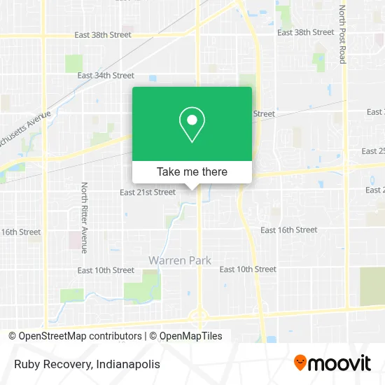
See Ruby Recovery, Indianapolis City (Balance), on the map
Public Transit to Ruby Recovery in Indianapolis City (Balance)
Wondering how to get to Ruby Recovery in Indianapolis City (Balance)? Moovit helps you find the best way to get to Ruby Recovery with step-by-step directions from the nearest public transit station.
Moovit provides free maps and live directions to help you navigate through your city. View schedules, routes, timetables, and find out how long does it take to get to Ruby Recovery in real time.
Looking for the nearest stop or station to Ruby Recovery? Check out this list of stops closest to your destination: 21st St & Shadeland Ave.
Bus: 21.
Want to see if there’s another route that gets you there at an earlier time? Moovit helps you find alternative routes or times. Get directions from and directions to Ruby Recovery easily from the Moovit App or Website.
We make riding to Ruby Recovery easy, which is why over 1.5 million users, including users in Indianapolis City (Balance), trust Moovit as the best app for public transit. You don’t need to download an individual bus app or train app, Moovit is your all-in-one transit app that helps you find the best bus time or train time available.
For information on prices of bus, costs and ride fares to Ruby Recovery, please check the Moovit app.
Use the app to navigate to popular places including to the airport, hospital, stadium, grocery store, mall, coffee shop, school, college, and university.
Ruby Recovery Address: 2060 N Shadeland Ave street in Indianapolis City (Balance)
- Health & Science Innovations,
- Bio Sensors,
- Spahr Roger G, MD,
- Salud Mental - Alivio Medical Center,
- Tax Indiana Spanish,
- Dr. Francisco Eraso Orthodontics,
- Alivio Dental Clinic,
- Mid America Clinical Laboratories,
- Community Physician Network, Neurosurgical Care - Kokomo,
- Jane Pauley Community Health Center - Shadeland,
- Lindy Bess Sergeant, Md,
- Sandy Adel Shafiek Botros, MD,
- Emily Marie Zarse, MD,
- Jamie Rup, Pa,
- Judith Anne Robinson, MD,
- Letha Anne Tetrick, do,
- Azra Abdullah, MD,
- Wellspring Pharmacy,
- Morgan Lynnette Rhodes, MD,
- Cynthia Strain Meneghini, MD
Places Near Ruby Recovery (Indianapolis City (Balance))
- THE BALT, Indianapolis City (Balance),
- Indiana Convention Center, Indianapolis City (Balance),
- Jersey Barn, Indianapolis City (Balance),
- Plainfield, IN, Plainfield,
- Indiana, Indianapolis City (Balance),
- I-465 / I-65 Interchange, Indianapolis City (Balance),
- Eskenazi Hospital, Indianapolis City (Balance),
- Lucas Oil Stadium, Indianapolis City (Balance),
- Lilly Corporate Center (Eli Lilly & Co), Indianapolis City (Balance),
- Indianapolis Motor Speedway, Speedway,
- St. Vincent Hospital - Indianapolis, Indianapolis City (Balance),
- St. Vincent entrance #1, Indianapolis City (Balance),
- I U Health Methodist Hospital, Indianapolis City (Balance),
- 119 W 19th St Parking, Indianapolis City (Balance),
- Castleton Square Mall, Indianapolis,
- Train Ride At Castleton Mall, Indianapolis City (Balance),
- Cotter's Massage Parlor With Happy Endings, Indianapolis City (Balance),
- Indianapolis Airport Zone 2, Indianapolis City (Balance),
- Methodist Hospital of Indianapolis, Indianapolis City (Balance),
- Gainbridge Fieldhouse, Indianapolis City (Balance)
How to get to popular places in Indianapolis with public transit
Get around Indianapolis City (Balance) by public transit!
Traveling around Indianapolis City (Balance) has never been so easy. See step by step directions as you travel to any attraction, street or major public transit station. View bus and train schedules, arrival times, service alerts and detailed routes on a map, so you know exactly how to get to anywhere in Indianapolis City (Balance).
When traveling to any destination around Indianapolis City (Balance) use Moovit's Live Directions with Get Off Notifications to know exactly where and how far to walk, how long to wait for your line, and how many stops are left. Moovit will alert you when it's time to get off — no need to constantly re-check whether yours is the next stop.
Wondering how to use public transit in Indianapolis City (Balance) or how to pay for public transit in Indianapolis City (Balance)? Moovit public transit app can help you navigate your way with public transit easily, and at minimum cost. It includes public transit fees, ticket prices, and costs. Looking for a map of Indianapolis City (Balance) public transit lines? Moovit public transit app shows all public transit maps in Indianapolis City (Balance) with all bus routes and stops on an interactive map.
Indianapolis has 1 transit type(s), including: bus, operated by several transit agencies, including IndyGo, FlixBus-us and Greyhound-us