Directions to Ruby Tuesday (Fullerton) with public transportation
The following transit lines have routes that pass near Ruby Tuesday
 Bus: FLIXBUS 2651, FLIXBUS N2640, GRN, 319, 210.
How to get to Ruby Tuesday by bus?
Click on the bus route to see step by step directions with maps, line arrival times and updated time schedules.
Bus stops near Ruby Tuesday in Fullerton
Bus lines to Ruby Tuesday in Fullerton
What are the closest stations to Ruby Tuesday?
The closest stations to Ruby Tuesday are:
- Grape Eb is 618 yards away, 8 min walk.
- Lvm - 1 Platform is 649 yards away, 9 min walk.
- Lehigh Valley Mall is 701 yards away, 10 min walk.
- Grape at Whitehall Mall Eb is 701 yards away, 10 min walk.
Which bus lines stop near Ruby Tuesday?
These bus lines stop near Ruby Tuesday: FLIXBUS 2651, FLIXBUS N2640.
What’s the nearest bus station to Ruby Tuesday in Fullerton?
The nearest bus station to Ruby Tuesday in Fullerton is Grape Eb. It’s a 8 min walk away.
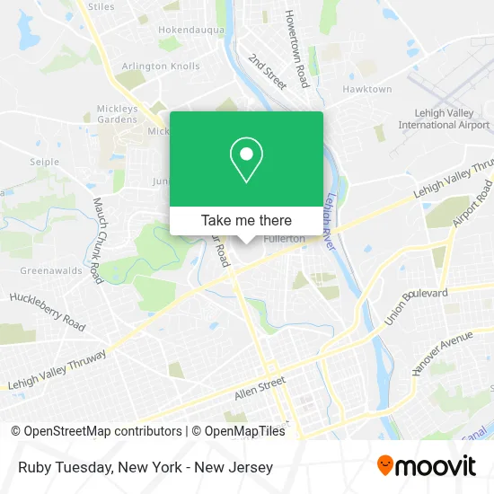
See Ruby Tuesday, Fullerton, on the map
Public Transit to Ruby Tuesday in Fullerton
Wondering how to get to Ruby Tuesday in Fullerton? Moovit helps you find the best way to get to Ruby Tuesday with step-by-step directions from the nearest public transit station.
Moovit provides free maps and live directions to help you navigate through your city. View schedules, routes, timetables, and find out how long does it take to get to Ruby Tuesday in real time.
Looking for the nearest stop or station to Ruby Tuesday? Check out this list of stops closest to your destination: Grape Eb; Lvm - 1 Platform; Lehigh Valley Mall; Grape at Whitehall Mall Eb.
Bus: FLIXBUS 2651, FLIXBUS N2640, GRN, 319, 210, 211, 702, 103.
Want to see if there’s another route that gets you there at an earlier time? Moovit helps you find alternative routes or times. Get directions from and directions to Ruby Tuesday easily from the Moovit App or Website.
We make riding to Ruby Tuesday easy, which is why over 1.5 million users, including users in Fullerton, trust Moovit as the best app for public transit. You don’t need to download an individual bus app or train app, Moovit is your all-in-one transit app that helps you find the best bus time or train time available.
For information on prices of bus and train, costs and ride fares to Ruby Tuesday, please check the Moovit app.
Use the app to navigate to popular places including to the airport, hospital, stadium, grocery store, mall, coffee shop, school, college, and university.
Ruby Tuesday Address: 101 Mcarthur street in Fullerton
- Verizon,
- Swarovski,
- Frites,
- Cinnabon,
- Clarks,
- Imagine,
- Verizon,
- Perfume Island,
- Ilhaan Enterprise T- A,
- Dtlr,
- The Melt 8 Food Truck,
- Tilly's,
- Dr. Kristen Fahey, Optometrist, and Associates - Lehigh Valley Mall,
- Habitat 9,
- Build-A-Bear Workshop,
- Cinnabon,
- Wetzel's Pretzels,
- Better Life With Bry,
- Shoe Dept. Encore,
- Macy's Lehigh Valley
Places Near Ruby Tuesday (Fullerton)
- SoHo, Manhattan,
- Rockefeller Center, Manhattan,
- 3 Stone St, Manhattan,
- 911 Memorial, Manhattan,
- Mountainside Hospital, Glen Ridge,
- 1 Police Plaza, Manhattan,
- Katz's Deli, Manhattan,
- Times Square, Manhattan,
- San Gennaro Feast, Manhattan,
- Wall Street, Manhattan,
- 66 John Street, Manhattan,
- Chinatown, Manhattan,
- 26 Federal Plaza, Manhattan,
- 376 Hudson Street, Manhattan,
- Bellevue Hospital, Manhattan,
- 111 Centre New York City Supreme Court, Manhattan,
- qqqq, Manhattan,
- Pier 83, Manhattan,
- Queens Center Mall, Queens,
- Hudson Yards, Manhattan
How to get to popular places in New York - New Jersey with public transit
Get around Fullerton by public transit!
Traveling around Fullerton has never been so easy. See step by step directions as you travel to any attraction, street or major public transit station. View bus and train schedules, arrival times, service alerts and detailed routes on a map, so you know exactly how to get to anywhere in Fullerton.
When traveling to any destination around Fullerton use Moovit's Live Directions with Get Off Notifications to know exactly where and how far to walk, how long to wait for your line, and how many stops are left. Moovit will alert you when it's time to get off — no need to constantly re-check whether yours is the next stop.
Wondering how to use public transit in Fullerton or how to pay for public transit in Fullerton? Moovit public transit app can help you navigate your way with public transit easily, and at minimum cost. It includes public transit fees, ticket prices, and costs. Looking for a map of Fullerton public transit lines? Moovit public transit app shows all public transit maps in Fullerton with all Bus, Train, Subway, Light Rail, Ferry and Cable Car routes and stops on an interactive map.
New York - New Jersey has 6 transit type(s), including: Bus, Train, Subway, Light Rail, Ferry and Cable Car, operated by several transit agencies, including MTA Subway, Metro-North Railroad, LIRR, PATH, MTA New York City Transit - Express routes, MTA Bus, NJ Transit, NYC Ferry, NICE bus, Bee-Line Bus, NJ Transit Rail, Norwalk Transit District, Hartford Line, River Valley Transit and HART