How to get to Ruby's Cafe by bus?
Click on the bus route to see step by step directions with maps, line arrival times and updated time schedules.
From Mall del Sol Guayaquil,Ecuador, Queens
60 minFrom Queens Center Mall, Queens
44 minFrom Elmhurst, NY, Queens
51 minFrom Harlem Hospital, Manhattan
74 minFrom The Shops At Atlas Park, Queens
59 minFrom Mt Sinai, Manhattan
57 minFrom Jersey City Medical Center, Jersey City
111 minFrom Community Lines, Jersey City
89 min
How to get to Ruby's Cafe by train?
Click on the train route to see step by step directions with maps, line arrival times and updated time schedules.
How to get to Ruby's Cafe by subway?
Click on the subway route to see step by step directions with maps, line arrival times and updated time schedules.
Bus stops near Ruby's Cafe in Manhattan
Subway stations near Ruby's Cafe in Manhattan
Bus lines to Ruby's Cafe in Manhattan
- M101, Ft George Via 3 Av Via Amsterdam Av,VIEW
- M102, East Village 6 St Via Lex Av,VIEW
- M103, City Hall Via Lex Av,VIEW
- M15, Pike St -Via 2 Av,VIEW
- M8, West St Crosstown,VIEW
- M1, Limited Harlem 147 St Via Madison Av,VIEW
- M2, East Village 8 St Via 5 Av,VIEW
- M3, 125 St St. Nicholas Av,VIEW
- M14A-SBS, Select Bus Les Grand-Fdr Via 14 St,VIEW
- M14D-SBS, Select Bus Union Sq Via 14 St,VIEW
What are the closest stations to Ruby's Cafe?
The closest stations to Ruby's Cafe are:
- 3 Av/E 11 St is 33 yards away, 1 min walk.
- 2 Av/E 12 St is 163 yards away, 3 min walk.
- 3 Av is 166 yards away, 2 min walk.
- E 9 St/3 Av is 174 yards away, 3 min walk.
- 4 Av/E 10 St is 180 yards away, 3 min walk.
- E 14 St/3 Av is 212 yards away, 3 min walk.
- Astor Pl is 731 yards away, 9 min walk.
- 8 St-Nyu is 916 yards away, 11 min walk.
- 14 St-Union Sq is 1686 yards away, 21 min walk.
Which bus lines stop near Ruby's Cafe?
These bus lines stop near Ruby's Cafe: M1, M102, M103, M3, Q54.
Which train lines stop near Ruby's Cafe?
These train lines stop near Ruby's Cafe: 2, YEL.
Which subway lines stop near Ruby's Cafe?
These subway lines stop near Ruby's Cafe: 6, 6X, L, N, R.
What’s the nearest subway station to Ruby's Cafe in Manhattan?
The nearest subway station to Ruby's Cafe in Manhattan is 3 Av. It’s a 2 min walk away.
What’s the nearest bus station to Ruby's Cafe in Manhattan?
The nearest bus station to Ruby's Cafe in Manhattan is 3 Av/E 11 St. It’s a 1 min walk away.
What time is the first subway to Ruby's Cafe in Manhattan?
The 6 is the first subway that goes to Ruby's Cafe in Manhattan. It stops nearby at 3:00 AM.
What time is the last subway to Ruby's Cafe in Manhattan?
The N is the last subway that goes to Ruby's Cafe in Manhattan. It stops nearby at 3:56 AM.
What time is the first bus to Ruby's Cafe in Manhattan?
The M2 is the first bus that goes to Ruby's Cafe in Manhattan. It stops nearby at 3:01 AM.
What time is the last bus to Ruby's Cafe in Manhattan?
The M103 is the last bus that goes to Ruby's Cafe in Manhattan. It stops nearby at 3:25 AM.
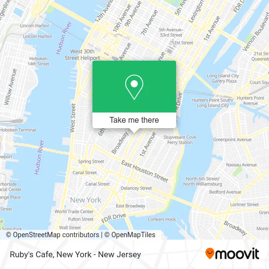
See Ruby's Cafe, Manhattan, on the map
Public Transit to Ruby's Cafe in Manhattan
Wondering how to get to Ruby's Cafe in Manhattan? Moovit helps you find the best way to get to Ruby's Cafe with step-by-step directions from the nearest public transit station.
Moovit provides free maps and live directions to help you navigate through your city. View schedules, routes, timetables, and find out how long does it take to get to Ruby's Cafe in real time.
Looking for the nearest stop or station to Ruby's Cafe? Check out this list of stops closest to your destination: 3 Av/E 11 St; 2 Av/E 12 St; 3 Av; E 9 St/3 Av; 4 Av/E 10 St; E 14 St/3 Av; Astor Pl; 8 St-Nyu; 14 St-Union Sq.
Bus: M1, M102, M103, M3, Q54, M101, M15.Train: 2, YEL.Subway: 6, 6X, L, N, R, 4, Q, W, 5.
Want to see if there’s another route that gets you there at an earlier time? Moovit helps you find alternative routes or times. Get directions from and directions to Ruby's Cafe easily from the Moovit App or Website.
We make riding to Ruby's Cafe easy, which is why over 1.5 million users, including users in Manhattan, trust Moovit as the best app for public transit. You don’t need to download an individual bus app or train app, Moovit is your all-in-one transit app that helps you find the best bus time or train time available.
For information on prices of subway, bus and train, costs and ride fares to Ruby's Cafe, please check the Moovit app.
Use the app to navigate to popular places including to the airport, hospital, stadium, grocery store, mall, coffee shop, school, college, and university.
Ruby's Cafe Address: 198 E 11th St street in Manhattan
- The Nyc Luxury Homes,
- Nycdoublebassist,
- Hmy Jewelry & Watch Repairs,
- Hmy Vision Optical,
- Coaching Empower,
- Chris Rushing,
- AMC Loews Village 7,
- Skull Shack,
- Ufc - Unidentified Flying Chickens,
- Community Board No 5-Bronx Community College,
- Saki,
- Cordoba House,
- Clayworks Pottery,
- Photos by Sheron,
- Amc Theatres (Loews Village 7 Theater),
- AMC Theatres-Village 7,
- Loews Village 7 Theater,
- Synergetic Psychotherapy / Allison Lloyds Lmft,
- Brenda Hall,
- Ruby's Nyc
Places Near Ruby's Cafe (Manhattan)
- Chinatown, Manhattan,
- 376 Hudson Street, Manhattan,
- SoHo, Manhattan,
- 1 Police Plaza, Manhattan,
- 26 Federal Plaza, Manhattan,
- 3 Stone St, Manhattan,
- Hudson Yards, Manhattan,
- Queens Center Mall, Queens,
- Bellevue Hospital, Manhattan,
- Wall Street, Manhattan,
- Pier 83, Manhattan,
- 66 John Street, Manhattan,
- 911 Memorial, Manhattan,
- Mountainside Hospital, Glen Ridge,
- 111 Centre New York City Supreme Court, Manhattan,
- Times Square, Manhattan,
- Rockefeller Center, Manhattan,
- qqqq, Manhattan,
- San Gennaro Feast, Manhattan,
- Katz's Deli, Manhattan
How to get to popular places in New York - New Jersey with public transit
Get around Manhattan by public transit!
Traveling around Manhattan has never been so easy. See step by step directions as you travel to any attraction, street or major public transit station. View bus and train schedules, arrival times, service alerts and detailed routes on a map, so you know exactly how to get to anywhere in Manhattan.
When traveling to any destination around Manhattan use Moovit's Live Directions with Get Off Notifications to know exactly where and how far to walk, how long to wait for your line, and how many stops are left. Moovit will alert you when it's time to get off — no need to constantly re-check whether yours is the next stop.
Wondering how to use public transit in Manhattan or how to pay for public transit in Manhattan? Moovit public transit app can help you navigate your way with public transit easily, and at minimum cost. It includes public transit fees, ticket prices, and costs. Looking for a map of Manhattan public transit lines? Moovit public transit app shows all public transit maps in Manhattan with all Bus, Train, Subway, Light Rail, Ferry and Cable Car routes and stops on an interactive map.
New York - New Jersey has 6 transit type(s), including: Bus, Train, Subway, Light Rail, Ferry and Cable Car, operated by several transit agencies, including MTA Subway, Metro-North Railroad, LIRR, PATH, MTA New York City Transit - Express routes, MTA Bus, NJ Transit, NYC Ferry, NICE bus, Bee-Line Bus, NJ Transit Rail, Norwalk Transit District, Hartford Line, River Valley Transit and HART